스트랫포드 역
Stratford station| 스트랫포드 | |
|---|---|
| 스트랫포드[1] 지역 | |
| 스트랫포드(런던)[2] | |
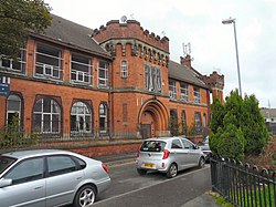
.jpg) 역 남쪽 출입구 | |
 스트랫포드 런던 뉴햄 구 스트랫포드 소재지 | |
| 위치 | 스트랫포드 |
| 지방 당국 | 런던 뉴햄 구 |
| 관리 대상자 | 런던 교통[3] |
| 주인 | 네트워크 레일[3] |
| 스테이션 코드 | SRA |
| DfT 카테고리 | B |
| 플랫폼 수 | 19(17개 사용 중) |
| 액세스 가능 | 네, 그렇습니다[4][5]. |
| 요금 구역 | 2와 3 |
| 런던 지하철 연간 출입국 | |
| 2016 | |
| 2017 | |
| 2018 | |
| 2019 | |
| 2020 | |
| DLR 연간 하숙 및 하숙 | |
| 2016 | |
| 2017 | |
| 2018 | |
| 2019 | |
| 2020 | |
| 내셔널 레일 연간 출입국 | |
| 2016–17 | |
| – 교환 | |
| 2017–18 | |
| – 교환 | |
| 2018–19 | |
| – 교환 | |
| 2019–20 | |
| – 교환 | |
| 2020–21 | |
| – 교환 | |
| 주요 날짜 | |
| 1839년 6월 20일 | ECR에 의해 열림 |
| 1946년 12월 4일 | 중앙선 시작 |
| 1987년 8월 31일 | DLR 시작 |
| 1999년 5월 14일 | 주빌리 라인 시작 |
| 다른 정보 | |
| 외부 링크 | |
| WGS84 | 51°32°32°N 0°00′12″w/51.5422°N 0.0033°W좌표: 51°32°32°N 0°00°12°W / 51.5422°N W |
Stratford는 영국에서 [16]가장 혼잡한 역으로 평가되는 주요 다층 철도역이며, 런던 동부 뉴햄 구에 있는 Stratford City와 Stratford City로 알려진 복합 용도의 개발에 서비스를 제공합니다.런던 지하철, 런던 오버그라운드, 도클랜드 경전철(DLR)이 운행하며, 웨스트 앵글리아 본선과 그레이트 이스트 본선의 내셔널 레일 역이기도 하며, 리버풀 스트리트에서 4마일 3체인(6.5km) 떨어져 있습니다.또한 Tube 네트워크에서 Travelcard Zone 1 밖에 있는 가장 혼잡한 역이기도 합니다.
지하철에서는 마일 엔드와 레이튼 사이의 센트럴 선의 직통역이며 웨스트 햄에 이어 주빌리 선의 동쪽 종착역입니다.DLR에서는 일부 열차의 종착역이며, 다른 열차의 경우에는 Stratford High Street와 Stratford International 사이의 통과역입니다.Overground에서는 Hackney Wick에 이어 북런던 선의 종착역이며, 간선에서는 Elizabeth 노선의 리버풀 스트리트와 Shenfield 간 정차 서비스 및 Greater Anglia가 운영하는 영국 동부의 수많은 목적지를 오가는 중장거리 서비스가 제공됩니다.런던, 틸버리, 사우스엔드 라인과 Shoeburyness로 연결되는 c2c에 의한 제한된 오프피크 서비스도 있습니다.
이 역은 1839년 Eastern Counties 철도에 의해 문을 열었다.현재는 네트워크 레일이 소유하고 있으며 Travelcard Zone 2/[17]3에 있습니다.Warwickshire의 Stratford-upon-Avon과 구별하기 위해 Stratford(런던)[2] 또는 Stratford International(370m)[1]과 구별하기 위해 Stratford Regional로 불리기도 한다.Stratford는 런던에서 [18]열린 2012 올림픽과 패럴림픽의 주요 여행 거점 역할을 했습니다.가장 최근의 내셔널 레일 출입 수치에 따르면,[19] 그것은 영국에서 가장 붐비는 역이다.
런던 오버그라운드 | |||||||||||||||||||||||||||||||||||||||||||||||||||||||||||||||||||||||||||||||||||||||||||||||||||||||||||||||||||||||||||||||||||||||||||||||||||||||||||||||||||||||||||||||||||||||||||||||||||||||||||||||||||||||||||||||||||||||||||||||||||||||||||||||||||||||||||||||||||||||||||||||||||||||||||||||||||||||||||
|---|---|---|---|---|---|---|---|---|---|---|---|---|---|---|---|---|---|---|---|---|---|---|---|---|---|---|---|---|---|---|---|---|---|---|---|---|---|---|---|---|---|---|---|---|---|---|---|---|---|---|---|---|---|---|---|---|---|---|---|---|---|---|---|---|---|---|---|---|---|---|---|---|---|---|---|---|---|---|---|---|---|---|---|---|---|---|---|---|---|---|---|---|---|---|---|---|---|---|---|---|---|---|---|---|---|---|---|---|---|---|---|---|---|---|---|---|---|---|---|---|---|---|---|---|---|---|---|---|---|---|---|---|---|---|---|---|---|---|---|---|---|---|---|---|---|---|---|---|---|---|---|---|---|---|---|---|---|---|---|---|---|---|---|---|---|---|---|---|---|---|---|---|---|---|---|---|---|---|---|---|---|---|---|---|---|---|---|---|---|---|---|---|---|---|---|---|---|---|---|---|---|---|---|---|---|---|---|---|---|---|---|---|---|---|---|---|---|---|---|---|---|---|---|---|---|---|---|---|---|---|---|---|---|---|---|---|---|---|---|---|---|---|---|---|---|---|---|---|---|---|---|---|---|---|---|---|---|---|---|---|---|---|---|---|---|---|---|---|---|---|---|---|---|---|---|---|---|---|---|---|---|---|---|---|---|---|---|---|---|---|---|---|---|---|---|---|---|---|---|---|---|---|---|---|---|---|---|---|---|---|---|---|---|---|---|
| |||||||||||||||||||||||||||||||||||||||||||||||||||||||||||||||||||||||||||||||||||||||||||||||||||||||||||||||||||||||||||||||||||||||||||||||||||||||||||||||||||||||||||||||||||||||||||||||||||||||||||||||||||||||||||||||||||||||||||||||||||||||||||||||||||||||||||||||||||||||||||||||||||||||||||||||||||||||||||
범례 | |||||||||||||||||||||||||||||||||||||||||||||||||||||||||||||||||||||||||||||||||||||||||||||||||||||||||||||||||||||||||||||||||||||||||||||||||||||||||||||||||||||||||||||||||||||||||||||||||||||||||||||||||||||||||||||||||||||||||||||||||||||||||||||||||||||||||||||||||||||||||||||||||||||||||||||||||||||||||||
| |||||||||||||||||||||||||||||||||||||||||||||||||||||||||||||||||||||||||||||||||||||||||||||||||||||||||||||||||||||||||||||||||||||||||||||||||||||||||||||||||||||||||||||||||||||||||||||||||||||||||||||||||||||||||||||||||||||||||||||||||||||||||||||||||||||||||||||||||||||||||||||||||||||||||||||||||||||||||||
역사
초기: 1839-62
스트랫포드 역은 1839년 6월 20일 Eastern Counties Railway (ECR)에 의해 문을 열었으며, 첫 번째 역 건물은 역의 동쪽에 있는 다리 위에서 선을 가로지르는 엔젤 레인에 위치해 있었다.Northern and Eastern 철도는 1840년 [20]9월 15일 스트랫포드에서 ECR에 가입하기 위해 Broxbourne에서 허가된 노선의 구간을 개통했습니다.역뿐만 아니라, 브록스본까지 가는 선로 근처에 철도 공사가 건설되었다.이 건물과 엔진룸은 후에 역 서쪽 지역으로 확장되었고, 현재는 쇼핑 센터와 Stratford International 역에 의해 점유되고 있다.
ECR 트랙은 원래 엔지니어 John Braithwaite의 권고에 따라 5피트(1,524mm)의 게이지로 설정되었습니다.그 당시에는 궤간 선택을 규정하는 법률이 없었고, 실제로 이사들은 Great Western 철도의 7피트(2,134 mm) 광궤를 선호했습니다.Braithwaite는 추가 비용을 이유로 이사들을 설득했지만, 기관차 부품의 마모를 줄이기 위해 5피트 게이지를 추천했습니다.이러한 선택은 Stratford와 Bishopsgate 간에 ECR 라인을 공유할 계획이었던 북부 및 동부 철도가 동일한 [21]게이지를 채택해야 한다는 것을 의미했습니다.
1840년대 초에 ECR이 확장됨에 따라 표준 게이지가 명확해졌습니다. 4피트 8+1⁄2인치(1,435mm)가 더 현실적인 선택이었고 이후 1844년 9월과 10월 사이에 게이지 변환이 수행되었다.이와 동시에, 관련된 북부 및 동부 철도도 전환되었다.
새로운 역 건물은 1847년에 엔젤 로드의 원래 구조물을 대체하여 지어졌다.이것들은 캠브리지 선과 콜체스터 선 사이의 V에 위치해 있었고, 스테이션 [22]로드를 통해 접근했다.
낮은 층의 플랫폼을 통과하는 노선은 1846년에 템즈 부두까지 화물 전용 지선으로 처음 개통되었다.간선 아래의 다리는 많은 기관차에 비해 너무 낮았기 때문에,[23] 많은 기관차에는 경첩이 달린 굴뚝이 설치되어 있었다.개통할 때, 현재 그레이트 이스턴 메인 라인으로 알려진 것을 콜체스터에서 템즈 워프까지 운행할 수 있는 부두에 직접 연결하는 노선도 있었다.부두와 관련 철도 네트워크는 [24]1847년부터 North Woolwich까지 승객 서비스를 통해 확장되었습니다.
1846년 7월 18일 스트랫포드역에서 입스위치발 여객열차의 뒷부분과 충돌하는 사고가 있었다.10명의 승객들이 중상을 입었고 그 중 한 명은 나중에 사망했다.[25]
1854년에 새롭게 문을 연 런던 틸버리와 사우스엔드 철도는 북쪽으로 몇 마일 떨어진 포레스트 게이트 교차로에서 스트랫포드가 본선에 합류하는 것을 운행했다.일부 객차는 Stratford에서 비숍게이트로 이동하기 위해 분리되었지만, 그들의 서비스는 일반적으로 펜처치 스트리트에 서비스를 제공하고 보우 로드 경로를 통해 운행되었다.이 관행은 1856년에 중단되었는데, 승객들이 펜처치 거리를 더 편리하게 이용할 수 있는 곳을 선호했기 때문입니다.
In connection with the introduction of the new LTSR services a third line was built from Stratford to Bow Junction which was used by down Fenchurch Street services and a new platform face opened.[22]
It soon became apparent that congestion was a problem at Stratford and by 1856 permission was sought to build a line from Barking to Gas Factory Junction (Bow) which was opened in 1858. After that LTSR trains were no longer routed via Stratford.[26]
By 1855 there were links from both the low and high-level stations to the North London Line as well as a spur that enabled trains from Liverpool Street to North Woolwich to avoid Stratford altogether (although this served Stratford Market station) which was a short distance away. Services from the North London line normally started from Victoria Park and ran through to Stratford Market. This service operated from 1866 until 1874 and was operated by the GER and North London Railway in alternate years up until 31 October 1874.[27]
The North London Railway was also running through Stratford high level with two return trains per day from Hampstead Road (later renamed Chalk Farm) via Victoria Park and Forest Gate Junctions to Tilbury which commenced on 1 July 1855 and finished 30 September.[28]
Services to Loughton commenced on 22 August 1856 and used the Lea Valley platforms, leaving the main line at Loughton Branch Junction half a mile north of Stratford. Initially nine trains per day operated to Fenchurch Street (Bishopsgate on Sundays) on this route.[29]
By the 1860s the railways in East Anglia were in financial trouble, and most were leased to the ECR; they wished to amalgamate formally, but could not obtain government agreement for this until 1862, when the Great Eastern Railway was formed by amalgamation. Thus Stratford became a GER station in 1862.[30]
Great Eastern Railway: 1862–1923
The Loughton branch was extended to Ongar on 24 April 1865 and by 1874 there were a total of 40 trains each day (10 terminating at Loughton, 18 at Epping and 12 at Ongar) with most serving the newly opened Liverpool Street although a few peak hour services continued to serve Fenchurch Street.[31]
Even after LTSR services were routed away from Stratford in 1858 working was intense. Following an accident in 1866 the accident report noted that "Stratford needs complete re-arranging, extending and fitting with modern improvements for working points and signals, as in its present state it appears to be quite insufficient for the traffic that passes through it". Although one of the signal boxes had interlocking fitted soon after, the poor state of GER finances saw little further work until 1877 when a significant rebuilding of Stratford took place.
Another short-lived North London Railway service operated in September and October 1866, linking Chalk Farm with Barking (again routed via Victoria Park and Forest Gate Junctions). This service was withdrawn due to congestion, and one of the services was involved in a collision on 10 September 1866 with 20 passengers being injured.[28][32]
The 1877 rebuilding saw a number of changes made, which were:
- A fourth line was added from Bow Junction to Stratford;
- Western Junction (where a spur to towards the Woolwich line existed along with various crossovers) was moved further west;
- New Goods lines added on the down (north) side of the line between Western Junction and the Cambridge line platforms – changes made at Central Junction to accommodate these;
- New Goods lines between Western Junction and Maryland Point signal box (west of the current 2015 Maryland station);
- Eastern curve (which allowed up goods trains from the main line to directly access the low level line towards the docks) was re-aligned; and
- New signal boxes at Eastern, Central and Western Junctions.
During 1886 and 1887 improvements were made to the station buildings and the canopies extended.[22]
On 26 December 1886 a train was derailed at Stratford station as facing points had not been properly locked into position. Fortunately there was no loss of life.[33]
By 1889 traffic on the GER had grown to such an extent, that quadrupling the section from Bethnal Green to Bow Junction and from Maryland Point-Romford was proposed. Once again significant changes which were implemented between 1891 and 1893 and included:
- Two additional lines from Bow Junction resulting in six tracks in total (named Up and Down Local, Up and Down Through and Up and Down Fenchurch Street);
- To accommodate these the Up and Down Fenchurch Street lines were slewed to the south of the formation;
- The 1877 signal boxes at Western, Central and Eastern Junctions were all replaced between 1891 and 1893; and
- Carpenters Road curve added at this time (Western Junction to Carpenters Road Junction) [34]
In 1896 the low-level line was lowered under the main line so locomotives no longer required hinged chimneys.[23]
By July 1897 it was apparent that the decision not to include platforms on both Through lines was causing some operational difficulty. To address this a new platform serving the Up Through line was opened in 1900.
The Fairlop Loop opened on 1 May 1903 and services generally ran as an out and back circle from either Liverpool Street or Fenchurch Street. The routing of these services was Liverpool Street – Stratford – Ilford – Fairlop Loop – Woodford – Stratford – Liverpool Street) and Liverpool Street – Stratford – Woodford – Fairlop Loop – Ilford – Stratford – Liverpool Street in the reverse direction.[35]

On 1 January 1923 the GER became part of the London & North Eastern Railway.
London and North Eastern Railway: 1923–47
By the 1930s electric tramways were taking a lot of traffic from the railway and proposals were drawn up to electrify the lines from Liverpool Street to Shenfield using the 1500 V DC system. By 1938 the major contracts were let and work started. Despite the commencement of World War 2 in 1939 work continued on the scheme but the scheme was postponed in late 1940. In February 1946 the LNER announced work would recommence. On 5 October 1946 the new interchange platforms with the Central Line (see below) were opened.[36]
Central Line services started on 4 December 1946, extended from Liverpool Street station in new tunnels after being delayed due to the Second World War. The line was further extended to Leyton on 5 May 1947 and then to the former Great Eastern Railway branch lines to Epping, Ongar and Hainault progressively until 1957. Prior to this date trains to and from Epping and Ongar had used the currently numbered platforms 11 and 12 and diverged from the Broxbourne line about half a mile north of the station. Trains for the Hainault loop used either these platforms or the currently numbered platform 5 (up) or 8 (down) diverging from the Great Eastern Main Line at a junction between Ilford and Seven Kings which has since been redeveloped as part of the Ilford Carriage sheds.
British Railways: 1948–96

The nationalisation of Britain's railways saw the operation of Stratford station pass to British Railways Eastern Region. A new station building was designed by Thomas Bennett and opened in 1948.[37]
Progress on electrification that had been halted by the Second World War resumed after the end of hostilities. The line between Liverpool Street and Stratford was electrified from 3 December 1946, and the full electrification of the Shenfield line at 1500 V DC was completed in September 1949. The electric service between Liverpool Street to Shenfield was inaugurated on 26 September 1949 but services were run to steam timings with a number of steam trains still operating. The full electric service officially commenced on 7 November 1949 (although a full dummy run had taken place the previous day). Two days earlier services to Fenchurch Street via Bow Road were withdrawn.[38]
On 8 April 1953 a collision occurred in the Central Line tunnels just to the east of Stratford station.[39][40]
In 1960-61 the 1,500 V DC electrification to Shenfield line which had been extended to Southend and Chelmsford was converted to 6.25kV ac.[41]}}.
In the autumn of 1980 conversion of the overhead electrification from 6.25kV ac to the standard supply of 25kV ac of the Liverpool St. to Shenfield line. [42]
The Docklands Light Railway opened on 31 August 1987 reusing redundant rail routes through the Bow and Poplar areas to reach the new Docklands developments on the Isle of Dogs. Initially the line used one of the south facing bays which had been built for the Fenchurch street via Bow Road service (but never used).
Privatisation era: 1996–present
The low-level station was substantially rebuilt in the late 1990s as part of the Jubilee Line Extension works, with a large new steel and glass building designed by Wilkinson Eyre that encloses much of the low-level station, and a new ticket hall. The old ticket hall, at the eastern end of the station and connected via a subway, has since been demolished. The Jubilee Line opened to passengers on 14 May 1999 as far as North Greenwich station, and to Green Park and Stanmore in November 1999.[43]
In April 2009 the North London Line platforms at Stratford moved to newly built high-level platforms 1 & 2 from the original low-level platforms 1 & 2, freeing the old platforms for the DLR's Stratford International service which opened in August 2011. After rebuilding the old platforms reopened as platforms 16 and 17.
With the great increase in services and passengers since the Second World War, Stratford has changed from a fairly busy junction into one of Britain's major rail interchanges.
With Crossrail a link will open between Stratford and Whitechapel in autumn 2022 to allow Elizabeth line trains to Heathrow and Reading via Paddington. Currently trains from Shenfield only run as far as Liverpool Street.
Station layout


High-level platforms
Stratford stations | |||||||||||||||||||||||||||||||||||||||||||||||||||||||||||||||||||||||||||||||||||||||||||||||||||||||||||||||||||||||
|---|---|---|---|---|---|---|---|---|---|---|---|---|---|---|---|---|---|---|---|---|---|---|---|---|---|---|---|---|---|---|---|---|---|---|---|---|---|---|---|---|---|---|---|---|---|---|---|---|---|---|---|---|---|---|---|---|---|---|---|---|---|---|---|---|---|---|---|---|---|---|---|---|---|---|---|---|---|---|---|---|---|---|---|---|---|---|---|---|---|---|---|---|---|---|---|---|---|---|---|---|---|---|---|---|---|---|---|---|---|---|---|---|---|---|---|---|---|---|---|
| |||||||||||||||||||||||||||||||||||||||||||||||||||||||||||||||||||||||||||||||||||||||||||||||||||||||||||||||||||||||
The high-level platforms run at right angles to the low-level, roughly east–west. The Docklands Light Railway serving platforms 16 and 17 passes beneath the high-level station. Except for platforms 4A and 4B, access from the main station entrance is via subways, one of which links the Jubilee line platforms directly to platforms 3 and 5 to 10. Another subway, which had served the old entrance to the station, was re-opened in September 2010.[44]
- Platforms 1 and 2 are used by the London Overground's North London Line. They comprise an island platform with a step-free link to platform 12 and the subways linking to platforms 3 to 11.[45] The platforms can accommodate trains with up to six carriages, though at present, due to short platforms elsewhere, shorter trains are used.
- Platforms 3, 3A and 6 are used by the London Underground Central line, which rise from their tunnels onto the overground here and then immediately descend back underground upon departure from Stratford. Platforms 3 and 6 are island platforms providing cross-platform interchange with the Elizabeth line and weekend c2c services operating from platforms 5 and 8 respectively, while platform 3A has a direct step-free connection at mezzanine level, facilitating easier interchange with Jubilee line trains on platforms 13 to 15 and DLR trains on platforms 4A and 4B. Westbound Central line trains travelling towards central London open doors on both sides so that passengers can alight and board trains from either platform, reducing dwell times and peak-hour congestion in the passageways.
- Platforms 4 and 7 are disused. When the main line to Shenfield was electrified in the 1940s there was an intention to run a shuttle service from Fenchurch Street to Stratford, calling at Stepney (now Limehouse) and Bow Road, which would have terminated at these bay platforms. However, this service was never introduced (despite all the works required being carried out). From the 1980s platform 4 was used as the terminus of the DLR while platform 7 remained abandoned. In 2007 platform 4 was abandoned again as the DLR moved to two new platforms to the south of platform 4, though these are signposted as "platform 4" within the station.
- Platforms 4A and 4B (signposted as "platform 4") are used by the DLR for services to Poplar, Canary Wharf, Greenwich and Lewisham. They are formed of an island platform, and are not accessed by the subways but through a separate entrance on the upper level of the main concourse.
- Platforms 5 and 8 are used by Elizabeth line stopping services on the electric line between Liverpool Street and Shenfield. They may also be used by some Greater Anglia-operated main line trains to and from Southend Victoria. Weekend c2c trains call on the way to or from Liverpool Street connecting to or from the London, Tilbury and Southend line via Barking. Cross-platform interchange is available with the Central line running from platforms 3 and 6 respectively.
- Platforms 9, 10 and 10A are used by Greater Anglia services on the main line out of Liverpool Street towards Norwich and intermediate stations and branch lines. Originally there were only two platforms here, but in the 1990s the station buildings on platform 9 were demolished to make an island platform with faces on both sides. The new face became number 9, the former 9 became 10, and the previous platform 10 became 10A.
- Platforms 11 and 12 are used for the Greater Anglia services to Bishop's Stortford that start from Stratford. There is currently a half-hourly service Mondays to Saturdays, with additional services to and from Hertford East, Harlow Town, Broxbourne or Cambridge in the peak hours with a half-hourly service to Hertford East on Sundays.[46] In 2021 these platforms were additionally used for London Overground's North London Line.
Low-level platforms
These platforms are at ground level and run north–south. Platforms 13 to 16 are served by a footbridge (with lifts and escalators) from the main station entrance, while platform 17 adjoins directly onto the main station concourse.
- Platforms 13 to 15 were built in the late 1990s to serve the Jubilee line when it was extended to Stratford in 1999. All three are bay platforms.[47] A footbridge joins the platforms at the southern end, away from the main station building. Since 2018, almost all trains use platforms 14 and 15 (an island platform), with platform 13 only seeing a few trains at either end of the day (including Night Tube services).
- Platforms 16 and 17 (known as platforms 1 and 2 until 2009) originally served trains from Palace Gates in north London to North Woolwich, but this service has since been discontinued. In the 1980s, North London Line trains from Richmond to Broad Street were diverted to run via these platforms to North Woolwich. Following the closure of the line to North Woolwich in 2006, these effectively became terminus platforms, with trains departing westbound only towards Richmond. Following the North London Line trains moving to new platforms 1 and 2 on the high level, they were converted in 2011 for use by DLR services: platform 16 is for northbound trains to Stratford International and platform 17 is for southbound trains via Canning Town to Woolwich Arsenal.[45][48] The new platforms have also been built with a reversing siding immediately to the south, accessible from both running lines. This enables trains from Stratford International to terminate at Stratford and trains from Canning Town to also terminate here. There is also a crossover immediately to the north, allowing trains from the southbound platform to reverse onto the northbound line back to Stratford International.
Services

Stratford is a major rail hub with services operated by Greater Anglia, London Overground, TfL Rail and London Underground on the Central and Jubilee Lines. The typical off-peak service in trains per hour (tph) is:
| Operator/line | Frequency to destination |
|---|---|
| London Underground Central line | 9 tph to Ealing Broadway 9 tph to West Ruislip 3 tph to Northolt 3 tph to White City |
| 6 tph to Hainault 3 tph to Newbury Park 3 tph to Woodford via Hainault 9 tph to Epping 3 tph to Loughton | |
| London Underground Jubilee line | 12 tph to Stanmore 4 tph to Wembley Park 4 tph to Willesden Green |
| Elizabeth Line | 8 tph to Liverpool Street |
| 8 tph to Shenfield | |
| London Overground | 4 tph to Richmond 4 tph to Clapham Junction |
| Docklands Light Railway | 12 tph to Canary Wharf via Poplar |
| 8 tph to Stratford International | |
| 8 tph to Woolwich Arsenal via London City Airport | |
| Greater Anglia | 7 tph (+ 1 tph to set down only) to London Liverpool Street |
| 3 tph to Southend Victoria 2 tph to Bishop's Stortford 2 tph to Meridian Water 1 tph to Norwich (pick up only) 1 tph to Braintree 1 tph to Clacton-on-Sea 1 tph to Colchester Town 1 tph to Ipswich | |
| c2c (weekends only) | 2tph to Shoeburyness 2tph to Liverpool Street |
Electrification
All lines at Stratford are electrified, although a few passenger and freight services which pass through this station are hauled by diesel locomotives. At one time there were four different systems of electrification in use, a record for any station in London. However, since the diversion of the North London Line from the low-level to the new high-level platforms these trains have changed the electrical system they use while at this station. The remaining systems used are:
- 25 kV 50 Hz overhead on Network Rail lines (high level)
- 630 V DC fourth rail on London Underground Central and Jubilee lines
- 750 V DC bottom-contact conductor rail on Docklands Light Railway
- Since April 2009, 750 V DC third rail is no longer used at this station. This was used for the London Overground (low level) North London Line services.
In 1949 the Great Eastern Main Line through Stratford was electrified at 1500 V DC overhead before being converted to 6.25 kV AC 50 Hz overhead in 1960 and converted again to 25 kV in about 1976.[49]
Geography
Channelsea River
The Channelsea River is a culverted major tidal stream that is one of the Bow Back Rivers that flow into the Bow Creek part of the River Lea. It flows under Stratford station and rises along the Jubilee line platforms to the south. It was diverted in the 19th century by the Great Eastern Railway and again during construction of the Jubilee Line platforms in the 1990s.[citation needed]
Nearby facilities
Goods facilities
There were three primary goods facilities in the Stratford area in the steam age, although the nearby Stratford Works and engine shed generated their own traffic. A short distance to the north of Stratford station (on the line to Cambridge) there were marshalling yards at Temple Mills. There was a small goods yard north of the station on the east side of the line which occupied a constrained site. The mainstay of traffic was domestic coal although shortly before closure in the 1960s the site was used as a reception point for concrete components for the building of tower blocks in Newham.[50]
There was a small depot at Carpenters Road about a quarter of a mile south of Stratford station. Opened in 1900, the depot consisted of four long sidings and primarily dealt with coal and building materials. It was closed on 7 December 1964.[51]
There was a large depot at Stratford Market railway station. All of these three facilities were operated by the Great Eastern Railway up until 1923 before being taken over by the London & North Eastern Railway until nationalisation in 1948 when they became part of British Railways Eastern Region.
There was also a goods terminal at Bow operated by the Midland Railway which is still open today mostly for building materials. This yard operated as the terminal for building materials for the adjacent Olympics site.[52]
Between Stratford and Maryland stations Windmill Lane cattle pens existed on the down side of the line whilst four private sidings belonging to Young & Martens were located on the up side.
During the 1960s part of the Stratford Works site was converted to the London International Freight Terminal (LIFT) which opened in 1967 and there was a freight liner terminal that operated on the far side of the Stratford railway complex (on the Channelsea Loop line) between 1967 and 1994. The former site is now occupied by the international station and shopping centre.[53][54]
Stratford International
The nearby Stratford International station opened on 30 November 2009 (for preview services only). Since 13 December 2009 Southeastern began its full domestic high-speed service between London St Pancras, directly to Ebbsfleet International[55] and Ashford in Kent. The Docklands Light Railway 'Stratford International' extension has provided a link between the two stations since 31 August 2011.[56] There is also a walking route between the two stations passing through Westfield Stratford City Shopping Centre.
Despite Stratford International's name, no international trains call there, and Eurostar (currently the only international operator) has no plans to do so. Passengers instead interconnect on high-speed trains travelling to either London St Pancras or Ebbsfleet in Kent, there are a number of other potential operators that may use the station for international services. These include Deutsche Bahn's proposed London-Frankfurt/Amsterdam service.[57]
Stratford City
In preparation for the Olympics and the Stratford City development, a new north-facing exit and ticket hall has been built. Both existing passenger subways have been extended north to connect with the ticket hall, and the abandoned subway at the eastern end of the station, which formed part of the old station complex, has been reopened and refurbished to allow interchange between platforms 3–12 and the new high-level platforms 1 & 2.[58] A new pedestrian bridge has also been built to connect Stratford shopping centre with the Stratford City development. This also connects the mezzanine-level ticket hall with the northern one. The northern ticket hall and the footbridge opened along with Westfield Stratford City on 13 September 2011.
Bus stations
Stratford bus station is to the south of the station and Stratford City bus station is to the north. Both are served by bus services right across London and to the Queen Elizabeth Olympic Park.
Future proposals
Stansted Express may call at Stratford in the future via the West Anglia Main Line, reconnecting the two to each other.[59][may be outdated as of May 2022]
The Hall Farm Curve link could be reinstated allowing a Liverpool Street to Chingford service via Stratford. Designs for new services have been suggested to reduce journey times between Chingford and Stratford to 20 minutes, and high-frequency journeys between Walthamstow Central and Stratford to 12 minutes from the current duration of about 35 minutes.[60][may be outdated as of May 2022]
References
- ^ a b "Stratford Regional Station". London 2012 Olympic Organising committee. Archived from the original on 2 December 2009. Retrieved 14 December 2009.
- ^ a b "Station Facilities: Stratford". National Rail Enquiries. 26 November 2009. Archived from the original on 5 January 2010. Retrieved 11 December 2009.
- ^ a b "Sub-committee Minutes". Rail & Underground Sub-committee. London TravelWatch. 16 May 2006. Archived from the original on 10 December 2006. Retrieved 8 December 2009.
- ^ "Step free Tube Guide" (PDF). Transport for London. April 2021. Archived (PDF) from the original on 15 May 2021.
- ^ "London and South East" (PDF). National Rail. September 2006. Archived from the original (PDF) on 6 March 2009.
- ^ a b "Multi-year station entry-and-exit figures (2007–2017)". London Underground station passenger usage data. Transport for London. January 2018. Archived from the original (XLSX) on 31 July 2018. Retrieved 22 July 2018.
- ^ "Station Usage Data" (CSV). Usage Statistics for London Stations, 2018. Transport for London. 21 August 2019. Archived from the original on 22 May 2020. Retrieved 27 April 2020.
- ^ "Station Usage Data" (XLSX). Usage Statistics for London Stations, 2019. Transport for London. 23 September 2020. Archived from the original on 9 November 2020. Retrieved 9 November 2020.
- ^ "Station Usage Data" (XLSX). Usage Statistics for London Stations, 2020. Transport for London. 16 April 2021. Retrieved 1 January 2022.
{{cite web}}: CS1 maint: url-status (link) - ^ "Passenger Numbers - Docklands Light Railway Limited" (XLSX (after downloading zip)). What Do They Know. Transport for London. 8 June 2017. Retrieved 11 September 2017.
- ^ "Station Usage Data" (XLSX). Usage Statistics for London Stations, 2017. Transport for London. 23 September 2020. Retrieved 9 January 2022.
- ^ "Station Usage Data" (XLSX). Usage Statistics for London Stations, 2018. Transport for London. 23 September 2020. Retrieved 9 January 2022.
- ^ "Station Usage Data" (XLSX). Usage Statistics for London Stations, 2019. Transport for London. 23 September 2020. Retrieved 9 January 2022.
- ^ "Station Usage Data" (XLSX). Usage Statistics for London Stations, 2020. Transport for London. 16 April 2021. Retrieved 9 January 2022.
- ^ a b c d e f g h i j "Estimates of station usage". Rail statistics. Office of Rail Regulation. Please note: Some methodology may vary year on year.
- ^ "Estimates of station usage ORR Data Portal".
- ^ [1] Archived 18 October 2015 at the Wayback Machine Stratford to be 're-zoned' to bring its three stations into transport zones 2/3. 21 July 2014. Retrieved 10 November 2015
- ^ London 2012: Stratford Regional station Archived 16 September 2010 at the Wayback Machine. Retrieved 9 September 2010.
- ^ "London Stratford emerges as UK's busiest station". BBC News. 25 November 2021. Retrieved 25 November 2021.
- ^ White, H.P. (1987). Thomas, David St John (ed.). A Regional History of the Railways of Great Britain – Volume 3: Greater London (3rd ed.). Dawlish: David & Charles.
- ^ Brooks, Lyn (October 1993). "Broad gauge on the Eastern Counties Railway". Great Eastern Journal: 34.
- ^ a b c Kay, Peter (1996). Great Eastern in Town and Country Vol 3. Clophill, UK: Irwell Press. p. 18. ISBN 1-871608-74-0.
- ^ a b Brooks, Lyn D; Watling J; et al. (1987). Return to North Woolwich. North Woolwich: PEMT/Great Eastern Railway Society. p. 4. ISBN 0-906123-09-7.
- ^ Brooks, Lyn D; Watling J; et al. (1987). Return to North Woolwich. North Woolwich: PEMT/Great Eastern Railway Society. pp. 24–25. ISBN 0-906123-09-7.
- ^ Cock, Chris; Roger Farrant (August 2006). "Hall's panel signals on the ECR". Great Eastern Journal. 128: 128.20.
- ^ Connor, J. E. (1998). Fenchurch Street to Barking. Midhurst UK: Middleton Press. p. x. ISBN 1-901706-20-6.
- ^ Borley, H V (1993). The memories and writings of a London railway man. Mold: Railway & Canal Historical Society. p. 76. ISBN 0-901461-16-4.
- ^ a b Borley, Harold V (1993). The memories and writings of a North London Railwayman. Clwyd, UK: Railway and Canal History Society. p. 77. ISBN 0-901461-16-4.
- ^ Jackson, Alan A (1999). London's Local Railways (Second ed.). Harrow Weald UK: Capital Transport Publishing. p. 382. ISBN 1-85414-209-7.
- ^ Vaughan, Adrian (1997). Railwaymen, Politics and Money. London: John Murray. pp. 134, 135. ISBN 0-7195-5150-1.
- ^ Jackson, Alan A (1999). London's Local Railways (Second ed.). Harrow Weald UK: Capital Transport Publishing. pp. 384, 387. ISBN 1-85414-209-7.
- ^ Kay, Peter (1996). London,Tilbury & Southend Railway. Teignmouth, United Kingdom: Peter Kay. p. 40. ISBN 1-899890-10-6.
- ^ Vosiey, F (July 1986). "Accidents on the Great Eastern part 13". Great Eastern Journal: 47.21.
- ^ Kay, Peter (1996). Great Eastern in Town and Country Vol 3. Clophill, UK: Irwell Press. pp. 18, 19. ISBN 1-871608-74-0.
- ^ Jackson, Alan A (1999). London's Local Railways (Second ed.). Harrow Weald UK: Capital Transport Publishing. pp. 395, 396. ISBN 1-85414-209-7.
- ^ Baker, John (April 1992). "The Great Eastern Section electrification part 1". Great Eastern Journal: 70.9–70.12.
- ^ Lawrence, David (2018). British Rail Architecture 1948-97. Crecy Publishing Ltd. p. 18. ISBN 9780860936855.
- ^ Baker, John (July 1992). "The Great Eastern Section electrification part 2". Great Eastern Journal: 71.8–71.9.
- ^ McMullen, D.; London Transport Executive (October 1953). Ministry of Transport (ed.). Report on the Collision which occurred on 8th April 1953 near Stratford on the Central Line (PDF). Railway Accidents (Report). Her Majestry's Stationery Office.
- ^ "Tube Train Crash – Stratford" (black & white newsreel). Pathé News. 1953. Archived from the original on 4 June 2012. Retrieved 12 June 2012.
- ^ Cowley, Ian (1987). Anglia East. Newton Abbot: David & Charles. p. 11. ISBN 9780715389782.
- ^ Cowley, Ian (1987). Anglia East. Newton Abbot: David & Charles. p. 59. ISBN 9780715389782.
- ^ Horne, M: The Jubilee Line, page 79. Capital Transport Publishing, 2000.
- ^ "Transport Big Build – Complete" (PDF). Olympic Delivery Authority. June 2011. p. 7. Archived from the original (PDF) on 1 December 2011. Retrieved 14 December 2011.
- ^ a b London Overground: Statford Platform Changes Archived 18 January 2012 at the Wayback Machine (Information leaflet, TfL January 2009)
- ^ "National Express West Anglia Timetable 18 – Cambridge/Bishop's Stortford to Stratford" (PDF). National Express East Anglia. December 2011. Retrieved 20 January 2012.
- ^ "Stratford Station". Commission for Architecture and the Built Environment (CABE). Archived from the original on 18 January 2011. Retrieved 1 March 2008.
- ^ "Stratford Station" (PDF). Archived from the original (PDF) on 7 October 2009. Retrieved 16 August 2009.
- ^ Glover, John (2003). Eastern Electric, Ian Allan, London. ISBN 0-7110-2934-2.
- ^ Watling, John (July 1984). "London Goods stations of the Great Eastern Railway Part 1". Great Eastern Journal (39): 12,13.
- ^ Watling, John (July 1984). "London Goods stations of the Great Eastern Railway Part 1". Great Eastern Journal (39): 13.
- ^ "Bow Midland Yard". London Reconnections. Archived from the original on 2 January 2014. Retrieved 31 December 2013.
- ^ Brennand, D (2011). London's East End Railways. Nottingham UK: Booklaw publications. p. 8. ISBN 978-1-907094-74-3.
- ^ Shannon, Paul (23 December 2015 – 5 January 2016). "Freightliner's 50 years". Rail. 790: 72.
- ^ "Ebbsfleet interconnecting station for international trains". Archived from the original on 15 February 2015. Retrieved 30 June 2012.
- ^ "Docklands Light Railway extension marks one year to go to the London 2012 Paralympic Games". Retrieved 31 August 2011.[dead link]
- ^ Jameson, Angela (10 March 2010). "Deutsche Bahn may run London to Frankfurt service". The Times. London. Archived from the original on 29 June 2011. Retrieved 2 April 2010.
- ^ "Stratford Station Upgrade: Proposed Subway Level Layout" (PDF). TfL. Archived (PDF) from the original on 4 June 2011. Retrieved 11 February 2009.
- ^ "Stansted targets 40-minute train trip to London". Archived from the original on 2 July 2015.
- ^ Curtis, Joe (26 June 2012). "CHINGFORD: Return of Hall Farm Curve to be 'seriously considered'". Waltham Forest Guardian. Archived from the original on 14 December 2012. Retrieved 1 October 2012.
External links
- Excel file displaying National Rail station usage information for 2005/06 Archived 22 January 2013 at the Wayback Machine
- Train times and station information for Stratford station from National Rail
- Docklands Light Railway website – Stratford station page
- Diagram showing planned platform layout of Stratford Station
- Diagram showing planned subway layout of Stratford Station
- More photographs of Stratford station
- DLR Project Updates at Stratford Station
| Bridges | ||
|---|---|---|
| Cultural | ||
| Education | ||
| Public Buildings | ||
| Tall buildings | ||
| Arenas | ||