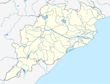
투수라 공습
Tusura Airstrip투수라 공습 | |||||||||||
|---|---|---|---|---|---|---|---|---|---|---|---|
| 요약 | |||||||||||
| 공항 유형 | 공용/개인 | ||||||||||
| 주인 | 오디샤 정부 | ||||||||||
| 서브 | 발랑기르 | ||||||||||
| 위치 | 오디샤 발랑기르 구 투수라 | ||||||||||
| 표고 AMSL | 656피트/200m | ||||||||||
| 좌표 | 20°30′41″n 83°26'50ºE/20.51139°N 83.44722°E좌표: 20°30'41ºN 83°26'50ºE / 20.51139°N 83.44722°E / | ||||||||||
| 지도 | |||||||||||
| 활주로 | |||||||||||
| |||||||||||
발랑기르 활주로(, ICAO: VETS)[2]라고도 알려진 [3][4]투수라 활주로는 오디샤 주 발랑기르 지구에 위치한 공중 활주로입니다.이 활주로에서 가장 가까운 공항/비행장은 [5][6]오디샤 주 바와니파트나에 있는 Utkela Airridp입니다.이 시설을 개량해 주내 GATI가 [7][8]비행학교의 제2기지로 활용할 계획입니다.
레퍼런스
- ^ "Great Circle Mapper".
- ^ "Airport codes Tusra, India (IN)". airportsbase.org.
- ^ "List of Airstrip in the State maintained by State Government" (PDF). ct.odisha.gov.in. Commerce and Transport Department, Government of Odisha. Retrieved 14 January 2023.
- ^ "AAI Unserved Airports" (PDF). aai.aero. Airports Authority of India.
- ^ "List of airports in Odisha, India (excluding heliports and closed airports)". Our Airports.
- ^ "Nuagaon Airport code and information". airportdatabase.net.
- ^ "Airstrip for flight training". www.telegraphindia.com.
- ^ "'Include Tusura airstrip in UDAAN Scheme'". Daily Pioneer. 7 September 2020.


