알바니아의 도시 목록

List of cities and towns in Albania

이 목록은 알바니아 공화국 도시와 마을통계연구소(INSTAT)가 사용하는 기준에 따라 자치체 또는 카운티별로 알파벳 순으로 분류한 목록입니다.이 연구소는 알바니아 정착촌을 도시와 시골로 분류한다.2014년 현재 도시권 74개 시, [1]농촌권 2,972개 촌이 있다.

이 나라의 [1]법률은 알바니아에서 도시 또는 도시 지역을 정의하는 기준에 대한 분류를 제공하지 않습니다.그럼에도 불구하고 경제협력개발기구(OECD)가 실시한 도시 방법론에 따르면, 티라나, 두러스, 엘바산, 슈코더, 블로러포함한 5개 지역은 도시 감사 [1][2]도시로 분류될 수 있다.

알바니아의 도시와 마을은 주민 수에 따라 다음과 같은 규모 범위에 속합니다.

목록.

도시[1] 자치체 자치주 Population (2011년) 지리 좌표 Ref.
바지람 쿠리 트로포제 쿠커스 5,340 42°21~29°N 20°4°33°E/42.35806°N 20.07583°E/ 42.35806, 20.07583(바흐람 쿠리) [3]
바지제 말러시 에 마데 슈코다루 2,346 42°16°35°N 19°255656eE/42.27639°N 19.43222°E/ 42.27639; 19.43222(바제)
발쉬 말라카스터 치열하다 7,657 40°36°3°N 19°44°11°E/40.60083°N 19.73639°E/ 40.60083, 19.73639(볼시) [4]
베라토 베라토 베라토 36,496 40°42°24°N 19°57′8″e/40.70667°N 19.95222°E/ 40.70667, 19.95222(베라트) [5]
빌리슈트 데보루 코르처 6,250 40°37°16°N 20°59, 17°E/40.62111°N 20.98806°E/ 40.62111, 20.98806(빌리쉬트) [6]
불키제 불키제 디버 8,177 41°29~30°N 20°13°19°E/41.49167°N 20.22194°E/ 41.49167; 20.22194(벌키저) [7]
부렐 매트. 디버 10,862 41°36°34°N 20°0′44″e/41.60944°N 20.01222°E/ 41.60944; 20.01222(버렐) [7]
케릭 케릭 엘바산 6,695 41°13636nN 19°592121eE/41.02667°N 19.98917°E/ 41.02667, 19.98917(커릭) [8]
쇼로보드 스크라파르 베라토 4,051 40°30′15″n 20°13°38°E/40.50417°N 20.22722°E/ 40.50417, 20.22722(소로보더) [5]
델비네 델비네 블로러 5,754 39°57, 17°N 20°5/56°E/39.95472°N 20.09889°E/ 39.95472, 20.09889(델바이너) [9]
디자커 디자커 치열하다 8,445 40°59′47§ N 19°31°57°E/40.99639°N 19.53250°E/ 40.99639, 19.53250(디바커) [4]
두러스 두러스 두러스 113,249 41°184040nN 19°26°21°E/41.3111°N 19.43917°E/ 41.3111; 19.43917(듀러) [10]
엘바산 엘바산 엘바산 78,703 41°64141nN 20°4°49°E/41.11139°N 20.08028°E/ 41 . 11139 20 . 08028(엘바산) [8]
에르세카 코오롱제 코르처 3,746 40°20′24″n 20°40′54″e/40.34000°N 20.68167°E/ 40.34000, 20.68167(Erseker) [6]
치열하다 치열하다 치열하다 55,845 40°43°30°N 19°33~26°E/40.72500°N 19.55722°E/ 40.72500, 19.55722() [4]
피에르제 트로포제 쿠커스 1,607 42°15°47°N 20°13030eE/42.26306°N 20.02500°E/ 42.26306, 20.02500() [3]
피니크 피니크 블로러 1,333 39°54°25°N 20°3°32°E/39.90694°N 20.05889°E/ 39.90694; 20.0589(Finiq) [9]
푸셔-아레즈 푸셔-아레즈 슈코다루 2,513 42°34343nN 20°0′59″e/42.06194°N 20.01639°E/ 42.06194; 20.01639(푸셔-아레즈) [11]
푸셔크루저 크루제 두러스 18,477 41°28°44°N 19°43°14°E/41.47889°N 19.72056°E/ 41.47889; 19.1956(푸셔-크루저) [10]
지로카스터 지로카스터 지로카스터 19,836 40°500nN 20°8°20°E/40.08333°N 20.1389°E/ 40.08333; 20.1889(지로카스터) [12]
그램시 그램시 엘바산 8,440 40°52°10°N 20°11′3″e/40.86944°N 20.18417°E/ 40.86944; 20.18417(그램) [8]
히마레 히마레 블로러 2,822 40°6/10°N 19°444444eE/40.10278°N 19.74556°E/ 40.10278; 19.74556(히마레) [9]
카메즈 카메즈 티라나 66,841 41°225454nN 19°45°37°E/41.38167°N 19.76028°E/ 41.38167; 19.76028(카메즈) [13]
카바제 카바제 티라나 20,192 41°111616nN 19°33°29°E/41.1878°N 19.55806°E/ 41.14078; 19.55806(카바제) [13]
켈시러 켈시러 지로카스터 2,651 40°18°32°N 20°10′55″e/40.30889°N 20.18194°E/ 40.30889; 20.18194(켈시러) [12]
클로스 클로스 디버 7,873 41°29, 58°N 20°544eE/41.49944°N 20.08444°E/ 41.49944; 20.08444(Klos) [7]
코니스폴 코니스폴 블로러 2,123 39°39°32°N 20°10′53″e/39.6589°N 20.18139°E/ 39.6589; 20.18139(코니스폴) [9]
코플릭 말러시 에 마데 슈코다루 3,734 42°12′49§ N 19°26°11°E/42.21361°N 19.43639°E/ 42.21361; 19.43639(코플릭) [11]
코르처 코르처 코르처 51,152 40°36°57°N 20°46°48°E/40.61583°N 20.78000°E/ 40.61583; 20.78000(코서) [6]
크라스터 불키제 디버 1,540 41°29~30°N 20°13°19°E/41.49167°N 20.22194°E/ 41.49167; 20.22194(Kraster) [7]
크라바 티라나 티라나 2,343 41°12°58°N 19°58,14°E/41.21611°N 19.97056°E/ 41.21611; 19.97056(크래버) [13]
크루제 크루제 두러스 11,721 41°30′50″n 19°47°31°E/41.51389°N 19.79194°E/ 41.51389; 19.79194(크루저) [10]
쿠루마 가지다 쿠커스 6,006 42°12°0°N 20°25°0°E/42.2만°N 20.41667°E/ 42.200, 20.41667(Krumé) [3]
쿠소버 쿠소버 베라토 12,654 40°48°13°N 19°54~52°E/40.80361°N 19.91444°E/ 40.80361; 19.91444(쿠소버) [5]
쿠커스 쿠커스 쿠커스 16,719 42°4°52°N 20°25′12″e/42.08111°N 20.42000°E/ 42.08111, 20.42000(쿠커) [3]
쿠르브네시 미르디테 레저 1,429 41°46°48°N 20°4°48°E/41.78000°N 20.08000°E/ 41.78000, 20.08000(커브네시) [14]
라츠 쿠르빈 레저 17,086 41°3866nN 19°42~46°E/41.63500°N 19.71278°E/ 41.63500, 19.71278(라즈) [14]
레스코비크 코오롱제 코르처 1,525 49°9°0°N 20°36°0°E/49.15000°N 20.60000°E/ 49.15000, 20.600(레스코비크) [6]
레저 레저 레저 15,510 41°46°55°N 19°38°40°E/41.78194°N 19.644444°E/ 41.78194; 19.6444(레저) [14]
리포호버 리포호버 지로카스터 1,992 40°1~52°N 20°15°47°E/40.03111°N 20.26306°E/ 40.03111, 20.26306(리보호버) [12]
천칭자리 천칭자리 엘바산 6,937 41°104646nN 20°18°54°E/41.17944°N 20.31500°E/ 41.14044; 20.31500(Librazhd) [12]
루슈니에 루슈니에 치열하다 31,105 40°56′34§ N 19°42°18°E/40.94278°N 19.70500°E/ 40.94278, 19.70500(루슈냐) [4]
말리크 말리크 코르처 4,290 40°42~30°N 20°42°0°E/40.70833°N 20.70000°E/ 40.70833; 20.700(Maliq) [6]
마모라 쿠르빈 레저 15,284 41°34°39°N 19°41′32″e/41.5750°N 19.69222°E/ 41.5750, 19.69222(마무라) [14]
마네즈 두러스 두러스 6,652 41°2600nN 19°35°0°E/41.433333°N 19.583333°E/ 41.43333; 19.58333(매너즈) [10]
메말리아지 메말리아지 지로카스터 2,647 40°21°0°N 19°59′0″e/40.35000°N 19.98333°E/ 40.35000, 19.98333(메모리아지) [12]
밀로 쿠르빈 레저 8,461 41°4111nN 19°42°57°E/41.68361°N 19.71583°E/ 41.68361; 19.71583(우유) [14]
오리쿰 블로러 블로러 5,503 40°2000nN 19°28°0°E/40.333333°N 19.46667°E/ 40.3333, 19.46667(오리쿰) [9]
파토스 파토스 치열하다 15,937 40°41°0°N 19°37°10°E/40.68333°N 19.61944°E/ 40.68333, 19.61944(Patos) [4]
페킨 페킨 엘바산 6,353 41°24646nN 19°45°4°E/41.04611°N 19.75111°E/ 41.04611; 19.75111(Peqin) [8]
퍼메트 퍼메트 지로카스터 5,945 40°1411nN 20°2166eE/40.2361°N 20.35167°E/ 40.2361; 20.35167(페어메트) [12]
페시코피 디버 디버 13,251 41°41°10°N 20°25°44°E/41.68611°N 20.42889°E/ 41.68611, 20.42889(페시코피) [7]
포그라데치 포그라데치 코르처 20,848 40°54°25°N 20°38°53°E/40.90694°N 20.64806°E/ 40.90694, 20.64806(포그라덱) [6]
폴리산 폴리산 베라토 4,318 40°36°36°36°N 20°5/56°E/40.61000°N 20.09889°E/ 40.61000, 20.09889(폴리산) [5]
프렌하스 프렌하스 엘바산 5,847 41°400nN 20°33°0°E/41.06667°N 20.55000°E/ 41.06667, 20.55000(프레냐스) [8]
푸커 푸커 슈코다루 3,607 42°24040nN 19°53′59§ E/42.04444°N 19.89972°E/ 42.0444, 19.89972(푸커) [11]
대표자 미르디테 레저 1,899 41°51°58°N 20°1′33″e/41.86611°N 20.02583°E/ 41.86611, 20.02583(담당자) [14]
로스코베츠 로스코베츠 치열하다 4,975 40°44°16°N 19°42°10°E/40.73778°N 19.70278°E/ 40.7078; 19.70278(로스코벡) [4]
라셴 미르디테 레저 8,803 41°4633nN 19°52°32°E/41.76750°N 19.87556°E/ 41.76750, 19.87556(라센) [14]
로고지네 로고지네 티라나 7,049 41°43535nN 19°39′55″e/41.07639°N 19.66528°E/ 41.07639; 19.66528(Rogozhiner) [13]
루빅 미르디테 레저 4,454 41°46°28°N 19°47°10°E/41.774444°N 19.78611°E/ 41.77444; 19.78611(루빅) [14]
사란데 사란데 블로러 17,233 39°52′33§ N 20°0′40″e/39.87583°N 20.01111°E/ 39.87583; 20.01111(새런더) [9]
셀레니커 셀레니커 블로러 2,235 40°31°50°N 19°38,9°E/40.53056°N 19.63583°E/ 40.53056, 19.63583(세니커) [9]
생진 레저 레저 8,091 41°48~49°N 19°35°38°E/41.81361°N 19.59389°E/ 41.81361; 19.59389(상진) [14]
시작 두러스 두러스 7,568 41°20′44″n 19°34°1°E/41.34556°N 19.56694°E/ 41.34556; 19.56694(시작) [10]
슈코다루 슈코다루 슈코다루 77,075 42°455nN 19°30′43″e/42.06806°N 19.51194°E/ 42.06806, 19.51194(슈코더) [11]
수스 두러스 두러스 15,966 41°22°42°N 19°32′9″e/41.37833°N 19.53583°E/ 41.37833; 19.53583(수크) [10]
테펠레나 테펠레나 지로카스터 4,342 40°17°44°N 20°188eE/40.29556°N 20.01889°E/ 40.29556; 20.01889(테펠레나) [12]
티라나 티라나 티라나 418,495 41°19′39§ N 19°49-6°E/41.32750°N 19.81833°E/ 41.32750, 19.81833(티라나) [13]
울러즈 매트. 디버 1,229 41°41°0°N 19°53′4″e/41.68333°N 19.88444°E/ 41.68333, 19.88444(울러즈) [7]
우라바구로레 우라바구로레 베라토 7,232 40°46~30°N 19°52°30°E/40.77500°N 19.87500°E/ 40.77500, 19.87500(우라바구로레) [5]
바우이 데제스 바우이 데제스 슈코다루 8,117 42°000nN 19°38°0°E/42.00000°N 19.63333°E/ 42.00000, 19.6333(Vau i Dejés) [11]
블로러 블로러 블로러 79,513 40°28, 14°N 19°29°27°E/40.47056°N 19.49083°E/ 40.49083(블로러) [9]
보러 보러 티라나 10,901 41°23°38°N 19°39°16°E/41.39389°N 19.654°E/ 41.39389; 19.65444(볼러) [13]

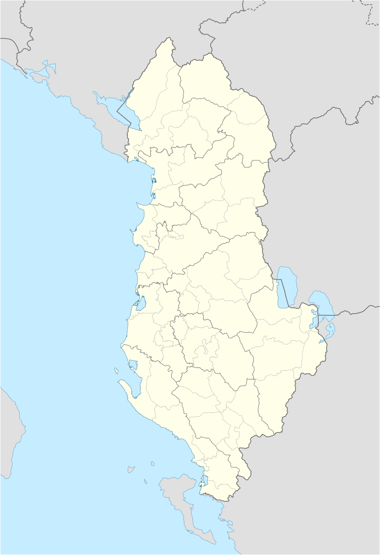
지도

갤러리

레퍼런스

  1. ^ a b c d "A new urban-rural classification of Albanian population" (PDF). Institute of Statistics (INSTAT). Archived from the original (PDF) on 21 November 2017. Retrieved 11 October 2020.
  2. ^ Dijkstra, Lewis; Poelman, Hugo. "Cities in Europe–The new OECD-EC definition" (PDF). Organisation for Economic Co-operation and Development (OECD). p. 13. Archived (PDF) from the original on 11 October 2020. Retrieved 11 October 2020.
  3. ^ a b c d Nurja, Ines. "Censusi i popullsisë dhe banesave/ Population and Housing Census–Kukës (2011)" (PDF). Tirana: Institute of Statistics (INSTAT). p. 39. Archived from the original (PDF) on 11 October 2020. Retrieved 11 October 2020.
  4. ^ a b c d e f Nurja, Ines. "Censusi i popullsisë dhe banesave/ Population and Housing Census–Fier (2011)" (PDF). Tirana: Institute of Statistics (INSTAT). p. 85. Archived from the original (PDF) on 11 October 2020. Retrieved 11 October 2020.
  5. ^ a b c d e Nurja, Ines. "Censusi i popullsisë dhe banesave/ Population and Housing Census–Berat (2011)" (PDF). Tirana: Institute of Statistics (INSTAT). p. 85. Archived from the original (PDF) on 11 October 2020. Retrieved 11 October 2020.
  6. ^ a b c d e f Nurja, Ines. "Censusi i popullsisë dhe banesave/ Population and Housing Census–Korçë (2011)" (PDF). Tirana: Institute of Statistics (INSTAT). p. 85. Archived from the original (PDF) on 11 October 2020. Retrieved 11 October 2020.
  7. ^ a b c d e f Nurja, Ines. "Censusi i popullsisë dhe banesave/ Population and Housing Census–Dibër (2011)" (PDF). Tirana: Institute of Statistics (INSTAT). p. 85. Archived from the original (PDF) on 27 March 2020. Retrieved 11 October 2020.
  8. ^ a b c d e Nurja, Ines. "Censusi i popullsisë dhe banesave/ Population and Housing Census–Elbasan (2011)" (PDF). Tirana: Institute of Statistics (INSTAT). p. 85. Archived from the original (PDF) on 11 October 2020. Retrieved 11 October 2020.
  9. ^ a b c d e f g h Nurja, Ines. "Censusi i popullsisë dhe banesave/ Population and Housing Census–Vlorë (2011)" (PDF). Tirana: Institute of Statistics (INSTAT). p. 85. Archived from the original (PDF) on 13 June 2020. Retrieved 11 October 2020.
  10. ^ a b c d e f Nurja, Ines. "Censusi i popullsisë dhe banesave/ Population and Housing Census–Durrës (2011)" (PDF). Tirana: Institute of Statistics (INSTAT). p. 85. Archived from the original (PDF) on 27 March 2020. Retrieved 11 October 2020.
  11. ^ a b c d e Nurja, Ines. "Censusi i popullsisë dhe banesave/ Population and Housing Census–Shkodër (2011)" (PDF). Tirana: Institute of Statistics (INSTAT). p. 85. Archived from the original (PDF) on 11 October 2020. Retrieved 11 October 2020.
  12. ^ a b c d e f g Nurja, Ines. "Censusi i popullsisë dhe banesave/ Population and Housing Census–Gjirokastër (2011)" (PDF). Tirana: Institute of Statistics (INSTAT). p. 85. Archived from the original (PDF) on 11 October 2020. Retrieved 11 October 2020.
  13. ^ a b c d e f Nurja, Ines. "Censusi i popullsisë dhe banesave/ Population and Housing Census–Tirana (2011)" (PDF). Tirana: Institute of Statistics (INSTAT). p. 85. Archived from the original (PDF) on 9 October 2020. Retrieved 11 October 2020.
  14. ^ a b c d e f g h i Nurja, Ines. "Censusi i popullsisë dhe banesave/ Population and Housing Census–Lezhë (2011)" (PDF). Tirana: Institute of Statistics (INSTAT). p. 85. Archived from the original (PDF) on 27 March 2020. Retrieved 11 October 2020.