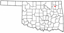
스너 섬
Snag Island | |
| 지리 | |
|---|---|
| 위치 | 북캘리포니아 주 |
| 좌표 | 38°04′22″N 121°58′23″w / 38.07278°N 121.97306°W[1]좌표: 38°04′22″N 121°58′23″W / 38.07278°N 121.97306°W/ 섬[1] |
| 인접 수역 | 쑤이순 만 |
| 관리 | |
| 주 | |
| 카운티 | 솔라노 |
스너섬은 캘리포니아 수이순만에 있는 작은 섬이다.[2][3][4] 솔라노 군의 일부다.[5][6] 좌표는 38°040422″N 121°5이다.8′23″W / 38.07278°N 121.97306°W/ 섬[1]
참조
- ^ a b 미국 지질조사국 지리적 이름 정보 시스템: 스너 섬
- ^ California State Automobile Association (1999). San Francisco Bay Region (Map). 1:190,000. American Automobile Association.
- ^ "Guess we'll just have to blame it on the bananas". The Modesto Bee. Modesto, California. 1995-12-07. p. 11.
- ^ "Contra Costa County". The San Francisco Examiner. San Francisco, California. 1990-06-25. p. 13.
- ^ "Legal Notice". Concord Transcript. Concord, California. 1967-11-02. p. 9.
- ^ "Agencies in dispute over oil spill cleanup". The San Francisco Examiner. San Francisco, California. 1988-05-02. p. 16.


