브래드무어 섬
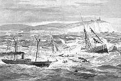
Bradmoor Island 브래드무어 섬의 USGS 공중사진 | |
 브래드무어 섬  브래드무어 섬  브래드무어 섬 | |
| 지리 | |
|---|---|
| 위치 | 북캘리포니아 주 |
| 좌표 | 38°11′26″N 121°55′05″w / 38.19056°N 121.91806°W[1]좌표: 38°11′26″N 121°55′05″W / 38.19056°N 121.91806°W/ [1] |
| 인접 수역 | 새크라멘토-산호아킨 강 삼각주 |
| 최고 고도 | 52피트(15.8m)[1] |
| 관리 | |
미국 | |
| 주 | |
| 카운티 | 솔라노 |
브래드무어 섬(Bradmoor Island)은 수이순만에 있는 섬이다.[2][3][4] 캘리포니아 솔라노 군의 일부로서 어떠한 간척지에서도 관리하지 않는다.[5] 좌표는 38°111126″N 121°5이다.5′05″W / 38.19056°N 121.91806°W/ 섬[1] 및 미국 지질조사국은 1981년에 52ft(16m)로 고도를 측정했다.[1]
참조
- ^ a b c d 미국 지질조사국 지명정보시스템: 브래드무어 섬
- ^ California State Automobile Association (1999). San Francisco Bay Region (Map). 1:190,000. American Automobile Association.
- ^ "Bradmoor Island Tidal Restoration Project" (PDF). California Natural Resources Agency. 2017.
- ^ "Bradmoor Island Tidal Restoration" (PDF). California Eco Restore. 2016.
- ^ "Municipal Service Review: Solano County Water, Irrigation, Reclamation, and Flood Management Agencies" (PDF). Solano County LAFCO. Michael Brandman Associates. 13 April 2009. Archived (PDF) from the original on 14 March 2021. Retrieved 25 February 2021.
|