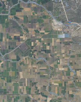
로버츠 섬 (캘리포니아 주)
Roberts Island (California) | |
| 지리 | |
|---|---|
| 위치 | 북캘리포니아 주 |
| 좌표 | 37°54′18″N 121°23′07″W / 37.9049250°N 121.3852250°W[1]좌표: 37°54′18″N 121°23′07″W / 37.9049250°N 121.3852250°W/ [1] |
| 인접 수역 | 새크라멘토-산호아킨 강 삼각주 |
| 관리 | |
| 주 | |
| 카운티 | 산호아킨 |
로버츠 섬(Roberts Island)은 캘리포니아 주 산 호아킨 강 삼각주에 있는 섬이다.[2][3][4][5][6][7][8][9] 산호아킨 현에 속하며, 매립지 544구(상부 로버츠 섬), 524구(중부 로버츠 섬), 684구(하부 로버츠 섬)에서 관리한다.[10] 좌표는 37°545418″N 121°2이다.3′07″W / 37.9049250°N 121.3852250°W/ 섬[1]
참조
- ^ a b 미국 지질조사국 지리적 이름 정보 시스템: 로버츠 섬
- ^ California State Automobile Association (2007). Coast and Valley: Bay Area to Southern California (Map). 1:560,000. American Automobile Association.
- ^ "Commercial". Daily Evening Herald. Stockton, California. 1875-03-12. p. 3.
- ^ "Large Transfers". Daily Evening Herald. Stockton, California. 1875-04-08. p. 3.
- ^ "A broken levee: Roberts' Island threatened with a serious flood". The Mail. Stockton, California. 1880-06-07. p. 3.
- ^ "Waters Break out of Paradise Cut on Both Sides". The Evening Mail. Stockton, California. 1914-01-28. p. 10.
- ^ "Rancher Declares Productive Worth of Roberts Island Leads Many of Higher-Value Sections by 5 to 1". The Evening Mail. Stockton, California. 1914-08-26. p. 6.
- ^ "Roberts Island Rifle club to hold big turkey shoot at its new club house tomorrow". Stockton Daily Evening Record. Stockton, California. 1919-11-22. p. 32.
- ^ "Water wars returning to boil over 'peripheral tunnel'". The Modesto Bee. Modesto, California. 2012-08-12. p. A15.
- ^ "Municipal Service Review: Selected San Joaquin County Reclamation Districts" (PDF). San Joaquin Local Agency Formation Commission. E Mulberg & Associates. 18 March 2018. Archived (PDF) from the original on 14 March 2021. Retrieved 24 February 2021.


