푸에르토리코 라하스
Lajas, Puerto Rico라하스 무니시오 데 라하스 시 | |
|---|---|
시와 시 | |
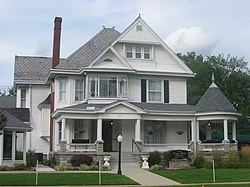
 라하스의 집 | |
.svg) 깃발  국장 | |
| 닉네임: 시우다드 카르데날리시아 "로스 티라 피에드라스" | |
| 애국가: "누에스트로 라하스, 푸에블리토 퀘리도" | |
 푸에르토리코의 지도 라하스 자치구 강조 | |
| 좌표: 18°03′07″N 67°03′35″w / 18.05194°N 67.05972°W좌표: 18°03′07″N 67°03′35″W / 18.05194°N 67.05972°W | |
| 영연방 | |
| 설립됨 | 1883 |
| 바리오스 | |
| 정부 | |
| • 시장 | 제이슨 마르티네스 (PNP) |
| • 상원 의원. | 5 - 폰스 |
| • 대표적인 차이. | 21 |
| 면적 | |
| • 합계 | 76.85 sq mi(199.04km2) |
| • 육지 | 61 sq mi (160 km2) |
| • 물 | 15.85 sq mi(41.04km2) |
| 인구 (2020)[1] | |
| • 합계 | 23,334 |
| • 밀도 | 300/sq mi(120/km2) |
| 데모닉 | 라예뇨스 |
| 시간대 | UTC-4(AST) |
| 우편번호 | 00667 |
| 지역 번호 | 787/939 |
| 주요 노선 | |
라하스(스페인어 발음: [ˈlaxas])는 푸에르토리코 남서부의 라하스 계곡에 위치한 푸에르토리코의 마을이자 자치단체로, 섬의 남쪽 해안에 위치하며 카리브 해와 접하고, 산 게르만과 사바나 그란데의 남쪽, 카보 로조의 동쪽, 과니카의 서쪽이다. 라하스는 11개의 바리오스와 라하스 푸에블로(도심 지역과 도시의 행정 중심지)에 걸쳐 분포되어 있다. 산 게르만-카보 로조 메트로폴리탄 통계 지구의 일부다.
역사
라하스 계곡에 위치한 이 마을은 1883년 쉬에타 테오도로 자코메 파간(Sheeta Teodoro Jacome Pangan)에 의해 설립되었다. 쉬에테스(Chuetas)는 메이저칸 유대인(세파르디 카탈루냐 유대인)이었다. 몇몇 가족들은 그들의 이름을 자코메에서 산티아고식으로 카스틸리아식으로 바꾸었다. 자코메는 제임스(아이아코프)의 말로퀸 형식이다. 마요르카 출신의 카탈루냐 유대인들은 (보리켄) 남부 (푸에르토리코)의 초기 정착민들의 일부였다.
푸에르토리코는 1898년 파리 조약의 조항에 따라 스페인-미국 전쟁의 여파로 스페인에 양도되어 미국의 영토가 되었다. 1899년, 미국은 푸에르토리코에 대한 첫 인구조사를 실시했는데, 라하스의 인구는 8,789명이었다.[2]
라파르게라 마을은 유명한 바이아 포스포레센테(인광만)와 수많은 열쇠와 섬을 볼 수 있는 유명한 관광지다.[3]
바리오 보케리온의 엘 콤바테 공동체 사람들은 살리나스를 둘러싼 싸움에 관한 민화에 근거하여 마타콘 하차("도끼로 죽이는 사람들")로 알려져 있는데, 카보 로조 출신들은 라하스 인근 마을에서 온 사람들과 도끼로 싸웠다. 라하스에서 온 사람들은 분명히 돌을 던짐으로써 맞서 싸웠기 때문에 그들은 티라 피에드라라고 알려져 있다.[4]
지리

라하스는 남해안에 위치해 있다. 라구나 카르타헤나 국립 야생동물 보호구역은 라하스에 위치한 국가 보호구역이다.[5]
바리오스

푸에르토리코의 모든 자치구와 마찬가지로 라하스도 바리오스로 세분된다. 시립 건물, 중앙 광장, 큰 가톨릭 교회는 "엘 푸에블로"라고 불리는 작은 바리오에 위치해 있다.[6][7][8][9][10][11]
섹터
바리오스와 서브바리오스는 차례로 [13]더 작은 지역 인구 밀집 지역/종파라 불리는 단일 지역으로 세분된다.[12] 종파의 종류는 보통 부문별로, 우르바니자시온에서 재파르토, 바리아다에서 잔재까지 다양할 수 있다.[14][15][16]
스페셜 커뮤니티
Comunidades Especiales de Puerto Rico(푸에르토리코 특별 공동체)는 시민들이 일정량의 사회적 배제를 경험하고 있는 소외된 공동체다. 지도는 이러한 지역사회가 연방의 거의 모든 자치단체에서 발생한다는 것을 보여준다. 2014년 순위에 오른 742곳 중 라하스에 속한 곳은 다음과 같은 바리오, 커뮤니티, 섹터 또는 동네였다. 엘 파파요, 엘 텐달, 섹터 사바나 예과스, 라 하야, 라스 쿠에바스, 로스 조빌로스, 마구야요, 피냐요스, 토키오.[17][18]
인구통계학
| 역사인구 | |||
|---|---|---|---|
| 인구조사 | Pop. | %± | |
| 1900 | 8,789 | — | |
| 1910 | 11,071 | 26.0% | |
| 1920 | 11,908 | 7.6% | |
| 1930 | 12,454 | 4.6% | |
| 1940 | 14,736 | 18.3% | |
| 1950 | 16,326 | 10.8% | |
| 1960 | 15,375 | −5.8% | |
| 1970 | 16,545 | 7.6% | |
| 1980 | 21,236 | 28.4% | |
| 1990 | 23,271 | 9.6% | |
| 2000 | 26,261 | 12.8% | |
| 2010 | 25,753 | −1.9% | |
| 2020 | 23,334 | −9.4% | |
| 미국 십수년 인구[19] 조사 1899년 (1990년 ~[20] 1900년) 1910년[21] 1930-1950[22] 1960-2000[23] 2010[24] 2020[25] | |||
관광업
라하스는 주요 관광명소인 인광만(La Parguera)으로 유명하며, 물이 움직이면 다른 색깔의 생물 발광 다이노플라겔라제트가 나타나는 곳이다. 채색 조명의 기원은 많은 전설의 대상이다. 라하스는 또한 어촌이다.
랜드마크 및 관심장소

라하스에는 5개의 해변이 있다.[26] 라하스의 주요 매력은 다음과 같다.
- 카르타헤나 라군
- 인도 박물관
- 올드 트레인 스테이션
- 올드 실버 광산
- 라파르게라
- 라예뇨 전사 기념비
- 이슬라 마귀예스
- 이슬라 마타 라 가타
- 파인애플 가공 공장 폐허
- 로사다 비치 또는 플레이리타 로사다
- 카라콜스 비치
- 카리브 어업
- 푸에르토리코 외계인 루트는 라하스 출신 현지인이 외계인 착륙을 환영하기 위해 개발한 착륙지대를 지나간다.[27]
문화
축제 및 행사
라하스는 2월에 그것의 수호 성인 축제를 기념한다. Fiestas Patrantales de Nuestra Senora de la Candelaria는 일반적으로 퍼레이드, 게임, 장인, 놀이 기구, 지역 음식, 라이브 엔터테인먼트를 특징으로 하는 종교적이고 문화적인 축하 행사다.[5][28]
라하스에서 기념되는 다른 축제와 행사는 다음과 같다.
- 연 축제 – 2월 / 3월
- 페스카 데 라 아구야 아줄 축제 – 5월
- 파인애플 축제 (페스티발 드 라 피냐 파라디시아카) - 5월 또는 6월, 미술, 공예, 음악, 그리고 파인애플[29] 30,000파운드까지 5만 명이 오는 곳
- 산페드로 축제 – 6월
- 농업 박람회 또는 (페리아 아그리콜라 나시오날 델 라하스) – 6월/7월[30]
- 크리스마스 퍼레이드 및 장인 박람회 – 12월
정부
푸에르토리코의 모든 자치 단체들처럼, 라하스는 시장이 관리한다. 현 시장은 진보신당 출신의 제이슨 마르티네스다. 마르티네스는 2020년 총선에서 당선되었다.
이 도시는 두 명의 상원의원으로 대표되는 푸에르토리코 상원의원 지역 5에 속한다. 2012년에는 민중민주당 출신의 라몬 루이즈와 마르틴 바르가스 모랄레스가 지역구 상원의원으로 선출되었다.[31]
교통
라하스에는 5개의 다리가 있다.[32]
주목할 만한 라예뇨스
- 루이스 아폰테 마르티네스, 로마 가톨릭 산후안 대교구 추기경
- 울리스 카시아노 마야구에즈 교구의 로마 가톨릭 주교
- 로빈슨 취소, 메이저리그 선수
- 자코보 모랄레스, 배우 겸 영화 감독
- 호세 "조" 바소라, 푸에르토리코 복서
기호
라하스 시티오는 공식 깃발과 무장을 가지고 있다.[33]
깃발
깃발은 세 개의 가로줄무늬로 구성되어 있는데, 위쪽 줄무늬는 녹색이고, 가운데 줄무늬는 흰색이고 아래쪽 줄무늬는 연한 노란색이다. 왼쪽 아래 수직의 흰색 줄무늬가 흰색 십자가를 만든다. 십자가 중앙에는 잘 익은 노란 파인애플이 있다. 십자가는 11개의 금성으로 둘러싸여 있는데, 그 가운데 윗부분은 5개, 아랫부분은 6개로 원을 그렸다.[34]
국장
그것은 금으로 그린 띠가 좌우 대각선으로 교차하는 금이다. 금은 땅의 부를 상징하고, 계곡의 아름다움을 상징하는데, 이것은 대자연이 라하스에게 준 선물이다. 그 밴드는 양쪽 끝에 금색과 검은색으로 파인애플이 둘려 장식되어 있다. 밴드의 중앙에는 금으로 된 조개껍질도 있다. 왼쪽 상단에는 붉은 추기경의 모자가 있고, 아래쪽에는 녹색의 붉은 닻이 있으며, 방패에는 각각 창문이 2개, 문이 1개씩 있는 3개의 탑 성이 있다. 아래쪽, 방패 바깥쪽에는 "Ciudad Cardenalicia"(카르디날리티 시티)라는 글씨가 새겨진 현수막이 걸려 있었다. 현수막과 비문이 검은색으로 나타난다.[34]
갤러리
라하스 주변의 장면:

페리아 아그리콜라 나시오날 델 발레 데 라하스의 어린이

라파르쿠에라의 케이와 보트

라하스의 카리브해의 보트

라파르게라의 로즈테른 (위협종 리스트에)

라파르게라 선착장 위 월출


참고 항목
참조
- ^ Bureau, US Census. "PUERTO RICO: 2020 Census". The United States Census Bureau. Retrieved 2021-08-25.
- ^ Joseph Prentiss Sanger; Henry Gannett; Walter Francis Willcox (1900). Informe sobre el censo de Puerto Rico, 1899, United States. War Dept. Porto Rico Census Office (in Spanish). Imprenta del gobierno. p. 164. Archived from the original on 2012-11-15. Retrieved 2020-01-22.
- ^ "La Parguera". Lajas PR. Archived from the original on 2016-10-28. Retrieved 2019-03-15.
- ^ "Página Oficial Municipio Autónomo de Cabo Rojo". Cabo Rojo PR. Archived from the original on 2019-04-04. Retrieved 2019-03-15.
- ^ a b "Lajas Municipality". enciclopediapr.org. Fundación Puertorriqueña de las Humanidades (FPH). Archived from the original on 2020-08-23. Retrieved 2019-03-20.
- ^ Picó, Rafael; Buitrago de Santiago, Zayda; Berrios, Hector H. Nueva geografía de Puerto Rico: física, económica, y social, por Rafael Picó. Con la colaboración de Zayda Buitrago de Santiago y Héctor H. Berrios. San Juan Editorial Universitaria, Universidad de Puerto Rico,1969. Archived from the original on 2018-12-26. Retrieved 2019-01-12.
- ^ Gwillim Law (20 May 2015). Administrative Subdivisions of Countries: A Comprehensive World Reference, 1900 through 1998. McFarland. p. 300. ISBN 978-1-4766-0447-3. Retrieved 25 December 2018.
- ^ Puerto Rico:2010:population and housing unit counts.pdf (PDF). U.S. Dept. of Commerce, Economics and Statistics Administration, U.S. Census Bureau. 2010. Archived (PDF) from the original on 2017-02-20. Retrieved 2019-01-12.
- ^ "Map of Lajas" (PDF). Archived from the original (PDF) on 2012-07-30. Retrieved 2018-12-28.
- ^ "Archived copy". Archived from the original on 2007-03-22. Retrieved 2007-12-18.CS1 maint: 제목으로 보관된 복사본(링크)
- ^ "Map of the Neighborhoods (Barrios) of Lajas". Lajas PR. Archived from the original on 2007-12-21. Retrieved 2007-12-18.
- ^ "US Census Barrio-Pueblo definition". factfinder.com. US Census. Archived from the original on 13 May 2017. Retrieved 5 January 2019.
- ^ "P.L. 94-171 VTD/SLD Reference Map (2010 Census): Lajas Municipio, PR" (PDF). www2.census.gov. U.S. DEPARTMENT OF COMMERCE Economics and Statistics Administration U.S. Census Bureau. Archived (PDF) from the original on 23 August 2020. Retrieved 22 August 2020.
- ^ "Agencia: Oficina del Coordinador General para el Financiamiento Socioeconómico y la Autogestión (Proposed 2016 Budget)". Puerto Rico Budgets (in Spanish). Archived from the original on 28 June 2019. Retrieved 28 June 2019.
- ^ Rivera Quintero, Marcia (2014), El vuelo de la esperanza: Proyecto de las Comunidades Especiales Puerto Rico, 1997-2004 (first ed.), San Juan, Puerto Rico Fundación Sila M. Calderón, ISBN 978-0-9820806-1-0
- ^ "Leyes del 2001". Lex Juris Puerto Rico (in Spanish). Archived from the original on 14 September 2018. Retrieved 24 June 2020.
- ^ Rivera Quintero, Marcia (2014), El vuelo de la esperanza:Proyecto de las Comunidades Especiales Puerto Rico, 1997-2004 (Primera edición ed.), San Juan, Puerto Rico Fundación Sila M. Calderón, p. 273, ISBN 978-0-9820806-1-0
- ^ "Comunidades Especiales de Puerto Rico" (in Spanish). 8 August 2011. Archived from the original on 24 June 2019. Retrieved 24 June 2019.
- ^ "U.S. Decennial Census". United States Census Bureau. Archived from the original on February 13, 2020. Retrieved September 21, 2017.
- ^ "Report of the Census of Porto Rico 1899". War Department Office Director Census of Porto Rico. Archived from the original on July 16, 2017. Retrieved September 21, 2017.
- ^ "Table 3-Population of Municipalities: 1930 1920 and 1910" (PDF). United States Census Bureau. Archived (PDF) from the original on August 17, 2017. Retrieved September 21, 2017.
- ^ "Table 4-Area and Population of Municipalities Urban and Rural: 1930 to 1950" (PDF). United States Census Bureau. Archived (PDF) from the original on August 30, 2015. Retrieved September 21, 2014.
- ^ "Table 2 Population and Housing Units: 1960 to 2000" (PDF). United States Census Bureau. Archived (PDF) from the original on July 24, 2017. Retrieved September 21, 2017.
- ^ Puerto Rico:2010:population and housing unit counts.pdf (PDF). U.S. Dept. of Commerce Economics and Statistics Administration U.S. Census Bureau. 2010. Archived (PDF) from the original on 2017-02-20. Retrieved 2019-01-12.
- ^ Bureau, US Census. "PUERTO RICO: 2020 Census". The United States Census Bureau. Retrieved 2021-08-25.
- ^ "Las 1,200 playas de Puerto Rico [The 1200 beaches of Puerto Rico]". Primera Hora (in Spanish). April 14, 2017. Archived from the original on December 12, 2019. Retrieved December 12, 2019.
- ^ "Archived copy". Archived from the original on 2020-08-23. Retrieved 2019-06-27.CS1 maint: 제목으로 보관된 복사본(링크)
- ^ J.D. (2006-05-02). "Lajas". Link To Puerto Rico.com (in Spanish). Archived from the original on 2014-03-14. Retrieved 2020-07-18.
- ^ "Esperan 50,000 personas en Festival de la Piña". Primera Hora (in Spanish). 20 May 2019. Archived from the original on 17 August 2019. Retrieved 17 August 2019.
- ^ Admin (2018-07-04). "Feria Agrícola Nacional del Valle de Lajas 2018". MiAgendaPR.com (in Spanish). Archived from the original on 2020-07-18. Retrieved 2020-07-18.
- ^ Eleciones Generales 2012: Escrutinio General Archived 2013-01-15, CEEPUR의 웨이백 머신에 보관
- ^ "Lajas Bridges". National Bridge Inventory Data. US Dept. of Transportation. Archived from the original on 20 February 2019. Retrieved 19 February 2019.
- ^ "Ley Núm. 70 de 2006 -Ley para disponer la oficialidad de la bandera y el escudo de los setenta y ocho (78) municipios". LexJuris de Puerto Rico (in Spanish). Retrieved 2021-06-15.
- ^ a b "LAJAS". LexJuris (Leyes y Jurisprudencia) de Puerto Rico (in Spanish). 19 February 2020. Archived from the original on 19 February 2020. Retrieved 17 September 2020.
외부 링크
 위키미디어 커먼즈 푸에르토리코 라하스와 관련된 미디어

