악사이 친
Aksai Chin |
| 분쟁 지역 기타 이름:악사이킨 | |
|---|---|
 | |
| 지리 | |
| 좌표 | 35°00ºN 79°00°E/35.0°N 79.0°E좌표: 35°00ºN 79°00ºE / 35.0°N 79.0°E / ,0 |
| 지역 | 38,000km2(15,000평방마일) |
| 관리 대상자 | |
| 중국 | |
| 자치주 | |
| 청구자 | |
| 인도 | |
| 구 | 라다크 유니온 준주 |
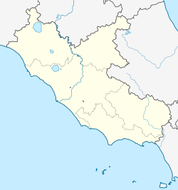
악사이친(Aksai Chin)은 중국이 티베트 응가리현 루토그현과 호탄현, 신장현[1], 호탄현의 일부로 관리하는 지역이다.인도는 이 지역이 라다크 유니온 준주의 일부라고 주장하고 있다.이곳은 카슈미르 지역 동부의 일부이며 [2]1950년대 후반부터 인도와 중국 사이에 분쟁의 대상이 되어 왔다.
이름.
악사이 친은 슐라긴트바이트 형제의 야르칸디 가이드 무함마드 아민에 의해 처음 언급되었다.아민의 악사이 친은 쿤룬 [3][4]산맥 남쪽의 티벳 동쪽까지 무한히 뻗어 있는 명확한 지역이 아니었다.
몇몇 자료들은 아크사이가 "하얀 돌 사막"이라는 뜻의 위구르어에서 유래한 단어로 해석하고 있는데, 여기에는 영국의 식민지,[5][6][12][13] 현대 서양,[7][8][9][10][1][11] 중국, 인도의 자료들이 포함된다.일부 현대 자료에서는 [14][15]'하얀 개울'이라는 뜻으로 해석하기도 한다.적어도 한 출처는 악사이가 야르칸디 위구르 [16]방언으로 "동쪽"을 의미한다고 해석한다.
"친"이라는 단어의 의미는 [15]논란이 되고 있다.일부 중국,[1][11][17][16] 서양,[5][9] 인도 소식통들은 이것이 "중국"을 의미하는 것으로 간주한다.하나 이상의 소스가 "합격"[14]을 의미합니다.다른 출처들은 해석에서 "[6][7][8][10][12][13]친"을 생략한다.
역사
해발 5,000미터(16,000피트)의 고도 때문에 악사이 친의 황량함은 신장과 [18]티베트 사이의 야크 캐러밴에게 여름 동안 임시 통로를 제공하는 고대 무역로 외에는 인간의 중요성을 갖지 않았다는 것을 의미했다.타림 분지에서 티베트까지 1년 내내 통행할 수 있는 유일한 경로였기 때문에 군사 작전에서 이 지역은 매우 중요했다.중가르 칸국은 1717년 [19]티베트로 들어가기 위해 이 길을 이용했다.
서부 지역의 경계에 관한 최초의 조약 중 하나가 1842년에 체결되었다.라다크는 몇 년 전에 시크 제국의 종주권 하에 라자 굴라브 싱의 군대에 의해 정복되었다.1840년 티베트 침공이 실패한 후, 굴라브 싱과 티베트인들은 조약에 서명했고,[20][21] "구식적이고 확립된 국경"을 고수하기로 합의했습니다.1846년 시크교도들의 패배로 라다크를 포함한 잠무와 카슈미르 지역이 영국에게 넘어갔고, 영국은 굴라브 싱을 그들의 종주권 하에 마하라자로 세웠다.영국 위원들은 국경 협상을 위해 중국 관리들과 접촉했지만,[22] 그들은 아무런 관심을 보이지 않았다.영국 국경위원회는 팡공 호수의 경계 남단을 확정했지만, 그 북쪽 지역은 미지의 [23]땅이라고 여겼다.
존슨 선


서베이 오브 인디아(Survey of India)의 공무원 윌리엄 존슨은 1865년 아크사이 친을 [24][unreliable source?]카슈미르에 두는 '존슨 라인'을 제안했다.이 시기는 중국이 신장의 대부분을 지배하지 않았던 둥안 반란의 시기였기 때문에,[24][unreliable source?] 이 선은 결코 중국인들에게 제시되지 않았다.존슨은 카슈미르의 마하라자에게 이 선을 제시했는데, 마하라자는 [24][unreliable source?]그 안에 18,000평방 킬로미터가 포함되어 있고, 몇몇 계정들에 의해 쿤룬 산맥의 산주 고개까지 북쪽의 영토라고 주장했다.카슈미르의 마하라자는 샤히둘라(오늘날의 샤이둘라)에 요새를 건설하고 카라반을 [25]보호하기 위해 몇 년 동안 군대를 주둔시켰다.결국 대부분의 출처는 샤히둘라와 카라카시 강 상류를 신장의 영토 내에 확고히 배치했다(첨부 [citation needed]지도 참조).1880년대 후반 이 지역을 탐험한 프란시스 영후스밴드에 따르면 샤히둘라에는 버려진 요새가 있을 뿐 사람이 사는 집은 없었다.그것은 단지 편리한 집결소이자 유목민 [26][non-primary source needed]키르기즈에게 편리한 본부였다.버려진 요새는 분명히 카슈미르 [27][non-primary source needed]사람들에 의해 몇 년 전에 지어졌었다.1878년에 중국인들은 신장을 재정복했고 1890년에는 [24][unreliable source?]이 문제가 결정되기 전에 이미 샤히둘라를 손에 넣었다.1892년까지 중국은 카라코람 [28]고개에 경계표지를 세웠다.
1897년 영국군 장교인 존 아다 경은 야르칸드 [25]강 북쪽의 쿤룬 산맥의 산꼭대기를 따라 경계선을 제안했다.당시 영국은 중국이 약해지면서 러시아 팽창의 위험을 우려했고 아다는 그의 노선이 더 방어가능하다고 주장했다.아르다 선은 사실상 존슨 선의 변형이었고, "존슨-아르다 선"으로 알려지게 되었다.
매카트니-맥도널드 선

1893년, St.의 중국 고위 관리인 Hung Ta Chen. 피터스버그는 카슈가르 주재 영국 총영사 조지 매카트니에게 이 지역 지도를 주었는데, 이 지도는 광범위한 [29]세부사항과 일치했다.1899년 영국은 처음으로 맥카트니가 제안하고 인도 총독 엘긴에 의해 개발된 수정된 경계를 제안했다.이 경계는 락짱 산맥의 남쪽인 링자탕 평원을 인도에, 락짱 산맥의 북쪽인 악사이친을 중국에 배치했다.카라코람 산맥을 따라 있는 이 국경은 여러 가지 이유로 영국 관리들에 의해 제안되고 지지를 받았다.카라코람 산맥은 영국의 국경선을 인더스강 유역까지 설정하고 타림강 유역을 중국의 지배로 남겨두는 자연경계를 형성했으며, 이 지역에 대한 중국의 통제는 러시아의 [30]중앙아시아 진출에 더 큰 걸림돌이 될 것이다.영국인들은 1899년 클로드 맥도널드 경의 편지에서 매카트니-맥도날드 선으로 알려진 이 선을 중국인들에게 제시했다.청 정부는 이 [31]편지에 응답하지 않았다.일부 논객들에 따르면, 중국은 이것이 용인된 [32][33]경계선이었다고 믿었다.
1899년부터 1947년까지
존슨-아다 선과 맥카트니-맥도날드 선 [24][unreliable source?]모두 영국의 인도 지도에 사용되었다.적어도 1908년까지 영국은 맥도날드 선을 [34]경계로 삼았으나 1911년 신해혁명으로 중국의 중앙집권이 붕괴되었고, 제1차 세계대전이 끝날 무렵 영국은 공식적으로 존슨 선을 사용했다.그러나 그들은 전초기지를 설립하거나 [28]지상의 실질적인 통제권을 주장하기 위한 어떠한 조치도 취하지 않았다.1927년 영국령 인도 정부가 존슨 선을 포기하고 카라코람 산맥을 따라 남쪽으로 [28]이동하면서 노선이 다시 조정되었다.그러나 지도는 갱신되지 않았고 여전히 존슨 [28]선을 표시했다.

1917년부터 1933년까지, 북경에서 중국 정부에 의해 발행된 우편 지도에는 쿤룬 [29][33]산맥을 따라 이어지는 존슨 선에 따라 악사이 진의 경계선이 표시되었다.1925년에 출판된 북경대학 지도책도 [35]악사이 친을 인도에 실었다.1940-1941년 신장의 군벌인 Sheng Shicai를 위해 악사이 진을 조사한 소련 관리들에 대해 영국 관리들이 알았을 때, 그들은 다시 존슨 [24][unreliable source?]선을 지지했다.이 시점에서 영국은 여전히 아크사이 진에 대한 전초기지를 설립하거나 통제하려는 시도를 하지 않았고, 중국이나 티베트 정부와 이 문제를 논의한 적도 없으며, 인도 [28]독립 당시에도 국경은 아직 정해지지 않았다.
1947년 이후

1947년 독립한 인도 정부는 아크로사이 [28]친을 포함한 서쪽의 공식 경계선을 기준으로 존슨 선을 사용했다.카라코람 고갯길(논쟁하지 않음)에서 인도 영토는 카라코람 산맥의 북동쪽으로 뻗어 있으며, 악사이 친의 염전을 통해 쿤룬 산맥의 경계를 정하고 카라카시 강과 야르칸드 강 유역의 일부를 통합한다.그곳에서 쿤룬 산맥을 따라 동쪽으로 흐르고, 악사이 친 염전을 지나 카라코람 산맥을 지나 팡공 [18]호수로 향합니다.
1954년 7월 1일 자와할랄 네루 수상은 인도 지도를 수정하여 모든 국경에서 명확한 경계를 나타내도록 지시하는 메모를 썼다.지금까지, 존슨 라인을 베이스로 한 악사이 친 구역의 경계는 「미달」[30]이라고 기술되어 있었다.
이 지역은 거의 사람이 살 수 없고 자원이 없음에도 불구하고 티베트와 신장을 연결하기 때문에 중국에게 전략적으로 중요하다.1950년대에 중화인민공화국은 신장(新 tibet)과 티베트 서부를 연결하는 1,200km(750마일)의 도로를 건설했으며, 이 중 179km(112마일)는 [18][28]인도가 주장하는 악사이진 지역을 지나 존슨선 남쪽으로 달렸습니다.악사이 친은 중국인들이 쉽게 접근할 수 있었지만 카라코람의 반대편에 있는 인디언들이 [18]도달하는 것은 더 어려웠다.인도인들은 [36]1958년 발간된 중국 지도에 표시된 1957년까지 이 도로의 존재를 알지 못했다.이 고속도로의 건설은 1962년 [37]청인도전쟁의 도화선 중 하나였다.
네루 수상이 밝힌 인도 측의 입장은 아크사이 친은 "수세기 동안 인도의 라다크 지역의 일부"였으며, 이 북쪽 국경은 [18]"아무와도 의논할 수 없는 확고하고 확실한 곳"이라는 것이었다.
저우언라이(周 border來) 중국 총리는 서쪽 국경이 정해진 적이 없고 악사이진을 중국 국경 안에 둔 맥카트니-맥도날드선은 중국 정부에 제안한 유일한 선이며 악사이진은 이미 중국 관할 하에 있으며 협상은 그 위상을 고려해야 한다고 주장했다.그대로 [18]두겠습니다.
2006년 6월, 구글 어스 서비스에 위성 사진 동부 아 커 사이친과 인접한 티벳의 1:500[38]규모 지형 모형, Huangyangtan의 마을 근처에 지어져, 약 35킬로미터(22mi) 밝혔다 인촨, 닝샤 후이족 자치구 중국의 자치 지역의 수도의 남서쪽.[39]비주얼 side-by-side비교 아 커 사이친의 진영에 아주 미세한 중복을 보여 준다.[40]그 900m×700m(3,000×12002,300ftft)[표창 필요한]모델 상당한 설비로,red-roofed 건물,olive-coloured 트럭의 점수와 높은 감시자 직책과 큰 통신 탑과 함께 큰 화합물의 줄로 둘러싸여 있었다.이러한 지형 모델들 군사 훈련과 모의 실험에서 사용할는 훨씬 적은 규모지만 일반적으로 알려져 있다.
닝샤 후이족 자치구의 지방 당국이 탱크 훈련장, 1998년 1999년에 건축된이 아 커 사이친의 모델은 일부분이라고 주장하고 있지만.[38]
8월 2017년에는 Pangong 호. 근처에 인도와 중국 힘 서로에게 돌을 던졌다.[41][42][43]
9월 11일 2019년에, 중국 인민 해방군 병력 팡공호의 북쪽 둑에 인도군과 대치를 벌였다.[44][45]
5월과 6월 2020년의 2020년 China–India 교전에서 Pangong 호. 호수 근처에서 인도와 중국 군대 사이의 지속적인 대결 정면 충돌에서 166월 2020년에 인도 쪽에서 적어도 20명의 사망자와 중국 쪽에서 당국자가 아니사망했다고 보고에 이르렀다.2021년에서 중국 국영 매체 4중국 사망하였다고 발표했다.[46]양측이 서로 도발이라고 주장한다.[47][48][42][49][50][51][52]
지리


아 커 사이친은 인도와 중국 사이에 커다란 두개의 국경 분쟁 지역이다.인도 라다크의 결합 영토의 동쪽에 있는 일환으로 아 커 사이친 주장한다.중국은 악사이친이 신장위구르자치구와 티베트자치구의 일부라고 주장하고 있다.라다흐의 인도 관리 지역과 아크사이 친을 구분하는 선은 LAC(Line of Real Control)로 알려져 있으며 중국의 아크사이 친 클레임 라인과 동시에 적용됩니다.
악사이친은 약 38,000 평방 킬로미터의 면적을 [53]차지하고 있습니다.이 지역은 대체로 해발 약 4,300m(14,100ft)의 낮은 지점(카라카시 강 위)이 있는 광대한 고지대 사막이다.남서쪽에는 뎁상 평원에서 남동쪽으로 7,000m(23,000ft)에 이르는 산이 악사이 친과 인도령 카슈미르 사이의 사실상의 국경(실제 통제선)을 형성하고 있습니다.
북쪽의 쿤룬 산맥은 호탄 현의 나머지 지역이 위치한 타림 분지와 악사이 진을 구분한다.최근의 상세한 중국 지도에 의하면, 호탄현내에서는 쿤룬 산맥을 횡단하는 도로는 없고, 힌두타시 고개를 [54]넘는 길은 1개뿐이다.
악사이 친 지역에는 많은 소금이나 소다 호수가 있는 내분지가 있습니다.주요 소금 호수는 수리 일가닝 콜, 쵸 탕, 악사이 친 호수, 홍산 호수 등입니다.Aksai Chin의 북쪽 대부분은 Aksai Chin의 가장 큰 강 근처에 위치한 소다 평원으로 알려져 있습니다. Karakash는 많은 빙하로부터 녹은 물을 공급받으며 피산 카운티의 북서쪽 더 멀리 Kunlun 강을 건너 Karaks 카운티의 Tarim Basin으로 들어가 Karak 카운티의 주요 수원 중 하나로 사용됩니다.
악사이 친 지역의 서쪽은 타림 강에 의해 배수된다.그 지역의 동쪽에는 몇 개의 작은 내피 분지가 있다.그 중 가장 큰 것은 같은 이름의 강이 흐르는 악사이 친 호수입니다.히말라야 산맥과 카라코람 산맥이 인도 몬순의 비를 막았기 때문에 이 지역 전체로는 강수량이 거의 없다.
인근 카라코람 트란스 지역은 카슈미르 [55][18]분쟁에서 중국과 인도 사이에 진행 중인 분쟁의 대상이기도 하다.
인구통계 및 경제
1940년대 이전에, 아크사이 친의 거주민들은 대부분 [56][57][58]이 지역을 지나는 인도 출신의 탐험가, 사냥꾼, 유목민이었다.
1860년대 유럽 탐험 이전, 악사이 [58][59]진의 신장 쪽에서는 옥 채굴 작업이 있었다.그들은 유럽 탐험가들이 그 [59]지역에 도착했을 때 버려졌다.1860년대부터 1870년대까지, 인도 아대륙과 타림 분지 사이의 무역을 용이하게 하기 위해, 영국은 어렵고 관세가 부과된 카라코람 [60]고개의 대안으로 악사이 친 서쪽을 경유하는 카라반 항로를 추진하려고 시도했다.장첸모 강 계곡의 기점 이후 장첸모 선으로 불리는 이 노선은 1874년 [61]하원에서 논의되었다.안타깝게도 카라코람 고개보다 길고 고도가 높을 뿐만 아니라 악사이진이라는 [60][61]황량한 사막을 지나가고 있다.1890년대까지 무역업자들은 대부분 이 [62]길을 포기했다.
1950년대에 인도는 이 [63][64]지역의 염광 사업의 경제성을 연구하기 위해 악사이 친의 여러 호수에서 소금을 채취했다.
1950년대 말까지 도로를 건설한 것 외에도 톈원뎬,[65] 콩카고개,[66] 화이탄[67], 톈수이하이 [68]등 몇몇 지역에 PLA 지상군 전초기지가 건설되었다.그 도로는 나중에 219번 중국 국도로 업그레이드되었다.현대에는 고속도로를 따라 운전자를 [69]위한 영업소가 몇 군데 있다.
2010년대에는 악사이 친이 [70]속한 서부 쿤룬 지역에서 지질 조사가 실시되었다.주요 납-아연 퇴적물인 후사오윤과 수많은 작은 퇴적물이 [70]이 지역에서 발견되었다.후사오윤은 티베트 [71]국경 근처의 악사이 진에 위치한 산이다.후사오윤의 광산 개발은 [72][73]2017년에 시작되었다.
교통.
중국 219번 국도는 라쯔 현(라쯔, 라쯔)과 티베트 자치구 신장(新 in)을 잇는 악사이 진을 관통한다.
「 」를 참조해 주세요.
참조
- ^ a b c 夏征农; 陈至立, eds. (September 2009). 辞海:第六版彩图本 [Cihai (Sixth Edition in Color)] (in Chinese). 上海. Shanghai: 上海辞书出版社. Shanghai Lexicographical Publishing House. p. 0008. ISBN 9787532628599.
阿克赛钦 地名区。维吾尔语意即"中国的白石滩"。在新疆维吾尔自治区和田县南部、喀喇昆仑山和昆仑山间。
- ^ 카슈미르의 다양한 지역에 "관리"라는 용어의 적용과 카슈미르 분쟁에 대한 언급은 커버리지의 적절한 비중을 반영하여 제3의 소스(a)와 (b)에 의해 지지된다.
(a) (서브스크립션 필요) 인용: "캐쉬미르, 인도 북서부 아대륙 지역...1947년 인도 아대륙이 분할된 이후 인도와 파키스탄 사이에 분쟁의 대상이 되어 왔다.북쪽과 서쪽 지역은 파키스탄에 의해 관리되고 세 지역으로 구성되어 있습니다: 아자드 카슈미르, 길기트, 그리고 발티스탄. 마지막 두 지역은 북부 지역이라고 불리는 영토의 일부입니다.인도가 관리하는 지역은 남부와 남동부로 잠무와 카슈미르 주를 구성하지만 두 개의 연방 영토로 분할될 예정이다.중국은 1950년대 카슈미르 동쪽 지역에서 활동하기 시작해 1962년부터 라다크 북동부(지역 최동단)를 지배해 왔다.";
(b) C.맨체스터 대학의 E보즈워스 인용: "인도 아대륙 최북단 지역인 카슈미르, 카슈메르, 인도, 파키스탄, 그리고 중국에 의해 관리되었습니다.이 지역은 1947년 인도와 파키스탄이 독립한 이후 인도와 파키스탄 사이에 격렬한 분쟁의 대상이 되어 왔다. - ^ 메흐라, "합의된" 개척지(1992) 페이지 79: "'악사이 친'이라는 이름은 '파미르 스텝과 야르칸드를 통과하는 캐러밴 루트의 대략적인 스케치, 수집한 정보'라는 표기가 붙은 지도에서 발생했는데, 이는 잘 알려진 '슐라그 형제'의 안내서이다.이것은 1862년에 쿼터마스터 총국 사무실에서 편집되었다.쿤룬 산맥 이쪽에 대한 자세한 내용은 알 수 없는 이 스케치에는 쿤룬 산맥 남쪽의 빈칸에 '악사이 친'이라고 쓰여 있었다.마호메드 아민은 '고개 너머(장첸모 강 북쪽)에 악사이 진이 있다'고 말했다.그것은 중국 영토에서 동양까지 뻗어 있다.'"
- ^ Brescius, Moritz von (2019), German Science in the Age of Empire, Cambridge University Press, pp. 197–199 (including Map 5.2: 'Rough Sketch of Caravan Routes through the Pamir Steppes and Yarkund, from Information Collected from Mahomed Ameen Yarkundi, Late Guide to Messrs. De Schlagintweit'), ISBN 978-1-108-42732-6
- ^ a b Government of Punjab (1862). Report on the Trade and Resources of the Countries on the North-western Boundary of British India. Lahore: Government Press. pp. xxii. c.
the "Aksai Chin," or as the term implies the great Chinese white desert or plain.
- ^ a b Journal of the Asiatic Society of Bengal. Bishop's College Press. 1868. p. 50.
the Akzai Chin or White Desert
- ^ a b Kaminsky, Arnold P.; Long, Roger D. (23 September 2011). India Today: An Encyclopedia of Life in the Republic [2 volumes]: An Encyclopedia of Life in the Republic. ABC-CLIO. p. 23. ISBN 978-0-313-37463-0. Archived from the original on 5 April 2020. Retrieved 11 January 2020.
Aksai Chin (as Uyghur name meaning "desert of white stones")
- ^ a b Sven Anders Hedin; Nils Peter Ambolt (1967). Central Asia Atlas, Memoir on Maps: Index of geographical names, by D.M. Farquhar, G. Jarring and E. Norin. Sven Hedin Foundation, Statens etnografiska museum. p. 12.
Aksai Chin, region between the K'unlun main range and the Loqzung Mountains: T. eq say 'white gravelly plain' + cin '(of) China' (Cin, earliest designation by which China was known in Central Asia).
- ^ a b Bertil Lintner (25 January 2018). China's India War: Collision Course on the Roof of the World. OUP India. p. 85. ISBN 978-0-19-909163-8.
The name Aksai Chin means 'the desert of white stones'
- ^ a b Zhou Enlai (Chou En-Lai) (15 November 1962). "Archived copy" 国务院总理周恩来就中印边界問題致亚非国家領导人的信 (PDF). 中华人民共和国国务院公报 (Bulletin of the State Council of PRC) (in Chinese): 228. Archived (PDF) from the original on 13 June 2015. Retrieved 30 December 2019 – via 中华人民共和国中央人民政府门户网站.
在西段,印度政府提出爭議的传统习惯綫以东和以北的地区,历来是屬于中国的。这个地区主要包括中国新疆所屬的阿克賽欽地区和西藏阿里地区的一部分,面积共为三万三千平方公里,相当于一个比利时或三个黎巴嫩。这个地区虽然人烟稀少,却历来是联結新疆和西藏阿里的交通命脉。新疆的柯尔克孜族和維吾尔族的牧民經常在这一带放牧。阿克賽欽这个地名就是維吾尔語“中国的白石滩”的意思。这块地方一直到現在是在中国的管轄之下。
{{cite journal}}: CS1 maint: 제목으로 아카이브된 복사(링크) - ^ a b Gurdip Singh Kler (1995). Unsung Battles of 1962. Lancer Publishers. p. 156. ISBN 978-1-897829-09-7.
Aksai Chin - the name, means the desert of white stones.
- ^ a b Sanjeev Kumar Bhasin (2006). Amazing Land Ladakh: Places, People, and Culture. Indus Publishing. p. 61. ISBN 978-81-7387-186-3.
The Aksai Chin (desert of white stones)
- ^ a b Bob Butalia (30 September 2015). In the Shadow of Destiny. Partridge Publishing India. p. 271. ISBN 978-1-4828-5791-7.
'Aksai Chin' in translation means 'White Brook Pass'.
- ^ a b Geeta Kochhar (19 March 2018). China's Foreign Relations and Security Dimensions. Taylor & Francis. pp. 40–. ISBN 978-0-429-01748-3.
The etymology of Aksai Chin is uncertain. Although 'Aksai' is a Turk term for 'white brooks', it is widely believed that the word 'chin' has nothing to do with China.
- ^ a b Harish Kapadia (March 2002). High Himalaya Unknown Valleys. Indus Publishing. p. 309. ISBN 978-81-7387-117-7.
Aksai Chin, (Aksai: eastern, Chin: China) ... Most of the names were found to be distinctly Yarkandi.
- ^ "ئاقساي چىنمۇ ياكى ئاقساي چۆلمۇ؟" [Is Aksai True or Aksai Desert?] (in Uyghur). Radio Free Asia. 22 June 2010. Archived from the original on 5 September 2010. Retrieved 18 January 2020.
ماقالە يازغۇچى داۋاملاشتۇرۇپ: بۇ تېررىتورىيىنىڭ نامى تۈرك تىلىدا، "ئاقساي چىن " دېيىلىدۇ، بۇ ئىسىمدىكى "چىن" سۆزى جۇڭگونى كۆرسىتىدۇ، ئېيتىشلارغا ئاساسلانغاندا، بۇ سۆزنىڭ مەنىسى – " جۇڭگونىڭ ئاق تاشلىق جىلغىسى ياكى جۇڭگونىڭ ئاق تاشلىق سېيى" دېگەنلىك بولىدۇ دەيدۇ. [The author goes on to say that the name of the territory is in Turkish, "Aksai Chin", and the word "Chin" in that name means China, and it is said that the word means "White Valley of China or China's White River".]
- ^ a b c d e f g Maxwell, Neville (1970). India's China War. New York: Pantheon. p. 3. Archived from the original on 1 November 2013. Retrieved 4 January 2020.
At 17,000 feet elevation, the desolation of Aksai Chin had no human importance other than an ancient trade route that crossed over it, providing a brief pass during summer for caravans of yaks from Sinkiang to Tibet that carried silk, jade, hemp, salt
- ^ Gaver, John W. (2011). Protracted Contest: Sino-Indian Rivalry in the Twentieth Century. University of Washington Press. p. 83. ISBN 978-0295801209. Retrieved 4 January 2020.
The westerly route via Aksai Chin was an old caravan route and in many ways the best. It was the only route that was open year-round, throughout both the winter and the monsoon season. The Dzungar army that had reached Lhasa in 1717 ... had followed this route.
- ^ 맥스웰, 인도의 1970년 중국 전쟁, 페이지 24
- ^ Alfred P.의 중국-인도 국경 분쟁.Rubin, The International and Comparative Law Quarterly, 제9권, 제1호(1960년 1월), 96-125쪽, JSTOR 756256.
- ^ 맥스웰, 인도의 1970년 중국 전쟁, 페이지 25-26.
- ^ 맥스웰, 인도의 1970년 중국 전쟁, 페이지 26.
- ^ a b c d e f Mohan Guruswamy, Mohan, The Great India-China Game, 2016년 9월 30일 Rediff, Wayback Machine, 2003년 6월 23일 아카이브.
- ^ a b 우드맨 1969, 페이지 101, 360ff
- ^ 영허스밴드, 프란시스 E.(1896)대륙의 심장.존 머레이, 런던.팩시밀리 전재: (2005) Elbiron Classics, 223–224페이지.
- ^ 그레나드, 페르난드(1904년).티벳: 나라와 주민들.페르난드 그레나드A 번역자테세이라 드 마토스.런던 허치슨 주식회사에서 원본을 발행했습니다.1904년 전재 코스모 출판사.델리, 1974년, 페이지 28~30
- ^ a b c d e f g Calvin, James Barnard (April 1984). "The China-India Border War". Marine Corps Command and Staff College. Archived from the original on 11 November 2011. Retrieved 14 October 2011.
- ^ a b c 우드맨 1969, 페이지 73, 78
- ^ a b Noorani, A.G. (30 August – 12 September 2003), "Fact of History", Frontline, Madras: The Hindu group, vol. 26, no. 18, archived from the original on 2 October 2011, retrieved 24 August 2011
- ^ Woodman 1969, 페이지 102: 제안된 경계는 Alastair Lamb가 1964년에 부활할 때까지 동일한 형태로 다시 고려되지 않았던 것으로 보인다.
- ^ "India-China Border Dispute". GlobalSecurity.org. Archived from the original on 15 February 2015.
- ^ a b Verma, Virendra Sahai (2006). "Sino-Indian Border Dispute at Aksai Chin – A Middle Path For Resolution". Journal of Development Alternatives and Area Studies. 25 (3): 6–8. ISSN 1651-9728.
- ^ 우드맨 1969, 페이지 79
- ^ Fisher, Margaret W.; Rose, Leo E.; Huttenback, Robert A. (1963). Himalayan Battleground: Sino-Indian Rivalry in Ladakh. Praeger. p. 101. Archived from the original on 30 September 2014. Retrieved 24 August 2017.[ISBN 실종]
- ^ John W. Garver에 의한 1962년 중국의 인도와의 전쟁 결정 2009년 3월 26일 Wayback Machine
- ^ Guo, Rongxing (2007). Territorial Disputes and Resource Management. Nova Science Publishers. p. 43. ISBN 978-1-60021-445-5. Retrieved 10 June 2019.
- ^ a b "Chinese X-file not so mysterious after all". The Age. Melbourne. 23 July 2006. Archived from the original on 13 January 2009. Retrieved 17 December 2008.
- ^ "From sky, see how China builds model of Indian border 2400 km away". 5 August 2006. Archived from the original on 2 January 2011. Retrieved 8 July 2009.
- ^ Google Earth 커뮤니티가 Wayback Machine에 2008년 12월 8일 아카이브를 게시, 2007년 4월 10일
- ^ 中共與印度邊境衝突!150士兵互毆10多人掛彩. New Tang Dynasty Television (in Traditional Chinese). 11 May 2020. Retrieved 16 May 2020.
- ^ a b 費風 (11 May 2020). 中印邊境再爆衝突 150士兵毆鬥釀12傷. Hong Kong Economic Times (in Traditional Chinese). Retrieved 16 May 2020.
消息指,第一起事件發生於5月5日至6日,在中印邊境的班公錯湖(Pangong Tso )地區,當時解放軍的「侵略性巡邏」(aggressive patrolling)被印度軍方阻攔。「結果發生了混亂,雙方都有一些士兵受傷。」{...}2017年8月,兩國軍隊曾於拉達克地區班公湖附近爆發衝突,當時雙方擲石攻擊對方,雙方均有人受傷,最終兩軍在半小時後退回各自據點。
- ^ Sushant Singh (20 May 2020). "India-China conflict in Ladakh: The importance of the Pangong Tso lake". The Indian Express. Retrieved 21 May 2020.
- ^ "Indian, Chinese Troops Face-off in Ladakh Ahead of Modi-Xi Summit, Army Says Tension De-escalated". News18. 12 September 2019. Archived from the original on 7 November 2019. Retrieved 12 May 2020.
- ^ Chang Ya-Han 張雅涵, ed. (10 March 2020). "Archived copy" 中國在西藏地區軍演頻繁 牽動中印未來危機應對. Radio Taiwan International (in Chinese (Taiwan)). Archived from the original on 11 March 2020. Retrieved 16 May 2020.
{{cite web}}: CS1 maint: 제목으로 아카이브된 복사(링크) - ^ "Ladakh: China reveals soldier deaths in India border clash". BBC News. 19 February 2021. Retrieved 26 February 2022.
- ^ "India China news live: At least 20 Indian Army personnel killed in violent face-off in Ladakh's Galwan Valley". The Times of India.
- ^ Dinakar Peri (10 May 2020). "Indian, Chinese troops face off in Eastern Ladakh, Sikkim". The Hindu. Archived from the original on 12 May 2020. Retrieved 13 May 2020.
- ^ "Chinese military bolsters troops in Aksai Chin region in Sino-India border: Report". The Economic Times. 19 May 2020. Archived from the original on 19 May 2020. Retrieved 19 May 2020.
On May 5, around 250 Indian and Chinese army personnel clashed in Pangong Tso lake area in Eastern Ladakh.
- ^ "Chinese, Indian troops engage in border conflicts". Taiwan News. 25 May 2020. Retrieved 26 May 2020.
- ^ Drake Long (22 May 2020). "India Voices Unusual Criticism of China's Conduct in South China Sea". Radio Free Asia. Retrieved 27 May 2020.
Chinese and Indian troops clashed on May 5 over road construction the Indian side was completing at Pangong Tso, a glacial lake bordering Ladakh and Tibet.
- ^ "Transcript of Media Briefing by Official Spokesperson (May 21, 2020)". Ministry of External Affairs. 21 May 2020. Retrieved 27 May 2020.
- ^ "Aksai Chin". Britannica. 2013. Retrieved 11 June 2021.
At the conclusion of the conflict, China retained control of about 14,700 square miles (38,000 square km) of territory in Aksai Chin.
- ^ Xinjiang Uyghur Autonomous Region Road Atlas (中国分省公路丛书:新疆维吾尔自治区), published by 星球地图出版社 Xingqiu Ditu Chubanshe, 2008, ISBN 978-7-80212-469-1.호탄현 지도, 18~19페이지.
- ^ "Signing with the Red Chinese". Time. 15 March 1963. Archived from the original on 24 August 2013. Retrieved 28 October 2019.
- ^ Chandran, D. Suba; Singh, Bhavna (21 October 2015). India, China and Sub-regional Connectivities in South Asia. SAGE Publications India. ISBN 9789351503262.
- ^ W.F. Van Eekelen (11 December 2013). Indian Foreign Policy and the Border Dispute with China. ISBN 9789401765558. Retrieved 13 December 2019.
Neither party exercised a great extent of administration in Aksai Chin, but the occasional explorer, big-game hunter or nomad from India may be sufficient to establish continuity of title.
- ^ a b Steven A. Hoffmann (20 April 2018). India and the China Crisis. Univ of California Press. p. 12. ISBN 978-0-520-30172-6.
There was jade mining from the Sinkiang side, and some ancient (if secondary) trade routes crossed it. But that was all
- ^ a b Robert Shaw (1871). Visits to High Tartary, Yârkand, and Kâshgar (formerly Chinese Tartary): And Return Journey Over the Karakoram Pass. J. Murray. p. 98.
[Oct 29] beginning of the soda-plain [Oct 30] Karakash River [Nov 3] At a corner on the south side there is a piece of path with a bit of wall built up to support it, and yesterday we passed a group of stone huts: all signs that this road was once in use. (We found afterwards that this valley had formerly been frequented by the Chinese, who objected jade from hence. This industry is now extinct, as the Mussulmans of Tookistan have no taste for ornaments of this stone.) [Nov 5] plains full of salt craters
- ^ a b Harish Kohli (2000). Across the Frozen Himalaya: The Epic Winter Ski Traverse from Karakoram to Lipu Lekh. Indus Publishing. pp. 86–87. ISBN 978-81-7387-106-1.
the five difficult passes through the Karakorams posed a barrier ... Cayley reconnoitred a route that went through the Changchenmo ranges ... if anything these new passes were higher than the ones they replaced, and the land in between them was also higher. ... The route had another advantage in that trade from British India could flow through Kulu via Changchenmo to Yarkand, completely bypassing the customs officials of the Maharaja at Leh.
- ^ a b Accounts and Papers. East India. Vol. XLIX. House of Commons, British Parliament. 1874. pp. 23–33.
(p26) The Changchenmo line ... The extra distance and the sojourn for 5 days longer in such a desolate tract (p33) Every endeavour has been made to improve the Changchenmo route—serais having been built at some places, and depots of grain established as far as Gogra
- ^ A. E. Ward (1896). The Tourist's And—sportsman's Guide to Kashmir and Ladak, &c. Thacker, Spink. pp. 106–107.
Joining the left bank of the river opposite to Kyam are the Silung Yokma, Silung Burma and Silung Kongma. ... cross the Changchenmo valley journey up the Kiepsang stream ... The traders have now almost entirely given up the Changchenmo-Shahidula route to Yarkand.
- ^ Brig Amar Cheema, VSM (31 March 2015). The Crimson Chinar: The Kashmir Conflict: A Politico Military Perspective. Lancer Publishers. pp. 157–158. ISBN 978-81-7062-301-4.
...though neither side had any physical presence there. The advantage India had was that she administered the grazing grounds and even collected salt from Amtogor Lake, deep in Aksai Chin.
- ^ Council of Scientific & Industrial Research (India) (1958). Technical Report. p. 127.
Brines from (i) Pong Kong, (ii) Sarigh Jilgang Kol and (iii) Amtogor lakes were examined for their suitability for salt manufacture. The brines from the first two sources have been found to be uneconomical for salt manufacture.
- ^ "Indian, Chinese armies decide to improve ties at functional level". News18. 2 January 2016. Archived from the original on 14 December 2019. Retrieved 14 September 2017.
- ^ "在海拔5070米的空喀山口哨卡某边防团政委宗建明和官兵深情的拥抱" [Zong Jianming, political commissar of a border defense regiment, and the officers and soldiers at the empty Kazan checkpoint at an altitude of 5,070 meters affectionately embrace]. Sina Military. 17 September 2009. Archived from the original on 14 December 2019. Retrieved 14 December 2019.
- ^ 颜玮珏 (30 September 2013). 马丹宁 (ed.). "Keeping watch over highest mountain". China Daily. Archived from the original on 29 December 2019. Retrieved 29 December 2019.
Soldiers pose for a picture at the Heweitan sentry post on Karakorum Mountains in Xinjiang Uygur autonomous region, Sept 30.
- ^ 陈金财; 徐俊 (7 December 2016). 杜麒麟; 孙和静 (eds.). "走进天路兵站甜水海 体会官兵生活的苦与乐" [Enter the army outpost Tianshuihai on the skyward road, experience the hardship and joy of army life]. 中国陆军网 [China Army Net] (in Chinese). People's Liberation Army News and Dissemination Center. Archived from the original on 13 December 2019. Retrieved 13 December 2019.
从1959年建站起,兵站所有的生活用水,都要到90公里外的“死人沟”泉水湖去拉,来回一趟至少6个小时,如果到了冬季,还得破冰取水。[Since the establishment of the station in 1959, all domestic water in the military depot has to be pulled from the "Deadrengou" spring lake 90 kilometers away. It takes at least six hours to go back and forth. If it is winter, the ice must be broken for water.]
- ^ 罗俊, ed. (18 November 2011). "新疆死人沟——窒息的环境 惊险的美" [Death Valley in Xinjiang-a suffocating environment, breathtaking beauty] (in Chinese). People's Daily Oversea Edition. Archived from the original on 21 January 2013. Retrieved 13 December 2019.
死人沟只有五顶帐篷,能为过往行人提供简单的饭菜面食。对面有一个兵站。[There are only five tents in the Dead Valley, which can provide simple meals and pasta for the passersby. There is a military station opposite.]
- ^ a b 张作衡 (September 2017). "2017年矿产资源地质调查新进展" [New progress in geological survey of mineral resources in 2017] (PDF) (in Chinese). China Geological Survey. p. 27. Archived (PDF) from the original on 25 January 2020. Retrieved 16 January 2020.
新疆西昆仑地区铅锌找矿取得一批新发现...火烧云铅锌矿已提交333以上铅锌资源储量1704万吨...调查发现多宝山、萨岔口、团结峰、甜水海、鸡冠石、天柱山等10余处中小型矿床 [A number of new discoveries have been made in lead-zinc prospecting in the West Kunlun area of Xinjiang... The Huoshaoyun lead-zinc deposit has submitted a lead-zinc resource reserve of more than 333 million tons... Tianzhushan and more than ten small and medium-sized deposits]
- ^ Gao, Ting; Yi, Huan; Han, Ling; Ren, Guangli; Yang, Min (2018). "Detection of Pb–Zn mineralization zones in west Kunlun using Landsat 8 and ASTER remote sensing data". Journal of Applied Remote Sensing. 12 (2): 1. Bibcode:2018JARS...12b6018Y. doi:10.1117/1.JRS.12.026018. ISSN 1931-3195.
- ^ Ma, Echo (24 February 2017). "Development starts on China's largest lead-zinc mine". Fastmarkets. Metal Bulletin. Archived from the original on 28 December 2019. Retrieved 28 December 2019.
The Huoshaoyun lead-zinc mine site in Xinjiang province, 5,500 metres above sea level, is reported to contain about 19 million tonnes of lead and zinc, with an average grade of 30%, according to the China Geological Survey. It will be the world’s seventh-largest lead-zinc mine.
- ^ Geological Survey in China (15 July 2019). "The Prospecting Space of Huoshaoyun lead-Zinc Mine in Xinjiang extends to the periphery by nearly 15 km-Shanghai Metals Market". Shanghai Metals Market. Archived from the original on 28 December 2019. Retrieved 28 December 2019.
참고 문헌
- Maxwell, Neville (1970), India's China War, Pantheon Books, ISBN 978-0-394-47051-1
- Mehra, Parshotam (1992), An "agreed" frontier: Ladakh and India's northernmost borders, 1846-1947, Oxford University Press, ISBN 9780195627589
- Woodman, Dorothy (1969), Himalayan Frontiers: A Political Review of British, Chinese, Indian, and Russian Rivalries, Praeger – via archive.org
- 중국-인도 국경 방어 추술 지역 (CIA, 1963년)
외부 링크
| 라이브러리 리소스 정보 악사이 친 |