버들 섬
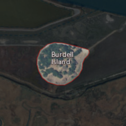
Burdell Island 버델 섬의 USGS 공중사진 | |
| 지리 | |
|---|---|
| 위치 | 북캘리포니아 주 |
| 좌표 | 38°09′22″N 122°33′17″w / 38.15611°N 122.55472°W[1]좌표: 38°09′22″N 122°33′17″W / 38.15611°N 122.55472°W/ [1] |
| 인접 수역 | 페탈루마 강 |
| 최고 고도 | 52피트(15.8m)[1] |
| 관리 | |
미국 | |
| 주 | |
| 카운티 | 마린 |

1954년 USGS 지형도에서 버들섬.
버델 섬(또는 미라 몬테)[2]은 산파블로 만(샌프란시스코 만) 상류 페탈루마 강의 옛 섬이다.[3][4] 이전에는 물과 수영장으로 둘러싸여 있었지만 지금은 대부분 마른 땅으로 둘러싸여 있다(주변 육지보다 훨씬 높은 곳에 남아 있기는 하지만). 캘리포니아 마린 카운티의 일부다.[5] 좌표는 38°09′22″N 122°3이다.3 in17″W / 38.15611°N 122.55472°W/ [1] 및 미국 지질조사국은 1981년에 52ft(16m)로 상승하였다.[1]그것은 그 지역의 1954년 USGS 지도에 나타난다.[6]
참조
- ^ a b c d 미국 지질조사국 지리적 이름 정보 시스템: 버들 섬
- ^ "All aboard for a river tour". Petaluma Argus-Courier. Petaluma, California. 1992-06-05. p. 17.
- ^ "Petaluma River History". Petaluma Argus-Courier. Petaluma, California. 1965-10-21. p. 10.
- ^ "Indians Left Mark Until 1955". Petaluma Argus-Courier. Petaluma, California. 1955-08-17. p. 34.
- ^ "Marinites will decide open space measure". Petaluma Argus-Courier. Petaluma, California. 1992-05-27. p. 13.
- ^ United States Geological Survey (1954). "Petaluma Quadrangle, California" (Map). United States Department of the Interior Geological Survey. 1:62500.


