살렘 항
Port of Salem| 살렘 항 | |
|---|---|
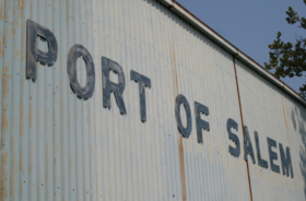 살렘 항구의 건물 표지판 | |
 | |
| 위치 | |
| 나라 | |
| 위치 | 세일럼 (뉴저지) |
| 좌표 | 39°34°26°N 75°29′02″w/39.574°N 75.484°W |
| 세부 사항 | |
| 운영자 | 사우스 저지 항만 공사 |
| 드래프트 깊이 | 16피트[1] |
| 에어 드래프트 | 가공 전력선 |
살렘 항구는 미국 뉴저지주 살렘에 있는 살렘강의 저지 부근에 있는 얕은 물줄기(16피트) 항구로, 델라웨어 강에서 동쪽으로 약 3.2km, 대서양에서 약 54마일(87km) 떨어져 있다.1984년에 수입항으로 재지정되어 1987년에 대외무역구역(FTZ)이 되었다.하역 작업에는 다양한 벌크 화물, 특히 건설 골재, 파손 벌크 화물 및 의류, 어복, 농산물 및 기타 소비재 컨테이너의 취급이 포함되며, 때로는 경량화가 수반되었다.사우스 저지 항만공사 주최로 운영됩니다.
세일럼 워터프런트

델라웨어 강 하구는 레나페 강의 영토였다.오늘날 세일럼 주변 지역의 유럽인들의 정착은 1638년 뉴 스웨덴 식민지가 설립되었고 세일럼 강은 바르켄스킬 또는 호그크릭으로 불렸다.전통에 따르면 1638년 핀족이 핀포인트에서 내륙으로 정착했다고 한다.1641년, 뉴 헤이븐 식민지의 한 무리가 바켄스 킬 주변에 정착했다.1655년, 이곳은 뉴네덜란드에 의해 다시 영유권이 주장되었고 1664년 뉴저지 주의 일부가 되었다.1675년, 그 마을을 세운 존 펜윅에게 토지 특허가 주어졌다.원래 세일럼의 부대는 펜윅 크릭과 세일럼 크릭을 따라 위치해 있었으며 필라델피아, 보스턴,[4][5] 카리브해로부터 전화를 받았다.미국 독립 전쟁 중에는 보급품이 [6]미군에 도달하는 것을 막기 위해 영국군에 의해 점령되었다.세일럼과 필라델피아 사이의 기선 운항은 1825년에 시작되었다.세일럼 철도는 [7]1863년에 개통되었다.
항구의 큰 굽은 강을 우회하는 살렘강 차단은 [8]1925년에 승인되었다.20세기 대부분 동안 세일럼 강 연안과 펜윅 강 연안의 수변은 유리 제조, 식품 가공, 광물/[9]석유 저장업을 중심으로 한 산업이 주를 이뤘다.1905년부터 1978년까지 H. J. Heinz Company는 펜윅 [10][11]크릭을 따라 대규모 가공 공장을 운영했습니다.매닝턴 밀스, 앵커 글래스, 알루켐은[12][13] 항구에 인접해 있으며, 우드스타운에 있는 사우스 저지 농부 교환소도 있습니다.
수출입항 및 무역구
살렘은 원래 1682년 영국 [14][15][16]왕실의 위임에 의해 수입항으로 지정되었다.
살렘 시는 1982년에 [17]시 항만청을 설립했다.1984년, 항구는 국제 선박 운항을 재개하였고, 미국 관세청은 1930년대 [14]이후 처음으로 이 항구를 수입항으로 지정하였다.현재는 미국 시민권 및 이민국(USCIS) 21구역의 수입항으로 뉴어크에 본사가 있으며 [18]뉴저지를 커버하고 있습니다.
밀빌 시영 공항과 함께,[19] 항구의 일부는 1987년 이후 외국 무역 구역 142호의 일부가 되었다.FTZ142와 관련된 서브존은 폴스보로 항과 사우스 [20][21]저지의 다른 지역에 있습니다.
배송 경로 및 등대

델라웨어강과 세일럼강은 조수이다.델라웨어 강의 메인 채널은 수심 40피트(12m)로 유지되고 있습니다.깊이 45피트(14m)까지 준설은 [22]2017년에 완료되었다.살렘 항구의 입구를 포함한 리치 C는 [23]2010년에 완공되었습니다.세일럼 강의 수송 수로는 훨씬 얕기 때문에 도시는 Handymax급 선박이 사용할 수 없는 얕은 통풍항이 됩니다.Salem River와 Cut-off는 1925년에 16피트(4.9m)[8] 깊이로 채널화되었습니다.강은 대서양에서 약 50마일(80km) 떨어진 세일럼 코브를 통해 델라웨어 만 입구에서 유입된다.이 채널은 코브의 남동쪽을 따라 3.2km(2마일) 동안 이동하며, 컷오프까지 0.8마일(1.3km)을 더 이동한 후 첫 번째 브리지 건널목(루트 49)[24][25]에서 항법 선두까지 1.8마일(2.9km)을 더 이동합니다.
델라웨어 강에는 다양한 레인지 라이트가 있습니다.리디 섬은 세일럼 강 하구에서 남서쪽으로 약 5마일(8km) 떨어진 곳에 있습니다.Reedy Island Front Light는 Reedy Island Range Rear Light와 연계하여 [26][27]강의 세일럼 범위를 탐색합니다.살렘 강의 핀 포인트 레인지 라이트 상류는 1950년에 비활성화되었습니다.델라웨어 강에서 항구로 들어가는 입구는 Salem River Range Lights, Salem River 방향등(39°34°14′N 75°304040wW / 570668°N 75.5119°W / 39; ) 및 기타 11개의 점등된 [28][29]항해를 통해 안내됩니다.
철도 및 도로
살렘의 도시와 카운티는 북미 최초의 성공적인 유리 생산 시설 [31]부지와 함께 오랜 유리 [30]제조 역사를 가지고 있습니다.항구에 인접한 곳에는 1863년에 설립되어 Anchor Glass로 알려진 미국에서 가장 오래된 유리 용기 제조 시설이 있으며, 한때 Anchor Hocking이 소유했고 현재는 Ardagh [4][32]Group의 일부입니다.

항구를 운행하는 철도 노선은 글라스 하우스 러닝 트랙이라고 불리며 세일럼 지선의 연장선입니다.콘레일에 의해 포기되기 직전, Swedesboro에서 Salem으로 가는 노선의 남쪽 구간은 1983년에 카운티에 의해 매입되어 New Jersey의 Surn Railway(SRNJ)에 임대되었습니다.오랫동안 방치되어 온 이곳은 상태가 좋지 않고 이동 속도가 매우 느립니다.이 노선은 철도 침대, 선로, 올드맨스 크릭의 받침대 및 기타 작업에 대한 업그레이드를 진행 중입니다.SRNJ는 Swedesboro에서 Conrail Shared Assets Operations와 교환하여 지역 철도 [33]센터인 Pavonia Yard에 도착합니다.
45번 국도와 49번 국도는 295번 국도, 뉴저지 턴파이크 및 인근 델라웨어 메모리얼 브릿지에 대한 접근을 제공합니다.2005년, 세일럼 강 위에 1927년에 건설된 49번 국도의 작은 다리는 수직 리프트[34][35] 다리로 전환될 수 있는 고정된 다리로 대체되었고 세일럼 카운티 기념 [36]다리의 재향군인 전용 다리로 지정되었습니다.
상업용 배송

살렘시 항만청은 1982년[37] [14]항만지구에서의 해운 활성화와 조정을 목적으로 설립되었다.2005년에230-acre(93하)살렘시 공업 지구 Brownfield 개발 구역 brownfields의 재사용 촉진을 위해, 안에 수많은 재산과 소득이 있는 강의 남쪽 둑을 따라 있는 살렘 강의 생산 금지에 관한 그리고 번째를 밖에 루트 49다리 사이에 위치한 포트 district,[38][39][40][41][42]에 인접한 포함하여 만들어졌다.e시내 지역이다.여기에는 바지선과 벌크 및 브레이크 벌크 화물 및 선적 컨테이너를 위한 여러 터미널 및 부두 시설이 포함됩니다.
2006년, 시 항만 당국은 항구를 이용하는 전형적인 컨테이너선이 150개의 컨테이너를 싣고 짐을 내리고 다시 [43]싣는데 약 12시간이 걸린다고 설명했다.네덜란드 국적 컨테이너선인 버뮤다 섬 사람은 세일럼에 [44][45][46][47]정기적으로 기항한다.
세일럼 터미널
사우스 저지 항만공사는 캠든 항구에서 3개의 터미널을 운영하고 있으며, [48]폴스보로 항으로 사업을 확장하고 있습니다.Salem Terminals Ltd.와 Dell Stevedoring에 의해 Salem Terminals Ltd.[49][50]로 운영되어 온 Salem Terminal을 소유하고 운영하고 있습니다.여기에는 350피트(110m)의 계류 공간과 65피트(20m)의 보(빵)에 대한 정박 측 트럭 접근이 포함됩니다.8,000 평방 피트(7402 m)의 커버가 있는 헛간 및 창고 저장 공간이 있습니다.터미널은 건설 골재, 의류, 어복, 자동차, 농산물, 해산물과 [51][52]소비재를 위한 바지선과 컨테이너선을 취급합니다.
대서양 중부 해운 및 기선 건설
미드애틀랜틱 해운 및 스테베도링은 1980년대에 메인주에서 세일럼으로 이전하여 수출 및 새로 설립된 항구 [14]시설을 활용했습니다.1990년, 그들은 다른 여러 해운 회사들에 의해서도 사용되고 있는 작은 부두 터미널인 Mid-Atlantic Shiping and Stevedoring Warf를 열었습니다.이는 Barber's Basin 마리나 동쪽에 있는 128 Tilbury Road에 있는 살렘강 입구 약 1.6마일(2.6km) 위에 위치해 벌크 및 대량 화물 운송을 처리하고 부수기 위한 것입니다.컨테이너그것은 350피트(110m)의 정박 공간과 16피트(4.9m)의 수심을 가지고 있다.여기에는 7에이커(2.8ha)의 개방형 저장 공간과 냉장 컨테이너를 위한 유틸리티 연결부가 포함됩니다.선착장은 현재 버뮤다 국제선 터미널이 소유하고 있지만, 중부 대서양에서 운영하고 있습니다.
Mid-Atlantic은 또한 540피트(160m)의 계류 공간, 냉장 컨테이너를 위한 유틸리티 연결 및 Barber's Basin 서쪽에 13에이커(5.3ha)의 개방형 저장 공간을 갖춘 틸버리 로드 어소시에이츠 소유의 부두를 운영하고 있습니다.
항만 내륙 유통망
항만 내륙 유통 네트워크는 트럭의 사용과 환경, 교통 및 고속도로 시스템에 대한 부담을 줄이기 위해 지역 항구에서 배송되는 선적된 상품과 컨테이너의 바지선과 철도에 의한 재배포를 위한 새로운 또는 확장된 운송 시스템을 포함합니다.뉴욕 뉴저지 항만청(PANYNJ), 뉴저지 교통부(NJDOT) 및 델라웨어 밸리 지역계획위원회(DVRPC)는 이 네트워크를 [53][54][55]검토 및 개발하기 위한 이니셔티브에 관여하고 있습니다.
결혼식은 프로그램 내에서 각종 수송 기관을 통합한 운임을 위한 컨테이너 선적을 처리하기 위해 살렘이 아니었어 이상적인 위치 결정했다 transport,[56] 민간 서비스 공급자 2010년 살렘 앤 Tremley 포인트, 보리수 사이의 아서 킬 항만으로 뉴욕에 바지선 서비스와 골재 제품의 짧은 바다 배송 시작했다.신규 저지.델라웨어 밸리의 항구와 북부 뉴저지의 도시 게이트웨이 [57]지역 간의 멀티모달 화물 운송에 있어 중대한 누락 링크를 해결합니다.
America's Marine Highway는 NJDOT가 신청한 상품의 운송을 위해 미국의 수로를 활용하기 위한 유사한 미국 교통부의 이니셔티브로, NJDOT가 연방정부의 지원을 받는 프로젝트에 대한 검토와 잠재적 개발 승인을 받았다.세일럼은 동해안을 [57][58][59][60][61]따라 선박을 운송함으로써 수송을 늘릴 수 있도록 고려될 것이다.
페리와 보트
이발소 분지는 Mid-Atlantic Shipping과 Stevedoring이 운영하는 두 개의 선창 사이에 있는 선착장이다.이곳은 5월 말부터 10월 중순까지 운영되는 계절 부대인 미국 해안 경비대 스몰 세일럼 기지가 있는 곳이다.2013년, 해경은 인력을 일상적인 [62]업무에서 주말 업무로 줄였다.펜스빌의 강 건너편에 있는 세일럼 보트 클럽의 개인 부두도 유람선을 운행합니다.
델라웨어 강 및 베이 오소리티의 3포트 페리 크로싱은 허리케인 샌디 피해로 인한 서비스 변화를 반영하여 2013년에 델라웨어 시티-세일럼 페리로 이름을 변경했습니다.계절 서비스는 Fort Mott로 이동하는 대신 강을 건너 Fort DuPont State Park가 있는 델라웨어 시티로 가는 서비스를 통해 Barber's Basin에서 출발하여 2013년 5월 4일부터 여름 계절 [63][64][65]서비스를 위해 Pea Patch Island의 델라웨어 요새로 연결됩니다.이 페리는 2015년에 이전 항로(세렘 대신) 포트 모트를 운항하는 항로로 돌아와 현재는 포트 페리 [66]크로싱으로 불린다.
Salem은 뉴저지주 Tall [67][68]Ship인 A. J. Meerwald의 홍보 및 교육 기능을 가끔 들르는 항구였습니다.
「 」를 참조해 주세요.
레퍼런스
- ^ "Salem River".
- ^ "Major Reybold". WorthPoint. Retrieved 2013-08-13.
Built by Harlan and Hollingsworth (later Bethlehem Steel Wilmington) in 1852 and abandoned in 1908 the Major Reybold ran the Delaware river between Philadelphia, PA and the town of Salem NJ for the Salem Line.
- ^ "Pilot of Old Major Reybold Living In Quiet Retirement". The Sunday Morning Star. May 31, 1936. Retrieved 2013-08-31.
- ^ a b "A Brief and Partial History of the City of Salem". The City of Salem Master Plan Historic Preservation Element, 1991. Preservation Salem. 1991. Archived from the original on 2004-10-22. Retrieved 2013-07-31.
- ^ "History of Commerce". Discover Salem County. Retrieved 2013-08-31.
- ^ Welsh, Ray. "Ports on the Delaware". Poor Will's Almanack for the Year of our Lord 1790. Stockton. Retrieved 2013-07-31.
- ^ "TIME LINE III 1800 to 1899 Salem County, New Jersey". Salem County Office of Archives and Records Management. Retrieved 2013-08-13.
- ^ a b "Salem River". US Army Corps of Engineers. April 2013. Retrieved 2013-07-31.
- ^ City of Salem Municipal Port Authority (September 1984). Recreation Facility Plan (Final Report) (Report). GPO. Retrieved 2013-07-22.
- ^ "July 16, 2011: Picture From The Past". nj.com. July 16, 2011. Retrieved 2013-08-10.
- ^ "Heinz Pickle Company plant, Salem, New Jersey". The Library company of Philadelphis. Archived from the original on 2013-08-13. Retrieved 2013-08-10.
- ^ "Salem, New Jersey". AluChem. Retrieved 2013-08-10.
- ^ "Salem Industrial District Brownfield Development Area" (PDF). New Jersey Department of Environmental Protection. Retrieved 2013-08-10.
- ^ a b c d Janson, Donald (December 29, 1984). "A Small City in South Jersey Welcomes the World's Trade". The New York Times. Retrieved 2013-08-10.
The way was cleared to open the port when Salem was designated by the United States Customs Service earlier this year, according to Robert Bartol, an official with the agency. He said it was the first such designation in the Northeast since the 1930s.
- ^ "Salem Terminal". Terminals. South Jersey Port Corporation. Archived from the original on 2014-04-18. Retrieved 2013-07-31.
- ^ Rouse, Ewart (December 18, 1996). "Partnership Will Take Over Dock At Salem The Public Part Of The Salem Port Will Be Leased To Private Investors. The Signing Is Today". The Philadelphia Inquirer. Retrieved 2013-08-31.
- ^ "Chapter 52: Port Authority". City of Salem, New Jersey. Retrieved 2013-08-15.
- ^ "Field Offices". Title 8 of Code Federal Regulations (8 CFR). USCIS. July 6, 2009. Retrieved 2013-08-10.
- ^ "Order No. 725 Designation of New Grantee for Foreign-Trade Zone 142, Salem, New Jersey Area; Resolution and Order" (PDF). Federal Register. 60 (244). September 8, 1987. Retrieved 2013-08-07.
- ^ Tiefenbrun, Susan (2012), Tax Free Trade Zones Of The World And In The United States, Edward Elgar Publishing, ISBN 978-1-84980-243-7
- ^ "Foreign Trade Zone". South Jersey Port Corporation. Archived from the original on 2014-03-18. Retrieved 2013-07-31.
- ^ "Delaware River Main Channel Deepening". United States Army Corps of Engineers. Retrieved 2013-07-25.
- ^ "Contract 1 Reach C" (PDF). US Army Corps of Engineers. Retrieved 2013-07-31.
- ^ "6". United States Coast Pilot 3 (46 ed.). National Oceanic and Atmospheric Administration. 2013-08-18. p. 193.
Salem River is entered through Salem Cove at Mile 50E, across the Delaware River from the entrance to the Chesapeake and Delaware Canal. The approach channel follows the southeast side of Salem Cove for about 2 miles to the mouth of the river; it is marked by a lighted buoy, lights, and a lighted 027.3° range. Within the river, the channel enters a land cut 0.8 mile above the mouth, thence leads to a basin at Salem, thence to the fixed highway bridge in Salem. The channel and basin have a Federal project depth of 16 feet...The fixed highway bridge has a clearance of 10 feet ..... State Route 49 Highway Bridge 1.8 miles above the mouth,...
- ^ Griffes, Peter L. (2004). (148) Salem River. Atlantic Boating Almanac 2004, Volume 3 – Sandy Hook, NJ to St. Johns River, FL & Bermuda – Including the Chesapeake and Delaware Bay. ProStar Publications. ISBN 9781577855033. Retrieved 2013-09-02.
- ^ "Reedy Island Rear Range, DE". Lighthouse Friends. Retrieved 2013-08-10.
- ^ "Historic Light Station Information Photography – Delaware – Reedy Island Front Range Light". United States Coast Guard. Retrieved 2013-09-01.
- ^ "LIGHT LIST ATLANTIC COAST (Shrewsbury River, New Jersey to Little River, South Carolina)" (PDF). United States Coast Guard. 2013. p. 26. Retrieved 2013-08-30.
- ^ "Delaware River & Bay Light Stations and Light Towers". Delaware River & Bay Lighthouse Foundation. Retrieved 2013-08-30.
- ^ Acton, R. (October 1885). "Short History of Glass Manufacture in Salem County, New Jersey". The Pennsylvania Magazine of History and Biography. 9 (3): 343–346. JSTOR 20084716.
- ^ "Wistarburg". www.wistarburg.org. Retrieved 2013-07-26.
- ^ Williams, Michael (June 23, 2013). "Under a new name and ownership, Salem City glass plant celebrates 150 years in operation". South Jersey Times. Retrieved 2013-07-25.
- ^ "West Jersey Shore Line Project" (PDF). Summary Statement. Delaware Valley Ragional Planning Commission. October 2005. Retrieved 2013-07-22.
- ^ "Salem River Bridge". Bridgehunter. Retrieved 2013-07-31.
- ^ "Governor McGreevey "Celebrates New Jersey" in Salem County". New Jersey Department of Transportation. Retrieved 2013-07-31.
The new bridge will have the capability to be converted into a movable bridge
- ^ "Dedicated Highways and Bridges" (PDF). Salem County Office of Archives and Records Management. October 25, 2012. Retrieved 2013-08-31.
- ^ "Chapter 52: Port Authority". City of Salem, New Jersey. Retrieved 2013-09-05.
- ^ Six, Jim (June 30, 2008). "City announces BDA will continue". South Jersey Times. Retrieved 2013-08-31.
- ^ Linnehan, Robert (May 22, 2007). "City accepts grants for Brownsfield property rehabilitation". Today's Sunbeam. Retrieved 2013-08-31.
- ^ "Salem City-Industrial Gateway BDA Map". Site Remediation Program. New Jersey Department of Environmental Protection (NJDEP). July 7, 2011. Retrieved 2013-09-01.
- ^ "Salem Industrial District BDA" (PDF). New Jersey Department of Environmental Protection (NJDEP). Retrieved 2013-09-01.
- ^ "Salem City Industrial District BDA, Salem, New Jersey". Excel Environmental Resources. Retrieved 2013-09-01.
- ^ "TIME LINES V 2000 to 2099 Salem County, New Jersey". Salem County Office of Archives and Records Management. Salem County, New Jersey. Retrieved 2013-08-13.
- ^ "Bermuda International Shipping Ltd. (BISL)". www.BermudaIslander.bm. Retrieved November 6, 2017.
- ^ "Big Storm Small Ship". Chesapeakeboating.net. April 2001. Archived from the original on 2013-09-21. Retrieved 2013-08-31.
- ^ "BERMUDA ISLANDER – Vessel's Details and Current Position – 9234434 – 244820000". Marinetraffic.com. Retrieved 2013-09-19.
- ^ "U.S. Coast Guard responds to cargo ship stuck in Delaware River". NJ.com. Retrieved November 6, 2017.
- ^ "Terminals". South Jersey Port Corporation. Archived from the original on 2013-09-21. Retrieved 2013-07-11.
- ^ Holcomb, Henry J. (July 7, 1995). "Controversial South Jersey Port Vice Chairman Resigns John Ober Is A Partner In A Steamship Firm. He Was Also A Member Of The Agency That Runs The Salem Dock". The Philadelphia Inquirer. philly.com. Retrieved 2013-08-31.
- ^ Rouse, Ewart (December 18, 1996). "Partnership Will Take Over Dock At Salem The Public Part Of The Salem Port Will Be Leased To Private Investors. The Signing Is Today". The Philadelphia Inquirer. philly.com. Retrieved 2013-08-31.
- ^ Salem 항만 터미널 2014-04-18 사우스 저지 항만공사 웨이백 머신에 보관.2012-07-2013 취득.
- ^ "Southern New Jersey Freight Transportation and Economic Development Assessment" (PDF). NJDOT. December 2010. Retrieved 2013-08-30.
The Port of Salem Terminal is a 22-acre complex located west of downtown Salem that includes both SJPC and private terminal related operations. The Port of Salem currently handles aggregate (e.g. sand), clothing apparel, fishing apparel, motor vehicles, food products, and consumer goods.
- ^ "Fact Sheet Port Inland Distribution Network" (PDF). Port Authority of New York and New Jersey. July 2004. Retrieved 2013-07-31.[영구 데드링크]
- ^ "PORT AUTHORITY LAUNCHES UNIQUE CARGO DISTRIBUTION SYSTEM BY ESTABLISHING FIRST REGIONAL PORT IN UPSTATE NEW YORK". Port Authority of New York and New Jersey. December 13, 2002. Retrieved 2013-07-31.
- ^ Rodrigue, Jean-Paul. "Port Inland Distribution Network of the Port of New York and New Jersey". Geography of Transport Systems. Hofstra University. Archived from the original on 2013-10-07. Retrieved 2013-07-31.
- ^ "PORT INLAND DISTRIBUTION NETWORK SOUTH JERSEY SITE EVALUATION AND FEASIBILITY DEVELOPMENT STUDY EXECUTIVE SUMMARY" (PDF). New Jersey Department of Transportation and the Delaware Valley Regional Planning Commission. June 2003. Retrieved 2013-07-31.
- ^ a b "Application for the Designation of the New Jersey Marine Highway Platform as a Marine Highway Project" (PDF). New Jersey Department of Transportation. June 11, 2010. Retrieved 2013-07-31.
- ^ "U.S. Transportation Secretary LaHood Announces Corridors, Projects and Initiatives Eligible for Funding as Part of America's Marine Highway" (Press release). United States Maritime Administration. August 22, 2010. Retrieved 2013-07-31.
- ^ "New Jersey Marine Highway Initiative" (PDF). United States Maritime Administration. 2010. p. 2. Retrieved 2013-09-01.
- ^ "Marine Highway Program". United States Maritime Administration. Retrieved 2013-09-01.
- ^ "Short Sea Shipping and Marine Highways – USDOT Maritime Administration (MARAD) Marine Highway Program". North Jersey Transportation Planning Authority. Archived from the original on 2013-09-02. Retrieved 2013-09-01.
- ^ Sparks Boyle, Sharon (August 3, 2012). "Coast Guard looking to reduce hours at Salem station". Today's Sunbeam. nj.com. Retrieved 2013-08-10.
- ^ Gallo Jr., Bill (April 17, 2013). "Passenger ferry service to link Salem City with 2 historic Delaware sites". South Jersey Times. nj.com. Retrieved 2013-07-22.
- ^ "Fares and Schedules". Delaware City-Salem Ferry. Delaware River and Bay Authority. 2013. Archived from the original on 2013-08-10. Retrieved 2013-07-22.
- ^ "Delaware City-Salem Ferry expands operating schedule, offers shuttle service in Salem". South Jersey Times. nj.com. June 22, 2013. Retrieved 2013-07-22.
- ^ "Delaware City – Salem Ferry Changes Name to Forts Ferry Crossing" (PDF). Delaware River and Bay Authority. March 13, 2015. Archived from the original (PDF) on June 11, 2016. Retrieved June 1, 2016.
- ^ "A.J. Meerwald, New Jersey's Tall Ship, set to drop anchor in Salem; public sails available". Today's Sunbeam. nj.com. April 28, 2010. Retrieved 2013-08-10.
- ^ "A.J. Meerwald returns to Salem this week for schedule of public sailings". Today's Sunbeam. nj.com. May 1, 2011. Retrieved 2013-08-31.
- ^ "Chapter 3: Southern New Jersey and the Delaware Bay". Historic Themes and Resources within the New Jersey Coastal Heritage Trail Route. National Park Service.
외부 링크
- 버뮤다 섬 주민 버뮤다 국제 해운 회사
- NOAA 조류도 – Sinnickson 상륙(Sandy River 하구)
- 세일럼 항만청
- 사우스 저지 화물 – 교통 및 경제 개발 평가 (2007년) NJDOT

좌표: 39°34°26°N 75°29 02 02 ww / 39 . 574 n 75 . 484、 . 、 - .