세지무르

Sedgemoor
세지무르
세지무르 주
Official logo of Sedgemoor
Shown within Somerset
서머셋 에서 표시됨
주권국영국
구성국잉글랜드
지역사우스웨스트잉글랜드
의례군서머셋
관리본부브리지워터
창조했다1974년 4월 1일
정부
• 종류비수도권
• 리더던컨 맥긴티
• 평의회보수당
MP:이안 리델 그레인저 C, 제임스 히피 C
지역
• 합계217.90 평방 밀리 (564.362 km)
인구.
(2019년 중반)[1]
• 합계123,178 (187위)
시간대UTC0(GMT)
• 여름 (DST)UTC+1 (BST)
우편번호
지역 번호01278
웹 사이트www.sedgemoor.gov.uk
다음을 사용하여 모든 좌표 매핑: 오픈스트리트맵
좌표 다운로드 방법: KML

Sedgemoor는 영국 서머셋에 있는 저지대 땅이다.이곳은 폴든 힐즈 남쪽의 해수면 근처에 위치해 있으며, 역사적으로 대부분 습지입니다.[2]동쪽은 킹스 세드무어, 서쪽은 웨스트 세드무어로 알려져 있다.Sedgemoor는 현재 Somerset Levels and Moors로 알려진 지역의 일부입니다.역사적으로 이 지역은 Sedgemoor 전투의 장소로 알려져 있었다.

Sedgemoor는 1972년 지방정부법에 따라 1974년 4월 1일 브릿지워터 , 번햄온시 도시지구, 브릿지워터 농촌지구액스브리지 농촌지구의 일부 합병으로 형성된 지방정부 지구에 이름을 붙였다.이 지역은 역사적인 Sedgemoor보다 더 넓은 면적을 차지하고 있으며, Polden Hills의 북쪽에서 Somerset Levels와 Moors를 지나 Mendip Hills까지 뻗어 있습니다.

2023년 4월 1일, 이 지역은 폐지되고 현재 서머셋 카운티의 새로운 단일 지구로 대체된다.새로운 협의회는 서머셋 [3]협의회로 알려질 것이다.새 평의회 선거는 2022년 5월에 실시되며, 이후 Sedgemoor와 다른 평의회와 함께 2023년 [4]4월에 폐지될 때까지 진행된다.

지형학

Sedgemoor는 "sedge moor"를 의미하지 않고, 대신 "Sicga"라고 불리는 고대 노르드어 개인 이름인 Sicga와 고대 영어 mor "moor"[5]에서 유래한 "Sicga라고 불리는 남자의 신비"입니다.그 이름은 1165년에 Secgamere로 기록되었다.

타운즈

교구

이미지 이름. 상황 인구[6] 구지방자치단체 좌표 참조
Street scene showing road junction with houses and cars 애슈콧 민교구 1,186 브리지워터 지방 51°07ºN 2°49°W/51.12°N 2.81°W/ 51.12; -2.81(애쉬콧) [7][8]
Street scene. On the left of the road is a half timbered house where the first and second storeys have irregular black wooden beams showing through white painted walls. 액스브리지 도시 2,057 액스브리지 지방구 51°17ºN 2°49°W/51.29°N 2.82°W/ 51.29; -2.82(Axbridge) [7][9]
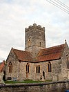
Stone building with square tower. In the foreground are gravestones. 배지워스 민교구 525 액스브리지 지방구 51°16ºN 2°52°W/51.27°N 2.87°W/ 51.27; -2.87(배드워스) [7][9]
Brown stone building with red roofs and central square tower. In the foreground are gravestones. 바우드립 민교구 506 브리지워터 지방 51°09ºN 2°56°W/51.15°N 2.94°W/51.15, -2.94(Bawdrip) [7][8]
Wooden hulk of ship, surrounded by wet sand. 베로 민교구 1,534 Axbridge 농어촌 지역 51°16′N 3°01′W/51.27°N 3.01°W/51.27, -3.01(Berrow, 서머싯) [7][9]
Looking due north at a beach, caravan sites and village in the distance seen from the top of a hill 브레인 민교구 635 Axbridge 농어촌 지역 51°18′N 3°01′W/51.30°N 3.01°W/51.30, -3.01(Brean) [7][9]
Red brick buildings in front of grey stone church. In the foreground in a grassy field contained within a hedge and fence. 브렌트 놀 민교구 1,271 Axbridge 농어촌 지역 51°15′N 2°57°W/51.25°N 2.95°W/ 51.25; -2.95(브렌트 Knoll) [7][9]
Statue of figure with outstretched arm. To the left a tall church spire and the right a circular building with columns. 브리지워터 도시 35,886 브리지워터 자치구 51°08ºN 2°59°W/51.13°N 2.99°W/ 51.13; -2.99(교량) [7][8]
Large road w2ith houses to left and right and hills beyond. 브릿지워터 미포함 민교구 428 브리지워터 지방 51°08ºN 2°58ºW/51.14°N 2.97°W/ 51.14; -2.97(교량 미포함) [7][8]
Stone building with prominent square tower. 브룸필드 민교구 249 브리지워터 지방 51°05ºN 3°07ºW/51.08°N 3.11°W/ 51.08; -3.11(Broomfield, Somerset) [7][8]
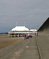
Short pier above sand, surmounted by white pavilion with flag poles. 바다와 하이브릿지의 번햄 도시 19,576 바다 도시 지역의 번햄 51°14ºN 2°59°W/51.24°N 2.99°W/ 51.24; -2.99(Burnham on SeaHighbridge) [7][10]
Small light coloured building behind a hedge and gate. 번햄 위드아웃 민교구 1,636 액스브리지 지방구 51°14ºN 2°58ºW/51.23°N 2.96°W/ 51.23; -2.96(Burnham 미포함) [7][9]
Small stone building with arched doorway. The church is partially obscured by trees. 버틀 민교구 388 브리지워터 지방 51°10ºN 2°52°W/51.17°N 2.87°W/ 51.17; -2.87(거북이) [7][8]
Red stone church with square tower. 캐닝턴 민교구 2,271 브리지워터 지방 51°09ºN 3°04ºW/51.15°N 3.07°W/ 51.15; -3.07(캐닝턴, 서머셋) [7][8]
View of the roofs of houses amongst trees and fields. Hills in the distance under a blue cloudless sky. 캣콧 민교구 531 브리지워터 지방 51°09ºN 2°52°W/51.15°N 2.87°W/ 51.15; -2.87(고양이) [7][8]
White circular building with four black sails. 채플 앨러튼 민교구 401 액스브리지 지방구 51°15′N 2°51ºW/51.25°N 2.85°W/ 51.25; -2.85(채플 앨러튼, 서머셋) [7][9]
Roofs of multiple buildings separated by trees and vegetation. In the distance is a lake and hills. 체다 민교구 5,755 액스브리지 지방구 51°17ºN 2°47°W/51.28°N 2.78°W/ 51.28; -2.78(체다) [7][9]
Stone building with square tower. 체조이 민교구 404 브리지워터 지방 51°08ºN 2°57°W/51.13°N 2.95°W/ 51.13; -2.95(체조이) [7][8]
Square stone tower, behind a stone wall and partially obscured by a tree. 칠튼 폴든 민교구 698 브리지워터 지방 51°09ºN 2°54°W/51.15°N 2.90°W/ 51.15; -2.90(칠튼 폴든) [7][8]
Reddish stone building with square tower. 칠튼 트리니티 민교구 260 브리지워터 지방 51°09ºN 3°01′W/51.15°N 3.01°W/ 51.15; -3.01(칠튼 트리니티) [7][8]
Church building with square tower seen within green fields with trees and hills behind. 콤프턴 비숍 민교구 620 액스브리지 지방구 51°18′N 2°52°W/51.30°N 2.87°W/ 51.30; -2.87(컴튼 비숍) [7][9]
Stone building with square tower at left hand end. In the foreground either side of a path are gravestones in a grassy area. 코싱턴 민교구 564 브리지워터 지방 51°10ºN 2°55°W/51.16°N 2.92°W/ 51.16; -2.92(코싱턴, 서머셋) [7][8]
Stone buildings with water in front. 더리 민교구 548 브리지워터 지방 51°07ºN 3°02°W/51.12°N 3.04°W/ 51.12; -3.04(듀리) [7][8]
Roofs of houses with prominent church spire to the right. Hills in the background. 이스트브렌트 주 민교구 1,302 액스브리지 지방구 51°16ºN 2°56°W/51.26°N 2.94°W/ 51.26; -2.94(동부 브렌트, 서머셋) [7][9]
Road junction with direction sign. In the background is a white painted building with a pub sign saying The Crown. 이스트헌츠필 민교구 1,146 브리지워터 지방 51°12ºN 2°59°W/51.20°N 2.98°W/ 51.20; -2.98(헌츠필) [7][8]
Stone wall with arched gap, overgrown with weeds. 에딩턴 민교구 372 브리지워터 지방 51°09ºN 2°53°W/51.15°N 2.88°W/ 51.15; -2.88(에딩턴, 서머셋) [7][8]
Square stone tower of church with residential buildings. In the foreground grass field contained by wooden fences. 엔모어 민교구 247 브리지워터 지방 51°07ºN 3°05°W/51.11°N 3.09°W/ 51.11; -3.09(더욱, 서머셋) [7][8]
Stone building with lighter coloured square tower. In the foreground are gravestones. 피딩턴 민교구 298 브리지워터 지방 51°10ºN 3°07ºW/51.16°N 3.12°W/ 51.16; -3.12(피딩턴) [7][8]
Stone building with pillars, surrounded by grass. 고투르스트 민교구 193 브리지워터 지방 51°06ºN 3°04ºW/51.10°N 3.06°W/ 51.10; -3.06(Goathurst) [7][8]
Stone building with square tower, separated from the road in the foreground by a stone wall. 그린턴 민교구 71 브리지워터 지방 51°07ºN 2°50ºW/51.12°N 2.84°W/ 51.12; -2.84(그린튼) [8]
White building with grey roof in the middle of green grass area. 림프샴 민교구 960 액스브리지 지방구 51°17ºN 2°57°W/51.29°N 2.95°W/ 51.29; -2.95(림프샴) [7][9]
Square church tower showing above tees and shrubs. In the foreground is a grass field with cattle. 민교구 338 브리지워터 지방 51°03ºN 2°58ºW/51.05°N 2.96°W/ 51.05; -2.96(링, 서머셋) [7][8]
Stone building with prominent square tower. In the foreground are gravestones. 마크. 민교구 1,478 액스브리지 지방구 51°14ºN 2°53°W/51.23°N 2.89°W/ 51.23; -2.89(마크, 서머셋) [7][9]
Stone building with prominent square tower. 미들조이 민교구 725 브리지워터 지방 51°05ºN 2°53°W/51.09°N 2.89°W/ 51.09; -2.89(미들보이) [7][8]
Square stone tower surrounded by trees and grass. 무린치 민교구 408 브리지워터 지방 51°08ºN 2°52°W/51.13°N 2.86°W/ 51.13; -2.86(물린치) [7][8]
Stone building with prominent square tower. In the foreground are gravestones. 네더스토이 민교구 1,373 브리지워터 지방 51°09ºN 3°09ºW/51.15°N 3.15°W/ 51.15; -3.15(네더 스토이) [7][8]
Stone building with prominent square tower. 노스페더턴 도시 6,730 브리지워터 지방 51°05ºN 3°01′W/51.09°N 3.01°W/ 51.09; -3.01(노스페터턴) [7][8]
Stone building with square tower 기타 민교구 642 브리지워터 지방 51°05ºN 2°53°W/51.08°N 2.88°W/ 51.08; -2.88(기타) [7][8]
Stone building with prominent square tower. In the foreground is a road and wall. 오터햄프턴 민교구 831 브리지워터 지방 51°11ºN 3°05°W/51.18°N 3.08°W/ 51.18; -3.08(오터햄프턴) [7][8]
Stone building with prominent square tower. In the foreground are daffodils. 오버스토이 민교구 352 브리지워터 지방 51°09ºN 3°09ºW/51.15°N 3.15°W/ 51.15; -3.15(스토이 위) [7][8]
modern building with shop. Sign over window says Pawlett Country Store & Off Licence. 폴렛 민교구 1,038 브리지워터 지방 51°11ºN 3°00ºW/51.18°N 3.00°W/ 51.18; -3.00(파울렛, 서머셋) [7][8]
Stone building with square tower 퓨리톤 민교구 1,068 브리지워터 지방 51°10ºN 2°58ºW/51.17°N 2.97°W/ 51.17; -2.97(청교도) [7][8]
Stone building with square tower 샤프윅 민교구 536 브리지워터 지방 51°08ºN 2°50ºW/51.14°N 2.83°W/ 51.14; -2.83(Shapwick, Somerset) [7][8]
Stone cross surrounded by railings on grass area in front of roads and houses. 십햄 민교구 1,087 액스브리지 지방구 51°19ºN 2°48ºW/51.31°N 2.80°W/51.31, -2.80(Shipham) [7][9]
White painted building with pub sign saying The Lamb Inn 스파스턴 민교구 1,012 브리지워터 지방 51°08ºN 3°07ºW/51.13°N 3.11°W/51.13, -3.11(Spaxton) [7][8]
Stone building with small square tower. In the foreground is a road and wall. 스타웰 민교구 386 브리지워터 지방 51°08ºN 2°55°W/51.14°N 2.91°W/51.14, -2.91(Stawell, 서머싯) [7][8]
Houses amongst trees seen across fields and hedges. 스톡랜드 브리스톨 민교구 165 브리지워터 지방 51°11′N 3°05°W/51.19°N 3.08°W/로;-3.08(Stockland 브리스톨) [7][8]
White painted building with black timbers. In the foreground is a road and road sign. 서록스턴 민교구 153 브리지워터 지방 51°04′N 3°02°W/51.07°N 3.04°W/51.07, -3.04(Thurloxton) [7][8]
Gray stone building with square tower 우리는 그래요. 민교구 658 액스브리지 지방구 51°16ºN 2°50ºW/51.27°N 2.84°W/ 51.27; -2.84(Weare, Somerset) [7][9]
Stone building with square tower 웨드모어 민교구 3,318 액스브리지 지방구 51°14ºN 2°49°W/51.23°N 2.81°W/ 51.23; -2.81(수요일) [7][9]
Red stone building with square tower. In the foreground are gravestones. 윔번 민교구 3,613 브리지워터 지방 51°08ºN 3°01′W/51.13°N 3.02°W/ 51.13; -3.02(Wembdon) [7][8]
Stone building with arched window and square tower, separated from the road by a stone wall and railings. 웨스트헌츠필 민교구 1,414 브리지워터 지방 51°12ºN 2°59°W/51.20°N 2.98°W/ 51.20; -2.98(헌츠필) [7][8]
Stone building with square tower 웨스턴조일랜드 민교구 1,801 브리지워터 지방 51°07ºN 2°55°W/51.11°N 2.92°W/ 51.11; -2.92(웨스턴조일랜드) [7][8]
Stone building with square tower 울라빙턴 민교구 2,115 브리지워터 지방 51°10ºN 2°56°W/51.17°N 2.93°W/ 51.17; -2.93(울라빙턴) [7][8]

배틀

산업

경공업은 현재 지배적이지만, 가축 사육 외에 이탄 채취, 버드나무 공예, 사이다 제조 등의 전통 무역이 여전히 발견될 수 있다.파렛 강은 1월부터 5월까지 장어와 엘버의 원천을 제공합니다.

또한 주목할 만한은 새로운 Isleport 거래 부동산에 Highbridge, 보관하고 많은 세계적인 회사들과 같은 Geest(Isleport 음식)게 만드는 사람들 yoghurt 아래에 스키&뮬러는, 브레이크 형제들을 지원하는 급식을 하는 무역, 생물학적 가양성 도매하는 대리한 건조한 상품에 빵집 이 도표, 우드 베리&헤인즈는 대리한 가구를 세계적으로, Polybeam 제한누가 밖 교육Marconi와 같은 고객에게 GRP 라디오 마스트와 AT&T를 제공합니다.또, AT&T의 센터는, 미국을 오가는 모든 인터넷 케이블 트래픽을 제어합니다.

브릿지워터의 산업도 최근 거버푸드(글로벌 과일주스 공급업체), NHS 로지스틱스 창고, 에디 스토바트 창고 등이 입주한 익스프레스 파크(Express Park)가 문을 열면서 크게 성장했다.Huntworth에 있는 Bridgwater 남쪽에는 서남쪽에 있는 Somerfield와 옛 Kwik Save 상점에 공급되는 대형 Somerfield 창고가 있습니다.

거버넌스

세지무르 구

Sedgemoor 지역은 1974년에 설립되었으며 브릿지워터에 기반을 두고 있습니다.콴톡 힐스와 멘디프 힐스 사이의 대부분 시골 지역에 걸쳐 있습니다.

영국 의회 의원

지역은 브릿지워터, 웨스트 서머셋, 웰스 카운티 선거구에 속하며, 이 선거구는 영국 하원에서 최초로 선출직으로 선출된다.현재 Bridgewater and West Somerset의 하원의원보수당원인 Ian Liddell-Grainger입니다.[11]Wells의 하원의원은 James Heappey입니다.James Heappey는 2015년 자유민주당 Tessa [12]Munt에서 의석을 획득했습니다.

교육

Sedgemoor의 학교(독립적이지 않은 학교)는 서머셋 카운티의 Children & Young People's Directorate of Somerset County Council을 운영하고 있지만, The Kings of Wesex School과 같은 몇몇 학교들은 재단과 그 후 아카데미 지위를 선택함으로써 카운티의회와 거리를 두고 있다.

「 」를 참조해 주세요.

레퍼런스

  1. ^ "Population Estimates for UK, England and Wales, Scotland and Northern Ireland, Mid-2019". Office for National Statistics. 6 May 2020. Retrieved 6 May 2020.
  2. ^ Robert Dunning, ed. (2004). "Introduction". A History of the County of Somerset: Volume 8: The Poldens and the Levels. Institute of Historical Research. Retrieved 1 August 2011.
  3. ^ "Frequently asked questions". Somerset County Council. Retrieved 1 January 2022.
  4. ^ "Elections for new Somerset Council to be held in May 2022". BBC News. 2 December 2021. Retrieved 1 January 2022.
  5. ^ "Sedgemoor District Council". Ethnic Multicultural Media Academy. Retrieved 4 August 2008.
  6. ^ "Sedgemoor parish population estimates for 2002" (PDF). Somerset County Council. 2002. Archived from the original (PDF) on 21 November 2009. Retrieved 17 October 2009.
  7. ^ a b c d e f g h i j k l m n o p q r s t u v w x y z aa ab ac ad ae af ag ah ai aj ak al am an ao ap aq ar as at au av aw ax ay az ba "Statistics for Wards, LSOAs and Parishes – SUMMARY Profiles" (Excel). Somerset Intelligence. Retrieved 4 January 2014.
  8. ^ a b c d e f g h i j k l m n o p q r s t u v w x y z aa ab ac ad ae af ag ah ai aj ak al "Brdigwater RD". A vision of Britain Through Time. University of Portsmouth. Retrieved 4 January 2014.
  9. ^ a b c d e f g h i j k l m n o "Axbridge RD". A vision of Britain Through Time. University of Portsmouth. Retrieved 4 January 2014.
  10. ^ "Burnham UD". A vision of Britain Through Time. University of Portsmouth. Retrieved 4 January 2014.
  11. ^ "Alphabetical List of Constituencies and Members of Parliament". House of Commons Information Office. Archived from the original on 17 January 2008. Retrieved 19 January 2008.
  12. ^ "Wells". Election 2010. BBC News. Retrieved 7 May 2010.

외부 링크