서머셋의 민가 목록

List of civil parishes in Somerset
서머셋의 행정 구역
노란색으로 표시된 지역은 단일 관할 당국이고 분홍색으로 표시된 지역은 서머셋 카운티 의회에 의해 관리되는 지역이다.
Somerset numbered districts 2019.svg
1남서머셋
2 서머셋 웨스트와 톤턴
3 세지무어
4 멘디프
5 배스노스이스트 서머셋(유니터리)
6 북서머셋 (단일화)
다음을 사용하여 모든 좌표 매핑: 오픈스트리트맵
좌표를 다른 이름으로 다운로드: KML

영국 서머셋 주의 의례적인 카운티민가로 알려진 418개의 지역으로 나뉘는데, 이것은 영국에서 지방정부의 가장 낮은 단위다.파리는 영국 교회 부서에서 생겨났고, 1894년 지방 정부법에 의해 현재의 권한과 책임을 부여받았다.[1]1972년 지방정부법은 농촌에 민가를 유지했다.많은 이전 도시 지역들과 시 자치구들이 새로운 후계 도시들로 대체되었다; 단일 도시들이 되기에는 너무 크다고 여겨졌던 도시 지역들은 비파생 지역이 되었다.[2]

서머셋 현은 서머셋 군의회가 관리하는 비수도권 군으로 4개 와 2개 단일 자치구로 나뉜다.서머셋의 구 는 사우스 서머셋, 서머셋 웨스트와 타운톤, 멘디프, 세지무어이다.1996년 4월 1일 아본 현이 해체됨에 따라 설립된 행정적으로 독립적인 두 개의 단일 자치 기관은 노스 서머셋배스, 노스 이스트 서머셋이다.이들 단일 관할 당국에는 1974년 에이본이 만들어지기 전까지 서머셋의 일부였던 지역들이 포함된다.[3]

배스 시는 배스와 노스이스트 서머셋에서 가장 큰 인구 중심지다.이전에 배스 카운티 자치구 내에 있던 도시의 지역들은 지금은 미개척 상태지만, 나머지 권한은 49개의 파리로 나뉜다.다른 단일 자치단체인 북소메르셋은 모두 192명의 인구를 가진 록스턴 마을부터 [4]7만6143명의 주민이 사는 웨스턴-슈퍼마레 마을까지 39개의 파리로 덮여 있다.[4]

2019년에는 구(舊) 타운턴 데인(Taunton Deane)과 웨스트 서머셋(대부분 농촌지역, 인구 35,712명)[5]이 통합되어 가장 큰 구(區)[6]인 서머셋 웨스트(Somerset West)와 타운톤(Taunton)을 형성하였다.사우스 서머셋은 데본도르셋과의 경계에서 서머셋 레벨의 가장자리까지 958 평방 킬로미터(370 평방 미)의 면적을 포함한다.[7]인구는 약 156,100명이다.[7]이 지역에서 가장 큰 정착지는 여빌로, 인구는 30,378명이다.[8]세지무어그린튼 71세부터[9] 브리지워터 33,698세까지 54개의 파리를 가지고 있다.[9]멘디프 지역은 멘디프 힐즈에서 서머셋 레벨에 이르는 738 평방 킬로미터(285평방미터)의 넓은 시골 지역을 차지하고 있다.[10]인구는 약 10만8,300명으로 62개 파리에 살고 있으며,[10] 그 중 가장 큰 도시인 프로메의 거주자는 24,510명이고,[11] 가장 작은 샤르팜의 인구는 71명이다.[11]

역사

파리는 영국 교회의 분열에서 생겨났으며, 원래는 순전히 교회적인 분열이었다.시간이 지남에 따라 그들은 행정권을 획득했다.[12]1555년 고속도로법은 도로 유지에 책임이 있는 파도를 만들었다.교구의 모든 성인 거주자들은 1년에 4일 동안 도로에서 일해야 했고, 그들만의 도구, 수레, 말들을 제공해야만 했다. 이 작업은 무보수 지역 지명자인 고속도로 조사원에 의해 감독되었다.가난한 사람들은 수도원들에 의해 그들이 해산될 때까지 보살핌을 받았다.1572년 치안 판사들은 '가난한 사람들을 조사'할 수 있는 권한을 부여받았고, 그들의 구제를 위해 세금을 부과했다.이 제도는 1601년 빈민법률에 의해 더욱 공식화되었고, 이는 빈민법을 관리하는 파출소를 책임지게 했으며, 교구의 빈민에 대한 지원 요금을 부과하기 위해 감독관이 임명되었다.[13]비록 가난한 법권력가난한 법동맹으로 넘어갔지만 19세기에는 파시의 책임감이 증가했다.[14]1872년 공중보건법은 빈민법률조합에 근거하여 파리를 농촌위생구역으로 분류했는데, 이는 농촌지역의 기초를 형성하였다.[15]파리는 매년 관료를 임명하기 위해 열리는 잔치에 의해 운영되었고, 비록 몇몇 큰 파리의 마을들이 가난한 법을 직접 집행하였지만,[16] 일반적으로 교회적인 파리와 동일했다; 1882년 파리 에 따르면, 별도의 요금을 부과한 모든 초극락 지역마을은 독립적인 시민 파시가 되었다.[17]

현대적 의미의 시민 도시들은 1894년 지방정부법으로부터 유래되었는데, 그 법은 잔재산을 폐지하고, 300명 이상의 선거인이 있는 모든 시골에 선출된 교구의회를 설립하고, 농촌의 도시들을 농촌지역으로 묶고, 군과 자치구의 경계와 교구의 경계를 일치시켰다.[17]도시민속 도시들은 계속 존재했고, 일반적으로 도시민속 도시들이 위치도시지구, 시영 자치구 또는 카운티 자치구와 인접했다. 많은 큰 도시들은 많은 도시들을 포함하고 있었고, 이것들은 보통 하나로 통합되었다.도시 지역에서는 교구의회가 구성되지 않았으며, 교구의 유일한 기능은 가난한 법률 연합의 수호자를 선출하는 것이었다; 1930년 가난한 법 제도가 폐지되면서 교구는 명목상의 존립에 불과했다.[18]1972년 지방정부법은 농촌에 민가를 보존하고 있었고, 폐지되고 있던 많은도시지역과 시 자치구가 새로운 후계자 도시들로 대체되었다. 단 하나의 도시라고 하기에는 너무 넓다고 여겨졌던 도시지역은 미개척 지역이 되었다.[19]

위치 위치

(서머서경)의 현 한 지도

최근 정부는 미수 지역에 마을과 교구의회 구성을 장려하고 있으며, 1997년 지방정부 등급법에서는 지역 주민들에게 새로운 시민 교구의 설립을 요구할 수 있는 권리를 주었다.[20]교구의회는 결의만으로 일방적으로 마을 의회가 될 수 있고,[19] 시민 교구 또한 도시의 지위를 얻을 수 있지만, 다만 그것이 왕실에 의해 허가되어야만 가능하다.[19]마을이나 시의회 의장을 시장이라고 한다.[19]카운티에는 현재 28개의 도시와 1개의 도시(우물)가 있다.2007년보건법」에서는 대체 명칭을 도입했는데, 교구의회가 이제 지역사회, 마을, 또는 이웃 의회로 불릴 수 있다는 것이다.[21]

배스 앤 노스이스트 서머셋

배스 카운티 버로우에 속했던 배스 시의 일대는 빈자리가 없다.

이미지 이름 상태 단체 구 지만 당 국 좌표 참조
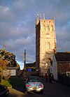
Yellow stone building, with porch with triangular roof in front. Short square tower with battlements topped by flag and flag pole. Gray gravestones in the foreground 바샘프턴 시민 교구 1,603 51°23˚N 2°19˚W/51.39°N 2.32°W/ 51.39; -2.32(배스햄튼) [22][23]
White fronted buildings with windows with small panes of glass. Shop signs for fish and chips and a pub. Postbox on the pavement in front of the buildings separated by black railings. 배트이스트론 시민 교구 2,735 51°25°N 2°19˚W/51.41°N 2.31°W/ 51.41; -2.31(동북쪽) [23][24]
Street scene with yellow stone houses on the left and trees showing above a wall on the right 배스퍼드 시민 교구 1,759 51°23˚N 2°18˚W/51.39°N 2.30°W/ 51.39; -2.30(배스퍼드) [23][25]
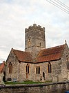
Square grey tower of stone church building, partially obscured by trees. Red roofed lych gate to right. Grass and gravestones in the foreground 카머턴 시민 교구 655 51°19°N 2°27′W/51.32°N 2.45°W/ 51.32; -2.45(카메라톤) [23][26]
Gray building with tower at the near end. Trees to right. Gravestones in front 시민 교구 422 51°25°N 2°22′W/51.41°N 2.36°W/ 51.41; -2.36(Charlcombe) [23][27]
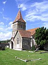
Gray stone building. Prominent square tower with arched window, topped by small slate pyramidal roof. Left and right of the building are yew trees amongst gravestones. 첼우드 시민 교구 148 51°21°N 2°31˚W/51.35°N 2.52°W/ 51.35; -2.52(첼우드) [28][29]
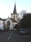
Street scene showing road junction and grey stone buildings with parked cars in front of them. To the left is a grassy area with a tree. 츄 마그나 시민 교구 1,149 51°22°N 2°37′W/51.37°N 2.61°W/ 51.37; -2.61(Chew Magna) [29][30]
multiple buildings with red and grey roofs nestled amongst trees. Church tower to the left. Foreground is grassy fields and hedgerows. Background is hills. 츄 스토크 시민 교구 991 51°21°N 2°38′W/51.35°N 2.64°W/ 51.35; -2.64(Chew Stoke) [29][31]
Gray stone building with slate roof. Attached to the right is a wooden structure over water, partially obscured by trees 클라버턴 시민 교구 115 51°23˚N 2°19˚W/51.38°N 2.31°W/ 51.38; -2.31(클라버튼, 서머셋) [23][32]
Stone building, partially obscured by trees. Red brick tower with horizontal stripe pattern surmounted by battlements. 클루턴 시민 교구 1,602 51°20°N 2°32˚W/51.33°N 2.54°W/ 51.33; -2.54(클러튼, 서머셋) [29][33]
Semicircular stone steps, partially obscured by trees. Water to the left 컴베 헤이 시민 교구 147 51°20°N 2°23′W/51.34°N 2.38°W/ 51.34; -2.38(컴베 헤이) [23][34]
Gray stone building with arched windows. Square tower topped with spirelet, flagpole and weather vane. Foreground has small trees and bushes and a wooden rail fence. 콤프턴 단도 시민 교구 579 51°23˚N 2°31˚W/51.38°N 2.51°W/ 51.38; -2.51(컴튼 단도) [35][36]
In the foreground are a stone wall and road. Beyond is an area of water surrounded by trees and white fronted houses. 콤프턴 마틴 시민 교구 508 51°19°N 화씨 2°39°W/51.31°N 2.65°W/ 51.31; -2.65(컴튼 마틴) [29][37]
Gray stone building with small square tower and pyramidal roof. Grassy foreground with a cross and gravestones 코스턴 시민 교구 494 51°23˚N 2°26′W/51.39°N 2.44°W/ 51.39; -2.44(코스턴, 서머셋) [23][38]
White caravan on grassy bridge, surrounded by small trees and shrubs 던커튼과 툰리 시민 교구 502 51°20°N 2°25˚W/51.33°N 2.41°W/ 51.33; -2.41(던커턴, 서머셋) [23][39]
Red and grey stone building with arched windows and triangular roof. Behind is a small square tower 이스트 하프트리 시민 교구 644 51°18°N 2°37′W/51.30°N 2.62°W/ 51.30; -2.62(이스트 하프트리) [29][40]
Roofs of houses visible amongst green fields and hedgerows. Large rock in the foreground. 잉글리시컴 시민 교구 318 51°22°N 2°25˚W/51.36°N 2.41°W/ 51.36; -2.41(영어 combe) [23][41]
Gray stone building with square tower at left hand end. Grass and gravestones in the foreground. 시민 교구 1,035 51°20°N 2°29′W/51.34°N 2.48°W/ 51.34; -2.48(Farmborough) [29][42]
Gray stone building with square tower at far end. Grass and gravestones in the foreground. ㅇㅇ니. 시민 교구 901 51°17°N 2°32˚W/51.29°N 2.53°W/ 51.29; -2.53(패링턴 거니) [29][43]
Yellow stone building with grey slate roof and grey chimney, surrounding by houses and trees. In the foreground is a path with a high stone wall and vegetation. 프레시퍼드 시민 교구 551 51°20°N 2°19˚W/51.34°N 2.31°W/ 51.34; -2.31(프레시퍼드) [23][44]
Grey stone building on 3 bays with a square stone tower at near end of central bay. To the left is a porch with slate roof. In front is a yew tree and gravestones behind a stone wall separating it from a road. 하이 리틀턴 시민 교구 2,104 51°19°N 2°31˚W/51.32°N 2.51°W/ 51.32; -2.51(하이 리틀턴) [29][45]
Church tower seen arising behind stone buildings with tile roofs, one of which has a pub sign. Foreground is grass 힌튼 블러웨트 시민 교구 308 51°19°N 2°35˚W/51.31°N 2.58°W/ 51.31; -2.58(힌튼 블러위트) [29][46]
Gray stone building with small square tower at left hand end. In the foreground is grass with a small tiled memorial. 힌튼 차터하우스 시민 교구 515 51°20°N 2°19˚W/51.33°N 2.32°W/ 51.33; -2.32(힌튼 헌터하우스) [23][47]
Stone building with tower to right hand side. In front is a wall separating the building from the road. 켈스턴 시민 교구 248 51°24°N 2°26′W/51.40°N 2.43°W/ 51.40; -2.43(켈스턴) [23][48]
Street scene showing shops on left and right, with cars and vans on road. On the left hand pavement is a sign saying welcome to Keynsham high street. 케인샴 마을 15,641 51°25°N 2°29′W/51.41°N 2.49°W/ 51.41; -2.49(Keynsham) [36][49]
Top of ower with spirelets seen behind trees. In the foreground is grass and gravestones 마크스베리 시민 교구 397 51°22°N 2°29′W/51.36°N 2.48°W/ 51.36; -2.48(마크스베리) [23][50]
A river running between pavements with railings. Shops behind 미도머 노턴 마을
10,997
노턴 래드스톡 51°17°N 2°29′W/51.28°N 2.48°W/ 51.28; -2.48(Midsomer Norton) [51][52]
The roofs of houses and farm buildings in a green valley. Trees in the foreground 몽크톤 콤베 시민 교구 554 51°22°N °20°W/51.36°N 2.33°W/ 51.36; -2.33(몬크톤 콤비) [23][53]
Gray stone building with tower at right hand end surmounted by a small spirelet, partially obscured by trees. 넴프넷 스럽웰 시민 교구 177 51°20°N 2°41˚W/51.34°N 2.68°W/ 51.34; -2.68(Nempnett Thrubwell) [29][54]
Reddish brown building with tower nearest the camera. Trees to left and right 뉴턴 세인트루 시민 교구 681 51°23˚N 2°26′W/51.38°N 2.43°W/ 51.38; -2.43(뉴턴 생로) [23][55]
The roofs of a row of houses amongst green fields. 노턴 말러워드 시민 교구 246 51°23˚N 2°34′W/51.39°N 2.57°W/ 51.39; -2.57(Norton Malreward) [29][56]
Large conical black mound with trees in the foreground 시민 교구 5,302 51°19°N 화씨 2°30°/51.31°N 2.50°W/ 51.31; -2.50(폴턴) [29][57]
Gray stone building on the left with a pub sign outside it. A road is central to the picture with a white coloured building on the right. 페이즈타운 세인트 존 시민 교구 6,446 51°19°N 2°26′W/51.32°N 2.44°W/ 51.32; -2.44(페이즈 다운 세인트 존) [23][58]
Gray building with arched windows. Square tower surmounted by a weather vane. Gravestones and crosses in grass in the foreground separated from the road by a stone wall. 프리스톤 시민 교구 232 51°20°N 2°26′W/51.34°N 2.44°W/ 51.34; -2.44(프리스톤) [23][59]
Gray stone bridge with two arches over water. The central pillar is on a small island. Trees to the left and right and behind the bridge. 퍼블로 시민 교구 1,119 51°22°N 2°33˚W/51.37°N 2.55°W/ 51.37; -2.55(게시판) [29][60]
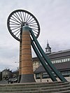
Large wheel on brick tower. 래드스톡 마을
5,620
노턴 래드스톡 타운 평의회 51°17′24″N 2°26′52″w/51.29°N 2.4477°W/ 51.29; -2.4477(웨스트필드) [52][61]
Gray stone building with red tiled roof, partially obscured by a hedge. A square tower is at the far end. The foreground includes several crosses and gravestones. 솔트퍼드 시민 교구 4,073 51°24°N 2°28˚W/51.40°N 2.46°W/ 51.40; -2.46(솔트포드) [36][62]
Several houses, many with white walls and red roofs nestling in a green valley with occasional trees. 쇼스콤베 시민 교구 443 51°18°N 2°25˚W/51.30°N 2.41°W/ 51.30; -2.41(쇼스콤비) [23][63]
Gray stone building with prominent four stage tower at the right hand end. To the left is a large yew tree. 사우스스토크 시민 교구 460 51°21°N 2°22′W/51.35°N 2.36°W/ 51.35; -2.36(남스토크) [23][64]
Gray stone building with square tower behind. In the foreground are green fields and bushes. 스탠튼 드루 시민 교구 787 51°22°N 2°35˚W/51.37°N 2.58°W/ 51.37; -2.58(스턴 드류) [29][65]
The roofs of many houses can be seen in a green valley with several trees. 스토이수튼 시민 교구 1,361 51°20°N 2°35˚W/51.34°N 2.59°W/ 51.34; -2.59(Stowey-Sutton) [29][66]
The roofs of several houses can be seen nestling in a green valley with lots of trees. 스웬스윅 시민 교구 265 51°25°N 2°21˚W/51.41°N 2.35°W/ 51.41; -2.35(스웨인스윅) [23][67]
Side of stone building with arched windows, partially obscured by trees. Gravestones in the foreground 템플 클라우드와 카메리 시민 교구 1,292 51°19°N 2°34′W/51.32°N 2.56°W/ 51.32; -2.56(케임리) [29][68]
Gray three bay building with arched windows. Tower behind and gravestones in the foreground. 팀즈베리 시민 교구 2,624 51°20°N 2°29′W/51.33°N 2.48°W/ 51.33; -2.48(팀즈베리, 서머셋) [29][69]
Gray stone building with square tower surmounted by a spire on the left. Surrounded by trees and green fields. 우블리 시민 교구 331 51°19°N 2°41˚W/51.32°N 2.68°W/ 51.32; -2.68(우블리) [29][70]
The roofs of many houses, and a church spire can be seen in a green valley with several trees. 웰로우 시민 교구 529 51°19°N 2°22′W/51.32°N 2.37°W/ 51.32; -2.37(웰로우, 서머셋) [23][71]
Westfield Shops, Wells Road, Radstock - geograph.org.uk - 431126.jpg 웨스트필드 시민 교구
5,854
노턴 래드스톡 타운 평의회 51°17′24″N 2°26′53″w/51.29°N 2.448°W/ 51.29; -2.448(웨스트필드) [52][72]
Street scene with a church and spire central to the picture. To the right is a yellow building with a pub sign. To the left is a large tree with a signpost in front. Several cars. 웨스트하프트리 시민 교구 439 51°19°N 2°38′W/51.31°N 2.63°W/ 51.31; -2.63(웨스트 하프트리) [29][73]
Gray stone building with arched windows. A central tower has a clock on the near face and is surmounted by a weather vane. 시민 교구 1,354 51°25°N 2°34′W/51.41°N 2.56°W/ 51.41; -2.56(휘처치) [23][74]

멘디프

그 지역 전체가 갈매기 모양으로 되어 있다.

이미지 이름 상태 인구[11] 단체 구 지만 당 국 좌표 참조
Gray stone building with square tower at left hand end. Foreground includes grass area with gravestones, taken over the top of metal railings. 애슈윅 시민 교구 1,352 51°14˚N 2°31˚W/51.23°N 2.52°W/ 51.23; -2.52(아쉬윅) [75][76]
Brown stone building with square tower at the left hand end. In the foreground is a grass area with gravestones. 발튼스버러 시민 교구 864 N51°07°N 2°38′W/51.11°N 2.64°W/ 51.11; -2.64(발튼스버러) [77][78]
A row of whitewashed buildings on the left with climbing plants. Small flower filled gardens separate them from a stone wall fronting a road. 배트콤비 시민 교구 439 51°09°N 2°26′W/51.15°N 2.44°W/ 51.15; -2.44(배트콤베, 서머셋) [76][79]
Street scene showing brown stone houses with tiled roofs. Several parked cars in the road. 시민 교구 983 프로메농촌구 51°16°N 2°17′W/51.26°N 2.28°W/ 51.26; -2.28(베킹턴) [80][81]
Yellow stone building with prominent square tower. Trees to left and right of the path leading to the building. 버클리 시민 교구 344 프로메농촌구 51°14˚N 2°16˚W/51.24°N 2.27°W/ 51.24; -2.27(베르클리, 서머셋) [81][82]
Stone three stage square tower surmounted by a flag pole. To the right are trees and in the foreground grass. 비네가르 시민 교구 313 51°14˚N 2°33˚W/51.24°N 2.55°W/ 51.24; -2.55(비네거) [76][83]
Street scene showing grey stone houses on the left of a road with a few cars. 버클랜드 딘햄 시민 교구 381 프로메농촌구 51°16°N 2°21˚W/51.26°N 2.35°W/ 51.26; -2.35(버클랜드 딘햄) [81][84]
Grassy area with trees in the foreground and a terrace of stone houses, one white fronted, in the background 부틀리 시민 교구 823 N51°05°N 2°41˚W/51.09°N 2.68°W/ 51.09; -2.68(버틀리) [78][85]
Stone two bay building with prominent ornamental tower behind 츄튼 멘디프 시민 교구 585 51°17°N 2°35˚W/51.28°N 2.58°W/ 51.28; -2.58(Chewton Mendip) [78][86]
Street scene with stone cross on three tier plinth to the left of the road. In the background is a white walled building. 시민 교구 2,062 51°16°N 화씨 2°30°/51.27°N 2.50°W/ 51.27; -2.50(칠컴톤) [29][87]
Stone building with prominent square tower at near end. In the foreground are gravestones and trees to the left and right. 콜퍼드 시민 교구 2,313 프로메농촌구 51°14˚N 2°27′W/51.24°N 2.45°W/ 51.24; -2.45(콜포드, 서머셋) [81][88]
Stone building with arched porchway. Prominent square tower to the left hand end of building. In the foreground gravestones and crosses on grass. 크랜모어 시민 교구 667 51°11°N 2°29′W/51.19°N 2.48°W/ 51.19; -2.48(크란모어, 서머셋) [76][89]
Water flowing through a channel and over a weir between a building and a wall. Vegetation on both sides of the water. 크로스콤비 시민 교구 603 51°12°N 2°35˚W/51.20°N 2.58°W/ 51.20; -2.58(크로스콤비) [76][90]
Yellow stone building with central square tower, Foreground is paths through green grass. 디치트 시민 교구 725 51°08°N 2°32˚W/51.13°N 2.54°W/ 51.13; -2.54(Ditcheat) [76][91]
Downhead parish church - geograph.org.uk - 231205.jpg 다운헤드 시민 교구 88 51°12′40″N 2°26′35″w/51.211°N 2.443°W/ 51.211; -2.443(아래쪽) [76]
Gray stone building with two arched porch entrance doors. Separated from road by stone wall. 더울팅 시민 교구 618 51°11°N 2°31˚W/51.19°N 2.51°W/ 51.19; -2.51(Doulting) [76][92]
Stone building with square tower to left hand end. Foreground shows gravestones in grass area. 이스트 페나르드 시민 교구 348 51°08°N 2°37′W/51.14°N 2.62°W/ 51.14; -2.62(이스트 페나르드) [76][93]
Whitewashed building with square tower. 엠보로프 시민 교구 148 51°16°N 2°33˚W/51.26°N 2.55°W/ 51.26; -2.55(엠버러) [76][94]
Street scene. Stone cross on a pillar rising from 5 step plinth. Iron lampost left and right of the road are stone terraced houses. 에버크리치 시민 교구 2,334 51°08°N 2°31˚W/51.14°N 2.51°W/ 51.14; -2.51(에브리치) [76][95]
Street scene. Buildings to left and right of narrow road. 프로메 마을 26,203 프로메농촌구
프로메 우르반
51°14˚N 2°19˚W/51.23°N 2.32°W/ 51.23; -2.32(Frome) [81][96]
Red roofs of multiple houses, with some larger white roofs at the far side. Surrounded by trees and grren fields on all sides. Hills on the horizon. 글래스턴베리 마을 8,932 글래스턴베리 시립 자치구 51°09°N 2°43˚W/51.15°N 2.71°W/ 51.15; -2.71(글라스톤베리) [97][98]
Stone building at the end of narrow lane with water filled ditches on either side. Surrounded by fields and trees. 고드니 시민 교구 237 51°11°N 2°44˚W/51.18°N 2.74°W/ 51.18; -2.74(고드니) [78][99]
Stone two arch bridge over water 그레이트 엘름 시민 교구 171 프로메농촌구 51°14˚N 2°22′W/51.24°N 2.36°W/ 51.24; -2.36(위대한 엘름) [81][100]
Stone building with arched windows. Prominent square tower to the right hand end. In the foreground are gravestones in grassy area. 헤밍턴 시민 교구 640 프로메농촌구 51°17°N 2°23′W/51.28°N 2.39°W/ 51.28; -2.39(헤밍턴, 서머셋) [81][101]
Street scene. Road junction with red stop sign. Two cars. The sides of the roads are stone walls with large trees showing above them. 홀콤비 시민 교구 947 51°14˚N 2°28˚W/51.24°N 2.46°W/ 51.24; -2.46(홀콤베, 서머셋) [76][102]
Stone building with old metal sign above the door saying Old Post Office, red post box set into the wall and to the left an old blue telephone box. The door is below the level of the road and separated by metal railings. Hanging baskets of flowers on the front of the building. 킬머스돈 시민 교구 541 프로메농촌구 51°16°N 2°26′W/51.27°N 2.44°W/ 51.27; -2.44(킬머스돈) [81][103]
Gray stone building with square tower at left hand end. In the foreground are gravestones on grass. 라미야트 시민 교구 183 N51°07°N 2°29′W/51.12°N 2.49°W/ 51.12; -2.49(라미야트) [76][104]
Street scene showing a road unction with parked cars. On the left and right are stone houses with trees and fields in the distance. 레이온멘디프 시민 교구 514 프로메농촌구 51°14˚N 2°26′W/51.23°N 2.44°W/ 51.23; -2.44(Leigh-on-Mendip) [81][105]
Stone building with square tower at left hand end. In the foreground are trees and gravestones. 리턴 시민 교구 240 51°17°N 2°35˚W/51.29°N 2.58°W/ 51.29; -2.58(리톤, 서머셋) [29][106]
Cast iron pump with its own tiled roof. Behind are two stone built thatched cottages. 자장링턴 시민 교구 162 프로메농촌구 51°16°N 2°19˚W/51.26°N 2.31°W/ 51.26; -2.31(울링턴, 서머셋) [81][107]
Small shop with white surrounds to the windows set in the right hand building of a terrace. 리드포드온포스 시민 교구 511 51°04°N 2°37′W/51.07°N 2.62°W/ 51.07; -2.62(Lydford-on-Fosse) [76][108]
Yellow stone building with tiled roof and arched doorway. 미어어 시민 교구 1,304 51°10°N 2°46˚W/51.17°N 2.77°W/ 51.17; -2.77(미어) [78][109]
Street of grey stone houses. The church tower can be seen n the background 멜스 시민 교구 638 프로메농촌구 51°14˚N 2°23′W/51.24°N 2.39°W/ 51.24; -2.39(멜스, 서머셋) [81][110]
Stone church tower with flag pole. In the foreground are gravestones on grass. 노스부턴 시민 교구 317 51°10°N 2°37′W/51.17°N 2.62°W/ 51.17; -2.62(북부턴, 서머셋) [78][111]
White fronted building with black beams prominent. Over the door is a sign saying The George Inn, Wadworths. 노턴 세인트 필립 시민 교구 858 프로메농촌구 51°17°N 2°19˚W/51.29°N 2.32°W/ 51.29; -2.32(Norton St Philip) [81][112]
Ruined stone castle with round towers at each corner. 누나 시민 교구 844 프로메농촌구 51°13°N 2°23′W/51.21°N 2.38°W/ 51.21; -2.38(누니) [81][113]
Long stone building with buttressed walls and red tiled roof. 필턴 시민 교구 998 51°10°N 2°35˚W/51.17°N 2.59°W/ 51.17; -2.59(필턴, 서머셋) [76][114]
Large area of green grass with stone farm buildings behind. In the centre is a small thatched wooden building. 프리디 시민 교구 624 51°15°N 2°41˚W/51.25°N 2.68°W/ 51.25; -2.68(프리디) [78][115]
Stone building with prominent square tower. Surrounded by trees and with green grass area in the foreground separated from the building by a stone wall. 필레 시민 교구 160 51°08°N 2°34′W/51.14°N 2.56°W/ 51.14; -2.56(필레) [76][116]
Street scene. Triangular area of grass with village sign on wooden post and stone cross behind. Stone houses with tiled roofs n the background. 로데인 시민 교구 1,025 프로메농촌구 51°17°N °12°W/51.28°N 2.2°W/ 51.28; -2.2(로데, 서머셋) [81][117]
Stone building with square three stage tower at the left hand end. Trees to the right hand gravestones in front. 로드니 스토크 시민 교구 1,326 51°15°N 2°44˚W/51.25°N 2.74°W/ 51.25; -2.74(로드니 스토크) [78][118]
셀우드 시민 교구 798 프로메농촌구 51°14˚N 2°19˚W/51.24°N 2.31°W/ 51.24; -2.31(셀우드, 서머셋) [81][119]
Stone buildings seen behind trees and grass area with wooden fence in the foreground. 샤르팜 시민 교구 130 51°08°N 2°46˚W/51.14°N 2.77°W/ 51.14; -2.77(샤르팜) [78][120]
Street scene with buildings on the left and right. In a central position is a stone arched building with a spire. 셰프턴 말렛 마을 10,369 51°11°N 2°33˚W/51.19°N 2.55°W/ 51.19; -2.55(셰프톤 말렛) [121][122]
Stone building with square tower 세인트 커트버트 아웃 시민 교구 3,749 51°11°N 2°41˚W/51.18°N 2.69°W/ 51.18; -2.69(St Cuthbert Out) [78][123]
Gray bstone building with square tower to the left hand end, partially obscured by tree. In the foreground is a stone wall separating the church from the road. 스토크 세인트 마이클 시민 교구 926 51°13°N 2°29′W/51.22°N 2.48°W/ 51.22; -2.48(Stoke St Michael) [76][124]
Stone building with square tower. Foreground is grass with gravestones. 스톤 이스턴 시민 교구 550 51°17°N 2°32˚W/51.28°N 2.54°W/ 51.28; -2.54(스턴 이스턴) [29][125]
Gray stone building with square tower. Foreground is grass with gravestones. 포스의 스트랫턴 시민 교구 1,108 51°15°N 2°29′W/51.25°N 2.49°W/ 51.25; -2.49(Stratton-on-the-Fosse) [76][126]
Paved shopping street with shops on either side. Green bollards 거리 시민 교구 11,805 스트리트 어번 구 N51°07°N 2°44˚W/51.12°N 2.74°W/ 51.12; -2.74(거리, 서머셋) [127][128]
Stone arched bridge with wooden handrail over river. 텔리스포드 시민 교구 182 프로메농촌구 51°17°N 2°17′W/51.29°N 2.28°W/ 51.29; -2.28(텔리스포드) [81][129]
Street scene. Red telephone box and telegraph pole. Stone buildings around road junction. 트루독스힐 시민 교구 423 프로메농촌구 51°11°N 2°22′W/51.19°N 2.37°W/ 51.19; -2.37(트루독스힐) [81][130]
Stone building with tower beyond field and stone wall. 업턴 노블 시민 교구 128 프로메농촌구 51°09°N 2°25˚W/51.15°N 2.41°W/ 51.15; -2.41(업턴 노블) [81][131]
White circular building with three windows, surrounded by vegetation. 월턴 시민 교구 1,106 51°08°N 2°46˚W/51.14°N 2.77°W/ 51.14; -2.77(월튼, 서머셋) [78][132]
Street scene. Houses to left and right of road junction. 완스트로우 시민 교구 489 프로메농촌구 51°10°N 2°25˚W/51.17°N 2.41°W/ 51.17; -2.41(완스트로우) [81][133]
People at coloured market stalls. Surrounding are houses with the towers of the cathedral visible behind. 웰스 도시 10,536 51°13°N 화씨 2°39°W/51.21°N 2.65°W/ 51.21; -2.65(우물) [78][134]
Yellow stone building with red tiled roof and square tower with short spire. Foreground is grass with gravestones. 웨스트브래들리 시민 교구 277 51°08°N 2°38′W/51.13°N 2.64°W/ 51.13; -2.64(웨스트 브래들리) [76][135]
Gray stone building with arched windows and square tower. Foreground is grass with gravestones. 웨스트 페너드 시민 교구 670 51°08°N 화씨 2°39°W/51.14°N 2.65°W/ 51.14; -2.65(웨스트 페나르드) [78][136]
Stone building with square tower partially obscured by tree. 웨스트베리 시민 교구 801 51°14˚N 2°43˚W/51.24°N 2.71°W/ 51.24; -2.71(Westbury-sub-Mendip) [78][137]
Stone building with archway through it for the road. Steps to wooden doorway on the first floor. 왓클리 시민 교구 245 프로메농촌구 51°14˚N 2°23′W/51.23°N 2.38°W/ 51.23; -2.38(왓클리, 멘디프) [81][138]
A row of cottages, partially obscured by vegetation. In the background is the bell tower of a much large building. 위담 프라이리 시민 교구 399 프로메농촌구 51°10°N 2°22′W/51.17°N 2.37°W/ 51.17; -2.37(금요일과 함께) [81][139]
Two bay building with square tower with spirelet. In the foreground are gravestones in a grassy area. 우키 시민 교구 1,311 51°13°N 2°41˚W/51.21°N 2.69°W/ 51.21; -2.69(우키) [78][140]

노스서머셋

그 지역 전체가 갈매기 모양으로 되어 있다.

이미지 이름 상태 단체 구 지만 당 국 좌표 참조
Stone building with prominent three stage square tower. In the foreground is a grass area and road separated from the church by a stone wall. 아보츠 리 시민 교구 799 51°28°N 화씨 2°39°W/51.46°N 2.65°W/ 51.46; -2.65(Abbots Leigh) [4][141]
Road signs with Backwell in black writing on white background and below it another sign saying village of the year South West and Wales regional winner 1997. 시민 교구 4,589 51°25°N 2°44˚W/51.41°N 2.73°W/ 51.41; -2.73(백웰) [4][141]
Stone building with slit windows and battlements. Foreground is road with grass verges. 시민 교구 2,919 액스브리지 농촌구 51°19°N °52°W/51.32°N 2.86°W/ 51.32; -2.86(반웰) [4][142]
Water contained within stone walls to the right of road. In the background stone house with red roof. 바로우 거니 시민 교구 349 51°24°N 2°40˚W/51.40°N 2.67°W/ 51.40; -2.67(Barrow Gurney) [4][141]
Church tower surrounded by trees with water in the background. 블래그돈 시민 교구 1,116 액스브리지 농촌구 51°20°N 2°43˚W/51.33°N 2.72°W/ 51.33; -2.72(블래그돈) [4][142]
Square three stage stone tower. To the right is a building with a white wall and in the foreground a parked car. 블라돈 시민 교구 1,079 액스브리지 농촌구 51°19°N 2°56′W/51.31°N 2.94°W/ 51.31; -2.94(블라돈) [4][142]
Brown field being ploughed by multiple red tractors. In the background it a hill with trees. 브로클리 시민 교구 277 51°23˚N 2°46˚W/51.39°N 2.76°W/ 51.39; -2.76(브록리, 서머셋) [4][141]
Stone building with arched windows and a square tower. 시민 교구 464 액스브리지 농촌구 51°20°N 2°44˚W/51.33°N 2.74°W/ 51.33; -2.74(버링턴, 서머셋) [4][142]
Stone building with arched windows and a square tower. 부콤비 시민 교구 218 액스브리지 농촌구 51°21°N 2°41˚W/51.35°N 2.69°W/ 51.35; -2.69(Butcombe) [4][142]
Multiple houses mostly with red roofs seen in a valley between the vegetation in the foreground and the hills beyond. 시민 교구 2,235 액스브리지 농촌구 51°20°N 2°47°W/51.33°N 2.79°W/ 51.33; -2.79(처칠, 서머셋) [4][142]
Red brick building with tall chimneys. In the foreground is an arched gateway. 클랩턴 인 고르다노 시민 교구 348 51°28°N °45°W/51.46°N 2.75°W/ 51.46; -2.75(고르다노의 클랩턴) [4][141]
Stone building with arched windows and central square tower.In the foreground are trees and a road. 클리브 시민 교구 902 51°23˚N 2°46˚W/51.39°N 2.77°W/ 51.39; -2.77(클레이브, 서머셋) [4][141]
Metal pier standing on thin legs rising from the sea. Beach in the foreground 클레베돈 마을 21,281 클레베돈 어반 구 51°26′N 2°51°W/51.43°N 2.85°W/ 51.43; -2.85(클러베돈) [4][143]
Roofs of houses showing amongst tree with prominent church tower. In the foreground are green fields with hills behind. 콘그레스베리 시민 교구 3,497 액스브리지 농촌구 51°22°N 2°49˚W/51.37°N 2.81°W/ 51.37; -2.81(콘그레스베리) [4][142]
Yellow stone church tower above other buildings of the same stone.In the foreground is a grassy field with cows. 둔드리 시민 교구 829 51°23˚N 2°38′W/51.39°N 2.64°W/ 51.39; -2.64(분수) [4][141]
Three stage square stone church tower on the left. Red painted building on the right and a rainbow. 플랙스 부르턴 시민 교구 715 51°25°N 2°43˚W/51.42°N 2.71°W/ 51.42; -2.71(플랙스 부르튼) [4][141]
Stone cross, with red wreaths, separated from a building behind by metal railings. 허튼 시민 교구 2,582 액스브리지 농촌구 51°19°N 2°56′W/51.32°N 2.93°W/ 51.32; -2.93(허튼, 서머셋) [4][142]
Stone church with square tower in the background partially obscured by trees. To the left is a pink painted house with red roof and in the foreground a car and grass area. 시민 교구 431 51°25°N 2°50˚W/51.42°N 2.84°W/ 51.42; -2.84(켄, 서머셋) [4][141]
Square stone tower and red roofed buildings behind a stone wall and partially obscured by trees. 큐스토크 시민 교구 1,690 액스브리지 농촌구 51°22°N 2°58˚W/51.37°N 2.96°W/ 51.37; -2.96(큐스토크) [4][142]
Street scene with area between two roads containing trees and stone column behind a white fence. 킹스턴 시모어 시민 교구 388 51°23˚N °52°W/51.39°N 2.86°W/ 51.39; -2.86(킹스턴 시모어) [4][141]
Locking village hall.jpg 시민 교구 2,756 액스브리지 농촌구 51°20°N 2°55˚W/51.33°N 2.91°W/ 51.33; -2.91(잠금, 북서머셋) [4][142]
Yellow painted building fronting the road is nearest the camera. In the background is the square stone tower. 롱 애슈턴 시민 교구 6,044 51°26′N 화씨 2°39°W/51.43°N 2.65°W/ 51.43; -2.65(긴 애슈턴) [4][141]
The houses and church of a small village can be seen in the bottom left of the picture. It is surrounded by a patchwork of fields with some trees on a hillside. Large hills in the distance. 록스턴 시민 교구 192 액스브리지 농촌구 51°17°N °53˚W/51.29°N 2.89°W/ 51.29; -2.89(Loxton, North Somerset) [4][142]
lots of house roofs, with trees and grass in the foreground and hills in the distance. 네일시 마을 15,630 51°26′N 2°46˚W/51.43°N 2.76°W/ 51.43; -2.76(네일시) [4][141]
Street sign with the words Welcome to Easton in Gordano & Pill. 필과 이스턴인고르다노(2011년 고르다노 주 이스턴까지) 시민 교구 4,828 51°29˚N 2°41˚W/51.48°N 2.69°W/ 51.48; -2.69(고르다노의 이스턴) [4][141]
Square stone tower behind churchyard with cross and gravestones. 포트베리 시민 교구 827 51°28°N 2°43˚W/51.47°N 2.72°W/ 51.47; -2.72(포트베리) [4][141]
Multiple buildings including terraces, detached houses and blocks of flats. In the foreground are fields and in the background water and then hills. 포티스헤드 마을 23,699
포르티스헤드 도시구
51°29˚N 2°46˚W/51.48°N 2.77°W/ 51.48; -2.77(포르티스헤드노스웨스턴) [4][141][144]
Low building with tiled roof and non-vertical square tower, surrounded by trees and with grass in the foreground. 팍스턴 시민 교구 359 액스브리지 농촌구 51°22°N 2°51°W/51.37°N 2.85°W/ 51.37; -2.85(Puxton) [4][142]
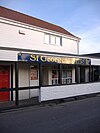
White fronted shop with sign saying St Georges News 세인트 조르주 시민 교구 3,379 액스브리지 농촌구 51°22°N 2°54˚W/51.36°N 2.90°W/ 51.36; -2.90(세인트 조르주, 북서머셋) [4][142]
Stone church view from a low angle. The church has a simple tower and there are gravestones in the churchyard surrounding it 티펜함 시민 교구 910 51°26′N 2°48˚W/51.44°N 2.80°W/ 51.44; -2.80(티켄햄) [4][142]
The markings on a road junction around a tree are visible in the foreground, in front of a small shop with Christmas decorations in the window. A red K8 model telephone box and a red post box built into a wall are to the left. 고르다노의 월턴 시민 교구 273 액스브리지 농촌구 51°27°N 2°50˚W/51.45°N 2.83°W/ 51.45; -2.83(고르다노의 월턴) [4][142]
Stone building with arched windows and square tower. In the foreground is a grass area with gravestones. 고르다노의 웨스턴 시민 교구 301 액스브리지 농촌구 51°28°N 2°47°W/51.46°N 2.79°W/ 51.46; -2.79(웨스턴고르다노) [4][142]
Multiple houses and other buildings around a bay into which a pier projects. On the background are hills. 웨스턴 슈퍼 마레 마을 76,143 액스브리지 농촌구
웨스턴 슈퍼마레 시립 자치구
51°21°N 2°58˚W/51.35°N 2.97°W/ 51.35; -2.97(웨스턴-슈퍼마레) [4][142]
Stone steps up to a stone shaft which would once have had a cross at the top. To the left are yellow painted houses. To the right is an old stone church with a square tower partially obscured by trees. 윅 세인트 로렌스 시민 교구 1,331 액스브리지 농촌구 51°23˚N 2°55˚W/51.38°N 2.91°W/ 51.38; -2.91(윅 세인트. 로렌스) [4][142]
Stone building with tiled roof. Sign saying Prince of Waterloo. In the foreground are tables, benches and planters. 윈퍼드 시민 교구 2,153 51°23˚N 2°40˚W/51.38°N 2.66°W/ 51.38; -2.66(윈포드) [4][141]
Street scene with houses and shops on both side of road on which there is a tractor. 윈스컴브 샌퍼드 시민 교구 4,546 액스브리지 농촌구 51°19°N 2°50˚W/51.31°N 2.83°W/ 51.31; -2.83(윈스컴브와 샌포드) [4][142]
Stone building with square tower. In the foreground are gravestones. 와락솔과 페일랜드 시민 교구 2,302 51°26′N 2°44˚W/51.44°N 2.73°W/ 51.44; -2.73(Wrxall and Failand) [4][141]
Street scene showing shops and houses with cars. 브링턴 시민 교구 2,633 액스브리지 농촌구 51°22°N 2°46˚W/51.36°N 2.76°W/ 51.36; -2.76(Wrington) [4][142]
Row of shops in pedestrianised precinct. In the foreground a bus shelter and tree. 얏턴 시민 교구 7,552 51°23˚N 2°50˚W/51.39°N 2.83°W/ 51.39; -2.83(야튼) [4][141]

세지무어

그 지역 전체가 갈매기 모양으로 되어 있다.

이미지 이름 상태 인구[9] 단체 구 지만 당 국 좌표 참조
Street scene showing road junction with houses and cars 애슈콧 시민 교구 1,186 브리지그워터 농촌구 N51°07°N 2°49˚W/51.12°N 2.81°W/ 51.12; -2.81(애쉬콧) [8][145]
Street scene. On the left of the road is a half timbered house where the first and second storeys have irregular black wooden beams showing through white painted walls. 액스브리지 마을 2,057 액스브리지 농촌구 51°17°N 2°49˚W/51.29°N 2.82°W/ 51.29; -2.82(Axbridge) [8][142]
Stone building with square tower. In the foreground are gravestones. 배드워스 시민 교구 525 액스브리지 농촌구 51°16°N °52°W/51.27°N 2.87°W/ 51.27; -2.87(배드그워스) [8][142]
Brown stone building with red roofs and central square tower. In the foreground are gravestones. 바우드리프 시민 교구 506 브리지그워터 농촌구 51°09°N 2°56′W/51.15°N 2.94°W/ 51.15; -2.94(바우드리프) [8][145]
Wooden hulk of ship, surrounded by wet sand. 베로 시민 교구 1,534 액스브리지 농촌구 51°16°N °01°W/51.27°N 3.01°W/ 51.27; -3.01(버로, 서머셋) [8][142]
Small stone building with crosses on the roof. 브레인 시민 교구 635 액스브리지 농촌구 51°18°N °01°W/51.30°N 3.01°W/ 51.30; -3.01(브란) [8][142]
Red brick buildings in front of grey stone church. In the foreground in a grassy field contained within a hedge and fence. 브렌트 크놀 시민 교구 1,271 액스브리지 농촌구 51°15°N °57˚W/51.25°N 2.95°W/ 51.25; -2.95(브렌트 크놀) [8][142]
Statue of figure with outstretched arm. To the left a tall church spire and the right a circular building with columns. 브리지워터 마을 35,886 브리지워터 시 자치구 51°08°N 2°59°W/51.13°N 2.99°W/ 51.13; -2.99(브리지워터) [8][145]
Large road w2ith houses to left and right and hills beyond. 브리지워터 위트 시민 교구 428 브리지그워터 농촌구 51°08°N 2°58˚W/51.14°N 2.97°W/ 51.14; -2.97(브리지워터 미포함) [8][145]
Stone building with prominent square tower. 빗자루필드 시민 교구 249 브리지그워터 농촌구 N51°05°N °07°W/51.08°N 3.11°W/ 51.08; -3.11(룸필드, 서머셋) [8][145]
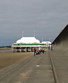
Short pier above sand, surmounted by white pavilion with flag poles. 바다와 하이브리지의 번햄 마을 19,576 . 51°14˚N 2°59°W/51.24°N 2.99°W/ 51.24; -2.99(Burnham-on-Sea and Highbridge) [8][146]
Small light coloured building behind a hedge and gate. 위드 시민 교구 1,636 액스브리지 농촌구 51°14˚N 2°58˚W/51.23°N 2.96°W/ 51.23; -2.96(Burnham Without) [8][142]
Small stone building with arched doorway. The church is partially obscured by trees. 버틀 시민 교구 388 브리지그워터 농촌구 51°10°N °52°W/51.17°N 2.87°W/ 51.17; -2.87(버틀) [8][145]
Red stone church with square tower. 시민 교구 2,271 브리지그워터 농촌구 51°09°N 3°04°W/51.15°N 3.07°W/ 51.15; -3.07(캐닝턴, 서머셋) [8][145]
View of the roofs of houses amongst trees and fields. Hills in the distance under a blue cloudless sky. 시민 교구 531 브리지그워터 농촌구 51°09°N °52°W/51.15°N 2.87°W/ 51.15; -2.87(캣콧) [8][145]
White circular building with four black sails. 채플 앨러턴 시민 교구 401 액스브리지 농촌구 51°15°N 2°51°W/51.25°N 2.85°W/ 51.25; -2.85(샤펠 앨러튼, 서머셋) [8][142]
Roofs of multiple buildings separated by trees and vegetation. In the distance is a lake and hills. 시민 교구 5,755 액스브리지 농촌구 51°17°N 2°47°W/51.28°N 2.78°W/ 51.28; -2.78(체다르) [8][142]
Stone building with square tower. 체조이 시민 교구 404 브리지그워터 농촌구 51°08°N °57˚W/51.13°N 2.95°W/ 51.13; -2.95(체조이) [8][145]
Square stone tower, behind a stone wall and partially obscured by a tree. 시민 교구 698 브리지그워터 농촌구 51°09°N 2°54˚W/51.15°N 2.90°W/ 51.15; -2.90(칠튼 폴든) [8][145]
Reddish stone building with square tower. 칠턴 트리니티 시민 교구 260 브리지그워터 농촌구 51°09°N °01°W/51.15°N 3.01°W/ 51.15; -3.01(칠튼 트리니티) [8][145]
Church building with square tower seen within green fields with trees and hills behind. 콤프턴 비숍 시민 교구 620 액스브리지 농촌구 51°18°N °52°W/51.30°N 2.87°W/ 51.30; -2.87(컴튼 비숍) [8][142]
Stone building with square tower at left hand end. In the foreground either side of a path are gravestones in a grassy area. 시민 교구 564 브리지그워터 농촌구 51°10°N 2°55˚W/51.16°N 2.92°W/ 51.16; -2.92(코싱턴, 서머셋) [8][145]
Stone buildings with water in front. 시민 교구 548 브리지그워터 농촌구 N51°07°N °02°W/51.12°N 3.04°W/ 51.12; -3.04(Durley) [8][145]
Roofs of houses with prominent church spire to the right. Hills in the background. 이스트 브렌트 시민 교구 1,302 액스브리지 농촌구 51°16°N 2°56′W/51.26°N 2.94°W/ 51.26; -2.94(이스트 브렌트, 서머셋) [8][142]
Road junction with direction sign. In the background is a white painted building with a pub sign saying The Crown. 이스트 헌츠필 시민 교구 1,146 브리지그워터 농촌구 51°12°N 2°59°W/51.20°N 2.98°W/ 51.20; -2.98(헌츠필) [8][145]
Stone wall with arched gap, overgrown with weeds. 에딩턴 시민 교구 372 브리지그워터 농촌구 51°09°N °53˚W/51.15°N 2.88°W/ 51.15; -2.88(에딩턴, 서머셋) [8][145]
Square stone tower of church with residential buildings. In the foreground grass field contained by wooden fences. 엔모어 시민 교구 247 브리지그워터 농촌구 N51°07°N °05°W/51.11°N 3.09°W/ 51.11; -3.09(엔모어, 서머셋) [8][145]
Stone building with lighter coloured square tower. In the foreground are gravestones. 시민 교구 298 브리지그워터 농촌구 51°10°N °07°W/51.16°N 3.12°W/ 51.16; -3.12(피딩턴) [8][145]
Stone building with pillars, surrounded by grass. 가터스트 시민 교구 193 브리지그워터 농촌구 51°06˚N 3°04°W/51.10°N 3.06°W/ 51.10; -3.06(고아터스트) [8][145]
Stone building with square tower, separated from the road in the foreground by a stone wall. 그린턴 시민 교구 71 브리지그워터 농촌구 N51°07°N 2°50˚W/51.12°N 2.84°W/ 51.12; -2.84(그린튼) [145]
White building with grey roof in the middle of green grass area. 림프샴 시민 교구 960 액스브리지 농촌구 51°17°N °57˚W/51.29°N 2.95°W/ 51.29; -2.95(Lympsham) [8][142]
Square church tower showing above tees and shrubs. In the foreground is a grass field with cattle. 시민 교구 338 브리지그워터 농촌구 51°03°N 2°58˚W/51.05°N 2.96°W/ 51.05; -2.96(링, 서머셋) [8][145]
Stone building with prominent square tower. In the foreground are gravestones. 마크 시민 교구 1,478 액스브리지 농촌구 51°14˚N °53˚W/51.23°N 2.89°W/ 51.23; -2.89(마크, 서머셋) [8][142]
Stone building with prominent square tower. 미들조이 시민 교구 725 브리지그워터 농촌구 N51°05°N °53˚W/51.09°N 2.89°W/ 51.09; -2.89(미들조이) [8][145]
Square stone tower surrounded by trees and grass. 무어린치 시민 교구 408 브리지그워터 농촌구 51°08°N °52°W/51.13°N 2.86°W/ 51.13; -2.86(몰린치) [8][145]
Stone building with prominent square tower. In the foreground are gravestones. 네더 스토이 시민 교구 1,373 브리지그워터 농촌구 51°09°N 3°09°W/51.15°N 3.15°W/ 51.15; -3.15(네덜 스토이) [8][145]
Stone building with prominent square tower. 노스페더턴 마을 6,730 브리지그워터 농촌구 N51°05°N °01°W/51.09°N 3.01°W/ 51.09; -3.01(북 페더턴) [8][145]
Stone building with square tower 기타이 시민 교구 642 브리지그워터 농촌구 N51°05°N °53˚W/51.08°N 2.88°W/ 51.08; -2.88(기타) [8][145]
Stone building with prominent square tower. In the foreground is a road and wall. 오터햄프턴 시민 교구 831 브리지그워터 농촌구 51°11°N °05°W/51.18°N 3.08°W/ 51.18; -3.08(Otterhampton) [8][145]
Stone building with prominent square tower. In the foreground are daffodils. 오버 스토이 시민 교구 352 브리지그워터 농촌구 51°09°N 3°09°W/51.15°N 3.15°W/ 51.15; -3.15(상부 보관함) [8][145]
modern building with shop. Sign over window says Pawlett Country Store & Off Licence. 시민 교구 1,038 브리지그워터 농촌구 51°11°N 3°00˚W/51.18°N 3.00°W/ 51.18; -3.00(폴렛, 서머셋) [8][145]
Stone building with square tower 퓨리턴 시민 교구 1,068 브리지그워터 농촌구 51°10°N 2°58˚W/51.17°N 2.97°W/ 51.17; -2.97(Puriton) [8][145]
Stone building with square tower 샤프윅 시민 교구 536 브리지그워터 농촌구 51°08°N 2°50˚W/51.14°N 2.83°W/ 51.14; -2.83(샤프윅, 서머셋) [8][145]
Stone cross surrounded by railings on grass area in front of roads and houses. 시민 교구 1,087 액스브리지 농촌구 51°19°N 2°48˚W/51.31°N 2.80°W/ 51.31; -2.80(선박) [8][142]
White painted building with pub sign saying The Lamb Inn 스팩스턴 시민 교구 1,012 브리지그워터 농촌구 51°08°N °07°W/51.13°N 3.11°W/ 51.13; -3.11(스패스턴) [8][145]
Stone building with small square tower. In the foreground is a road and wall. 스타웰 시민 교구 386 브리지그워터 농촌구 51°08°N 2°55˚W/51.14°N 2.91°W/ 51.14; -2.91(스타웰, 서머셋) [8][145]
Houses amongst trees seen across fields and hedges. 스톡랜드 브리스톨 시민 교구 165 브리지그워터 농촌구 51°11°N °05°W/51.19°N 3.08°W/ 51.19; -3.08(스톡랜드 브리스톨) [8][145]
White painted building with black timbers. In the foreground is a road and road sign. 툴록스턴 시민 교구 153 브리지그워터 농촌구 51°04°N °02°W/51.07°N 3.04°W/ 51.07; -3.04(Thurloxton) [8][145]
Gray stone building with square tower 우리는 그래요. 시민 교구 658 액스브리지 농촌구 51°16°N 2°50˚W/51.27°N 2.84°W/ 51.27; -2.84(웨어, 서머셋) [8][142]
Stone building with square tower 웨드모어 시민 교구 3,318 액스브리지 농촌구 51°14˚N 2°49˚W/51.23°N 2.81°W/ 51.23; -2.81(웨드모어) [8][142]
Red stone building with square tower. In the foreground are gravestones. 켐브돈 시민 교구 3,613 브리지그워터 농촌구 51°08°N °01°W/51.13°N 3.02°W/ 51.13; -3.02(Wembdon) [8][145]
Stone building with arched window and square tower, separated from the road by a stone wall and railings. 웨스트 헌츠필 시민 교구 1,414 브리지그워터 농촌구 51°12°N 2°59°W/51.20°N 2.98°W/ 51.20; -2.98(헌츠필) [8][145]
Stone building with square tower 웨스턴조일랜드 시민 교구 1,801 브리지그워터 농촌구 N51°07°N 2°55˚W/51.11°N 2.92°W/ 51.11; -2.92(웨스턴조일랜드 주) [8][145]
Stone building with square tower 울라빙턴 시민 교구 2,115 브리지그워터 농촌구 51°10°N 2°56′W/51.17°N 2.93°W/ 51.17; -2.93(울러빙턴) [8][145]

그 지역 전체가 갈매기 모양으로 되어 있다.

이미지 이름 상태 단체 구 지만 당 국 좌표 참조
Stone 3-storey building with white frames windows on street junction. Sign saying shop. 아바스와 템플콤베 시민 교구 1,560 50°59°N 2°25˚W/50.99°N 2.41°W/ 50.99; -2.41(템플컴) [8][147]
Stone building with small square tower. 앨퍼드 시민 교구 63 N51°05°N 2°34′W/51.08°N 2.57°W/ 51.08; -2.57(알포드, 서머셋) [147]
Stone building with sign saying The Old Pound Inn, on street junction. 앨러 시민 교구 410 51°03°N 2°51°W/51.05°N 2.85°W/ 51.05; -2.85(알러, 서머셋) [8][148]
Patchwork of fields and trees with buildings showing in the distance. In the foreground is grass with a ruined building. 앤스포드 시민 교구 1,085 N51°05°N 2°31˚W/51.09°N 2.51°W/ 51.09; -2.51(앤스포드) [8][147]
Stone building with prominent square tower. In the foreground are gravestones. 시민 교구 626 50°59°N °45°W/50.98°N 2.75°W/ 50.98; -2.75(Ash, Soumerset) [8][149]
Stone two stage square tower with buttresses. 아실 시민 교구 529 샤르드 농촌 구 50°56′N 2°58˚W/50.94°N 2.96°W/ 50.94; -2.96(애슐, 서머셋) [8][150]
Stone building with prominent square tower. In the foreground are gravestones. 개코원숭이 시민 교구 248 51°03°N 2°37′W/51.05°N 2.62°W/ 51.05; -2.62(밥커리) [8][148]
Three bay house with multiple windows, pinnacles and chimneys 시민 교구 438 50°58˚N °52°W/50.96°N 2.87°W/ 50.96; -2.87(배링턴, 서머셋) [8][148]
White painted houses with red roofs. In the background is a hill with a tower on it and in the foreground grass and hedgerows 바턴 세인트 데이비드 시민 교구 561 N51°05°N 화씨 2°39°W/51.08°N 2.65°W/ 51.08; -2.65(Barton St David) [8][148]
Stone building with sign saying The Royal Oak 시민 교구 1,221 50°55˚N 2°37′W/50.92°N 2.62°W/ 50.92; -2.62(바윅, 서머셋) [8][149]
Green area with trees. In the background a terrace of houses. 베르크로콤비 시민 교구 134 50°59°N 2°58˚W/50.98°N 2.97°W/ 50.98; -2.97(Beercrocombe) [8][148]
Small stone building with square tower partially obscured by trees. In the foreground is a stone wall with metal gates. 콤프턴 펀슈트 시민 교구 130 N51°02°N 화씨 2°30°/51.03°N 2.50°W/ 51.03; -2.50(컴튼 펀스풋) [147]
Stone building with square tower. 브래튼 시모어 시민 교구 104 51°04°N 2°28˚W/51.07°N 2.47°W/ 51.07; -2.47(Bratton Symour) [8][147]
Area of still water surrounded by trees and grass. 브레햄 시민 교구 441 51°08°N 2°24°W/51.13°N 2.40°W/ 51.13; -2.40(Brewham) [8][147]
Old stone building with thatched roof on road junction. 브로드웨이 시민 교구 740 샤르드 농촌 구 50°56′N 2°58˚W/50.93°N 2.97°W/ 50.93; -2.97(브로드웨이, 서머셋) [8][150]
multiple buildings including a square church tower amongst fields and trees. 브루턴 마을 2,907 N51°07°N 2°27′W/51.11°N 2.45°W/ 51.11; -2.45(브루턴) [8][147]
Yellow stone building at the end of a driveway accessed via stone gateposts. 브림프턴 시민 교구 7,308 50°56′N 2°41˚W/50.94°N 2.68°W/ 50.94; -2.68(브립톤) [8][149]
Old buildings behind a wall 버클랜드 세인트 메리 시민 교구 521 샤르드 농촌 구 50°55˚N °02°W/50.91°N 3.04°W/ 50.91; -3.04(버클랜드 세인트 메리) [8][150]
A church with spire surrounded by trees and houses. 마을 2,276 N51°05°N 2°31˚W/51.09°N 2.51°W/ 51.09; -2.51(캐리 캐리) [8][147]
Stone building with square tower. 채프콤비 시민 교구 229 샤르드 농촌 구 50°53°N 2°55˚W/50.89°N 2.92°W/ 50.89; -2.92(Chaffcombe) [8][150]
Street scene showing shops, cars and a set of traffic lights. 샤드 타운 마을 13,074 샤르드 시 자치구 N50°52°N 2°58˚W/50.87°N 2.96°W/ 50.87; -2.96(차드, 서머셋) [8][150]
Stone building with square tower. In the foreground is a garssy area with gravestones. 호손 시민 교구 591 N51°01°N 2°29′W/51.01°N 2.48°W/ 51.01; -2.48(Charlton Horethorne) [8]
Stone building with small tower attached to the right hand side. At the nearest end is a circular window above an arched doorway. 찰턴 머스그로브 시민 교구 398 N51°05°N 2°23′W/51.08°N 2.39°W/ 51.08; -2.39(Charlton Musgrove) [8][147]
Stone building with tiled roof. 시민 교구 164 샤르드 농촌 구 50°53°N °52°W/50.89°N 2.87°W/ 50.89; -2.87(칠링턴, 서머셋) [8][150]
Stone building with small bell tower. In the foreground are gravestones. 칠토른 도메르 시민 교구 574 50°58˚N 2°41˚W/50.97°N 2.68°W/ 50.97; -2.68(칠손 도머) [8][149]
Stone building with square tower, partially obscured by trees. 칠턴 칸텔로 시민 교구 445 51°00˚N 2°36˚W/51.00°N 2.60°W/ 51.00; -2.60(칠튼 칸텔로) [8][149]
Stone building with spire surrounded by trees. 시민 교구 275 50°56′N 2°46˚W/50.93°N 2.76°W/ 50.93; -2.76(치젤버러) [8][149]
Stone building with square tower 클로즈워스 시민 교구 220 50°53°N 2°37′W/50.89°N 2.62°W/ 50.89; -2.62(클로스워스) [8][149]
Street scene showing multiple houseson the far side of the road. In the foreground is a metal railing. 컴베 세인트 니콜라스 시민 교구 1,373 샤르드 농촌 구 50°53°N 2°59°W/50.89°N 2.99°W/ 50.89; -2.99(Combe St Nicholas) [8][150]
A patchwork of green and yellow fields with the roofs of houses visible centrally. In the background are hills and in the foreground the backs of several seated people. 콤프턴 던던 시민 교구 705 N51°05°N 2°44˚W/51.09°N 2.73°W/ 51.09; -2.73(컴튼 던든) [8][148]
Square church tower surrounded by trees with a road in the foreground. 코튼 덴햄 시민 교구 189 51°00˚N 2°31˚W/51.00°N 2.52°W/ 51.00; -2.52(코튼 덴햄) [8][147]
Decorated yellow stone building with square tower. 크루커네 마을 7,000 50°53°N 2°47°W/50.88°N 2.79°W/ 50.88; -2.79(크루커네) [8][151]
Large house with terrace and lawn. 크리켓 세인트 토마스 시민 교구 50 샤르드 농촌 구 N50°52°N °53˚W/50.87°N 2.89°W/ 50.87; -2.89(크리켓 세인트 토마스) [150]
Thatched and red roofed houses along a road with a patchwork of fields behind. 커글링턴 시민 교구 173 51°03°N 2°21˚W/51.05°N 2.35°W/ 51.05; -2.35(쿠클링턴) [8][147]
Stone building with arched windows. In the foreground are gravestones. 커드워스 시민 교구 69 샤르드 농촌 구 50°53°N °53˚W/50.89°N 2.89°W/ 50.89; -2.89(쿠드워스, 서머셋) [150]
Road sign on junction. In the background is a building partially obscured by a tree. 카레 말렛 시민 교구 306 50°59°N 2°58˚W/50.99°N 2.96°W/ 50.99; -2.96(커리 망치) [8][148]
Stone building with a road in the foregrond. In the background is the quare tower of a church. 커리 리벨 시민 교구 2,148 N51°02°N °52°W/51.03°N 2.86°W/ 51.03; -2.86(커리 리벨) [8][148]
Stone building with arched window and slate roof. In the foreground are gravestones. 다이닝턴 시민 교구 65 샤르드 농촌 구 50°55˚N 2°51°W/50.91°N 2.85°W/ 50.91; -2.85(다이닝턴, 소머세) [150]
alt-Stone building with square tower 도나트 시민 교구 347 샤르드 농촌 구 50°56′N 2°57˚W/50.93°N 2.95°W/ 50.93; -2.95(도나트) [8][150]
Stone bridge with four arches and low parapet. 다우지 웨이크 시민 교구 277 샤르드 농촌 구 50°55˚N 2°53˚W/50.91°N 2.89°W/ 50.91; -2.89(Dowlish Wake) [8][150]
Stone square tower with gravestones in the foreground. 드레이튼 시민 교구 379 랑포트 농촌구 51°01′08″N 2°51′00″w/51.019°N 2.85°W/ 51.019; -2.85(드레이튼, 서머셋) [8][148]
Stone building with square tower. In the foreground are gravestones. 동친녹 시민 교구 479 여빌농촌구 50°55˚N 2°43˚W/50.92°N 2.72°W/ 50.92; -2.72(치녹스) [8][149]
Stone building with square tower. 이스트코커 시민 교구 1,667 여빌농촌구 50°55˚N 화씨 2°39°W/50.91°N 2.65°W/ 50.91; -2.65(이스트 코커) [8][149]
Stone building with square tower, separated from the road in the foreground by a stone wall. 파이브헤드 시민 교구 609 랑포트 농촌구 50°59°N 2°55˚W/50.99°N 2.92°W/ 50.99; -2.92(파이브헤드) [8][148]
Tall house with upper story projecting above the ground floor and faced with white wooden boards. 함브리지와 웨스트포트 시민 교구 514 랑포트 농촌구 50°59°N 2°52°W/50.99°N 2.86°W/ 50.99; -2.86(햄브리지웨스트포트) [8][148]
Two-storey stone houses with a road in front. 하딩턴 맨더빌 시민 교구 585 여빌농촌구 50°54°N 2°41˚W/50.90°N 2.69°W/ 50.90; -2.69(하딩턴 맨더빌) [8][149]
Yellow stone building with square tower. 하셀베리 플렉넷 시민 교구 744 여빌농촌구 50°53°N 2°45°W/50.89°N 2.75°W/ 50.89; -2.75(Haselbury Pullnett) [8][149]
Stone building with arched windows and square tower partially obscured by trees. In the foreground are gravestones. 헨스트리지 시민 교구 1,814 윈칸턴 농촌구 50°58˚N 2°23′W/50.97°N 2.39°W/ 50.97; -2.39(헨스트리지) [8]
Stone building with square tower. 하이햄 시민 교구 909 랑포트 농촌구 51°05°N 2°49˚W/51.08°N 2.82°W/ 51.08; -2.82(높은 햄) [8][148]
Stone building with arched windows and square tower. In the foreground are gravestones. 힌튼 세인트 조지 시민 교구 442 샤르드 농촌 구 50°55˚N 2°49˚W/50.91°N 2.82°W/ 50.91; -2.82(힌튼 세인트 조지) [8][150]
Stone building with square tower behind stone wall. 홀턴 시민 교구 238 윈칸턴 농촌구 51°02°N 2°27′W/51.04°N 2.45°W/ 51.04; -2.45(홀튼, 서머셋) [8][147]
Stone building with arched windows and square tower. 호링턴 시민 교구 571 윈칸턴 농촌구 51°01°N 2°26′W/51.01°N 2.43°W/ 51.01; -2.43(Horsington, Somerset) [8][147]
Stone building with thatched roof. In the foreground are cars separated from the road by a stone wall. 호튼 시민 교구 812 샤르드 농촌 구 50°56′N 2°58˚W/50.93°N 2.97°W/ 50.93; -2.97(호튼, 서머셋) [8][150]
Stone building with arched windows and square tower. 후이시 에피스코피 시민 교구 2,095 랑포트 농촌구 51°02°N 2°49˚W/51.04°N 2.81°W/ 51.04; -2.81(후이시 에피스코피) [8][148]
Street scene showing a pub the Ilchester Arms on the left with several other buildings leading to a church tower. 일체스터 시민 교구 2,153 여빌농촌구 51°00˚N 2°41˚W/51.00°N 2.68°W/ 51.00; -2.68(일체스터) [8][149]
Elaborately ornamented stone building with square tower. 일민스터 마을 5,808 샤르드 농촌 구
일민스터 도시구
50°56′N 2°55˚W/50.93°N 2.91°W/ 50.93; -2.91(일민스터) [8][150]
Thatched house with wisteria growing up the near end. 일턴 시민 교구 854 샤르드 농촌 구 50°57°N 2°55˚W/50.95°N 2.92°W/ 50.95; -2.92(일튼) [8][150]
Stone building with arched window. Square tower surrounded by scaffolding. 아보츠 섬 시민 교구 205 랑포트 농촌구 50°59°N 2°55˚W/50.98°N 2.92°W/ 50.98; -2.92(Isle Abbots) [8][148]
Stone building with square tower which becomes hexagonal near the roof. 섬 브루어스 시민 교구 150 랑포트 농촌구 50°59°N 2°54˚W/50.99°N 2.90°W/ 50.99; -2.90(이슬 브루어스) [8]
Stone building with square tower. In the foreground is a gateway with its own roof. 킨튼 만데빌 시민 교구 1,068 랑포트 농촌구 51°04°N 화씨 2°39°W/51.07°N 2.65°W/ 51.07; -2.65(킨튼 맨데빌) [8][148]
Yellow stone building with square tower. 킹스베리 에피스코피 시민 교구 1,307 랑포트 농촌구 50°59°N 2°49˚W/50.99°N 2.81°W/ 50.99; -2.81(킹스베리 에피스코피) [8][148]
Stone building with square tower. 킹스돈 시민 교구 303 랑포트 농촌구 51°02°N 2°41˚W/51.04°N 2.69°W/ 51.04; -2.69(킹스돈, 서머셋) [8][148]
Stone building with central square tower. 킹스톤 시민 교구 83 샤르드 농촌 구 50°55˚N 2°53˚W/50.92°N 2.89°W/ 50.92; -2.89(킹스톤, 서머셋) [150]
Stone building with spire above a square tower. 킹웨스턴 시민 교구 128 랑포트 농촌구 51°05°N 2°41˚W/51.08°N 2.68°W/ 51.08; -2.68(킹웨스턴) [148]
A series of houses along a lane. 노울 스트 자일스 시민 교구 244 샤르드 농촌 구 50°54°N 2°56′W/50.90°N 2.93°W/ 50.90; -2.93(Knowle St Giles) [8][150]
A town with church tower seen on the far side of a wide river. 랑포트 마을 1,081 랑포트 농촌구 51°02°N 2°50˚W/51.04°N 2.83°W/ 51.04; -2.83(랑포트) [8][148]
Stone building with square tower. 리밍턴 시민 교구 199 여빌농촌구 50°59°N 화씨 2°39°W/50.99°N 2.65°W/ 50.99; -2.65(리밍턴) [149]
Stone bridge over water. 롱 로드 시민 교구 332 여빌농촌구 51°01°N 2°46˚W/51.01°N 2.76°W/ 51.01; -2.76(긴 하중) [8][149]
Stone bridge over water. 롱 서튼 시민 교구 833 랑포트 농촌구 [8][148]
A line of cottages, some thatched, along a road. Lopen 시민 교구 260 샤르드 농촌 구 50°56′N 2°49˚W/50.93°N 2.82°W/ 50.93; -2.82(열림) [8][150]
Stone building with square tower. 러빙턴 시민 교구 141 윈칸턴 농촌구 51°04°N 2°35˚W/51.07°N 2.58°W/ 51.07; -2.58(러빙턴, 서머셋) [8][147]
Yellow stone building with square tower, surrounded by trees. 마퍼턴 시민 교구 140 윈칸턴 농촌구 51°02°N 2°28˚W/51.04°N 2.46°W/ 51.04; -2.46(Maperton) [8][147]
Stone building with square tower. 마스턴 매그나 시민 교구 523 여빌농촌구 51°00˚N 2°35˚W/51.00°N 2.58°W/ 51.00; -2.58(마스턴 매그나) [8][149]
Stone building with square tower. 마톡 시민 교구 4,766 여빌농촌구 50°58˚N 2°46˚W/50.97°N 2.77°W/ 50.97; -2.77(마톡) [8][149]
Stone building with square tower. 메리엇 시민 교구 1,979 샤르드 농촌 구 50°55˚N 2°47°W/50.91°N 2.79°W/ 50.91; -2.79(메리엇) [8][150]
Yellow stone building with arched windows and a square tower. 밀본 포트 시민 교구 2,802 윈칸턴 농촌구 50°58˚N 2°28˚W/50.97°N 2.46°W/ 50.97; -2.46(밀본 포트) [8][147]
Stone building partially obscured by trees. In the foreground are gravestones. 마스터턴 시민 교구 826 샤르드 농촌 구 50°52°N 2°47°W/50.87°N 2.78°W/ 50.87; -2.78(미스터턴, 서머셋) [8][150]
View of the roofs of houses with a prominent square church tower, interspersed with trees. 몬타쿠트 시민 교구 831 여빌농촌구 50°57°N 2°43˚W/50.95°N 2.72°W/ 50.95; -2.72(몬타쿠트) [8][149]
Thatched stone house surrounded by trees. In the foreground a road junction and sign. 무첼니 시민 교구 195 랑포트 농촌구 51°01′16″N 2°49′12″w/51.021°N 2.82°W/ 51.021; -2.82(무첼니) [8][148]
Stone building with square tower. In the foreground is a road. 머드퍼드 시민 교구 696 여빌농촌구 50°58˚N 2°37′W/50.97°N 2.61°W/ 50.97; -2.61(머드포드) [8][149]
Stone building with square tower, surrounded by trees. 노스바로 시민 교구 233 윈칸턴 농촌구 51°04°N 2°34′W/51.06°N 2.57°W/ 51.06; -2.57(북 바로우) [8][147]
Old mansion house with triangular roofs. In the foreground is a graden with gravestones. 노스캐드베리 시민 교구 950 윈칸턴 농촌구 51°03°N 2°31˚W/51.05°N 2.52°W/ 51.05; -2.52(북캐드베리) [8][147]
Small stone building with gravestones in the foreground. 노스체리턴 시민 교구 208 윈칸턴 농촌구 51°02°N 2°26′W/51.03°N 2.44°W/ 51.03; -2.44(북체리톤) [8][147]
Stone building with square tower. 노스페럿 주 시민 교구 246 여빌농촌구 50°53°N 2°45°W/50.88°N 2.75°W/ 50.88; -2.75(North Perrott) [8][149]
Yellow stone building with square tower. 노턴 서브 햄던 시민 교구 743 여빌농촌구 50°56′N 2°46˚W/50.94°N 2.76°W/ 50.94; -2.76(Norton Sub Hamdon) [8][149]
Yellow stone building with square tower, partially obscured by trees. 오드콤베 시민 교구 759 여빌농촌구 50°56′N 2°42°W/50.94°N 2.70°W/ 50.94; -2.70(Odcombe) [8][149]
Stone building with square tower. 펜슬우드 시민 교구 273 윈칸턴 농촌구 51°05°N 2°21˚W/51.08°N 2.35°W/ 51.08; -2.35(펜슬우드) [8][147]
Two arches of a stone and brick bridge with a car beneath. 핏콤비 시민 교구 532 윈칸턴 농촌구 51°06˚N 2°28˚W/51.10°N 2.47°W/ 51.10; -2.47(핏콤비) [8][147]
A view across fields to houses and the square tower of a yellow stone church. 피트니 시민 교구 374 랑포트 농촌구 51°03°N 2°47°W/51.05°N 2.79°W/ 51.05; -2.79(피트니) [8][148]
A view through a gate and graveyard to a yellow stone building with a square tower. 푸킹턴 시민 교구 117 랑포트 농촌구 50°58˚N 2°53˚W/50.96°N 2.89°W/ 50.96; -2.89(푸킹턴) [8][148]
Stone building with square tower. 퀸 카멜 시민 교구 908 윈칸턴 농촌구 51°01°N 2°35˚W/51.02°N 2.58°W/ 51.02; -2.58(낙타여왕) [8][147]
Stone building with square tower. 림프턴 시민 교구 235 여빌농촌구 50°59°N 2°34′W/50.99°N 2.56°W/ 50.99; -2.56(림프턴) [8][149]
Stone building with square tower 세이빙턴 세인트 메리 시민 교구 384 샤르드 농촌 구 50°56′N 2°52°W/50.93°N 2.86°W/ 50.93; -2.86(세이빙턴 세인트 메리) [8][150]
Street scene with a row of detached houses including a pub. 세이빙턴 세인트 마이클 시민 교구 127 샤르드 농촌 구 50°56′N 2°50˚W/50.93°N 2.84°W/ 50.93; -2.84(Savington St Michael) [8][150]
Building with arched window and small turret. 셰프턴 보샹 시민 교구 728 샤르드 농촌 구 50°57°N 2°51°W/50.95°N 2.85°W/ 50.95; -2.85(셰프톤 보샹) [8][150]
Street scene with houses dotted amongst the trees. 셰프턴 몬태규 시민 교구 208 윈칸턴 농촌구 51°05°N 2°28˚W/51.08°N 2.47°W/ 51.08; -2.47(Shepton Montague) [8][147]
Street scene with houses and pub on the right and trees on the left. 소머턴 마을 4,697 랑포트 농촌구 51°03°N 2°44˚W/51.05°N 2.74°W/ 51.05; -2.74(소머턴) [8][148]
Stone building with square tower. 사우스바로 시민 교구 162 윈칸턴 농촌구 51°03°N 2°34′W/51.05°N 2.56°W/ 51.05; -2.56(남바로) [8][147]
Stone building with square tower. 사우스캐드버리와 서튼 몬티스 시민 교구 284 윈칸턴 농촌구 51°02°N 2°31˚W/51.03°N 2.52°W/ 51.03; -2.52(사우스 캐드베리서튼 몬티스) [8][147]
Street scene showing houses with octagonal church tower behind 사우스페더턴 시민 교구 3,367 여빌농촌구 50°57°N 2°49˚W/50.95°N 2.81°W/ 50.95; -2.81(남 페더턴) [8][149]
Building with pub sign saying the Sparkford Inn with car park and road in the foreground. 스파크퍼드 시민 교구 617 윈칸턴 농촌구 51°02°N 2°34′W/51.04°N 2.57°W/ 51.04; -2.57(스파크포드) [8][147]
Yellow stone building with square tower set in green fields. 스톡린치 시민 교구 154 샤르드 농촌 구 50°57°N 2°53˚W/50.95°N 2.88°W/ 50.95; -2.88(스톡린치) [8][150]
Yellow stone building with square tower set in graveyard. 스토크 서브 햄던 시민 교구 1,068 여빌농촌구 50°57°N 2°45°W/50.95°N 2.75°W/ 50.95; -2.75(Stoke-sub-Hamdon) [8][149]
Street scene with a narrow road with houses on the right and trees on the left. 스토크 트리스터 시민 교구 313 윈칸턴 농촌구 51°04°N 2°23′W/51.06°N 2.38°W/ 51.06; -2.38(스토크 트리스터) [8][147]
Stone building with arched windows and small turret. 태트워스와 포턴 시민 교구 2,660 샤르드 농촌 구 50°51°N 2°58˚W/50.85°N 2.96°W/ 50.85; -2.96(타트워스) [8][150]
Stone building with square tower separated from the road in the foreground by a stone wall. 찰턴 가족 시민 교구 1,073 랑포트 농촌구 51°03°N 2°41˚W/51.05°N 2.68°W/ 51.05; -2.68(찰튼 맥크렐) [8][148][152]
Street scene showing houses on the left and church with square tower on the left. 틴틴헐 시민 교구 902 여빌농촌구 50°58˚N 2°43˚W/50.97°N 2.71°W/ 50.97; -2.71(틴틴홀) [8][149]
Green rolling hills with a cluster of houses and a church left of centre. 방브룩 시민 교구 184 샤르드 농촌 구 50°52°N 3°00˚W/50.86°N 3.00°W/ 50.86; -3.00(밤브룩) [8][150]
Two-storey house with columns in front of the door. 웨이퍼드 시민 교구 114 샤르드 농촌 구 50°51°N 2°51°W/50.85°N 2.85°W/ 50.85; -2.85(웨이포드) [150]
Stone building with square tower topped by a small spires. 웨스트 카멜 시민 교구 459 여빌농촌구 51°01°N 2°36˚W/51.02°N 2.60°W/ 51.02; -2.60(웨스트 카멜) [8][149]
Building with square tower. In the foreground are gravestones. 서부 및 중부 치녹 시민 교구 592 여빌농촌구 50°55˚N 2°46˚W/50.92°N 2.76°W/ 50.92; -2.76(웨스트 치녹) [8][149]
Street scene with buildings on the right including a pub with sign The Castle. 웨스트코커 시민 교구 2,018 여빌농촌구 50°55˚N 2°41˚W/50.92°N 2.69°W/ 50.92; -2.69(웨스트 코커) [8][149]
Decorated yellow stone building with square tower. 웨스트 크루커네 시민 교구 631 샤르드 농촌 구 50°53°N 2°47°W/50.88°N 2.79°W/ 50.88; -2.79(크루커네) [8][150]
Stone church with square tower. In the foreground are a path and gravestones 화이트리스트링턴 시민 교구 209 샤르드 농촌 구 50°56′N 2°53˚W/50.94°N 2.88°W/ 50.94; -2.88(Whitelackington) [8][150]
Stone building with square tower. In the foreground are gravestones. 휘트스턴턴 시민 교구 256 샤르드 농촌 구 50°53°N 3°01°W/50.89°N 3.02°W/ 50.89; -3.02(Whitestaunton) [8][150]
Street scene with white and pink buildings. 윈칸턴 마을 5,272 윈칸턴 농촌구 51°04°N 2°25˚W/51.06°N 2.41°W/ 51.06; -2.41(윈칸턴) [8][147]
Street scene, showing shops and houses including a post office. 윈샴 시민 교구 748 샤르드 농촌 구 50°51°N 2°53˚W/50.85°N 2.89°W/ 50.85; -2.89(윈샴) [8][150]
Stone building with square tower separated from the road in the foreground by a stone wall. 야링턴 시민 교구 123 윈칸턴 농촌구 51°04°N 2°29′W/51.06°N 2.49°W/ 51.06; -2.49(야링턴) [8][147]
red brick building with small car park in front. 여빌 마을 30,378 여빌 시립 구 50°57°N 2°38′W/50.95°N 2.64°W/ 50.95; -2.64(요빌) [8][153]
Street scene with modern brick built shop. 여빌 위드 시민 교구 6,834 여빌농촌구 50°58˚N 화씨 2°39°W/50.96°N 2.65°W/ 50.96; -2.65(요빌 무포함) [8][149]
Wier on river with cows in the field beyond. 여빌턴 시민 교구 1,226 여빌농촌구 51°00˚N 화씨 2°39°W/51.00°N 2.65°W/ 51.00; -2.65(요빌턴) [8][149]

서머셋 웨스트와 타운턴

타운턴 시립 자치구의 일부분은 파괴되지 않았다.

이미지 이름 상태 인구[154] 구 지방 당국 좌표 참조
Old yew tree 애쉬버릿 시민 교구 225 웰링턴 농촌구

툰턴 디인

50°59°N 3°21˚W/50.98°N 3.35°W/ 50.98; -3.35(부스러기) [8][155]
Red stone building with square tower. 애쉬 프리어스 시민 교구 155 툰턴 농촌구

툰턴 디인

51°04°N 3°13°W/51.06°N 3.21°W/ 51.06; -3.21(Ash Priors) [8][156]
Road junction with house on the right of the road. On the left is a churchyard behind a wall accessed via steps. 카발턴 시민 교구 194 웰링턴 농촌구

툰턴 디인

51°01°N 3°19˚W/51.01°N 3.31°W/ 51.01; -3.31(배탈턴) [8][155]
A few buildings scattered amongst fields and trees. 비켄홀 시민 교구 122 툰턴 농촌구

툰턴 디인

50°58˚N 3°02°W/50.96°N 3.03°W/ 50.96; -3.03(비켄홀) [156]
Stone building with arched windows and square tower. 빅놀러 시민 교구 371 윌리톤농촌구

서서머셋

51°09°N 3°16˚W/51.15°N 3.27°W/ 51.15; -3.27(빅놀러) [8][157]
Yellow stone house with tall chimneys behind brick wall. 비숍스 헐 시민 교구 2,975 툰턴 농촌구

툰턴 디인

51°01°N 3°08°W/51.02°N 3.14°W/ 51.02; -3.14(비숍의 헐) [8][156]
Red stone building with square tower. In the foreground is a graveyard. 리디어드 주교 시민 교구 2,839
(Cotford St Luke 포함)
툰턴 농촌구

툰턴 디인

51°04°N 3°11°W/51.06°N 3.19°W/ 51.06; -3.19(리디어드 비숍스) [8][156]
Stone building with square tower. 브래드포드온톤 시민 교구 622 웰링턴 농촌구

툰턴 디인

51°00˚N 3°11°W/51.00°N 3.18°W/ 51.00; -3.18(Bradford on Tone) [8][155]
Stone building with square tower, partially obscured by trees. In the foreground are gravestones. 브롬턴 랠프 시민 교구 287 윌리톤농촌구

서서머셋

51°05°N 3°19˚W/51.08°N 3.31°W/ 51.08; -3.31(브롬턴 랠프) [8][157]
Several buildings including a square church tower amongst trees. 브롬프턴 레지스 시민 교구 449 덜버턴 농촌구

서서머셋

51°04°N 3°29′W/51.07°N 3.49°W/ 51.07; -3.49(브롬턴 레지스) [8][158]
Stone building with square tower, partially obscured by trees. 브러시퍼드 시민 교구 519 덜버턴 농촌구

서서머셋

51°01°N 화씨 3°32°/51.02°N 3.53°W/ 51.02; -3.53(브러시퍼드, 서머셋) [8][158]
Arched bridge with metal railing. Sign showing River Parrett, Burrow Bridge. 버로우브리지 시민 교구 508 툰턴 농촌구

툰턴 디인

51°04°N 2°55˚W/51.07°N 2.92°W/ 51.07; -2.92(버로브리지) [159][160]
Stone building with square tower. In the foreground are gravestones and trees. 칼햄프턴 시민 교구 865 윌리톤농촌구

서서머셋

51°10°N 3°25°W/51.17°N 3.42°W/ 51.17; -3.42(카햄프턴, 서머셋) [8][157]
Large tree on the left of a field in the foreground with buildings in the distance. 체돈 피츠파인 시민 교구 1,929 툰턴 농촌구

툰턴 디인

51°02°N 3°05°W/51.04°N 3.08°W/ 51.04; -3.08(체돈 피츠파인) [159][160]
Houses and fields be3side a country lane. 칩스테이블 시민 교구 309 웰링턴 농촌구

툰턴 디인

51°02°N 3°22′W/51.04°N 3.37°W/ 51.04; -3.37(칩스테이블) [159][161]
Stone building with square tower, partially obscured by trees. 처치스턴턴 시민 교구 752 툰턴 농촌구

툰턴 디인

50°55˚N 3°09°W/50.92°N 3.15°W/ 50.92; -3.15(처치스턴턴) [159][160]
Stone building with square tower. In the foreground are stone crosses, gravestones and trees. 달가닥가닥가닥터 시민 교구 101 윌리톤농촌구

서서머셋

51°04°N 3°21˚W/51.07°N 3.35°W/ 51.07; -3.35(클랫다운) [157]
Street scene with houses and trees separated from the road by a stone wall. 컴베 플로리 시민 교구 261 툰턴 농촌구

툰턴 디인

51°05°N 3°13°W/51.08°N 3.21°W/ 51.08; -3.21(콤브 플로리) [159][160]
Multiple reddish brown roofs of houses. A church tower is visible in the distance. 코이트로우 시민 교구 5,463 툰턴 시립 자치구
툰턴 농촌구

툰턴 디인

51°01°N 3°08°W/51.01°N 3.13°W/ 51.01; -3.13(코미트로우) [8][156]
Celtic pattern stone cross in the foreground with trees and houses in the background. 코프 시민 교구 253 툰턴 농촌구

툰턴 디인

50°58˚N 3°05°W/50.97°N 3.09°W/ 50.97; -3.09(코프) [8][156]
Modern suburban housing estate with cars parked. 코트퍼드 세인트루크 시민 교구 후기생성 툰턴 농촌구

툰턴 디인

51°02′21″N 3°11′19″w/51.0392°N 3.1886°W/ 51.0392; -3.1886(코프) [156]
Large house seen through trees. 코텔스톤 시민 교구 111 툰턴 농촌구

툰턴 디인

51°05°N 3°10°W/51.08°N 3.16°W/ 51.08; -3.16(코텔스톤) [8][156]
Bridge over still water with a house to the right. 크리치 세인트 미카엘 시민 교구 2,416 툰턴 농촌구

툰턴 디인

51°01°N 3°02°W/51.02°N 3.04°W/ 51.02; -3.04(Creech St Michael) [8][156]
Stone building with square tower. In the foreground are stone crosses, gravestones and trees. 크로콤비 시민 교구 489 윌리톤농촌구

서서머셋

51°07°N 3°14˚W/51.12°N 3.23°W/ 51.12; -3.23(Crowcombe) [8][157]
White painted building with arched windows. In the foreground are gravestones. 컬랜드 시민 교구 225 툰턴 농촌구

툰턴 디인

50°57°N 3°02°W/50.95°N 3.03°W/ 50.95; -3.03(곡선) [8][156]
Stone building with square tower. In the foreground are gravestones. 커트콤비 시민 교구 361 윌리톤농촌구

서서머셋

51°08°N 화씨 3°32°/51.14°N 3.53°W/ 51.14; -3.53(컷콤비) [8][157]
Stone building with arched windows and square tower seen at the end of a narrow lane with white painted houses on the right and a wall on the left. 덜버턴 마을 1,408 덜버턴 농촌구

서서머셋

51°03°N 3°33˚W/51.05°N 3.55°W/ 51.05; -3.55(Dulverton) [8][158]
Street scene with houses and shops on the left and an octagonal structure has a central stone pier which supports a heavy timber framework which carries a slate roof with central wooden lantern surmounted by a weather vane. In the distance is a castle. 던스터 시민 교구 817 윌리톤농촌구

서서머셋

51°11°N 3°27′W/51.18°N 3.45°W/ 51.18; -3.45(Dunster) [8]
Stone building with square tower and arched windows. 더스턴 시민 교구 136 툰턴 농촌구

툰턴 디인

51°03°N 3°01°W/51.05°N 3.01°W/ 51.05; -3.01(Durston) [8][156]
Stone building with square tower amongst trees. In the foreground are cows in a field. 이스트 콴톡스헤드 시민 교구 104 윌리톤농촌구

서서머셋

51°11°N 3°14˚W/51.18°N 3.24°W/ 51.18; -3.24(East Quantoxhead) [8]
Stone building with tiled roof and square tower, surrounded by vegetation. 엘워시 시민 교구 103 윌리톤농촌구

서서머셋

51°07°N 3°19˚W/51.11°N 3.31°W/ 51.11; -3.31(Elworth) [157]
Stone building with square tower. Trees are to the right and behind with gravestones in the foreground. 엑퍼드 시민 교구 405 덜버턴 농촌구

서서머셋

51°08°N 3°38′W/51.13°N 3.64°W/ 51.13; -3.64(엑스포드, 서머셋) [8][158]
Mound of stones with fields in the background. 엑수르 시민 교구 251 덜버턴 농촌구

서서머셋

51°08°N 3°45°W/51.14°N 3.75°W/ 51.14; -3.75(외부 시민 교구) [8][158]
Wooden waterwheel on the side of a white painted building, partially obscured by trees. 엑스턴 시민 교구 243 덜버턴 농촌구

서서머셋

51°05°N 화씨 3°32°/51.09°N 3.54°W/ 51.09; -3.54(Exton, Somerset) [8][158]
Reddish building with square tower. 피츠헤드 시민 교구 264 웰링턴 농촌구

툰턴 디인

51°03°N 3°16˚W/51.05°N 3.26°W/ 51.05; -3.26(피츠헤드) [8][155]
Reddish stone building with square tower. 할스 시민 교구 290 툰턴 농촌구

툰턴 디인

51°02°N 3°14˚W/51.04°N 3.23°W/ 51.04; -3.23(할세, 서머셋) [8][156]
Gray stone building with square tower and slate roof. 해치 보샹 시민 교구 620 툰턴 농촌구

툰턴 디인

50°59°N 2°59°W/50.98°N 2.99°W/ 50.98; -2.99(해치 보샹) [156]
Buildings nestled in rolling hills. 홀퍼드 시민 교구 392 윌리톤농촌구

서서머셋

51°10°N 3°13°W/51.16°N 3.21°W/ 51.16; -3.21(홀포드) [8][157]
Square stone tower with gravestones in the foreground. 후이시 참플라워 시민 교구 301 덜버턴 농촌구

서서머셋

51°04°N 3°22′W/51.06°N 3.36°W/ 51.06; -3.36(Huish Champflower) [8][158]
Stone wall with window of ruined building. 킬브 시민 교구 344 윌리톤농촌구

서서머셋

51°11°N 3°13°W/51.18°N 3.22°W/ 51.18; -3.22(킬브) [8][157]
Gray stone building with ornate square tower and slate roof. In the foreground are gravestones. 킹스턴 세인트 메리 시민 교구 921 툰턴 농촌구

툰턴 디인

51°04°N 3°07°W/51.06°N 3.11°W/ 51.06; -3.11(킹스턴 세인트 메리) [8][156]
Church tower seen across fields 랭퍼드 버드빌 시민 교구 535 웰링턴 농촌구

툰턴 디인

51°00˚N 3°16˚W/51.00°N 3.27°W/ 51.00; -3.27(랑포드 버드빌) [8][155]
Looking down on the village with houses and stone church building with square tower. 뤼콤베 시민 교구 157 윌리톤농촌구

서서머셋

51°11°N 3°34′W/51.19°N 3.56°W/ 51.19; -3.56(루컴베, 서머셋) [8][157]
Stone bridge over water, surrounded by vegetation. 룩스버러 시민 교구 237 윌리톤농촌구

서서머셋

51°08°N 3°28°W/51.13°N 3.46°W/ 51.13; -3.46(룩스버러) [8][157]
Reddish building with square tower. 리디어드 세인트로렌스 시민 교구 506 툰턴 농촌구

툰턴 디인

51°05°N 3°15°W/51.09°N 3.25°W/ 51.09; -3.25(리디어드 세인트 로렌스) [8][156]
Reddish stone building with square tower. In the foreground are a cross and lamppost. 밀버턴 시민 교구 1,438 웰링턴 농촌구

툰턴 디인

51°01°N 3°15°W/51.02°N 3.25°W/ 51.02; -3.25(밀버튼, 서머셋) [8][155]
Town seen from a nearby hill with multiple houses. The sea can be seen on the left and the white tent like canopy left of centre is the Butlins centre. 마인헤드 마을 11,981 윌리톤농촌구
마인헤드 어반구

서서머셋

51°12°N 3°28°W/51.20°N 3.47°W/ 51.20; -3.47(미네헤드) [8][157][162]
Old stone building with archway. 마인헤드 프리드 시민 교구 60 윌리톤농촌구

서서머셋

51°12°N 화씨 3°31°W/51.20°N 3.51°W/ 51.20; -3.51(마인헤드 미포함) [157]
Stone building with square tower. 몽실버 시민 교구 113 윌리톤농촌구

서서머셋

51°08°N 3°20°W/51.13°N 3.33°W/ 51.13; -3.33(Munksilver [8][157]
Reddish stone buildings. The church in the foreground has a square tower. 네틀콤비 시민 교구 174 윌리톤농촌구

서서머셋

51°08°N 3°21˚W/51.13°N 3.35°W/ 51.13; -3.35(네틀콤베, 서머셋) [8][157]
Ornate church building with hexagonal tower. 노스커리 시민 교구 1,640 툰턴 농촌구

툰턴 디인

51°01°N 2°58˚W/51.02°N 2.96°W/ 51.02; -2.96(북커리) [8][156]
Stone building with square tower. 노턴 피츠워런 시민 교구 3,046 툰턴 농촌구

툰턴 디인

51°01°N 3°09°W/51.02°N 3.15°W/ 51.02; -3.15(노튼 피츠워렌) [8][156]
Reddish building with square tower. 니네헤드 시민 교구 415 웰링턴 농촌구

툰턴 디인

50°59°N 3°14˚W/50.99°N 3.23°W/ 50.99; -3.23(니네헤드) [8][155]
Red stone church with square tower. 오케 시민 교구 765 웰링턴 농촌구

툰턴 디인

51°01°N 3°13°W/51.02°N 3.21°W/ 51.02; -3.21(오케) [8][155]
Small stone bridge over a stream 오라레 시민 교구 68 윌리톤농촌구

서서머셋

51°12°N 3°43°W/51.20°N 3.71°W/ 51.20; -3.71(오레, 서머셋) [157]
Stone building with square tower. In the foreground are gravestones. 올드 클리브 시민 교구 1,672 윌리톤농촌구

서서머셋

51°10°N 3°23′W/51.17°N 3.38°W/ 51.17; -3.38(올드 클리브) [8][157]
Red stone building with grey square tower. 오차드 포트먼 시민 교구 150 툰턴 농촌구

툰턴 디인

50°59°N 3°05°W/50.99°N 3.08°W/ 50.99; -3.08(오차드 포트만) [8][156]
Stone building with square tower. 오터퍼드 시민 교구 356 툰턴 농촌구

툰턴 디인

50°55˚N 3°06˚W/50.92°N 3.10°W/ 50.92; -3.10(Otterford) [8][156]
Pitminster, The Blagdon Inn - geograph.org.uk - 195110.jpg 핏민스터 시민 교구 956 툰턴 농촌구

툰턴 디인

50°58˚N 3°07°W/50.97°N 3.11°W/ 50.97; -3.11(핏민스터) [8][156]
Street scene showing stone church with truncated spire, On the right is a white painted building. 포록 시민 교구 1,440 윌리톤농촌구

서서머셋

51°13°N 3°36′W/51.21°N 3.60°W/ 51.21; -3.60(포록) [8][157]
Stone building with square tower showing across fields. 루이시턴 시민 교구 1,473 툰턴 농촌구

툰턴 디인

51°01°N 3°03˚W/51.02°N 3.05°W/ 51.02; -3.05(루이시턴) [8][156]
Several houses and school behind fields and hedgerows. 샘퍼드 아룬델 시민 교구 268 웰링턴 농촌구

툰턴 디인

50°58˚N 3°17°W/50.96°N 3.28°W/ 50.96; -3.28(샘퍼드 아룬델) [8][155]
Stone building with white painted square tower. In the foreground is a road junction. 샘퍼드 브렛 시민 교구 270 윌리톤농촌구

서서머셋

51°10°N 3°19˚W/51.16°N 3.31°W/ 51.16; -3.31(샘퍼드 브렛) [8][157]
Thatched roofs of white painted houses nestled in tree filled valley. 셀러비시 시민 교구 477 윌리톤농촌구

서서머셋

51°13°N 3°33˚W/51.21°N 3.55°W/ 51.21; -3.55(셀워시) [8][157]
Stone building with square tower. In the foreground are gravestones. 스킬게이트 시민 교구 100 덜버턴 농촌구

서서머셋

51°02°N 3°27′W/51.04°N 3.45°W/ 51.04; -3.45(스킬게이트) [158]
Stone manor house with tall chimneys. In front of the house are gardens and trees. 스테이플 피츠페인 시민 교구 189 툰턴 농촌구

툰턴 디인

50°58˚N 3°03˚W/50.96°N 3.05°W/ 50.96; -3.05(Staple Fitzpaine) [8][156]
Stone building with square tower. In the foreground are gravestones and trees. 스테이플레그로브 시민 교구 1,649 툰턴 농촌구

툰턴 디인

51°02°N 3°07°W/51.03°N 3.12°W/ 51.03; -3.12(Staplegrove) [8][156]
A village of houses nestled in rolling green hills. 스타울리 시민 교구 279 웰링턴 농촌구

툰턴 디인

51°00˚N 3°20°W/51.00°N 3.33°W/ 51.00; -3.33(Stawley) [8][155]
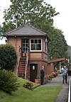
Wooden signal box next to railway platform decorated with flowers. 스토그넘버 시민 교구 702 윌리톤농촌구

서서머셋

51°08°N 3°17°W/51.13°N 3.29°W/ 51.13; -3.29(Stogumber) [8][157]
White painted church with square tower topped with a spire. 스토거시 시민 교구 1,385 윌리톤농촌구

서서머셋

51°11°N 3°08°W/51.18°N 3.14°W/ 51.18; -3.14(스토거시) [8][157]
Stone building with Octagonal tower topped by a short spirelet. 스토크 세인트 그레고리 시민 교구 942 툰턴 농촌구

툰턴 디인

51°02°N 2°56′W/51.04°N 2.94°W/ 51.04; -2.94(Stoke St Gregory) [8][156]
Stone building with square tower. 스토크 세인트 메리 시민 교구 421 툰턴 농촌구

툰턴 디인

50°59°N 3°03˚W/50.99°N 3.05°W/ 50.99; -3.05(Stoke St Mary) [8][156]
Stone church with red tiled roofs. 스트링스턴 시민 교구 116 윌리톤농촌구

서서머셋

51°11°N 3°11°W/51.18°N 3.18°W/ 51.18; -3.18(스트링스톤) [157]
White building with square tower. 손팔콘 시민 교구 119 툰턴 농촌구

툰턴 디인

51°01°N 3°01°W/51.01°N 3.02°W/ 51.01; -3.02(토른팔콘) [8][156]
Reddish stone church with square tower. 팀버스콤비 시민 교구 402 윌리톤농촌구

서서머셋

51°08°N 화씨 3°32°/51.13°N 3.54°W/ 51.13; -3.54(팀버스콤비) [8][157]
Stone building with square tower. 톨랜드 시민 교구 81 툰턴 농촌구

툰턴 디인

51°05°N 3°17°W/51.08°N 3.28°W/ 51.08; -3.28(톨랜드, 서머셋) [156]
Stone kilns built into a bank with a road in front. 트레버러 시민 교구 51 윌리톤농촌구

서서머셋

51°07°N 3°25°W/51.12°N 3.41°W/ 51.12; -3.41(트레버러) [157]
Stone building with square tower. 트룰 시민 교구 2,288 툰턴 농촌구

툰턴 디인

51°00˚N 3°07°W/51.00°N 3.12°W/ 51.00; -3.12(추적) [8][156]
Stone building with small bell tower. In the foreground are gravestones. 업턴 시민 교구 250 덜버턴 농촌구

서서머셋

51°06˚N 3°26′W/51.10°N 3.44°W/ 51.10; -3.44(업턴, 서머셋) [8][158]
View of multiple houses with sea on the left and hills in the background. 와칫 마을 3,785 와트셰트 어반 구

서서머셋

51°11°N 3°20°W/51.18°N 3.33°W/ 51.18; -3.33(Watchet) [8][163]
Roofs of several houses with the square tower of the church prominent amongst them. In the background are fields and hills. 웰링턴 마을 13,822 웰링턴 어번 구

툰턴 디인

50°59°N 3°13°W/50.98°N 3.22°W/ 50.98; -3.22(웰링턴, 서머셋) [8][164]
Former chapel, Holywell Lake (geograph 4717204).jpg 웰링턴 위드 시민 교구 727 웰링턴 농촌구

툰턴 디인

50°58˚N 3°14˚W/50.96°N 3.23°W/ 50.96; -3.23(웰링턴 제외) [8][155]
White painted building to the right of the road, with a sign saying The Rising Sun. 웨스트백버러 시민 교구 358 툰턴 농촌구

툰턴 디인

51°05°N 3°11°W/51.09°N 3.18°W/ 51.09; -3.18(웨스트 백버러) [8][156]
Stone building with square tower and stair turret. 웨스트버클랜드 시민 교구 1,189 웰링턴 농촌구

툰턴 디인

50°59°N 3°11°W/50.98°N 3.18°W/ 50.98; -3.18(웨스트 버클랜드) [8][155]
Stone church with square tower 웨스트 해치 시민 교구 306 툰턴 농촌구

툰턴 디인

50°59°N 3°01°W/50.98°N 3.02°W/ 50.98; -3.02(웨스트 해치) [8][156]
Stone building with square tower, partially obscured by trees. 웨스트몽크턴 시민 교구 2,787 툰턴 농촌구

툰턴 디인

51°03°N 3°03˚W/51.05°N 3.05°W/ 51.05; -3.05(웨스트 몽크톤) [8][156]
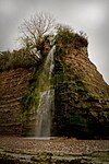
Waterfall cascading down rockface. 웨스트 콴톡스헤드 시민 교구 343 윌리톤농촌구

서서머셋

51°10°N 3°16˚W/51.17°N 3.27°W/ 51.17; -3.27(웨스트 콴톡스헤드) [8][157]
Stone building with arched doorway and windows. Two small towers. 윌리톤 시민 교구 2,607 윌리톤농촌구

서서머셋

51°10°N 3°19˚W/51.16°N 3.31°W/ 51.16; -3.31(윌리턴) [8][157]
Stone building with square tower. In the foreground are gravestones. 윈스포드 시민 교구 321 덜버턴 농촌구

서서머셋

51°06˚N 3°34′W/51.10°N 3.57°W/ 51.10; -3.57(윈스포드, 서머셋) [8][158]
White painted church with square tower. 위디콤베 시민 교구 293 윌리톤농촌구

서서머셋

51°10°N 3°25°W/51.16°N 3.41°W/ 51.16; -3.41(Withycombe) [8][157]
Stone bridge with six arches over water. 위디풀과 호크리지 시민 교구 201 덜버턴 농촌구

서서머셋

51°07°N 화씨 3°39°W/51.11°N 3.65°W/ 51.11; -3.65(위디풀과 호크리지) [8][158]
Street scene with buildings and shops. The three-storey building on the left has a sign saying The Courthouse. 위블리스콤베 마을 2,893 웰링턴 농촌구

툰턴 디인

51°02°N 3°19˚W/51.04°N 3.31°W/ 51.04; -3.31(Wiveliscombe) [8][155]
Stone building with square tower. In the foreground are gravestones. 우튼 코트네 시민 교구 264 윌리톤농촌구

서서머셋

51°11°N 화씨 3°31°W/51.18°N 3.52°W/ 51.18; -3.52(Wootton Courtenay) [8][157]

참고 항목

참조

  1. ^ "The Parish Councils Bill". The Times. 27 March 1893. p. 8.
  2. ^ HMSO. 1972년 지방정부법. 1972년 c.70
  3. ^ "The Avon (Structural Change) Order 1995". HMSO. Archived from the original on 4 November 2010. Retrieved 9 December 2007.
  4. ^ a b c d e f g h i j k l m n o p q r s t u v w x y z aa ab ac ad ae af ag ah ai aj ak al am an ao "2011 Census Profile" (Excel). North Somerset Council. Archived (PDF) from the original on 29 January 2017. Retrieved 29 January 2017.
  5. ^ "Community Profile" (PDF). Somerset Intelligence Network. Archived (PDF) from the original on 2 February 2017. Retrieved 29 January 2017.
  6. ^ "Somerset West and Taunton Council". somersetwestandtaunton.gov.uk. Retrieved 31 December 2020.
  7. ^ a b "An introduction to South Somerset" (PDF). South Somerset District Council. Archived (PDF) from the original on 29 November 2014. Retrieved 4 January 2014.
  8. ^ a b c d e f g h i j k l m n o p q r s t u v w x y z aa ab ac ad ae af ag ah ai aj ak al am an ao ap aq ar as at au av aw ax ay az ba bb bc bd be bf bg bh bi bj bk bl bm bn bo bp bq br bs bt bu bv bw bx by bz ca cb cc cd ce cf cg ch ci cj ck cl cm cn co cp cq cr cs ct cu cv cw cx cy cz da db dc dd de df dg dh di dj dk dl dm dn do dp dq dr ds dt du dv dw dx dy dz ea eb ec ed ee ef eg eh ei ej ek el em en eo ep eq er es et eu ev ew ex ey ez fa fb fc fd fe ff fg fh fi fj fk fl fm fn fo fp fq fr fs ft fu fv fw fx fy fz ga gb gc gd ge gf gg gh gi gj gk gl gm gn go gp gq gr gs gt gu gv gw gx gy gz ha hb hc hd he hf hg hh hi hj hk hl hm hn ho hp hq hr hs ht hu hv hw hx hy hz ia ib ic id ie if ig ih ii "Statistics for Wards, LSOAs and Parishes — SUMMARY Profiles". Somerset Intelligence. Archived from the original (Excel) on 4 January 2014. Retrieved 4 January 2014.
  9. ^ a b c "Sedgemoor parish population estimates for 2002" (PDF). Somerset County Council. 2002. Archived from the original (PDF) on 21 November 2009. Retrieved 17 October 2009.
  10. ^ a b "A Portrait of Mendip". Mendip Council. Archived from the original on 4 January 2014. Retrieved 4 January 2014.
  11. ^ a b c "Mendip Parish Population Statistics" (PDF). ONS Census 2001. Somerset County Council. Archived from the original (PDF) on 21 November 2009. Retrieved 3 July 2008.
  12. ^ Winchester, Angus (2000). Discovering Parish Boundaries. Princes Risborough: Shire Publications. ISBN 978-0-7478-0470-3.
  13. ^ "The Poor Law : Introduction". The Victorian Web. Archived from the original on 11 April 2010. Retrieved 22 August 2009.
  14. ^ "The New Poor Law". The Workhouse. Archived from the original on 12 October 2016. Retrieved 29 January 2017.
  15. ^ "A Vision of Britain Through Time : Status Details for Rural Sanitary District". Great Britain Historical GIS Project 2004/University of Portsmouth. Data Office for National Statistics, for England and Wales. Archived from the original on 14 May 2011. Retrieved 22 August 2009.
  16. ^ Tittler, Robert (1998). The Reformation and the Towns in England: Politics and Political Culture, c.1540–1640. Oxford University Press. ISBN 978-0-19-820718-4.
  17. ^ a b "Modern British Surnames : Selected Events in the History of Civil Registration and Boundary Changes 1801–1996". Archived from the original on 20 August 2008. Retrieved 22 August 2009.
  18. ^ MacMorran, Alexander; Colquhoun Dill, T. R. (1907). The Local Government Act 1894 and the Subsequent Statutes Affecting Parish Councils. London: Butterworth and Co.
  19. ^ a b c d "Local Government Act 1972". Office of Public Sector Information. Retrieved 22 August 2009.
  20. ^ "Local Government and Rating Act 1997". Office of Public Sector Information. Archived from the original on 8 May 2016. Retrieved 29 January 2017.
  21. ^ "Local Government and Public Involvement in Health Act 2007". Office of Public Sector Information. Archived from the original on 1 February 2017. Retrieved 29 January 2017.
  22. ^ "Bathampton Parish". Neighbourhood Statistics. Office for National Statistics. Archived from the original on 1 January 2014. Retrieved 31 December 2013.
  23. ^ a b c d e f g h i j k l m n o p q r s t u v w "Bathavon RD". A vision of Britain Through Time. University of Portsmouth. Archived from the original on 13 October 2013. Retrieved 4 January 2014.
  24. ^ "Batheaston Parish". Neighbourhood Statistics. Office for National Statistics. Archived from the original on 1 January 2014. Retrieved 31 December 2013.
  25. ^ "Bathford Parish". Neighbourhood Statistics. Office for National Statistics. Archived from the original on 1 January 2014. Retrieved 31 December 2013.
  26. ^ "Camerton Parish". Neighbourhood Statistics. Office for National Statistics. Archived from the original on 1 January 2014. Retrieved 31 December 2013.
  27. ^ "Charlcombe Parish". Neighbourhood Statistics. Office for National Statistics. Archived from the original on 1 January 2014. Retrieved 31 December 2013.
  28. ^ "Chelwood Parish". Neighbourhood Statistics. Office for National Statistics. Archived from the original on 1 January 2014. Retrieved 31 December 2013.
  29. ^ a b c d e f g h i j k l m n o p q r s t u v w "Clutton RD". A vision of Britain Through Time. University of Portsmouth. Archived from the original on 13 October 2013. Retrieved 4 January 2014.
  30. ^ "Chew Magna Parish". Neighbourhood Statistics. Office for National Statistics. Retrieved 31 December 2013.
  31. ^ "Chew Stoke Parish". Neighbourhood Statistics. Office for National Statistics. Retrieved 31 December 2013.
  32. ^ "Claverton Parish". Neighbourhood Statistics. Office for National Statistics. Archived from the original on 1 January 2014. Retrieved 31 December 2013.
  33. ^ "Clutton Parish". Neighbourhood Statistics. Office for National Statistics. Archived from the original on 1 January 2014. Retrieved 31 December 2013.
  34. ^ "Combe Hay Parish". Neighbourhood Statistics. Office for National Statistics. Retrieved 31 December 2013.
  35. ^ "Compton Dando Parish". Neighbourhood Statistics. Office for National Statistics. Retrieved 31 December 2013.
  36. ^ a b c "Keynsham UD". A vision of Britain Through Time. University of Portsmouth. Archived from the original on 13 October 2013. Retrieved 4 January 2014.
  37. ^ "Compton Martin Parish". Neighbourhood Statistics. Office for National Statistics. Retrieved 31 December 2013.
  38. ^ "Corston Parish". Neighbourhood Statistics. Office for National Statistics. Archived from the original on 1 January 2014. Retrieved 31 December 2013.
  39. ^ "Dunkerton Parish". Neighbourhood Statistics. Office for National Statistics. Archived from the original on 1 January 2014. Retrieved 31 December 2013.
  40. ^ "East Harptree Parish". Neighbourhood Statistics. Office for National Statistics. Retrieved 31 December 2013.
  41. ^ "Englishcombe Parish". Neighbourhood Statistics. Office for National Statistics. Archived from the original on 1 January 2014. Retrieved 31 December 2013.
  42. ^ "Farmborough Parish". Neighbourhood Statistics. Office for National Statistics. Archived from the original on 1 January 2014. Retrieved 31 December 2013.
  43. ^ "Farrington Gurney Parish". Neighbourhood Statistics. Office for National Statistics. Retrieved 31 December 2013.
  44. ^ "Freshford Parish". Neighbourhood Statistics. Office for National Statistics. Archived from the original on 1 January 2014. Retrieved 31 December 2013.
  45. ^ "High Littleton Parish". Neighbourhood Statistics. Office for National Statistics. Retrieved 31 December 2013.
  46. ^ "Hinton Blewett Parish". Neighbourhood Statistics. Office for National Statistics. Retrieved 31 December 2013.
  47. ^ "Hinton Charterhouse Parish". Neighbourhood Statistics. Office for National Statistics. Retrieved 31 December 2013.
  48. ^ "Kelston Parish". Neighbourhood Statistics. Office for National Statistics. Archived from the original on 1 January 2014. Retrieved 31 December 2013.
  49. ^ "Keynsham Parish". Neighbourhood Statistics. Office for National Statistics. Archived from the original on 1 January 2014. Retrieved 31 December 2013.
  50. ^ "Marksbury Parish". Neighbourhood Statistics. Office for National Statistics. Archived from the original on 1 January 2014. Retrieved 31 December 2013.
  51. ^ "Midsomer Norton Parish". Neighbourhood Statistics. Office for National Statistics. Archived from the original on 1 January 2014. Retrieved 31 December 2013.
  52. ^ a b c "Norton Radstock UD". A vision of Britain Through Time. University of Portsmouth. Archived from the original on 5 January 2014. Retrieved 4 January 2014.
  53. ^ "Monkton Combe Parish". Neighbourhood Statistics. Office for National Statistics. Retrieved 31 December 2013.
  54. ^ "Nempnett Thrubwell Parish". Neighbourhood Statistics. Office for National Statistics. Retrieved 31 December 2013.
  55. ^ "Newton St Loe Parish". Neighbourhood Statistics. Office for National Statistics. Archived from the original on 1 January 2014. Retrieved 31 December 2013.
  56. ^ "Norton Malreward Parish". Neighbourhood Statistics. Office for National Statistics. Retrieved 31 December 2013.
  57. ^ "Paulton Parish". Neighbourhood Statistics. Office for National Statistics. Archived from the original on 1 January 2014. Retrieved 31 December 2013.
  58. ^ "Peasedown St John Parish". Neighbourhood Statistics. Office for National Statistics. Archived from the original on 1 January 2014. Retrieved 31 December 2013.
  59. ^ "Priston Parish". Neighbourhood Statistics. Office for National Statistics. Archived from the original on 1 January 2014. Retrieved 31 December 2013.
  60. ^ "Publow Parish". Neighbourhood Statistics. Office for National Statistics. Archived from the original on 1 January 2014. Retrieved 31 December 2013.
  61. ^ "Radstock Parish". Neighbourhood Statistics. Office for National Statistics. Archived from the original on 1 January 2014. Retrieved 31 December 2013.
  62. ^ "Saltford Parish". Neighbourhood Statistics. Office for National Statistics. Archived from the original on 1 January 2014. Retrieved 31 December 2013.
  63. ^ "Shoscombe Parish". Neighbourhood Statistics. Office for National Statistics. Archived from the original on 1 January 2014. Retrieved 31 December 2013.
  64. ^ "Southstoke Parish". Neighbourhood Statistics. Office for National Statistics. Archived from the original on 1 January 2014. Retrieved 31 December 2013.
  65. ^ "Stanton Drew Parish". Neighbourhood Statistics. Office for National Statistics. Retrieved 31 December 2013.
  66. ^ "Stowey-Sutton Parish". Neighbourhood Statistics. Office for National Statistics. Archived from the original on 1 January 2014. Retrieved 31 December 2013.
  67. ^ "Swainswick Parish". Neighbourhood Statistics. Office for National Statistics. Archived from the original on 1 January 2014. Retrieved 31 December 2013.
  68. ^ "Cameley Parish". Neighbourhood Statistics. Office for National Statistics. Archived from the original on 1 January 2014. Retrieved 31 December 2013.
  69. ^ "Timsbury Parish". Neighbourhood Statistics. Office for National Statistics. Archived from the original on 1 January 2014. Retrieved 31 December 2013.
  70. ^ "Ubley Parish". Neighbourhood Statistics. Office for National Statistics. Archived from the original on 1 January 2014. Retrieved 31 December 2013.
  71. ^ "Wellow Parish". Neighbourhood Statistics. Office for National Statistics. Archived from the original on 1 January 2014. Retrieved 31 December 2013.
  72. ^ "Westfield Parish". Neighbourhood Statistics. Office for National Statistics. Archived from the original on 1 January 2014. Retrieved 31 December 2013.
  73. ^ "West Harptree Parish". Neighbourhood Statistics. Office for National Statistics. Retrieved 31 December 2013.
  74. ^ "Whitchurch Parish". Neighbourhood Statistics. Office for National Statistics. Archived from the original on 1 January 2014. Retrieved 31 December 2013.
  75. ^ "Ashwick Parish". Neighbourhood Statistics. Office for National Statistics. Archived from the original on 2 January 2014. Retrieved 1 January 2014.
  76. ^ a b c d e f g h i j k l m n o p q r s "Shepton Mallet RD". A vision of Britain Through Time. University of Portsmouth. Archived from the original on 5 January 2014. Retrieved 4 January 2014.
  77. ^ "Baltonsborough Parish". Neighbourhood Statistics. Office for National Statistics. Archived from the original on 2 January 2014. Retrieved 1 January 2014.
  78. ^ a b c d e f g h i j k l m n o "Wells RD". A vision of Britain Through Time. University of Portsmouth. Archived from the original on 5 January 2014. Retrieved 4 January 2014.
  79. ^ "Batcombe Parish". Neighbourhood Statistics. Office for National Statistics. Archived from the original on 2 January 2014. Retrieved 1 January 2014.
  80. ^ "Beckington Parish". Neighbourhood Statistics. Office for National Statistics. Archived from the original on 2 January 2014. Retrieved 1 January 2014.
  81. ^ a b c d e f g h i j k l m n o p q r s t u "Frome RD". A vision of Britain Through Time. University of Portsmouth. Archived from the original on 16 October 2013. Retrieved 4 January 2014.
  82. ^ "Berkley Parish". Neighbourhood Statistics. Office for National Statistics. Archived from the original on 2 January 2014. Retrieved 1 January 2014.
  83. ^ "Binegar Parish". Neighbourhood Statistics. Office for National Statistics. Archived from the original on 2 January 2014. Retrieved 1 January 2014.
  84. ^ "Buckland Dinham Parish". Neighbourhood Statistics. Office for National Statistics. Retrieved 1 January 2014.
  85. ^ "Butleigh Parish". Neighbourhood Statistics. Office for National Statistics. Archived from the original on 2 January 2014. Retrieved 1 January 2014.
  86. ^ "Chewton Mendip Parish". Neighbourhood Statistics. Office for National Statistics. Retrieved 1 January 2014.
  87. ^ "Chilcompton Parish". Neighbourhood Statistics. Office for National Statistics. Archived from the original on 2 January 2014. Retrieved 1 January 2014.
  88. ^ "Coleford Parish". Neighbourhood Statistics. Office for National Statistics. Archived from the original on 2 January 2014. Retrieved 1 January 2014.
  89. ^ "Cranmore Parish". Neighbourhood Statistics. Office for National Statistics. Archived from the original on 2 January 2014. Retrieved 1 January 2014.
  90. ^ "Croscombe Parish". Neighbourhood Statistics. Office for National Statistics. Archived from the original on 2 January 2014. Retrieved 1 January 2014.
  91. ^ "Ditcheat Parish". Neighbourhood Statistics. Office for National Statistics. Archived from the original on 2 January 2014. Retrieved 1 January 2014.
  92. ^ "Doulting Parish". Neighbourhood Statistics. Office for National Statistics. Archived from the original on 2 January 2014. Retrieved 1 January 2014.
  93. ^ "East Pennard Parish". Neighbourhood Statistics. Office for National Statistics. Retrieved 1 January 2014.
  94. ^ "Emborough Parish". Neighbourhood Statistics. Office for National Statistics. Archived from the original on 2 January 2014. Retrieved 1 January 2014.
  95. ^ "Evercreech Parish". Neighbourhood Statistics. Office for National Statistics. Archived from the original on 2 January 2014. Retrieved 1 January 2014.
  96. ^ "Frome Parish". Neighbourhood Statistics. Office for National Statistics. Archived from the original on 2 January 2014. Retrieved 1 January 2014.
  97. ^ "Glastonbury Parish". Neighbourhood Statistics. Office for National Statistics. Archived from the original on 2 January 2014. Retrieved 1 January 2014.
  98. ^ "Glastonbury MB". A vision of Britain Through Time. University of Portsmouth. Archived from the original on 5 January 2014. Retrieved 4 January 2014.
  99. ^ "Godney Parish". Neighbourhood Statistics. Office for National Statistics. Archived from the original on 6 September 2015. Retrieved 1 January 2014.
  100. ^ "Great Elm Parish". Neighbourhood Statistics. Office for National Statistics. Retrieved 1 January 2014.
  101. ^ "Hemington Parish". Neighbourhood Statistics. Office for National Statistics. Archived from the original on 2 January 2014. Retrieved 1 January 2014.
  102. ^ "Holcombe Parish". Neighbourhood Statistics. Office for National Statistics. Archived from the original on 2 January 2014. Retrieved 1 January 2014.
  103. ^ "Kilmersdon Parish". Neighbourhood Statistics. Office for National Statistics. Archived from the original on 2 January 2014. Retrieved 1 January 2014.
  104. ^ "Lamyat Parish". Neighbourhood Statistics. Office for National Statistics. Archived from the original on 2 January 2014. Retrieved 1 January 2014.
  105. ^ "Leigh-on-Mendip Parish". Neighbourhood Statistics. Office for National Statistics. Archived from the original on 2 January 2014. Retrieved 1 January 2014.
  106. ^ "Litton Parish". Neighbourhood Statistics. Office for National Statistics. Archived from the original on 2 January 2014. Retrieved 1 January 2014.
  107. ^ "Lullington Parish". Neighbourhood Statistics. Office for National Statistics. Archived from the original on 2 January 2014. Retrieved 1 January 2014.
  108. ^ "Lydford-on-Fosse Parish". Neighbourhood Statistics. Office for National Statistics. Archived from the original on 2 January 2014. Retrieved 1 January 2014.
  109. ^ "Meare Parish". Neighbourhood Statistics. Office for National Statistics. Archived from the original on 2 January 2014. Retrieved 1 January 2014.
  110. ^ "Mells Parish". Neighbourhood Statistics. Office for National Statistics. Archived from the original on 2 January 2014. Retrieved 1 January 2014.
  111. ^ "North Wootton Parish". Neighbourhood Statistics. Office for National Statistics. Retrieved 1 January 2014.
  112. ^ "Norton St Philip Parish". Neighbourhood Statistics. Office for National Statistics. Retrieved 1 January 2014.
  113. ^ "Nunney Parish". Neighbourhood Statistics. Office for National Statistics. Archived from the original on 2 January 2014. Retrieved 1 January 2014.
  114. ^ "Pilton Parish". Neighbourhood Statistics. Office for National Statistics. Archived from the original on 2 January 2014. Retrieved 1 January 2014.
  115. ^ "Priddy Parish". Neighbourhood Statistics. Office for National Statistics. Archived from the original on 2 January 2014. Retrieved 1 January 2014.
  116. ^ "Pylle Parish". Neighbourhood Statistics. Office for National Statistics. Archived from the original on 2 January 2014. Retrieved 1 January 2014.
  117. ^ "Rode Parish". Neighbourhood Statistics. Office for National Statistics. Archived from the original on 2 January 2014. Retrieved 1 January 2014.
  118. ^ "Rodney Stoke Parish". Neighbourhood Statistics. Office for National Statistics. Retrieved 1 January 2014.
  119. ^ "Selwood Parish". Neighbourhood Statistics. Office for National Statistics. Archived from the original on 2 January 2014. Retrieved 1 January 2014.
  120. ^ "Sharpham Parish". Neighbourhood Statistics. Office for National Statistics. Archived from the original on 2 January 2014. Retrieved 1 January 2014.
  121. ^ "Shepton Mallet Parish". Neighbourhood Statistics. Office for National Statistics. Retrieved 1 January 2014.
  122. ^ "Shepton Mallet UD". A vision of Britain Through Time. University of Portsmouth. Archived from the original on 13 October 2013. Retrieved 4 January 2014.
  123. ^ "St Cuthbert Out Parish". Neighbourhood Statistics. Office for National Statistics. Retrieved 1 January 2014.
  124. ^ "Stoke St Michael Parish". Neighbourhood Statistics. Office for National Statistics. Retrieved 1 January 2014.
  125. ^ "Ston Easton Parish". Neighbourhood Statistics. Office for National Statistics. Retrieved 1 January 2014.
  126. ^ "Stratton on the Fosse Parish". Neighbourhood Statistics. Office for National Statistics. Retrieved 1 January 2014.
  127. ^ "Street Parish". Neighbourhood Statistics. Office for National Statistics. Archived from the original on 2 January 2014. Retrieved 1 January 2014.
  128. ^ "Street UD". A vision of Britain Through Time. University of Portsmouth. Archived from the original on 5 January 2014. Retrieved 4 January 2014.
  129. ^ "Tellisford Parish". Neighbourhood Statistics. Office for National Statistics. Archived from the original on 2 January 2014. Retrieved 1 January 2014.
  130. ^ "Trudoxhill Parish". Neighbourhood Statistics. Office for National Statistics. Archived from the original on 2 January 2014. Retrieved 1 January 2014.
  131. ^ "Upton Noble Parish". Neighbourhood Statistics. Office for National Statistics. Retrieved 1 January 2014.
  132. ^ "Walton Parish". Neighbourhood Statistics. Office for National Statistics. Archived from the original on 2 January 2014. Retrieved 1 January 2014.
  133. ^ "Wanstrow Parish". Neighbourhood Statistics. Office for National Statistics. Archived from the original on 2 January 2014. Retrieved 1 January 2014.
  134. ^ "Wells Parish". Neighbourhood Statistics. Office for National Statistics. Archived from the original on 2 January 2014. Retrieved 1 January 2014.
  135. ^ "West Bradley Parish". Neighbourhood Statistics. Office for National Statistics. Retrieved 1 January 2014.
  136. ^ "West Pennard Parish". Neighbourhood Statistics. Office for National Statistics. Retrieved 1 January 2014.
  137. ^ "Westbury Parish". Neighbourhood Statistics. Office for National Statistics. Archived from the original on 2 January 2014. Retrieved 1 January 2014.
  138. ^ "Whatley Parish". Neighbourhood Statistics. Office for National Statistics. Archived from the original on 2 January 2014. Retrieved 1 January 2014.
  139. ^ "Witham Friary Parish". Neighbourhood Statistics. Office for National Statistics. Retrieved 1 January 2014.
  140. ^ "Wookey Parish". Neighbourhood Statistics. Office for National Statistics. Archived from the original on 2 January 2014. Retrieved 1 January 2014.
  141. ^ a b c d e f g h i j k l m n o p q r "Long Ashton RD". A vision of Britain Through Time. University of Portsmouth. Archived from the original on 12 October 2013. Retrieved 4 January 2014.
  142. ^ a b c d e f g h i j k l m n o p q r s t u v w x y z aa ab ac ad ae af ag ah ai "Axbridge RD". A vision of Britain Through Time. University of Portsmouth. Archived from the original on 13 October 2013. Retrieved 4 January 2014.
  143. ^ "Clevedon UD". A vision of Britain Through Time. University of Portsmouth. Archived from the original on 13 October 2013. Retrieved 4 January 2014.
  144. ^ "Portishead". ONS. Retrieved 15 March 2018.
  145. ^ a b c d e f g h i j k l m n o p q r s t u v w x y z aa ab ac ad ae af ag ah ai aj ak al "Brdigwater RD". A vision of Britain Through Time. University of Portsmouth. Archived from the original on 21 October 2013. Retrieved 4 January 2014.
  146. ^ "Burnham UD". A vision of Britain Through Time. University of Portsmouth. Archived from the original on 5 January 2014. Retrieved 4 January 2014.
  147. ^ a b c d e f g h i j k l m n o p q r s t u v w x y z aa ab ac "Wincanton RD". A vision of Britain Through Time. University of Portsmouth. Archived from the original on 5 January 2014. Retrieved 4 January 2014.
  148. ^ a b c d e f g h i j k l m n o p q r s t u v w x y "Langport RD". A vision of Britain Through Time. University of Portsmouth. Archived from the original on 5 January 2014. Retrieved 4 January 2014.
  149. ^ a b c d e f g h i j k l m n o p q r s t u v w x y z aa ab ac ad "Yeovil RD". A vision of Britain Through Time. University of Portsmouth. Archived from the original on 8 December 2013. Retrieved 4 January 2014.
  150. ^ a b c d e f g h i j k l m n o p q r s t u v w x y z aa ab ac ad ae af "Chard RD". A vision of Britain Through Time. University of Portsmouth. Archived from the original on 5 January 2014. Retrieved 4 January 2014.
  151. ^ "Crewkerne UD". A vision of Britain Through Time. University of Portsmouth. Archived from the original on 5 January 2014. Retrieved 4 January 2014.
  152. ^ "Bulletin of change 2014 Final" (PDF). Lgbce. Archived from the original (PDF) on 16 March 2018. Retrieved 15 March 2018.
  153. ^ "Yeovil MB". A vision of Britain Through Time. University of Portsmouth. Archived from the original on 5 January 2014. Retrieved 4 January 2014.
  154. ^ "Taunton Deane" (PDF). Population estimates 2002. Somerset County Council. Archived from the original (PDF) on 21 November 2009. Retrieved 14 November 2009.
  155. ^ a b c d e f g h i j k l m "Wellington RD". A vision of Britain Through Time. University of Portsmouth. Archived from the original on 30 December 2013. Retrieved 5 January 2014.
  156. ^ a b c d e f g h i j k l m n o p q r s t u v w x y z aa ab ac ad ae "Taunton RD". A vision of Britain Through Time. University of Portsmouth. Archived from the original on 6 January 2014. Retrieved 5 January 2014.
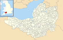
  157. ^ a b c d e f g h i j k l m n o p q r s t u v w x y z aa ab ac "Williton RD". A vision of Britain Through Time. University of Portsmouth. Archived from the original on 6 January 2014. Retrieved 5 January 2014.
  158. ^ a b c d e f g h i j k "Dulverton RD". A vision of Britain Through Time. University of Portsmouth. Archived from the original on 13 October 2013. Retrieved 5 January 2014.
  159. ^ a b c d e "Statistics for Wards, LSOAs and Parishes — SUMMARY Profiles". Somerset Intelligence. Archived from the original (Excel) on 4 January 2014. Retrieved 4 January 2014.
  160. ^ a b c d "Taunton RD". A vision of Britain Through Time. University of Portsmouth. Archived from the original on 6 January 2014. Retrieved 5 January 2014.
  161. ^ "Wellington RD". A vision of Britain Through Time. University of Portsmouth. Archived from the original on 30 December 2013. Retrieved 5 January 2014.
  162. ^ "Minehead UD". A vision of Britain Through Time. University of Portsmouth. Archived from the original on 6 January 2014. Retrieved 5 January 2014.
  163. ^ "Watchet UD". A vision of Britain Through Time. University of Portsmouth. Archived from the original on 6 January 2014. Retrieved 5 January 2014.
  164. ^ "Wellington UD". A vision of Britain Through Time. University of Portsmouth. Archived from the original on 1 January 2014. Retrieved 5 January 2014.