치라 현
Qira County치라 현 چىرا ناھىيىسى 策勒县 치라, 셀레, 체레 | |
|---|---|
.png) 호탄(노란색)과 신장(新))의 현 위치 | |
 키라 신장 자치구 좌석 위치 | |
| 좌표:37°00ºN 80°48°E/37.000°N 80.800°E좌표: 37°00ºN 80°48ºE / 37.000°N 80.800°E / , | |
| 나라 | 중화인민공화국 |
| 자치구 | 신장 |
| 현 | 호탄 현 |
| 읍 단위 부서 | 2개 읍, 6면 |
| 지역 | |
| • 합계 | 31,688.01km2(12,234.81평방마일) |
| 승진 | 1,500 ~ 7,282 m (4,900 ~23,981 피트) |
| 인구. (2015년)[4] | |
| • 합계 | 166,735 |
| • 밀도 | 5.3/km2(14/140mi) |
| 민족 | |
| • 주요 인종 집단 | 위구르족[1][5] |
| 시간대 | UTC+8(중국 표준) |
| 우편번호 | 848300 |
| 웹 사이트 | xjcl |
| 치라 현 | |||||||||||
|---|---|---|---|---|---|---|---|---|---|---|---|
| 위구르 이름 | |||||||||||
| 위구르족 | چىرا ناھىيىسى | ||||||||||
| |||||||||||
| 한자이름 | |||||||||||
| 간체자 중국어 | 策勒县 | ||||||||||
| 번체 중국어 | 策勒縣 | ||||||||||
| |||||||||||
치라[3][6] 현(, ) 은 중화 인민 공화국 신장 위구르 자치구 호탄 시의 현급 행정구역이다.거의 모든 주민이 위구르족이며 황량한 타클라마칸 사막과 쿤룬 [5]산맥 사이에 위치한 오아시스 주변에 살고 있다.북쪽은 악수현, 동쪽은 유톈/케리야현, 북서쪽은 롭현, 남서쪽은 중국-인도 분쟁지역인 아크사이친(Aksai Chin)을 포함한 호탄현, 남쪽은 티베트 [7]은가리현 루토그현과 각각 접하고 있다.
역사
6세기 단단오일릭 오아시스 마을 고고학 유적지는 치라(치라)현 북부의 사막에 있다.
현재 치라현의 군청 소재지인 치라타운(치라)은 타클라마칸 [1][8][9]사막의 모래침해로 세 차례에 걸쳐 장소를 변경해야 했다.
1900-01년 이 지역 탐험에서 아우렐 스타인은 오늘날의 랍 카운티와 케리야 강 사이의 타클라마칸 사막 지역인 오늘날의 치라 카운티 북부 지역을 횡단했습니다.그가 [10]가는 길을 따라 우물이 몇 개 있었다.
치라 현은 1928/[11][12]9년에 위톈/케리야 현에서 분리되었습니다.
1950년대와 1980년대 사이의 30년 동안, 카운티 소재지 근처의 상당한 농경지가 모래 [13]바람에 의해 사막으로 옮겨졌습니다.
치라 현은 1955년 신장 자치구가 설립된 이래 호탄 [11]현의 일부였다.
1980년대에는 타클라마칸 사막이 주택으로부터 1.5km(0.93mi) 이내에 있는 사막화의 영향으로 군청 소재지 446가구가 이주해야 했고, 때로는 하룻밤 [8]사이에 집을 모래에 파묻기도 했다.
"어느 날 아침에 일어났을 때, 밤새 쌓인 모래 무게 때문에 문을 열 수 없다는 것을 알게 되었습니다.농작물도 매몰됐기 때문에 이사할 수밖에 없었다." - Memet Simay, 지역[8] 주민
1983년, 중국 과학원의 키라 연구소가 유사를 [9]퇴치하기 위해 설립되었습니다.우주정거장에 있던 과학자들의 도움을 받아 과도기 구역을 설정했고, 모래는 5킬로미터(3.1 mi)[14][better source needed] 이상 뒤로 밀려났다.
2005년에는 다미쿠(다마구)[15]에서 7km(4.3마일) 떨어진 곳에서 1500년 된 작은 절이 발견됐다.
2014년 10월 20일에 다미쿠(다마구)가 정에서 [2]정으로 변경되었다.
2016년 1월 7일, 치라 현의 누르, 보스탄, 울루사이 마을 근처의 지역이 새롭게 만들어진 쿠뉴의 [16][17]일부가 되었다.
2017년 2월 28일, 카운티 정부는 다른 사람들이 옷이나 개인 물품에 '별과 초승달' 휘장을 꿰매거나 휴대폰 케이스, 지갑 또는 다른 보석류에 '동쪽 투르크스탄'이라는 문구를 새겼다고 신고한 사람은 현금 [18]지급 자격이 있다고 발표했다.
2017년 3월, 차카읍의 벡찬 마을이자 위구르족인 살라메트 메메티민 공산당 서기는 자신의 집에서 니카족 결혼 서약을 했다는 이유로 직위해제되었다.호탄일보에 따르면 당시 [19]97명의 공무원들이 징계 위반 혐의로 기소됐다.
2018년, 카운티 지방 정부 당국은 직업 수용소와 구치소에 약 12,000명의 수감자가 있을 것으로 예상했으며, 이 센터와 관련된 일부 프로젝트는 예산 [20]한계를 초과했다.
중국 정부에 따르면 2018년 말까지 치라타운에 진난신촌(金南新村)이 [21]완공됐다.신장에 대한 원조 전달을 늘리기 위해 신장에 있는 지역들은 원조를 제공할 수 있는 중국의 다른 지역들과 짝을 이루고 있다.이 프로그램에서는 천진과 호탄이 짝을 이룬다.톈진 정부의 지원을 받아 현 [22]제1의 초등학교에 표준 축구장과 훈련 센터가 건설되었다.
지리
치라현의 북부는 사구로 이루어져[10] 호탄현과 악수현의 경계를 이루는 타클라마칸 사막에서 일직선으로 끝납니다.그 지역은 [1]해발 1,500미터에서 1,800미터 사이이다.
오아시스 지역은 카운티 [1]전체 면적의 2.9%를 차지한다.중국 국도 315호선을 따라 있는 오아시스 지역에는 치라 현, 굴라흐마 현, 다미쿠 현이 포함된다.치라 카운티에 있는 카카, 울루사이, 누르, 보스탄, 쿤유의 작은 외침은 쿤룬 산맥에 인접해 있습니다.
치라 현의 남부는 평균 해발 3,[1]200m(10,500ft)의 산악 지대이다.호탄(호탄)에 물을 공급하는 백옥강(유룽카슈) 상류는 치라현 [23]남부의 쿤룬산맥에서[1] 볼 수 있다.이 지역의 산길은 만다르 콜 다완, 샬곤 다완, 쿠치카시 불락 다완, 아트 [23]다완을 포함한다.이 나라의 유명한 산 중 하나는 해발 [3]7,282m(23,891ft)에 있는 Muztag[3][24](K5,[25] Wu-lu-ko Ho Shan,[10] Mo-sh Shan,[10][26] Mu-sh Shih Shan, Muztagh Jilga)[23]입니다[28].[27]이 산의 녹은 물은 치라 강(Cele River, Ts'e-lo Ho;[10] 勒[29]); 勒)) the)을 만들어 카카를 통해 치라 [10]군청으로 흘러든다.
20세기 중반, 인구가 적은 남부 산악지대의 캠핑장에는 쵸트마, 양기칸, 자욱, 야스카코 타그, 만다르 차프, [23]추믹 등이 있었다.
행정 부문
치라 현은 2개 진, 6개 진, 기타 [1][2][30]1개 지역을 포함한다.
도시:
- 키라[3](Cele, Chira; چچبب gul gul gul gul gul gul gul gul gul gul gul gul gul gul q q q q q q q q q q q q q q q q q q[31] q q q q q q q q q q q q q q q q q q q q q q q q q q q q q q q q q q q q q q q)
타운십:
기타:
경제.
이 나라의 농산물은 밀, 옥수수, 면화, 석유 제품, 멜론, 석류, 호두, 복숭아, 살구 등이다.이 카운티에서 사육되는 가축에는 말, 소, 양이 포함된다.이 나라의 산업에는 전자, 건설, 면직, 식품 가공(과일)[12]이 포함된다.
인구 통계
| 연도 | Pop. | ±% p.a. |
|---|---|---|
| 2000 | 132,139 | — |
| 2010 | 147,050 | +1.07% |
| 2015 | 166,735 | +2.54% |
| [2][4] | ||
2015년 현재 주민 16만6735명 중 16만3705명이 위구르족, 2921명이 한족,[4] 109명이 타민족이다.
2010년대 기준으로 치라 현의 인구는 98% 이상이다.[1]
1999년 현재 치라 현 인구의 98.45%가 위구르족이고 1.51%[35]가 한족이다.
교통.
저명한 인물
- 이스마일 아마트 전 신장(新 is) 회장(총독)
갤러리

치라를 포함한 지도(1865년)

치라를 포함한 지역 지도(1893)

키라를 포함한 스벤 헤딘(1906-8년)의 탐험 지도(RGS, 20세기 초)

키라(TS'E-LE 라벨)를 포함한 지도(DMA, 1974년)

20세기 초의 무역상 키라(키라)


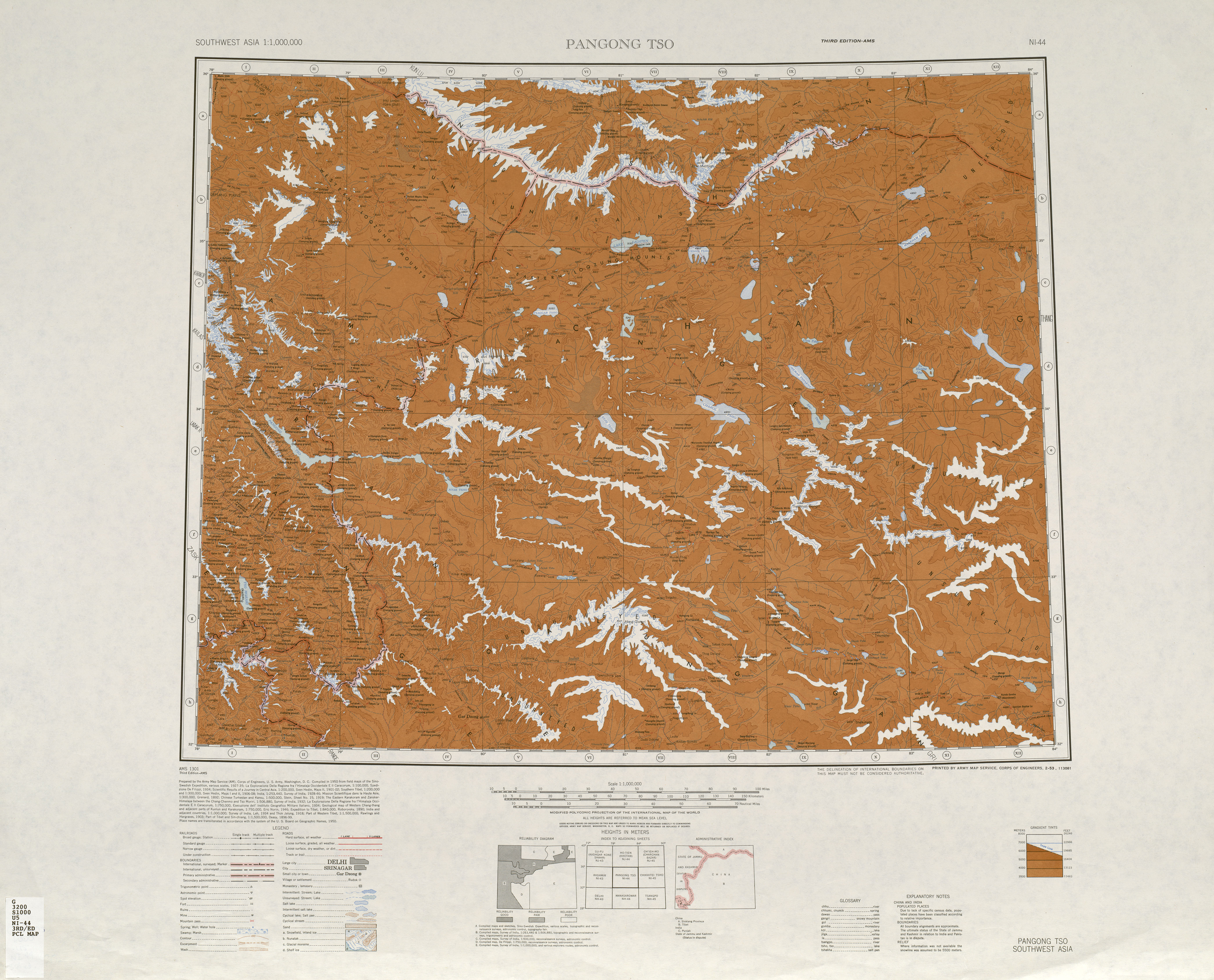
![Map including the southern part of Qira County and the county's border with Tibet (AMS, 1950)[a]](/wiki/File:Txu-oclc-6654394-ni-44-3rd-ed.jpg)
![Map including Qira (labeled as TS'E-LO (CHIRA BAZAR)) and surrounding region (USATC, 1971)[b]](/wiki/File:Txu-oclc-6654394-nj-44-3rd-ed.jpg)

![From the Operational Navigation Chart; map including Qira (labeled as QIRA (TS'E-LE)) (DMA, 1980)[c]](/wiki/File:Operational_Navigation_Chart_G-7,_6th_edition.jpg)
![Map including Qira (labeled as QIRA (TS'E-LE)) (DMA, 1984)[d]](/wiki/File:Txu-pclmaps-oclc-22834566_g-7a.jpg)


메모들
레퍼런스
- ^ a b c d e f g h i j 策勒概况. چىرا ناھىيىسى 策勒县人民政府 (in Simplified Chinese). Archived from the original on 14 December 2019. Retrieved 14 December 2019 – via Internet Archive.
策勒县位于新疆最南端,南枕昆仑山、北临塔克拉玛干大沙漠,县域总面积3.16万平方公里。全县地势总体南高北低,山区平均海拔3200米,平原区海拔1500—1800米。{...}县境内可供人类生存的绿洲面积仅占2.9%,且被沙漠和戈壁分割包围成大小不等的72块,历史上策勒县城因风沙侵袭三次被迫搬迁。策勒县总人口16.8万人,维吾尔族占总人口的98%以上。全县辖6乡2镇1街道,
- ^ a b c d 策勒县历史沿革 [Qira County Historical Development] (in Simplified Chinese). XZQH.org. 2 December 2014. Retrieved 14 December 2019.
2000年第五次人口普查,策勒县常住总人口132139人,{...}2003年,全县总面积31688.01平方千米,{...}2010年第六次人口普查,策勒县常住总人口147050人,其中:策勒镇14562人,策勒乡31123人,固拉哈玛乡26621人,达玛沟乡19250人,恰哈乡15010人,乌鲁克萨依乡4587人,奴尔乡11581人,博斯坦乡6626人,色日克街道15684人,兵团一牧场2006人。 2014年10月20日,自治区政府(新政函[2014]177号)同意撤销固拉合玛乡,设立固拉合玛镇。调整后,全县辖2个镇、6个乡:策勒镇、固拉哈玛镇、策勒乡、达玛沟乡、恰哈乡、乌鲁克萨依乡、奴尔乡、博斯坦乡。
- ^ a b c d e Complete Atlas Of The World (3 ed.). Penguin Random House. 2016. p. 238 – via Internet Archive.
Qira{...}Muztag 7282m
- ^ a b c 3-7 各地、州、市、县(市)分民族人口数 (in Simplified Chinese). شىنجاڭ ئۇيغۇر ئاپتونوم رايونى 新疆维吾尔自治区统计局 Statistic Bureau of Xinjiang Uygur Autonomous Region. Archived from the original on 2017-10-11. Retrieved 2017-09-03.
- ^ a b 1997年策勒县行政区划 [1997 Qira County Administrative Divisions]. XZQH.org (in Simplified Chinese). 6 January 2011. Retrieved 3 April 2020.
和田地区辖县。位于昆仑山北麓、塔克拉玛干沙漠南缘。面积3.6万平方千米,人口12.6万,有维吾尔、汉、回、藏、壮等民族。其中维吾尔族占98.4%,辖1镇7乡。
- ^ 공식 철자는 Zhongguo dimiongl bebe bebebe ( Biging , ShinoMaps Press 1997 ; ISBN 7-5031-1718-4 ; 페이지 308 )에 따르면 "키라"이다.
- ^ Shixin Wang, Baolin Yang, Yi Zhou, Futao Wang, Rui Zhang, Qing Zhao (2018). "Snow Cover Mapping and Ice Avalanche Monitoring from the Satellite Data of the Sentinels". International Archives of Photogrammetry, Remote Sensing and Spatial Information Sciences. 42 (3): 1766. Bibcode:2018ISPAr42.3.1765W. doi:10.5194/ISPRS-ARCHIVES-XLII-3-1765-2018. S2CID 59056188.
{{cite journal}}: CS1 maint: 작성자 파라미터 사용(링크) - ^ a b c "Holding back the sands of time". China Daily. 27 May 2013. Retrieved 15 December 2019.
Qira county was once a kingdom on the ancient Silk Road in the days of the Eastern Han Dynasty (AD 25-220). The county seat has relocated north three times because the sands have eaten up the cultivatable land. The first relocation occurred more than 2,000 years ago and the most recent about 620 years ago. In the 1980s, the county seat faced yet another relocation because the desert was only about 1.5 km away. Many locals were forced to move because their houses were buried under sand, often overnight.{...}Memet Simay's household was one of 446 in Qira township forced to relocate in the 1980s, although the family has since returned to the area. "When I woke up one morning, I found I couldn't open the door because of the weight of sand that had accumulated overnight. My crops were buried too, so I had no choice but to move," he recalled.
- ^ a b Breckle, Siegmar-W; Veste, Maik; Wucherer, Walter (2012-12-06). Siegmar-W. Breckle; Maik Veste; Walter Wucherer (eds.). Sustainable Land Use in Deserts. p. 351. ISBN 978-3-642-64027-8 – via Google Books.
- ^ a b c d e f "NJ 44 Ho-tien". Washington, D. C.: U.S. Army Topographic Command. 1971 – via Perry–Castañeda Library Map Collection.
DUNES{...}STEIN 1900-01{...}WELL{...}Ts'e-lo Ho{...}WU-LU-KO HO SHAN (MO-SHIH SHAN)
- ^ a b 历史沿革. چىرا ناھىيىسى 策勒县人民政府 (in Simplified Chinese). Retrieved 14 December 2019.
民国17年(公元1928年)2月23日,中华民国政府批准将策勒县佐升格为策勒县治,同年,和阗行政长官制改为和田行政长官公署,策勒县隶属新疆省和阗行政长官公署管辖。中华人民共和国成立初,策勒县隶属新疆省和阗行政公署;1955年10月1日,新疆维吾尔自治区成立,策勒县隶属新疆维吾尔自治区和田地区。
- ^ a b 夏征农; 陈至立, eds. (September 2009). 辞海:第六版彩图本 [Cihai (Sixth Edition in Color)] (in Chinese). 上海. Shanghai: 上海辞书出版社. Shanghai Lexicographical Publishing House. p. 230. ISBN 9787532628599.
1929年由于阗县(今于田县)析置。{...}农产有小麦、玉米、小麦、棉花、油料作物及甜瓜、石榴、核桃、桃、杏等。畜产以马、牛、羊为主。工业有电力、建材、轧花、食品加工(果脯)等。
- ^ Ximing Zhang, Xiaoming Li, Henian Zhang (2001). "The Control of Drift Sand on the Southern Fringe of the Taklamakan Desert — an Example from the Cele Oasis". Sustainable Land Use in Deserts. p. 350. doi:10.1007/978-3-642-59560-8_37. ISBN 978-3-642-64027-8.
In the 30 years from the 1950s to the 1980s, shifting sand had moved about 5 km in the village of Cele located on the margin of the Cele county oasis, so that 1.333 ha farmland was desertified.
{{cite book}}: CS1 maint: 작성자 파라미터 사용(링크) - ^ Cheng Yingqi (16 August 2013). "Scientists make land arable again". China Daily. Retrieved 15 December 2019.
- ^ "World's smallest temple discovered in China". Times of India. 2 November 2005. Retrieved 16 December 2019.
The temple, dating back more than 1,500 years, was located about seven kilometres from the Damagou Township of Cele County.
- ^ a b 昆玉市概况地图 (in Simplified Chinese). 24 February 2016. Retrieved 15 December 2019.
辖4个农牧团场(皮山农场、一牧场、47团、224团),其中{...}一牧场驻策勒县、
- ^ a b 昆玉市历史沿革. 24 February 2016. Retrieved 15 December 2019.
- ^ Joshua Lipes, Jilil Kashgary (4 April 2017). "Xinjiang Police Search Uyghur Homes For 'Illegal Items'". Radio Free Asia. Translated by Mamatjan Juma. Retrieved 16 December 2019.
A second announcement, issued Feb. 28 by the Chira (Cele) county government, said those who report individuals for having “stitched the ‘star and crescent moon’ insignia on their clothing or personal items” or the words “East Turkestan”—referring to the name of a short-lived Uyghur republic—on their mobile phone case, purse or other jewelry, were also eligible for cash payments.
{{cite web}}: CS1 maint: 작성자 파라미터 사용(링크) - ^ "'No Sign' of Kazakh Imam Scheduled For Release From Prison in July". Radio Free Asia. 9 August 2017. Retrieved 16 December 2019.
In March, Xinjiang authorities fired an ethnic Uyghur official for holding her wedding ceremony at home according to Islamic traditions instead of at a government-sanctioned venue. Salamet Memetimin, the communist party secretary for Chaka township’s Bekchan village, in Hotan (in Chinese, Hetian) prefecture’s Chira (Cele) county, was among 97 officials recently charged with disciplinary violations, according to an April 10 report by the state-run Hotan Daily newspaper. Local residents said the woman was relieved of her duties for taking her "nikah" marriage vows in her own home. "I think this may be a local policy unique to Xinjiang," the source said. "You have to first apply for a marriage certificate and then carry out the Islamic practice of nikah." "The imams aren't allowed to perform nikah if there is no marriage certificate, or they will be sent to prison."
- ^ Lily Kuo (11 January 2019). "'If you enter a camp, you never come out': inside China's war on Islam". The Guardian (in Simplified Chinese). Retrieved 16 December 2019.
Some local governments are struggling to maintain this pace of spending. In neighbouring Cele county, where authorities expected to have almost 12,000 detainees in vocational camps and detention centres, a budget for 2018 says: “There are still many projects not included in the budget due to a lack of funds. The financial situation in 2018 is very severe.”
- ^ 2019年统计用区划代码和城乡划分代码:策勒镇 [2019 Statistical Area Numbers and Rural-Urban Area Numbers: Qira Town] (in Simplified Chinese). National Bureau of Statistics of the People's Republic of China. 2019. Retrieved 4 May 2020.
653225100210 220 津南新村村委会
- ^ Shi Yinglun, ed. (8 July 2019). "Tianjin helping Xinjiang's football development in China". Xinhua News Agency. Archived from the original on July 8, 2019. Retrieved 16 December 2019.
Memet Azizi, director of Cele County's bureau of education, said that Tianjin's help had brought them hope for the future. With support from Tianjin, a standard football field and training center was constructed at Cele County's No. 1 Primary School.
- ^ a b c d "NI 44 Pangong Tso". Washington, D. C.: Army Map Service. 1950 – via Perry–Castañeda Library Map Collection.
Muztagh Jilga{...}Yurung Kash{...}Chotma (Camping ground){...}Yangi kan (Camping ground){...}Zaiuk (Camping ground){...}Yaskako Tagh (Camping ground){...}Mandar Chap (Camping ground){...}Chumik (Camping ground){...}Mandar Kol Dawan{...}Shalgon Dawan{...}Kuchkash Bulak Dawan{...}Art Dawan
- ^ 미국 국립지리공간정보국 GEOnet Names Server의 Muztag(승인 - N)
- ^ 미국 국립지리공간정보국(National Geospace-Intelligence Agency), GEOnet Names Server의 K5(Variant - V)
- ^ 미국 국립지리공간정보국(National Geospace-Intelligence Agency), GEOnet Names Server의 Mu-shan(Variant - V)
- ^ 미국 국립지리공간정보국(National Geospace-Intelligence Agency, GEOnet Names Server, Non-Roman Script - NS)
- ^ 世界地图集 (in Chinese) (1 ed.). Beijing: 地圖出版社. 1958. p. 66. 统一书号 (National Standard Book Number of China) 12014·449.
策勒{...}木斯山
- ^ 【新疆是个好地方】 “飞‘阅’新疆”之八:昆仑山下“世外桃源”卧龙谷 托起村民致富新希望. Xinhua News Agency (in Simplified Chinese). 20 July 2019. Archived from the original on July 24, 2019. Retrieved 16 December 2019.
卧龙谷位于新疆和田策勒县恰哈乡玉如克塔什村,在它的怀抱里,策勒河带着这里人的喜怒哀乐悠悠地流向远方。
- ^ 2018年统计用区划代码和城乡划分代码:策勒县 [2018 Statistical Area Numbers and Rural-Urban Area Numbers: Qira County] (in Simplified Chinese). National Bureau of Statistics of the People's Republic of China. 2018. Retrieved 15 December 2019.
统计用区划代码 名称 653225100000 策勒镇 653225101000 固拉合玛镇 653225200000 策勒乡 653225202000 达玛沟乡 653225203000 恰哈乡 653225204000 乌鲁克萨依乡 653225205000 奴尔乡 653225206000 博斯坦乡 653225500000 兵团一牧场
- ^ 미국 국립지리공간정보국(National Geospace-Intelligence Agency, GEOnet Names Server, Variant Non-Roman Script - VS)
- ^ Ellsworth Huntington (1907). The Pulse of Asia A Journey in Central Asia Illustrating the Geographic Basis of History. Houghton Mifflin Company. p. 171 – via Internet Archive.
We tried in vain to hire camles at Chira, and so went eastward a few miles to Dumuka, a neighboring village, to try again.
- ^ 미국 국립지리공간정보국(National Geospace-Intelligence Agency, GEOnet Names Server, Variant Non-Roman Script - VS)
- ^ 미국 국립지리공간정보국(National Geospace-Intelligence Agency, GEOnet Names Server, Variant Non-Roman Script - VS)
- ^ Morris Rossabi, ed. (2004). Governing China's Multiethnic Frontiers (PDF). University of Washington Press. p. 180. ISBN 0-295-98390-6.

