A371 도로
A371 road| A371 | |
|---|---|
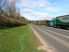
 A371 배스 앤 웨스트 쇼그라운드 근처, 셉튼 말렛 | |
| 경로 정보 | |
| 길이 | 37.6 mi (60.5 km) |
| 주요 접합부 | |
| 남동쪽 끝 | 윈칸톤 51°02′54§ N 2°25′06″w/51.0484°N 2.4182°W |
A37 A39 A38 | |
| 노스웨스트 엔드 | 웨스턴 슈퍼마레 51°20′39″n 2°55′54″w/51.3443°N 2.9317°W |
| 장소 | |
| 나라 | 영국 |
| 도로망 | |
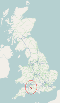
A371은 Wincanton에서 Shepton Mallet, Croscombe, Wells, Westbury-sub-Mendip, Rodney Stoke, Draycott, Cheddar, Axbridge, Winscombe, Ban-Well Weston-Mare를 거쳐 노스 서머셋의 Weston-Mare로 이어지는 영국의 주요 도로입니다.
A371은 A303에서 출발하여 Castle Cary, Ansford, Cannard's Grave(A37에 잠시 합류하는 곳), Shepton Mallet, Croscombe, Wells, Westbury-Sub-Mendip, Rodney Stoke, Draycott, Ceddar, Axbridge(38에 잠시 합류하는 곳)를 지나갑니다.
A371은 Mendip Hills를 지나 Bath and West 쇼그라운드, Wells Cathedral, Wookkey Hole Caves, Cheddar Gorge와 The Helicopter [1]Museum 및 Junction 21 Enterprise Area와 같은 주요 관광지와 가까운 웨스턴-슈퍼-메어 도로를 통과합니다.
레퍼런스


