탤벗 제도
Talbot Islands | |
| 지리 | |
|---|---|
| 위치 | 호주. |
| 좌표 | 9°16′01″S 142°13′01″E / 9.267°S 142.217°E좌표: 9°16′01″S 142°13′01″E / 9.267°S 142.217°E |
| 관리 | |
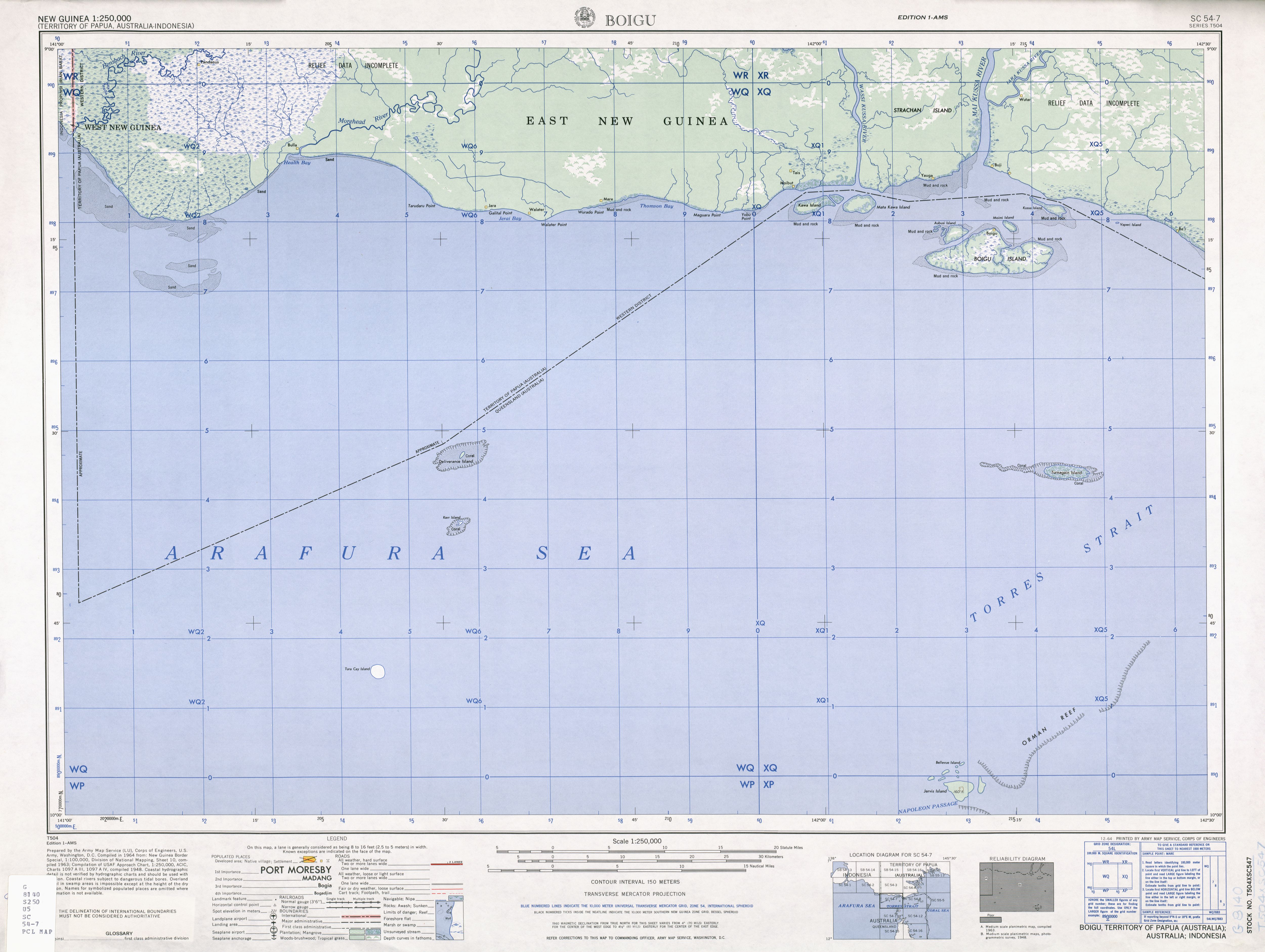
탤벗 제도(Talbot Islands)는 오스트레일리아 퀸즐랜드에 있는 토레스 해협 제도의 한 그룹이다.[1] 이들은 호주 본토와 뉴기니 섬, 사이바이 섬, 토레스 해협에서 서쪽으로 몇 킬로미터 떨어져 있으며, 마이쿠사 강 하구의 파푸아 뉴기니 본토에서 불과 4 킬로미터 떨어져 있다.
탈봇 제도에는 5개의 이름이 붙은 섬과 약 6개의 작은 섬이 있다.
- 보이구 섬
- 모미 섬
- 오부시 섬
- 모에기나카와
- 아이머무드
보아구 섬만이 살고 있다. 보아구 마을은 호주의 최북단 정착지다. 최북단 섬인 모이미 섬은 1978년 토레스 해협 조약에서 뉴기니의 일부를 인정받은 쿠사 섬에서 불과 4km밖에 떨어져 있지 않지만,[2] 오래된 지도에 호주의 일부로 기술되어 있다.[3] Kussa Island and tiny nearby Athian Maza and Yaperi (Vapere) islands, also at the mouth of the Mai Kussa River, are geographically part of the island group, as are the Kawai Islands (Kawa Island, Karobailo Kawa Island, Adabadana Kawa Island and Mata Kawa Island) nine kilometres further west/west-northwest close to the mouth of Wassi Kussa River, w히흐는 1978년 조약 이후 파푸아 뉴기니의 일부였다.[4]
스트라찬 섬은 와시 쿠사 강과 마이 쿠사 강 사이의 큰 강 섬으로 남쪽 해안과 토레스 해협과 국경을 맞대고 있지만 탈봇이나 토레스 해협 제도에 속하지는 않는다. 그것은 사람이 살고 있다.
탈봇 열도는 사이바이, 다우안과 함께 토레스 해협 열도의 탑 웨스턴 섬으로 알려져 있다.
참조
- ^ "Talbot Islands – island group (entry 33165)". Queensland Place Names. Queensland Government. Retrieved 1 August 2021.
- ^ "Treaty between Australia and the Independent State of Papua New Guinea concerning Sovereignty and Maritime Boundaries in the area between the two Countries, including the area known as Torres Strait, and Related Matters [1985] ATS 4". www.austlii.edu.au. Retrieved 3 November 2019.
- ^ http://www.lib.utexas.edu/maps/ams/new_guinea/txu-oclc-6552576-sc54-7.jpg
- ^ "SOUTH COAST OF PAPUA NEW GUINEA—BENSBACH RIVER TO SOUTH CAPE" (PDF). PUB. 164. SAILING DIRECTIONS (ENROUTE). National Imagery and Mapping Agency, United States Government. 2003.
토레스 해협 주제 목록 | |||||||||||||||||||
|---|---|---|---|---|---|---|---|---|---|---|---|---|---|---|---|---|---|---|---|
| 토레스 해협 제도 섬과 케이 |
| ||||||||||||||||||
| 사람, 문화, 커뮤니티 및 언어들 |
| ||||||||||||||||||
| 거버넌스 및 법률상의 문제 |
| ||||||||||||||||||
| 건물 및 구조물 | |||||||||||||||||||
| 기타 | |||||||||||||||||||