서머스턴
Summerston| 서머스턴 | |
|---|---|
 아로차르 가의 아파트 단지 | |
 서머스턴 글래스고 내 위치 | |
| OS 그리드 참조 | NS570702 |
| 평의회 | |
| 부관영역 |
|
| 나라 | 스코틀랜드 |
| 소버린 주 | 영국 |
| 포스트타운 | 글래스고 |
| 우편 번호 구 | G23 |
| 디알링 코드 | 0141 |
| 경찰 | 스코틀랜드 |
| 불 | 스코틀랜드의 |
| 구급차 | 스코틀랜드의 |
| 영국 의회 | |
| 스코틀랜드 의회 | |
서머스턴(Summerston)은 스코틀랜드 글래스고의 주거 지역이다. 1970년대에 대부분의 주택이 건설되어 도시의 북쪽 끝에 위치하고 있으며 더 큰 메리힐 지구의 일부로 간주되지만 우편번호가 다르다. 다른 인근 지역들은 남쪽으로는 길쇼칠, 남동쪽으로는 캐더가 있다.[1] 북동쪽으로 개방된 농지를 가진 서머스턴은 켈빈 강과 골프장에 의해 베어스덴 마을의 남쪽 부분과 북서쪽으로 분리되어 있다.
편의시설
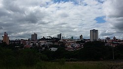
.jpg)
서머스턴은 영국 자선단체인 라이딩 포 장애인들에 의해 운영되는 라이딩 스쿨을 운영하고 있다.[2] 이 지역에는 세인트 블레인 프라이머리(St Blane's Primary[3])와 존 폴 아카데미(John Paul Academy)도 있다.
제4회 글래스고우 스카우트 비버 콜로니 및 큐브 스카우트 팩은 101 인버스히엘 로드의 칼더큐일트 초등학교를 거점으로 하고 있다. 1995년 개교 이래 가장 인기 있는 서머스턴의 패밀리 러닝 앤 아웃 오브 스쿨 센터인 서머스턴 육아(Summerston Knowling)의 집이기도 하다. 클럽을 운영하는 매리힐 해리어스는 존 폴 아카데미는 물론 다양한 클럽들과 학교에서 다양한 피트니스 수업과 함께 저녁에 만난다. 서머스턴은 또한 화학자인 [4]ASDA를 포함한 몇 개의 큰 가게를 가지고 있다. 이전에 B&M 바겐, 파운드레처 매장, 그리고 그들이 이후에 제거된 바닥재 가게가 있었고 새로운 가게들이 아이슬란드와 주택 바겐으로 소문이 나 있는 곳을 만들기 위해 건물을 리모델링했다.
2021년 7월 현재 현재 상점들이 문을 연다. 아스다, 홈 바겐, 그레그스, 아이슬란드.
서머스턴에서 메리힐 공원으로 들어가는 입구는 테니스장, 어린이 놀이 공간, 산책로가 있다.
거주 거리는 대부분 스코틀랜드의 고원과 섬에서 이름을 따왔다. 여기에는 고르스탄, 카보스트, 톨스타, 아르데시, 로치 물라르치, 밀로바그와 같은 불명확한 장소들이 포함된다.
역사


현재의 서머스턴 역은 대략 켈빈 계곡 철도에 있던 원래 철도의 남쪽 1+1/4 마일.[8] 원래 역은 켈빈 강의 북쪽과 서쪽이었고, 서머스턴 농장과 코타지[9], 그리고 안토닌 장벽의 포틀렛 부지에 가까웠다.[10] 이 포기는 1980년 공중 관측에서 발견되었다.[11] 켈빈 남쪽의 임시 행군 캠프는 1978년에도 공중에서 발견되었다. 1694년 이전에 서머스턴 농장에서 사암 거리 슬라브가[12] 발견되었다. 돌에서 찍은 스캔 영상이 제작되었다.[13] '신부 슬래브'를 연상시키는 슬래브는 제2군단이 만든 것으로 헬멧을 쓴 마부와 나체 포로가 그려져 있다.[14] 그것은 지금 글래스고의 헌터 박물관에 있다.[15] 슬라브는 아마도 원래 밝은 색소로 칠해져 있었을 것이다.[16] 이 색깔들은 엑스레이와 레이저 기술을 사용하여 발견되었다.[17] 이 석판에는 얼굴, 몸, 다리에 밝은 붉은 피를 가진 원주민들이 보였다.[18] 이 요새의 이웃들은 서쪽으로는 베어스덴에 있었고 동쪽으로는 발무일디에 있었다.
또 다른 서머스턴 슬라브는 캐슬힐 근처에서 발견된 슬라브와 비교될 수 있다. 두 개의 비슷한 슬래브 모두 던토셔의 다른 두 개와 마찬가지로 두 개의 장식적인 펠타 방패를 가지고 있는데 하나는 슬래브 양쪽에 있다. 각 방패의 뿔은 캐슬힐 슬래브에 세 개의 로제트로 장식되어 있는 반면 서머튼 슬래브에는 두 개의 그리핀의 머리 속에 이러한 끝이 있다.
첫 번째, 심하게 휘어진 슬라브는 방패와 비문 사이에 네 개의 로제트가 있다. 1803년 로우 밀로찬 농장에서 발견되었다. 나중에 이스트 밀리헨으로 불리는 이 농장은 서머스턴 근처에 있다.[19] 비둘기코트에 세워졌고, 제6군단에 의해 3666.5보 성벽의 건물을 기록하고 있다. 맥도날드는 이 작업을 거친 것으로 묘사하고 있으며, 일부 약어가 특이하다고 한다. 그는 그것이 서머스턴에서 6번(RIB 2193)이라고 부르는 것과 나란히 섰다고 제안한다. 비슷한 캐슬힐 슬라브(RIB 2196)에서 그는 돌 절단기가 실수를 해서 4번째 줄에 F(피델리스를 위한) 글자를 써야 하는 P자를 만들었다고 제안한다. 캐슬힐 슬라브도 3666.5 페이스를 기록하고 있지만 사용된 단위는 연구가 진행 중인 사안이다.[20]


서머스턴과 발무일디 사이의 켈빈 강 위에 로마 다리의 증거가 몇 가지 있다.[28] 서머스턴은 스트라스블레인의 교구의 일부였다.[29] 철석과[30] 석탄은[31] 역사적으로 그 지역에서 채굴되었다.

참조
- ^ "North West (1950)". The Glasgow Story. Retrieved 22 October 2018.
- ^ "RDA Groups". www.rda.org.uk. Retrieved 27 January 2017.
- ^ Stewart, Catriona (19 December 2016). "St Blane's Primary hailed by education bosses". Evening Times. Retrieved 28 April 2018.
- ^ "Asda Maryhill Superstore - opening times & facilities". storelocator.asda.com. Retrieved 27 January 2017.
- ^ "RIB 2193. Distance Slab of the Second Legion". Roman Inscriptions of Britain. Retrieved 18 November 2017.
- ^ Macdonald, Sir George (1934). The Roman wall in Scotland, by Sir George Macdonald (2d ed., rev., enl., and in great part rewritten ed.). Oxford: The Clarendon press. pp. 373–376. Retrieved 11 October 2017.
- ^ "Distance Slab of the Second Legion , Balmuildy". Retrieved 25 November 2017.
- ^ "Summerston [1st]". Scotrail. Retrieved 28 April 2018.
- ^ "Summerston Farm and Cottages". Open Street Map. Retrieved 18 November 2017.
- ^ "OS 25 inch map 1892-1949, with Bing opacity slider". National Library of Scotland. Ordnance Survey. Retrieved 12 October 2017.
- ^ "Summerston Antonine Wall Fortlet & Camp". Roman Britain. Retrieved 25 November 2017.
- ^ "Distance Slabs". The Antonine Wall. CastlesFortsBattles.co.uk network. Retrieved 27 October 2017.
- ^ "Distance Slab of the Second Legion , Balmuildy". Retrieved 25 November 2017.
- ^ "RIB 2193. Distance Slab of the Second Legion". Roman Inscriptions of Britain. Retrieved 18 November 2017.
- ^ "distance slab of the Second Legion, recording the completion of 3666.5 paces". Hunterian Museum Archaeology & Ethnography Collections: GLAHM F.5. University of Glasgow. Retrieved 18 November 2017.
- ^ "University of Glasgow research finds red and yellow paint on Antonine Wall". University of Glasgow. University news. 20 April 2018. Retrieved 27 April 2018.
- ^ Campsie, Alison (18 April 2018). "Original colour scheme of Antonine Wall revealed". The Scotsman. Retrieved 28 April 2018.
- ^ Harrison, Jody (20 April 2018). "Grisly secrets of the Antonine wall revealed". The Herald. Retrieved 28 April 2018.
- ^ "OS 25 inch map 1892-1949, with Bing opacity slider". National Library of Scotland. Ordnance Survey. Retrieved 12 October 2017.
- ^ Krakowka, Kathryn. "Meticulous metric survey of the Antonine Wall". Current Archaeology. Retrieved 28 April 2018.
- ^ Historic Environment Scotland. "East Millichen (44473)". Canmore. Retrieved 5 May 2018.
- ^ Macdonald, Sir George (1934). The Roman wall in Scotland, by Sir George Macdonald (2d ed., rev., enl., and in great part rewritten ed.). Oxford: The Clarendon press. pp. 376–377. Retrieved 11 October 2017.
- ^ "OS 25 inch map 1892-1949, with Bing opacity slider". National Library of Scotland. Ordnance Survey. Retrieved 12 October 2017.
- ^ "Distance Slab from the Antonine Wall (A.1942.18)". Sketchfab. glasgowmuseums. Retrieved 5 May 2018.
- ^ "A.1942.18EastMillichenSlab". Retrieved 9 November 2018.
- ^ "RIB 2196. Distance Slab of the Sixth Legion". Roman Inscriptions of Britain. Retrieved 18 November 2017.
- ^ Macdonald, Sir George (1934). The Roman wall in Scotland, by Sir George Macdonald (2d ed., rev., enl., and in great part rewritten ed.). Oxford: The Clarendon press. pp. 377–381. Retrieved 11 October 2017.
- ^ Miller, S. N. (1952). The Roman Occupation Of South Western Scotland Being Reports Of Excavations And Surveys Carried Out Under The Auspices Of The Glasgow Archaeological Society By John Clarke, J. M. Davidson, Anne S. Robertson, J. K. St. Joseph, Edited For The Society With An Historical Survey By S. N. Miller. Glasgow: Robert Maclehose & Company Limited. pp. 88–94. Retrieved 11 October 2017.
- ^ Smith, John Guthrie (1886). The parish of Strathblane and its inhabitants from early times: a chapter in Lennox history. Glasgow: J. Maclehose and sons. p. 16. Retrieved 28 April 2018.
- ^ Summary of progress (of the Geological survey ... and Museum of practical geology) . London: Wyman and sons, limited , Printed for H.M. Stationery office. pp. 100–101. Retrieved 28 April 2018.
- ^ Historic Environment Scotland. "Garscube Colliery (132087)". Canmore. Retrieved 28 April 2018.
외부 링크
| 위키미디어 커먼즈에는 서머스턴과 관련된 미디어가 있다. |