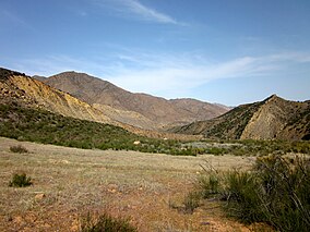
세스페 와일더니스
Sespe Wilderness| 세스페 와일더니스 | |
|---|---|
 | |
| 위치 | 캘리포니아, 미국 |
| 가장 가까운 도시 | 캘리포니아 주, 벤추라 |
| 좌표 | 34°35006nN 119°01′12″w/34.585°N 119.02°W좌표: 34°35°06°N 119°01°12°W / 34.585°N 119.02°W / [1] |
| 지역 | 219,700에이커 (88,900ha) |
| 설립된 | 1992 |
| 이사회 | 미국 산림청 |
Sespe Wilderness는 캘리포니아 남부 Ventura 카운티에 있는 Los Padres 국유림(LPNF) 내에 있는 토파토파 산맥 동부와 시에라 펠로나 산맥에 있는 219,700에이커(88,900ha)의 황무지입니다.자연보호구역은 주로 LPNF의 오자이 및 피노스산 감시구역 내에 있다.
이 황무지는 1992년 미국 의회가 로스 파드리스 콘도르 산맥과 하천보호법의 일부로 조성한 것이다.같은 법으로 추마시, 가르시아, 마체스나 산, 마틸리야,[2][3] 실버 피크 황야 지역도 설립되었습니다.세스페 콘도르 성역은 세스페 황야 안에 있다.캘리포니아 콘도르의 번식 및 성장을 촉진하기 위해 설립되었으며 일반인에게 [4][5]공개되지 않았습니다.
특징들
세스페 황무지는 주로 채파랄로 뒤덮인 지형이며 캘리포니아 참나무 숲과 강변 서식지가 있습니다.세스페 크릭의 일부가 이곳을 통해 흐른다.
황무지에는 등산로, 다년생 및 계절에 따른 하천, 폭포, 온천, 암반 형성, 지정된 야영지 등이 있다.
남부 로스 파드리스 국유림의 인근 황무지에는 마틸랴 황무지(서쪽)와 추마쉬 황무지(북서쪽)가 있습니다.딕 스미스 와일더너스는 더 북서쪽에 있다.
「 」를 참조해 주세요.
레퍼런스
- ^ "Sespe Wilderness". Geographic Names Information System. United States Geological Survey. Retrieved August 27, 2015.
- ^ "George Bush: Statement on Signing the Los Padres Condor Range and River Protection Act". The American Presidency Project. Retrieved 20 January 2018.
- ^ "Los Padres Condor Range and River Protection Act". Act of June 19, 1992 (PDF). Retrieved January 19, 2018.
- ^ "Sespe Wilderness". Wilderness.net. Retrieved August 27, 2015.
- ^ "Sespe Wilderness". U.S. Forest Service. Retrieved August 27, 2015.


