랄리차 빙하
Ralitsa Glacier| 랄리차 빙하 | |
|---|---|
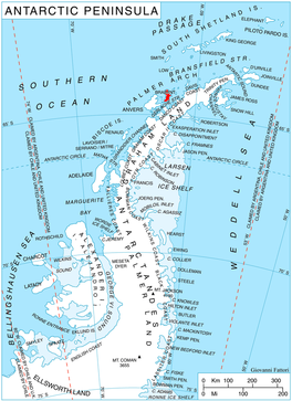
 남극 반도 지역의 브라반트 섬 위치 | |
남극의 랄리차 위치 | |
| 위치 | 파머 군도 |
| 좌표 | 64°07′10″S 62°29′20″w/64.11944°S 62.4889°W |
| 길이 | 3nmi(6km; 3mi) |
| 폭 | 2nmi(4km, 2mi) |
| 두께 | 알 수 없는 |
| 터미네이터스 | 구유 만 |
| 상태 | 알 수 없는 |
Ralitsa Glacier (Bulgarian: ледник Ралица, romanized: lednik Ralitsa, IPA: [ˈlɛdnik ˈralit͡sɐ]) is the 5.5 km long and 3.5 km wide glacier on Brabant Island in the Palmer Archipelago, Antarctica, situated south of Oshane Glacier, southwest of Lister Glacier, northwest of the head of Paré Glacier and north of Palilula Glacier.스트리보그 산맥에 있는 로키탄스키 산의 북서쪽 경사면을 배수하고, 북서쪽으로 구유 만으로 흐른다.
빙하는 북동부와 불가리아 남부에 있는 랄리차 정착지의 이름을 따서 지어졌다.
위치
Ralitsa Glacier is centred at 64°07′10″S 62°29′20″W / 64.11944°S 62.48889°WCoordinates: 64°07′10″S 62°29′20″W / 64.11944°S 62.48889°W.1980년과 2008년의 영국 지도 제작.
참고 항목
지도
- 남극 디지털 데이터베이스(ADD).척도 1:2500 남극 지형도남극 연구 과학 위원회(SCAR1993년 이후, 정기적으로 업그레이드되고 업데이트되었다.
- 영국령 남극 지역.척도 1:200,000 지형도.DOS 610 시리즈, 시트 W 64 62.1980년 영국 톨워스 해외조사국.
- 브라반트 섬에서 아르헨티나 섬까지척도 1:250000 지형도.2008년 영국 남극 조사.
참조
- 불가리아 남극 가제터.남극 지명 위원회.(불가리아어로 세부사항, 영어로 된 기본 데이터)
- 랄리차 빙하.SCAR 복합 남극 가제터.
외부 링크
- 랄리차 빙하.코퍼닉스 위성 이미지
이 기사는 허가를 받아 사용되는 불가리아 남극지명위원회의 정보를 포함하고 있다.


