제너 빙하
Jenner Glacier| 제너 빙하 | |
|---|---|
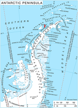
 남극 반도 지역의 브라반트 섬 위치 | |
남극의 제너 위치 | |
| 위치 | 파머 군도 |
| 좌표 | 64°27˚S 62°35˚W/64.450°S 62.583°W/ -64.450; -62.583 |
| 길이 | 3nmi(6km; 3mi) |
| 두께 | 알 수 없는 |
| 터미네이터스 | 뒤페레 만 |
| 상태 | 알 수 없는 |
Jenner Glacier (64°27′S 62°35′W / 64.450°S 62.583°W / -64.450; -62.583Coordinates: 64°27′S 62°35′W / 64.450°S 62.583°W / -64.450; -62.583) is a glacier 3 nautical miles (6 km) long flowing southwest from the Solvay Mountains between Paprat Peak and Kondolov Peak into the eastern arm of Duperré Bay, in the southern part of Brabant Island in the Palm남극 대륙의 군도.
이 빙하는 1953년 아르헨티나 정부 차트에 공개되었지만 이름은 밝혀지지 않았다.1956-57년 Hunting Aerosurveys Ltd.에 의해 촬영되고 1959년 이 사진들에서 지도화된 이 사진은 예방의학의 선구자였으며 천연두 예방접종에 소두백신을 사용하게 된 영국인 의사 에드워드 제너(Endward Jenner)의 영국 남극지명위원회에 의해 명명되었다.[1]
참고 항목
지도
- 남극 디지털 데이터베이스(ADD).척도 1:2500 남극 지형도남극 연구 과학 위원회(SCAR1993년 이후, 정기적으로 업그레이드되고 업데이트되었다.
- 영국령 남극 지역.척도 1:200,000 지형도.DOS 610 시리즈, 시트 W 64 62.1980년 영국 톨워스 해외조사국.
- 브라반트 섬에서 아르헨티나 섬까지척도 1:250000 지형도.2008년 영국 남극 조사.
참조
- ^ "Jenner Glacier". Geographic Names Information System. United States Geological Survey. Retrieved 23 July 2012.


