한센 빙하
Hansen Glacier| 한센 빙하 | |
|---|---|
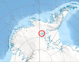
 남극 서부의 센티넬 산맥 위치 | |
남극 한센 빙하의 위치 | |
| 위치 | 엘즈워스 랜드 |
| 좌표 | 78°21′00″S 84°33′00″w / 78.35000°S 84.55000°W |
| 길이 | 10해리(19km; 12mi) |
| 두께 | 알 수 없는 |
| 터미네이터스 | 다터 빙하 |
| 상태 | 알 수 없는 |
Hansen Glacier (78°21′S 84°33′W / 78.350°S 84.550°WCoordinates: 78°21′S 84°33′W / 78.350°S 84.550°W) is a tributary glacier 10 nautical miles (19 km; 12 mi) long, flowing northeast from Mount Tuck between Veregava Ridge and Doyran Heights to join Dater Glacier west of Dickey Peak, in the Sentinel Range of the E남극의 llsworth 산맥.
미국 지질조사국이 1957~59년 조사와 미 해군 항공사진으로부터 처음 지도를 받았고, 허버트 L의 남극이름 자문위원회에서 이름을 올렸다. 1957년 남극역 기상학자 한센.[1]
참고 항목
지도
- 빈슨 마시프. 척도 1:250,000의 지형도. 버지니아 주 레스턴: 1988년 미국 지질조사국
- 남극 디지털 데이터베이스(ADD). 척도 1:2500 남극 지형도 남극 연구 과학 위원회(SCAR 1993년 이후, 정기적으로 업데이트되었다.
참조
- ^ "Hansen Glacier". Geographic Names Information System. United States Geological Survey. Retrieved 2012-05-21.
 이 문서에는 미국 지질조사국(Geographic Names Information System)의 공용 도메인 자료가 통합되어 있다.


