코데트
Codette코데트 | |
|---|---|
| 코데트의 마을 | |
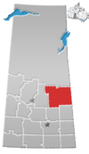
서스캐처원의 코데트 위치 | |
| 좌표:53°09′52″N 104°00′48″w/53.164407°N 104.013320°W | |
| 나라 | |
| 주 | |
| 지역 | 동중앙 |
| 인구조사과 | 14 |
| 농촌시 | 니파윈로487번길 |
| 정부 | |
| • 유형 | 시영 |
| • 관리 기관 | 코데트 마을 협의회 |
| • 시장 | 말콤 하베룬 |
| • 관리자 | 나탈리 힙킨스 |
| 면적 | |
| • 육지 | 0.37km2(0.14 sq mi) |
| 인구 (2016) | |
| • 합계 | 198 |
| • 밀도 | 539.2/km2(1,397/sq mi) |
| 시간대 | UTC-6(CST) |
| 우편번호 | S0E 0P0 |
| 지역 번호 | 306 |
| 고속도로 | |
코데트(2016년 인구: 1988)는 니파윈 487번 농촌시 및 인구조사과 14번 내에 있는 캐나다 서스캐처원 주의 마을이다.마을은 니파윈에서 남쪽으로 10km 떨어진 35번 국도와 789번 국도 분기점에 위치해 있다.
역사
코데트는 1929년 3월 9일 마을로 편입되었다.[1]이 공동체는 프랑수아 핀레이 댐에 가로막혀 있는 사스카처원 강의 인공호수인 코데트 호수 인근과 이름을 공유하고 있다.
인구통계학
캐나다 통계청이 실시한 2021년 인구총조사에서 코데트는 전체 민간주거 105개 중 95개 지역에 180명의 인구가 거주하고 있어 2016년 인구 198개에서 -9.1%의 변화가 있었다.국토면적이 0.41km2(0.16sqmi)로 2021년 인구밀도가 439.0/km2(1,137.1/sqmi)에 달했다.[4]
2016년 인구총조사에서 코데트 마을은 전체 민간주거 105채 중 103채에 198명이 거주하고 있어 2011년 인구 205채에 비해 -3.5%의 변화가 있었다.국토면적이 0.37km2(0.14sqmi)로 2016년에는 인구밀도가 535.1/km2(1,386.0/sqmi)로 나타났다.[5]
참고 항목
참조
- ^ "Urban Municipality Incorporations". Saskatchewan Ministry of Government Relations. Archived from the original on October 15, 2014. Retrieved June 1, 2020.
- ^ "Saskatchewan Census Population" (PDF). Saskatchewan Bureau of Statistics. Archived from the original (PDF) on September 24, 2015. Retrieved May 31, 2020.
- ^ "Saskatchewan Census Population". Saskatchewan Bureau of Statistics. Retrieved May 31, 2020.
- ^ "Population and dwelling counts: Canada, provinces and territories, census divisions and census subdivisions (municipalities), Saskatchewan". Statistics Canada. February 9, 2022. Retrieved April 1, 2022.
- ^ "Population and dwelling counts, for Canada, provinces and territories, and census subdivisions (municipalities), 2016 and 2011 censuses – 100% data (Saskatchewan)". Statistics Canada. February 8, 2017. Retrieved May 30, 2020.


