마렝고, 서스캐처원
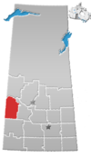
Marengo, Saskatchewan사스카처완의 마렝고 위치
마렝고(2016년 인구: 67년)는 밀턴 292번 농촌시 및 인구조사과 13번 내에 있는 캐나다 서스캐처원 지방의 마을이다.킨더슬리에서 서쪽으로 약 45km(28mi) 떨어져 있다.선웨스트 학부 내에 위치한다.
역사
마렝고는 1910년 11월 5일 마을로 편입되었다.[1]이 마을은 원래 멜버른이라는 이름으로 편입되었는데, 아마도 캐나다 북부 철도가 붙인 예비 이름이었을 것이다.그러나 우체국에는 1911년 개척자 J. 레이 굿리치의 고향인 일리노이주 마렝고의 이름을 따서 마렝고라는 이름이 붙여졌다.이후 1911년, 우체국에서 "멜본"을 허용하지 않았기 때문에 목장의 관리인을 따라 풀러로 이름이 바뀌었다.3년 후 다시 마렝고로 바뀌었다.[2]
2020년 10월 8일, 마을에서 곡물 엘리베이터에 불이 붙었는데, 화재는 예상되었고 아무도 다치지 않았다.[3]
인구통계학
캐나다 통계청이 실시한 2016년 인구총조사에서 마렝고 마을은 전체 민박 36채 중 29채에 67명의 인구를 기록해 2011년 인구 47채에 비해 29.9%의 변화가 있었다.국토면적이 0.87km2(0.34sqmi)로 2016년 인구밀도가 77.0/km2(199.5/sqmi)에 달했다.[6]
2011년 인구조사에서 마렝고 마을은 47명의 인구를 기록했는데, 이는 2006년 인구 51명에서 -7.8%의 변화였다.국토면적이 0.87km2(0.34sqmi)로 2011년 인구밀도가 54.0/km2(139.9/sqmi)에 달했다.[7]
참조
- ^ "Urban Municipality Incorporations". Saskatchewan Ministry of Government Relations. Archived from the original on October 15, 2014. Retrieved June 1, 2020.
- ^ Barry, Bill (September 2005). Geographic Names of Saskatchewan. Regina, Saskatchewan: People Places Publishing, Ltd. p. 272. ISBN 1-897010-19-2.
- ^ "Marengo, Sask, still in shock after major fire".
- ^ "Saskatchewan Census Population" (PDF). Saskatchewan Bureau of Statistics. Archived from the original (PDF) on September 24, 2015. Retrieved May 31, 2020.
- ^ "Saskatchewan Census Population". Saskatchewan Bureau of Statistics. Retrieved May 31, 2020.
- ^ "Population and dwelling counts, for Canada, provinces and territories, and census subdivisions (municipalities), 2016 and 2011 censuses – 100% data (Saskatchewan)". Statistics Canada. February 8, 2017. Retrieved May 30, 2020.
- ^ "Population and dwelling counts, for Canada, provinces and territories, and census subdivisions (municipalities), 2011 and 2006 censuses (Saskatchewan)". Statistics Canada. June 3, 2019. Retrieved May 30, 2020.


