틴달 산맥
Tyndall Range| 틴달 산맥 | |
|---|---|
| 틴달스 | |
 틴달스 지역 항공 사진 | |
| 최고점 | |
| 절정 | 틴달 산 |
| 승진 | 1,868 m (3,868 피트) AHD |
| 좌표 | 41°554848sS 145°35′24″e/41.93000°S 145.59000°E[1] |
| 지리 | |
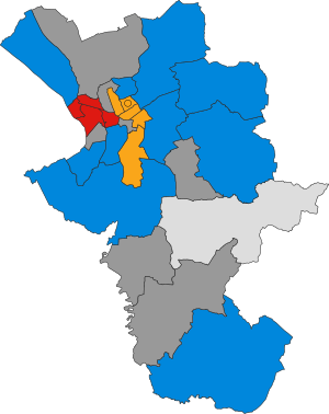
 태즈메이니아 주 소재지 | |
| 나라 | 호주. |
| 주 | 태즈메이니아 주 |
| 지역 | 서태즈메이니아 주 |
| 범위 좌표 | 41°56′24§ S 145°35′24″e/41.94000°S 145.59000°E좌표: 41°56°24°S 145°35°24°E / 41.94000°S 145.59000°E / [2] |
| 부모 범위 | 서해안 산맥 |
| 지질학 | |
| 록의 시대 | 쥐라기 |
| 암석의 종류 | 돌라이트 |
흔히 Tyndalls라고 불리는 Tyndall 산맥은 호주 태즈메이니아 서부 지역에 위치한 서부 해안 산맥의 일부이다.
이 산맥의 주요 초점은 산맥의 북쪽에 있는 타인달 산이다.앤서니 로드에서는 서부 슬로프 전체를 조망할 수 있는 반면, 틴달스의 형성과 같은 고원은 공중에서 또는 도보로 조망해야 하는 도로 프리 지역입니다.
범위 내에는 크래들 마운틴-레이크 세인트클레어 국립공원 세계유산 지역의 [3]서쪽 완충지대인 자연보호구역인 Tyndall Regional Reserve가 있다.그 지역은 세지윅 산의 북쪽에 있다.
Tyndalls는 1877년 James Reid Scott에 의해 물리학, 대기과학, [4]지질학에서 중요한 공헌을 한 지질학회 연구원인 John Tyndall 교수에게 경의를 표하기 위해 Thomas Bather Moore의 제안으로 명명되었다.
특징들
Tyndall 산맥에는 많은 빙하 호수가 있으며, 더 큰 호수는 Huntley 호수, Rolleston 호수, Tyndall 호수, Matthew 호수입니다.빙하의 징후는 1894년 [5][6][7]토마스 배더 무어에 의해 처음 기술되었다.
Tyndalls는 20세기 초에 광물을 탐사했지만,[8][9] 이렇다 할 광산은 없었다.
Tyndalls는 Henty Gold Mine의 남동쪽, Hydro Tasmania 댐은 Henty River의 상류와 Mackintosh 호수, Murchison 호수, Tullah의 남쪽에 있습니다.그들은 스티히트 산맥 서쪽에 있다.
「 」를 참조해 주세요.
레퍼런스
- ^ "Mount Tyndall (TAS)". Gazetteer of Australia online. Geoscience Australia, Australian Government.
- ^ "Tyndall Range (TAS)". Gazetteer of Australia online. Geoscience Australia, Australian Government.
- ^ Tyndall (Map) (2 ed.). Tasmap. 2007. Sheet 3835.
- ^ Baillie, Peter (2010). "The West Coast Range, Tasmania: Mountains and Geological Giants" (PDF). Papers and Proceedings of the Royal Society of Tasmania (reprint ed.). Hobart, Tasmania: University of Tasmania. 144: 1–13. ISSN 0080-4703. Retrieved 18 June 2015.
- ^ Moore, Thomas Bather (1893), Discovery of glaciation in the vicinity of mount Tyndall, in Tasmania, retrieved 21 June 2015
- ^ "CURRENT TOPICS". Launceston Examiner. Tas. 22 June 1894. p. 4. Retrieved 9 June 2012 – via National Library of Australia.
- ^ Bowden, Adrian Russell (1974), The glacial geomorphology of the Tyndall Mountains, western Tasmania, retrieved 21 June 2015
- ^ "AN ABANDONED DISTRICT". The Examiner (DAILY ed.). Launceston, Tasmania. 12 March 1909. p. 2. Retrieved 23 February 2012 – via National Library of Australia.
- ^ White, Matthew J (1996), Stratigraphy, volcanology and sedimentology of the Cambrian Tyndall Group, Mount Read volcanics, western Tasmania, retrieved 21 June 2015
추가 정보
- Corbett, K. D.; Jackson, J. C. (1987). "Geology of the Tyndall Range area [cartographic material]" (Map). Mt. Read Volcanics project: map. 5. 1:25,000. Hobart: Geological Survey of Tasmania, Dept. of Mines.
- Blainey, Geoffrey (2000). The Peaks of Lyell (6th ed.). Hobart: St. David's Park Publishing. ISBN 0-7246-2265-9.
- Whitham, Charles. Western Tasmania: A Land of Riches and Beauty.
외부 링크
- Google 지도의 서해안 범위
- https://web.archive.org/web/20070907132410/http://www.parks.tas.gov.au/wha/wherein/detail.html – 세계유산 지역 상황