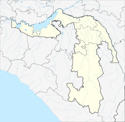
일리노이 주 위네바고 카운티 셜랜드 타운쉽
Shirland Township, Winnebago County, Illinois셜랜드 타운쉽 | |
|---|---|
타운쉽 | |
 위네바고 현의 위치 | |
| 좌표:42°28′08″N 89°12′12″w/42.46889°N 89.20333°W좌표: 42°28′08″N 89°12′12″W / 42.46889°N 89.20333°W/ ) | |
| 나라 | 미국 |
| 주 | 일리노이 주 |
| 카운티 | 위네바고 |
| 확립된 | 1849년 11월 6일 |
| 정부 | |
| • 감독자 | 헬렌 위버 |
| 면적 | |
| • 합계 | 19.28 sq mi(49.9km2) |
| • 육지 | 19.2 sq mi(50km2) |
| • 물 | 0.08 sq mi(0.2km2) 0.41% |
| 표고 | 801ft(244m) |
| 인구 (2010) | |
| • 견적 (2016)[1] | 958 |
| • 밀도 | 51.5/sq mi(19.9/km2) |
| 시간대 | UTC-6(CST) |
| • 여름(DST) | UTC-5(CDT) |
| FIPS 코드 | 17-201-69615 |
| [2][3] | |
셜랜드 타운쉽은 일리노이 주 위네바고 카운티에 위치해 있다.그것은 셜랜드의 비법인 공동체를 포함한다.
2010년 인구조사 기준 인구는 988명이고 423채의 주택을 포함하고 있다.[4]
지리
2010년 인구조사에 따르면 읍면적은 총 19.28제곱마일(49.9km2)이며, 이 중 19.2제곱마일(50km2)은 토지, 0.08제곱마일(0.21km2)은 물이다.[4]
인구통계학
| 역사인구 | |||
|---|---|---|---|
| 인구조사 | Pop. | %± | |
| 2016년(최상) | 958 | [1] | |
| 미국 십수년 인구[5] 조사 | |||
참조
- ^ a b "Population and Housing Unit Estimates". Retrieved June 9, 2017.
- ^ 미국 지질조사국 지리적 이름 정보 시스템:셜랜드의 행정 구역
- ^ Illinois Regional Archives Depository System. "Name Index to Illinois Local Governments". Illinois State Archives. Illinois Secretary of State. Retrieved 19 September 2014.
- ^ a b "Population, Housing Units, Area, and Density: 2010 - County -- County Subdivision and Place -- 2010 Census Summary File 1". United States Census. Archived from the original on 2020-02-12. Retrieved 2013-05-28.
- ^ "Census of Population and Housing". Census.gov. Retrieved June 4, 2016.
외부 링크


