패턱센트 리버 주립공원
Patuxent River State Park| 패턱센트 리버 주립공원 | |
|---|---|
 Patuxent River State 공원 본부, 방문객 센터 및 자연 센터 | |
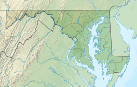
| 위치 | 하워드 군 & 몽고메리 군, 미국 메릴랜드 주 |
| 가장 가까운 마을 | 메릴랜드 주 올니 |
| 좌표 | 39°15′34″n 77°04′53″W / 39.25944°N 77.08139°W좌표: 39°15′34″N 77°04′53″W / 39.25944°N 77.08139°W/ [1] |
| 면적 | 6,703에이커(27.13km2)[2] |
| 표고 | 407 ft(평방미터 m)[1] |
| 지정 | 메릴랜드 주립공원 |
| 확립된 | 1963 |
| 관리자 | 메릴랜드 천연자원부 |
| 웹사이트 | 패턱센트 리버 주립공원 |
패턱센트 리버 스테이트 파크는 하워드 주의 패턱센트 강 상류와 메릴랜드 주의 몽고메리 카운티에 위치한 공공 휴양 지역이다. 주립공원은 수렵, 낚시, 산악자전거, 승마, 그리고 서명되지 않은 오솔길에서의 하이킹을 특징으로 한다.[3] 1963년 메릴랜드 총회가 1964년부터 1968년까지 매년 토지 매입에 자금을 지원하면서 공원 계획이 시작되었다.[4][5] 그것은 북동 해안 숲 생태계의 일부다.[6]
참고 항목
참조
- ^ a b "Patuxent River State Park". Geographic Names Information System. United States Geological Survey.
- ^ "DNR Lands Acreage" (PDF). Maryland Department of Natural Resources. p. 9. Retrieved January 8, 2020.
- ^ "Patuxent River State Park". Maryland Department of Natural Resources. Retrieved November 20, 2013.
- ^ "Maryland State Park History". Maryland Department of Natural Resources. Retrieved November 14, 2016.
- ^ Olson, D.M.; Dinerstein, E.; et al. (2001). "Terrestrial Ecoregions of the World: A New Map of Life on Earth". BioScience. 51 (11): 933–938. doi:10.1641/0006-3568(2001)051[0933:TEOTWA]2.0.CO;2.
외부 링크
| 위키미디어 커먼즈에는 패턱센트 리버 스테이트 파크와 관련된 미디어가 있다. |
- 패턱센트 리버 주립공원 메릴랜드 천연자원부
- 패턱센트 리버 스테이트 파크 맵 메릴랜드 천연자원부


