롱그리겐드
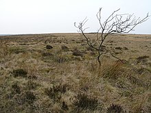
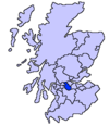
Longriggend롱그리겐드(Longriggend)는 스코틀랜드의 북라나크셔 주에 있는 마을로, 인구는 약 200명이다.그것은 뉴 몽크랜드의 교구인 에어드리 북동쪽 8km의 무어랜드에 위치해 있다.어퍼튼과 칼더크룩스사이의 대략 절반쯤 된다.마을은 티모시 폰트가 지도에, 랭로드지라는 이름으로 나타났다.1596년에 출판되었지만 글자는 읽기 어렵다.[3]토포니는 다른 -리깅 플래카드와 함께 나열되어 있다.[4]롱그리겐드는 로이 c1754의 또 다른 지도에도 나타나 있다.[5]슬라만 철도는 1840년 에어드리, 유니언 운하와 롱리겐드에 합류했지만, 그 궤간으로 에든버러 & 글래스고 철도와 연결이 막혔다.그 지역의 석탄 구덩이들은 철도를 광범위하게 이용했고,[6] 1895년까지 롱그리겐드에 역이 있었다.[7]1901년까지 그것의 인구는 1500명이 넘었고, 그것은 우체국과 전신국, 그리고 근처에 여관을 가지고 있었다.[8]
1867년 오드넌스 조사에서도 이 마을에 로마 가톨릭 학교를 기록하였다.[9]
롱리지엔드 열병원과 리만드 연구소
역사적으로 현재 Upperton으로 알려진 마을의 일부에는 결핵 요양소가 있었다.[10]그 병원은 Longriggend Remand Institute로 전환되었고 지금은 문을 닫고[11] 철거되었다.[12]
참조
- ^ Blaeu, Joan. "Sterlinensis praefectura, Sterlin-Shyr". National Library of Scotland. Retrieved 30 December 2017.
- ^ Pont, Timothy. "The East Central Lowlands (Stirling, Falkirk & Kilsyth) - Pont 32". National Library of Scotland. Retrieved 9 August 2016.
- ^ "Glasgow and the county of Lanark - Pont 34". Maps of Scotland. Timothy Pont (16th century). Retrieved 31 December 2017.
- ^ Drummond, Peter, John (2014). An analysis of toponyms and toponymic patterns in eight parishes of the upper Kelvin basin (PDF). Glasgow: Glasgow University. p. 354. Retrieved 3 July 2017.
- ^ "Roy's map of the Lowlands". National Library of Scotland. Retrieved 3 January 2018.
- ^ Dron, Robert W. (1902). The Coal-fields of Scotland. London: Blackie & Son. p. 157. Retrieved 3 February 2018.
- ^ "O.S. Map with zoom and Bing overlay". National Library of Scotland. Ordnance Survey. Retrieved 30 December 2017.
- ^ The Makeing of Scotland, Robin Smith, Canongate Books Ltd, 2001, ISBN 1-84195-170-6
- ^ Longriggend의 역사, 2011년 2월 18일에 액세스
- ^ "25 inch O.S. map with Open Street Map overlay". National Library of Scotland. Retrieved 4 January 2018.
- ^ "High-security prison opens its doors to Hollywood". The Scotsman. 13 June 2004. Retrieved 4 January 2018.
- ^ Tonner, Judith (29 July 2009). "Developer plans 240 houses for Upperton". Daily Record. Retrieved 4 January 2018.
- ^ Blaeu, Joan. "Glottiana Praefectura Inferior". National Library of Scotland. Retrieved 30 December 2017.
- ^ "Glasgow and the county of Lanark - Pont 34". Maps of Scotland. Timothy Pont (16th century). Retrieved 31 December 2017.
| 위키미디어 커먼즈에는 롱그리겐드와 관련된 미디어가 있다. |
좌표:55°54′35″N 3°53′07″W/55.9097°N 3.8852°W


