쿰부 빙하
Khumbu Glacier| 쿰부 | |
|---|---|
 쿰부 빙하 | |
| 유형 | 계곡 빙하 |
| 좌표 | 27°57°32°N 86°49′29″e/27.9589°N 86.82472°E좌표: 27°57°32°N 86°49 †29 †E / 27.9589°N 86.82472°E / |
 | |
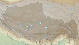
The Khumbu Glacier (Nepali: खुम्बु हिमनदी) is located in the Khumbu region of northeastern Nepal between Mount Everest and the Lhotse-Nuptse ridge.끝부분이 4,900m(16,100ft)이고 근원이 7,600m(24,900ft)인 이곳은 세계에서 가장 높은 [1]빙하입니다.쿰부 빙하는 에베레스트 베이스캠프 중 하나로 가는 길의 마지막 부분을 따라갑니다.빙하의 시작은 에베레스트 [2]근처의 웨스턴 쿰에서 시작된다.이 빙하는 서부 쿰 서쪽 끝에 큰 얼음폭포인 쿰부 빙하가 있다.이 얼음폭포는 에베레스트 정상까지 가는 표준 사우스콜 루트에서 가장 위험한 첫 번째 주요 장애물입니다.이것은 네팔에서 가장 큰 빙하이기도 합니다.
쿰부 빙하의 끝은 북위 27°55°55°N 86°4에 있다.8µ18ºE/27.932°N 86.805°E
개요
「 」를 참조해 주세요.
레퍼런스
- ^ "ASTER measurement of supraglacial lakes in the Mount Everest region of the Himalaya: The main Khumbu Glacier is about 17 km long with elevations ranging from 4900m at the terminus to 7600m at the source....The 7600m to 8000m elevations are also depicted on numerous detailed topographic maps". Retrieved 2008-11-24.
- ^ "The Khumbu Glacier". Archived from the original on 2011-07-07. Retrieved 2010-05-29.
외부 링크


