갑리제
Kaprije
갑리제
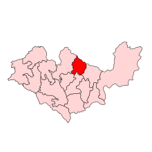
크로아티아 지도에 있는 카프리제 섬의 위치.

카프리제(이탈리아어: Capri di Dalmazia)는 아드리아해의 크로아티아 지역에 있는 섬이다. 시베닉 군도에 위치한다. 이 섬에는 7.11km2(2.75평방 미)[1]의 면적과 189명의 인구가 거주하고 있다.[2] 이 섬은 풀과 희박한 소나무 숲이 자라는 횡단 계곡과 종계곡으로 나뉘어진 언덕으로 이루어져 있다.[3] 포도와 올리브는 그곳에서 재배된다.[4] 주요 산업은 농업, 어업, 관광이다.[4] 그 섬에서는 자동차가 허용되지 않는다.
14세기와 15세기에 이 섬은 시베니크 출신의 귀족 가문들에 속했다.[3] 16~17세기 오스만 정복 당시 이 섬에는 본토에서 온 난민들이 거주하고 있다.[3] 그 무렵 섬에는 성 베드로 교회가 세워졌다.[3]
참조
- ^ Duplančić Leder, Tea; Ujević, Tin; Čala, Mendi (June 2004). "Coastline lengths and areas of islands in the Croatian part of the Adriatic Sea determined from the topographic maps at the scale of 1 : 25 000" (PDF). Geoadria. Zadar. 9 (1): 5–32. doi:10.15291/geoadria.127. Retrieved 2019-12-12.
- ^ Statistical Yearbook of the Republic of Croatia 2017 (PDF) (in Croatian and English). Zagreb: Croatian Bureau of Statistics. December 2017. p. 45. ISSN 1333-3305. Retrieved 23 May 2018.
- ^ a b c d (크로아티아어로) infoadriatic.com의 카프리제 2012-07-10년 웹사이트 보관
- ^ a b (크로아티아어로) 최초의 크로아티아 온라인 펠자르
추가 읽기
- Magaš, Damir; Faričić, Josip; Surić, Maša (2003). "Prirodno-geografske odrednice razvitka otoka Kaprija, Kakna i pripadajućih otočića" [Geographical Determinants of Kaprije and Kakan Islands and Adjacent Islets, Croatia] (PDF). Geoadria (in Croatian). 8 (2): 45–66. doi:10.15291/geoadria.100. Retrieved 12 December 2019.
좌표: 43°41′51″N 15°42′01″E / 43.697479°N 15.700407°E