헤이토 빙하
Heitō Glacier남극의 빙하
| 헤이토 빙하 | |
|---|---|
.svg) 남극의 여왕 모드랜드 위치 | |
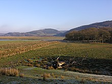
 남극 하이토 빙하의 위치 | |
| 위치 | 퀸모드랜드 |
| 좌표 | 69°16°S 화씨 39도 48도/69.267°S 39.800°E/ -69.267; 39.800 |
| 두께 | 알 수 없는 |
| 터미네이터스 | 랑호브데 힐스 |
| 상태 | 알 수 없는 |
Heitō Glacier (69°16′S 39°48′E / 69.267°S 39.800°E / -69.267; 39.800Coordinates: 69°16′S 39°48′E / 69.267°S 39.800°E / -69.267; 39.800) is a small glacier draining westward along the south side of Mount Heitō in the southern part of the Langhovde Hills, Queen Maud Land, Antarctica.1957-62년 일본 남극 연구 원정대(JARE)의 조사와 항공 사진에서 지도화되었으며, 1973년 JARE 본부에서 헤이토 산과 근접해 헤이토 효가(평평판 빙하)로 명명되었다.[1]
참고 항목
참조
- ^ "Heitō Glacier". Geographic Names Information System. United States Geological Survey. Retrieved 2012-06-09.
 이 문서에는 미국 지질조사국(Geographic Names Information System)의 공용 도메인 자료가 통합되어 있다.