워싱턴 주립대로260번길
Washington State Route 260 | ||||
|---|---|---|---|---|
 SR 260은 빨간색으로 강조되어 있다. | ||||
| 경로 정보 | ||||
| SR26길 | ||||
| WSDOT에 의해 유지 관리 | ||||
| 길이 | 37.98mi[1](61.12km) | |||
| 존재했다 | 1964년-현재[2] | |||
| 주요 접점 | ||||
| 웨스트엔드 | ||||
| 동쪽 끝 | ||||
| 위치 | ||||
| 카운티 | 프랭클린, 애덤스 | |||
| 고속도로 시스템 | ||||
| ||||
주 260번 국도(SR 260)는 미국 워싱턴 주의 프랭클린과 애덤스 카운티를 운행하는 37.98마일(61.12km) 길이의 주 고속도로다.이 고속도로는 코넬 서쪽의 SR 17에서 시작하여 와슈투크나 쿨리를 거쳐 카흐로투스로 이동하여 SR 21의 남쪽 종착역과 SR 263의 북쪽 종착지를 형성한 후, 와슈투크나에서 SR 261과 동시통행한다.
SR 260은 앞서 1916년 코넬과 카롤토스 사이의 자갈길로 존재했으며, 1937년 야키마에서 코넬로 가는 2차 주 고속도로 11A(SSH 11A)와 코넬에서 와슈투크나로 가는 2차 주 고속도로 11B(SSH 11B)로 지정되었다.코넬 지역의 SSH 11A는 1957년에 SSH 11B의 연장이 되었고, 1964년 고속도로 번호 변경에서 SR 260이 되었다.
경로 설명
SR 260은 시골 프랭클린 카운티의 코넬 서쪽 SR 17과 교차점에서 시작한다.이 고속도로는 동쪽으로 이동하여 남동쪽으로 코넬로 바뀌며, BNSF 철도가 소유하고 파스코와 스포캔 사이의 암트랙 엠파이어 빌더 노선에 이용된다.[3][4]2011년 하루 평균 2,800대의 차량을 받은 다이아몬드 교환소인 395번 국도(US 395)를 전체 노선에서 가장 혼잡한 구간에서 교차한 후, 이 도로는 와슈투크나 쿨리를 통해 동쪽으로 계속 이어져 술루르 호수 남쪽을 지나 카클로토스에 진입한다.[5][6]SR 260이 카흘로투스를 통과함에 따라 SR 21의 남쪽 종착지를 형성하고, 린드를 향해 북쪽으로 가고, SR 263의 북쪽 종착지를 형성하여 하부 기념비적 댐을 섬긴다.이 도로는 동쪽으로 카흘로투스 호수와 워슈투크나 호수로 이동하는 도시를 빠져나와 북동쪽으로 컬럼비아 고원 트레일과 평행선을 이루며 SR 261과의 동시 접속이 시작된다.[7]두 고속도로는 애덤스 카운티 도시 와슈투크나에 진입해 SR 260이 끝나고 SR 261이 리츠빌로 이어지는 SR 26과의 교차로 이전에 메인 스트리트가 된다.[1][8]
역사
현재 국도 260호선(SR 260)의 노선은 1916년 지도에서 코넬과 카롤토스 사이의 도로로 처음 나타난다.[9]이 고속도로는 1차 및 2차 주 고속도로 시스템이 조성되는 1937년에 야키마에서 코넬로 가는 2차 주 고속도로 11A(SSH 11A)와 코넬에서 와슈투크나로 가는 2차 주 고속도로 11B(SSH 11B)의 일부로 지정되었다.[10]SSH 11A는 1957년에 재조정되었고 코넬 부근의 노선은 SSH 11B의 일부가 되었다.[11]1964년 고속도로 번호를 다시 매기는 동안 SSH 11B는 SR 260이 되어, 새로 생성된 SR 17에서 미국 395번 국도(US 395)와의 짧은 동시성으로 포장되지 않았다 1981년까지 전체 노선이 포장되고 US 395번 국도와의 동시성이 제거되어 코넬 우회도로의 교차로로 대체되었다.[14][15]SR 260 노선에 대한 주요 개정은 1980년대 이후 발생하지 않았다.[16]
주요 교차점

| 카운티 | 위치 | mi[1] | km | 목적지 | 메모들 |
|---|---|---|---|---|---|
| 프랭클린 | 0.00 | 0.00 | 서부 종착역 | ||
| 코넬 | 7.43– 7.63 | 11.96– 12.28 | 인터체 | ||
| 카를로투스 | 23.21 | 37.35 | SR 21의 남부 종착역 | ||
| 23.49 | 37.80 | SR 263의 북부 종착역 | |||
| 31.54 | 50.76 | SR 261의 서쪽 끝 중첩 | |||
| 애덤스 | 와슈투크나 | 37.98 | 61.12 | 동부 종단, SR 261의 동쪽 끝 부분이 겹침 | |
| 1.000 mi = 1.609 km, 1,000 km = 0.621 mi | |||||
참조
- ^ a b c Strategic Planning Division (March 5, 2012). State Highway Log Planning Report 2011, SR 2 to SR 971 (PDF) (Report). Washington State Department of Transportation. pp. 1284–1288. Retrieved January 13, 2013.
{{cite report}}: CS1 maint : url-status (링크) - ^ a b "47.17.475: State route No. 260". Revised Code of Washington. Washington State Legislature. 1970. Retrieved January 13, 2013.
- ^ 2011 Washington State Rail System (PDF) (Map). Washington State Department of Transportation. January 2012. Retrieved January 13, 2013.
- ^ Passenger Rail System - Washington State (PDF) (Map). Washington State Department of Transportation. January 2012. Retrieved January 13, 2013.
- ^ "SR 395 - Junction SR 260" (PDF). Washington State Department of Transportation. February 28, 2011. Retrieved January 13, 2013.
- ^ Staff (2011). "2011 Annual Traffic Report" (PDF). Washington State Department of Transportation. pp. 162–163. Retrieved January 13, 2013.
- ^ Columbia Plateau Trail State Park South (PDF) (Map). Washington State Parks. Retrieved January 13, 2013.
- ^ Google (January 13, 2013). "State Route 260" (Map). Google Maps. Google. Retrieved January 13, 2013.
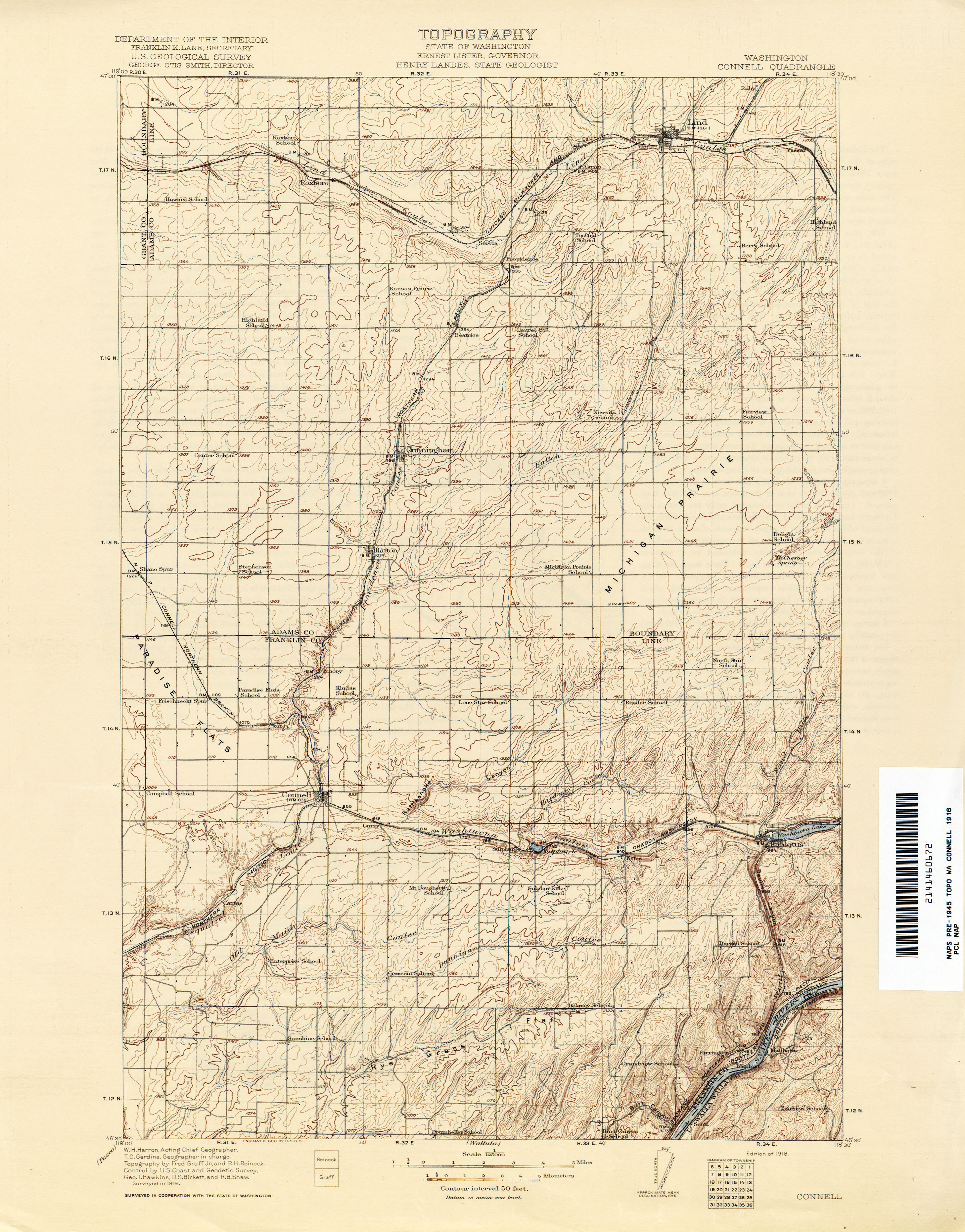
- ^ Washington: Connell Quadrangle, 1916 (Map). 1:250,000. United States Geological Survey. 1916. Retrieved January 13, 2013.
- ^ Washington State Legislature (March 17, 1937). "Chapter 190: Establishment of Primary State Highways". Session Laws of the State of Washington. Session Laws of the State of Washington (1937 ed.). Olympia, Washington: Washington State Legislature. pp. 1007–1008. Retrieved January 13, 2013.
(a) Secondary State Highway No. 11A; beginning at Connell on Primary State Highway No. 11, thence in a westerly direction by the most feasible route to Yakima on Primary State Highway No. 3; the director of highways of the State of Washington shall provide suitable facilities for vehicle and pedestrian crossing of the Columbia river at the point where Secondary State Highway No. 11A, as herein described, crosses the river, and shall maintain said means of crossing at the expense of the State of Washington and without charge to the traveling public; (b) Secondary State Highway No. 11B; beginning at Dusty on Primary State Highway No. 3, thence in a westerly direction by the most feasible route by way of Washtucna to a junction with Primary State Highway No. 11, in the vicinity south of Connell.
- ^ Washington State Legislature (1957). Session Laws of the State of Washington. Session Laws of the State of Washington (1957 ed.). Olympia, Washington: Washington State Legislature. Retrieved January 13, 2013.
- ^ Prahl, C. G. (December 1, 1965). "Identification of State Highways" (PDF). Washington State Highway Commission, Department of Highways. Retrieved January 13, 2013.
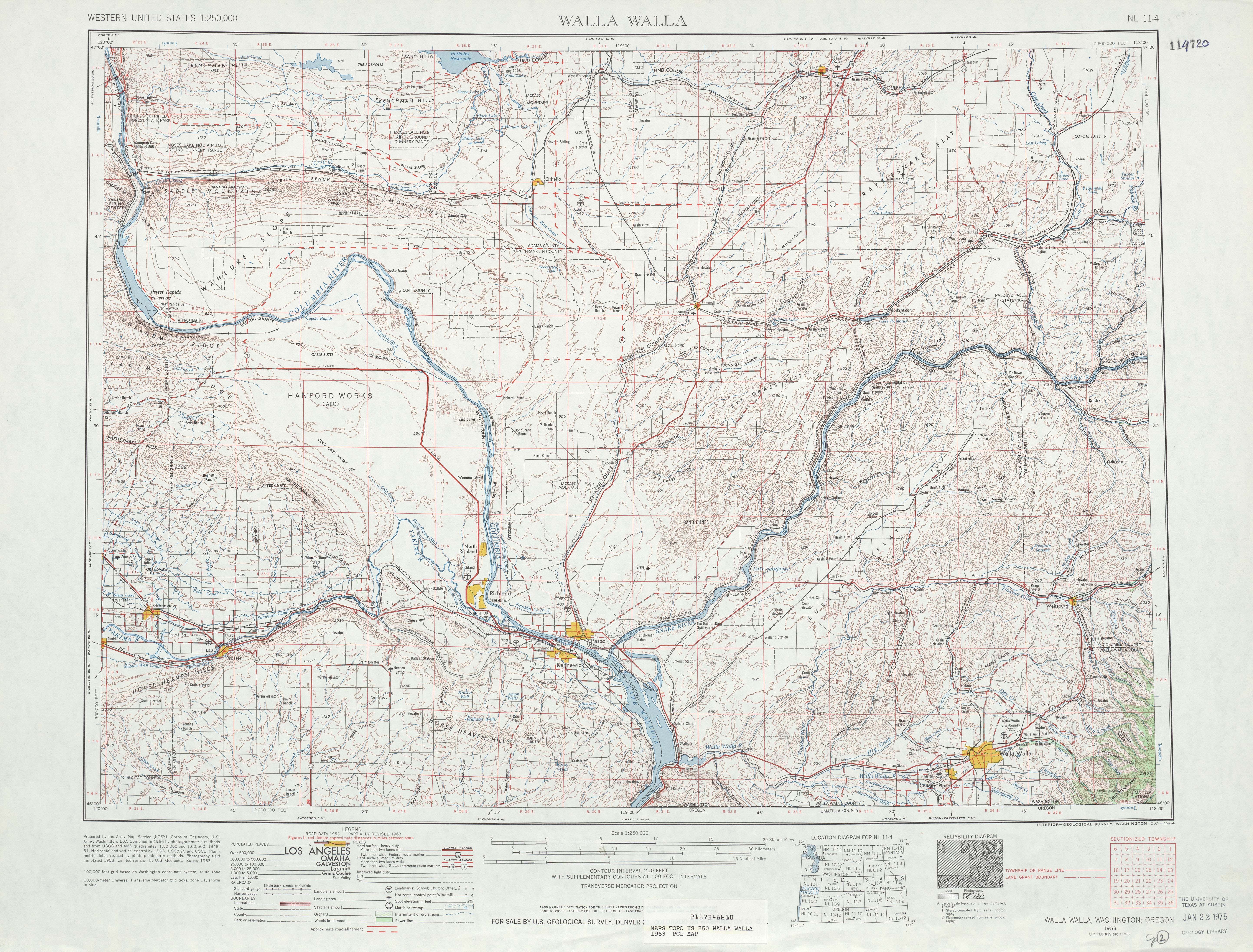
- ^ Walla Walla, 1963 (Map). 1:250,000. United States Geological Survey. 1963. Retrieved January 13, 2013.
- ^ "Lind By-Pass Will Straighten Kinks". Tri-City Herald. August 21, 1956.
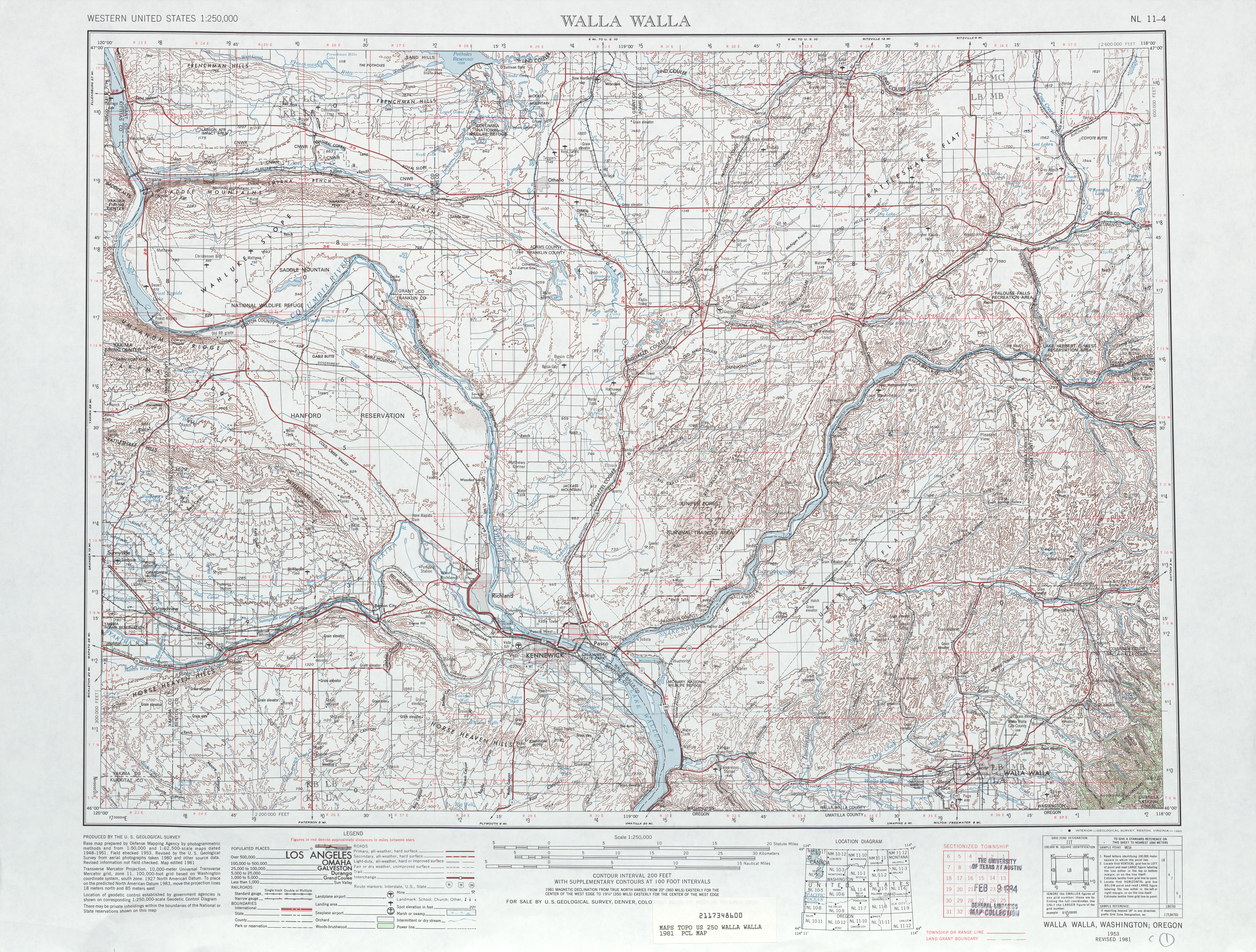
- ^ Walla Walla, 1981 (Map). 1:250,000. United States Geological Survey. 1981. Retrieved January 13, 2013.
- ^ Washington State Highways, 2011–2012 (PDF) (Map). 1:842,000. Washington State Department of Transportation. 2011. Retrieved January 13, 2013.
외부 링크
경로 지도:
| KML 파일(편집 • 도움말) |

