퀸즐랜드 주 더 폴스
The Falls, Queensland| 더 폴스 퀸즐랜드 | |||||||||||||||
|---|---|---|---|---|---|---|---|---|---|---|---|---|---|---|---|
 더 폴스 | |||||||||||||||
| 좌표 | 28°19′02″s 152°23′41″E/28.3172°S 152.3947°E좌표: 28°19′02″S 152°23′41″E / 28.3172°S 152.3947°E/ | ||||||||||||||
| 인구 | 70(2016년 인구조사)[1] | ||||||||||||||
| • 밀도 | 1.26/km2(3.27/sq mi) | ||||||||||||||
| 우편번호 | 4373 | ||||||||||||||
| 면적 | 55.5km2(21.4제곱 mi) | ||||||||||||||
| 시간대 | 심미(UTC+10:00) | ||||||||||||||
| 위치 | |||||||||||||||
| LGA | 서던 다운스 주 | ||||||||||||||
| 주 선거인단 | 서던 다운스 | ||||||||||||||
| 연방 부서 | 마라노아 | ||||||||||||||
| |||||||||||||||
폭포는 오스트레일리아 퀸즐랜드 주 서던다운스 지역에 있는 시골 지역이다.[2]2016년 인구조사에서 더 폴스는 70명의 인구를 가지고 있었다.[1]
그것은 뉴사우스웨일스와 접하고 있다.[3]
역사
그 위치는 아마도 그 지역 내에 있는 스프링 크릭에 있는 퀸 메리 폭포에서 이름을 따온 것 같다.[4]
Ferndale 임시 학교는 1948년 11월 9일에 개교했다.1953년에 그것은 1953년에 폭포 주립학교가 되었다.이 학교는 1974년 8월 26일에 폐교했다.[5]학교는 스프링 크릭 로드 902번지(28°19°53″S 152°2)에 위치해 있었다.3′19″E / 28.3315°S 152.3885°E/ ))[6][3]
2016년 인구조사에서 더 폴스는 70명의 인구를 가지고 있었다.[1]
명소
이 지역에는 다음과 같은 여러 가지 명소가 있다.
- 메인 레인지 국립공원 676번지 스프링 크릭 로드 반대편인 퀸 메리 폴스 망루터(28°20′23″S 152°22′24″E / 28.3396°S 152.3733°E/ 퀸 [7][8]
- 카르스워치, 1503 스프링 크릭 로드(28°173535sS 152°2)4′58″E / 28.2931°S 152.4160°E/ [7][9]
- 모스 가든, 스프링 크릭 로드 약 2km(1.2mi) 뒤 카르스 워치(28°173838sS 152°2)6′36″E / 28.2940°S 152.4433°E/ [7][10]
참조
- ^ a b c Australian Bureau of Statistics (27 June 2017). "The Falls (SSC)". 2016 Census QuickStats. Retrieved 20 October 2018.
- ^ "The Falls – locality in Southern Downs Region (entry 50082)". Queensland Place Names. Queensland Government. Retrieved 29 December 2020.
- ^ a b "Queensland Globe". State of Queensland. Retrieved 5 May 2020.
- ^ "Queen Mary Falls – waterfall in the Southern Downs Region (entry 27792)". Queensland Place Names. Queensland Government. Retrieved 2 January 2017.
- ^ Queensland Family History Society (2010), Queensland schools past and present (Version 1.01 ed.), Queensland Family History Society, ISBN 978-1-921171-26-0
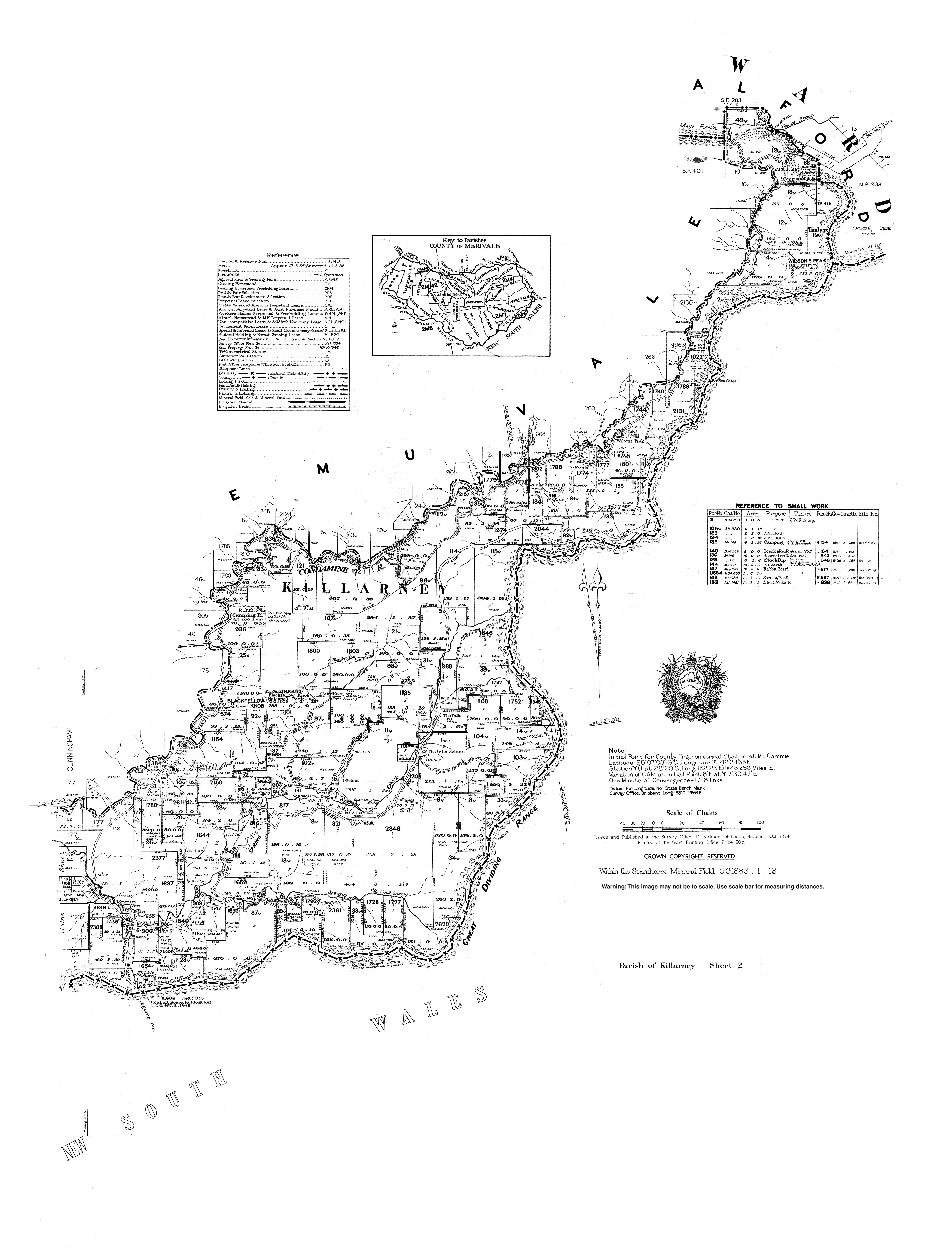
- ^ "Parish of Killarney map, sheet 2". Queensland Government. 1974. Archived from the original on 27 January 2021. Retrieved 19 November 2019.
- ^ a b c "Tourist points - Queensland". Queensland Open Data. Queensland Government. 18 November 2020. Archived from the original on 24 November 2020. Retrieved 24 November 2020.
- ^ "Queen Mary Falls". Southern Downs & Granite Belt. Southern Downs Regional Council. Archived from the original on 16 November 2020. Retrieved 27 January 2021.
- ^ "Carr's Lookout". Southern Downs & Granite Belt. Southern Downs Regional Council. Archived from the original on 19 September 2020. Retrieved 27 January 2021.
- ^ "The Falls Drive". Southern Downs & Granite Belt. Southern Downs Regional Council. Archived from the original on 5 January 2021. Retrieved 27 January 2021.

