목장로1길
Ranch Road 1 | ||||
|---|---|---|---|---|
 RR 1이 빨간색으로 강조 표시됨 | ||||
| 경로 정보 | ||||
| TxDOT에서 유지 관리 | ||||
| 길이 | 6.587 mi[1](10.601 km) | |||
| 존재했다 | 1963-현재[1] | |||
| 주요 접점 | ||||
| 웨스트엔드 | ||||
| 동쪽 끝 | ||||
| 위치 | ||||
| 나라 | 미국 | |||
| 주 | 텍사스 | |||
| 카운티 | 길레스피, 블랑코 | |||
| 고속도로 시스템 | ||||
| ||||

랜치 로드 1(RR 1)은 미국 텍사스 주의 중부 지방에 있는 길레스피와 블랑코 카운티에 위치한 랜치 로드다.이 고속도로는 약 6.6마일(10.6km)이며, 린든 B를 거쳐 페더날레스 강을 따라 흐르는 스톤월 290번 국도(미국 290번 국도)에서 시작된다. 존슨 국립역사공원, 고 린든 존슨 대통령의 전 목장, 린든 B를 통해. 존슨 스테이트 공원과 유적지, 혜 근처에 있는 미국 290번지에서 종착한다.1963년 지정된 이 도로는 txDOT가 '랜치 로드'로 지정한 주(州)의 유일한 도로다.주 고속도로 시스템 초기에는 이 노선이 주 20번 고속도로의 일부였고, 나중에 그 고속도로가 남쪽으로 이전되기 전까지 미국의 290번 고속도로의 일부가 되었다.
경로 설명
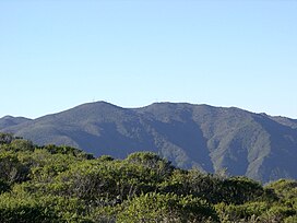
랜치 로드 1은 스톤월 서쪽 290번지에서 2차선 포장도로로 시작된다.이 고속도로는 페데르날레스 강의 남쪽 둑을 따라 마을 북쪽을 돌고 있으며, 마을 동쪽의 RM 1623을 교차한다.이 노선은 린다온 B의 좁은 남서부를 지나 강을 따라 잠시 계속된다. 존슨 국립 역사 공원, 린든 B 존슨 주립 공원과 유적지에 들어가기 전.[2]이 노선은 강둑을 따라 북쪽 가장자리에 있는 주립공원의 길이를 가로지른 뒤 공원을 빠져나간 뒤 강을 건너 국가 유적지에 접근하는 PR 49를 교차한다.블랑코 현으로 건너간 이 노선은 강둑에서 동남쪽으로 방향을 바꿔 혜 서쪽 290번지로 돌아간다.[2][3]이 도로는 텍사스 힐 컨트리(Texas Hill Country)에 위치하지만 페더날레스 강 수역 내에서 완만한 성적만을 만날 뿐이다.[4][5]
분류
랜치 로드 1은 텍사스 교통부(txDOT)가 랜치 로드로 분류하고 있으며, 현재 주 내에서 유일하게 이렇게 분류된 고속도로다.[6]이 노선은 비록 Farm to Market Road 제도와 유사하다고 여겨지지만 공식적으로 주의 Farm and Langch to Market Road System의 일부가 아니다.[7]RR 1은 랜치 투 마켓 로드와 유사한 방패로 서명된다.[8]고속도로는 레크리에이션 로드 분류와 거의 완벽하게 맞지만 시스템의 일부로 간주되지 않는다.[7]
역사
랜치 로드 1은 린든 존슨이 대통령에 취임한 지 27일 만인 1963년 12월 19일 스톤월 인근 미국 290번 종착지에서 길레스피와 블랑코 군 사이의 카운티 라인 서쪽 1.2마일(1.9km) 지점까지 지정됐다.이듬해에는 길이 동쪽으로 2.1mi(3.4km) 연장되어 혜성 부근의 현재 종착역까지 확장되었다.이 노선은 원래 SH 20의 일부였다.[9]1935년, 미국 290명이 도로 위에 배치되었고,[10] 1939년 주 고속도로의 일반적 재탈환에서 SH 20 지명이 삭제되었다.[11]US 290은 1941년과[12][13] 1961년 사이에 현재의 위치로 남쪽으로 다시 이동되었다.[14][15]
주요 교차점
| 카운티 | 위치 | mi[16] | km | 목적지 | 메모들 |
|---|---|---|---|---|---|
| 길레스피 | 스톤월 | 0.000 | 0.000 | 서부 종착역 | |
| 1.259 | 2.026 | ||||
| LBJ 주립공원 | 3.174 | 5.108 | |||
| 4.734 | 7.619 | ||||
| 블랑코 | 6.587 | 10.601 | 동부 종착역 | ||
| 1.000 mi = 1.609 km, 1,000 km = 0.621 mi | |||||
참고 항목
참조
- ^ a b Transportation Planning and Programming Division (n.d.). "Ranch Road No. 1". Highway Designation Files. Texas Department of Transportation. Retrieved July 24, 2010.
- ^ a b Transportation Planning and Programming Division (2018). Texas County Mapbook (PDF) (Map) (2018 ed.). 1:72,224. Texas Department of Transportation. p. 1586. Retrieved July 15, 2021.
- ^ Google (July 24, 2010). "Route of Ranch Road 1" (Map). Google Maps. Google. Retrieved July 24, 2010.
- ^ United States Geological Survey (1961). Stonewall Quadrangle, Texas (Topographic map). 1:24,000. 7.5 Minute Series. Reston, VA: United States Geological Survey. Retrieved July 24, 2010.
- ^ United States Geological Survey (1961). Hye Quadrangle, Texas (Topographic map). 1:24,000. 7.5 Minute Series. Reston, VA: United States Geological Survey. Retrieved July 24, 2010.
- ^ Transportation Planning and Programming Division. "Search Results for Ranch Road". Highway Designation File. Texas Department of Transportation. Retrieved July 7, 2010.
- ^ a b Transportation Planning and Programming Division. "Highway Designation Glossary". Texas Department of Transportation. Retrieved July 31, 2012.
- ^ Texas Department of Transportation (2012). "Section 3: Small Guide Signs" (PDF). Standard Highway Sign Designs. Austin: Texas Department of Transportation. pp. 3–5.7. Retrieved July 31, 2012.
- ^ Texas State Highway Commission (1926). Official Highway Map of Texas (Map). 1:1,900,800. Austin: Texas State Highway Commission. Retrieved July 25, 2010.
- ^ Transportation Planning and Programming Division (n.d.). "U.S. Highway No. 290". Highway Designation Files. Texas Department of Transportation. Retrieved July 25, 2010.
- ^ Transportation Planning and Programming Division (n.d.). "State Highway No. 20". Highway Designation Files. Texas Department of Transportation. Retrieved July 25, 2010.
- ^ Texas State Highway Department (February 1, 1941). General Highway Map, Gillespie County, Texas (Map). 1:126,720. Austin: Texas State Highway Commission. Retrieved July 24, 2010.
- ^ Texas State Highway Department (February 1, 1941). General Highway Map, Blanco County, Texas (Map). 1:126,720. Austin: Texas State Highway Commission. Retrieved July 24, 2010.
- ^ Texas State Highway Department (January 1, 1961). General Highway Map, Gillespie County, Texas (Map). 1:126,720. Austin: Texas State Highway Commission. Retrieved July 24, 2010.
- ^ Texas State Highway Department (January 1, 1961). General Highway Map, Blanco County, Texas (Map). 1:126,720. Austin: Texas State Highway Commission. Retrieved July 24, 2010.
- ^ Transportation Planning and Programming Division. Statewide Planning Map (Map). Austin: Texas Department of Transportation. Retrieved July 30, 2012.
경로 지도:
| KML 파일(편집 • 도움말) |