롤랜드 산 보존 구역
Mount Roland Conservation Area| 롤랜드 산 | |
|---|---|
 셰필드 망루에서 본 롤랜드 산 | |
| 최고점 | |
| 표고 | 1,234m(4,049ft)AHD [1] |
| 두각을 나타남 | 563m(1,847ft)[1] |
| 목록 | 태즈메이니아의 가장 높은 산 목록 |
| 좌표 | 41°27′35″S 146°15′35″e/41.45972°S 146.25972°E[2] |
| 지리 | |
| 위치 | 오스트레일리아 노스웨스트 태즈메이니아 |
| 지질학 | |
| 암석시대 | 쥐라기 |
| 산형 | 돌레라이트 |
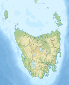
롤랜드 산은 오스트레일리아 태즈메이니아 북서부 해안 지역에 있는 지역, 산, 보존 지역이다.[3]
그 산은 셰필드 마을 근처에 있다.최고봉은[1] 해발 1,234미터(4,049피트)까지 올라가며, 즐거운 운동으로 하루를 보내기에 적합한 잘 표시된 숲속 산책로가 많이 있다.클로드 길과 고우리 공원으로부터 정상까지 오랫동안 확립된 산책로가 있다.[4][5][6][7]
마운트 롤랜드 케이블카는 여러 차례 그 산에 제안되었다.[8]케이블카의 적합성이나 만족도를 놓고 지역사회는 여전히 의견이 분분하다.[9]
롤랜드 산의 지역성은 므안데르 계곡과 론체스톤의 켄티쉬 지방정부 지역과 태즈메이니아의 북북서부에 있는 농촌 지역이다.그 지역은 웨스트베리 마을에서 서쪽으로 약 75킬로미터(47밀리미터) 떨어져 있다.2016년 인구조사에는 롤랜드 산 교외 지역의 인구가 0명이다.[10]롤랜드 산은 확실한 지역이다.[11]
머시 강은 남쪽 경계선의 일부를 이룬다.롤랜드산 보존 지역은 그 지역 북쪽의 작은 지역을 차지하고 있다.[12]C136번 국도(클로드 도로)는 그 지역의 북동쪽 모퉁이를 통과한다.C138번 도로(올리버즈 로드)는 북서쪽에서 진입하여 출구가 있을 때까지 남쪽으로 운행한다.[11][13]
2015년 정상 근처에서 사망자가 발생했다.보건 고위 관리가 아내를 살해한 혐의를 받고 있다.그 관리는 나중에 리스돈 감옥에 있는 동안 스스로 목숨을 끊었다.[14]
참고 항목
참조
- ^ a b c "Mount Roland, Australia". Peakbagger.com. Retrieved 7 June 2015.
- ^ "Mount Roland (TAS)". Gazetteer of Australia online. Geoscience Australia, Australian Government.
- ^ University of Tasmania. Institute for Regional Development; Mount Roland Steering Committee (Tas.) (2011), Mount Roland developing a destination, University of Tasmania, archived from the original on 1 May 2012, retrieved 12 July 2012
- ^ "ON MOUNT ROLAND". The Examiner (DAILY ed.). Launceston, Tasmania. 11 January 1910. p. 4. Retrieved 12 July 2012 – via National Library of Australia.
- ^ Tasmania. Dept. of Parks, Wildlife and Heritage (1990), Mount Roland day walk map, Tasmap, retrieved 12 July 2012
- ^ Mount Roland day walk map, Tasmap, 1986, retrieved 12 July 2012
- ^ Mount Roland bushwalk, Hiking the World, 2020, retrieved 17 December 2020
- ^ "Cable car tourism push for Sheffield's Mt Roland". The Mercury. 27 April 2014. Archived from the original on 23 January 2015. Retrieved 23 January 2015.
- ^ "Archived copy" (PDF). Archived (PDF) from the original on 23 January 2015. Retrieved 20 April 2015.
{{cite web}}: CS1 maint: 타이틀로 보관된 사본(링크) - ^ "2016 Census Quick Stats Mount Roland (Tas.)". quickstats.censusdata.abs.gov.au. Australian Bureau of Statistics. 23 October 2017. Retrieved 13 September 2020.
- ^ a b "Placenames Tasmania – Mount Roland". Placenames Tasmania. Select “Search”, enter "38115E", click “Search”, select row, map is displayed, click “Details”. Retrieved 13 September 2020.
- ^ Google (13 September 2020). "Mount Roland, Tasmania" (Map). Google Maps. Google. Retrieved 13 September 2020.
- ^ "Tasmanian Road Route Codes" (PDF). Department of Primary Industries, Parks, Water & Environment. May 2017. Archived from the original (PDF) on 1 August 2017. Retrieved 13 September 2020.
- ^ https://www.adelaidenow.com.au/news/south-australia/south-australian-man-robin-michael-charged-with-murdering-his-wife-in-tasmania-takes-his-own-life-in-custody/news-story/b2a620358bbb73deaa7a56366df26602[bare URL]


