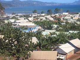
M'Tsangamouji
M'TsangamoujiM'Tsangamouji | |
|---|---|
 음산가모우지 중심부 | |
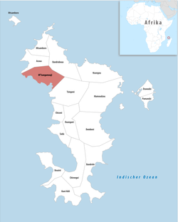
 마요트 내 코뮌(빨간색) 위치 | |
| Coordinates: 12°45′35″S 45°04′58″E / 12.7597°S 45.0827°E | |
| 나라 | 프랑스. |
| 해외지역 및 부서 | 마요트 |
| 칸톤 | 칭고니 |
| 인터커뮤니티 | 센터-오우스트 |
| 정부 | |
| • 시장 (2020–2026) | 마안리파 이브라히마[1] |
| 지역 1 | 21.84 km2 (8.43 sq mi) |
| 인구. (2017)[2] | 6,432 |
| • 밀도 | 290/km2 (760/sq mi) |
| 시간대 | UTC+03:00 |
| INSEE/우편번호 | 97613 /97650 |
| 1 호수, 연못, 빙하가 1km2 이상(0.386 평방미터 또는 247 에이커) 및 강 하구를 제외한 프랑스 토지 등록부 데이터. | |
M'Tsangamouji ( 프랑스어 발음:[mts ɑ̃ɡamu ʒi]]는 인도양의 마요트에 위치한 프랑스의 코뮌입니다.
인구.
| 연도 | Pop. | ±% |
|---|---|---|
| 2002 | 5,382 | — |
| 2007 | 5,028 | −6.6% |
| 2012 | 6,314 | +25.6% |
| 2017 | 6,432 | +1.9% |
참고문헌
위키미디어 커먼즈에는 M'Tsangamouji 관련 미디어가 있습니다.


