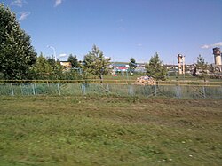
과라싸이
Guaraçaí과라싸이 | |
|---|---|
| 어원: 코아러시(Sun)[1][2] | |
| 닉네임: | |
| 애국가: 히노 아 과라시 | |
 과라싸이를 그린 대화형 지도 | |
 상파울루 주 내의 위치 | |
| 좌표:21°1′42″S 51°12′24″w/21.02833°S 51.20667°W좌표: 21°1′42″S 51°12′24″W / 21.02833°S 51.20667°W/ | |
| 나라 | |
| 지역 | 남동부 |
| 주 | |
| 메소레지온 | 아라사투바 |
| 미시적 지역 | 안드라디나 |
| Incorporated | 1948년[3] 12월 24일 |
| 설립자: | 주앙 마차도 데 소우자[1][2] |
| 에 대해 명명됨 | 몰덴하웨라 플로리분다[1] |
| 정부 | |
| • 유형 | 시장-의회 |
| • 시장 | 다나카 넬슨 카즈미(시다니아) |
| • 시립 회의실 | 참의원 |
| 면적 | |
| • 시 | 569.168km2(219.768 제곱 mi) |
| • 순위 | 브라질로2246번길 |
| 표고 | 440.22m(1,444.29ft) |
| 인구 | |
| • 시 | 8,435 |
| • 견적 (2020)[7] | 8,290 |
| • 순위 | 브라질로3277번길 |
| • 밀도 | 14.80/km2(38.3/sq mi) |
| • 도시 | 6,654 |
| • 시골지역 | 1,781 |
| 데모닉 | 과라센스[7][11] |
| 민족성 | |
| • 흰색 | 60.12% (주민 5,071명) |
| • 파도 | 32.77%(2,764명) |
| • 검은색 | 3.84%(324명 주민) |
| • 노란색 | 3.27% (주민 276명) |
| 시간대 | UTC-03:00(BRT) |
| • 여름(DST) | UTC-02:00(BRST) |
| 우편번호 | 16980-000 |
| 지역 번호 | 18[13] |
| HDI (2010)[14] | 0.719 – 높음 |
| 웹사이트 | 공식 웹사이트 |
과라싸이는 브라질 상파울루 주에 있는 자치 단체다.추정 인구는 569.197km2(220평방미터)[7]의 면적에 8,290명(2020년 기준)이며, 높이는 해발 440.22m(1,444ft)이다.[8]
시군은 1998년 조성된 아귀피 주립공원 9044ha(2만2350에이커)의 32.46%를 차지하고 있다.[15]
참조
- ^ a b c d "História do Município" [Municipality History]. Prefeitura Municipal de Guaraçaí [Guaraçaí City Hall] (in Portuguese). Webline Sistemas. Retrieved 22 December 2020.
- ^ a b "IBGE Cidades@ São Paulo Guaraçaí História & Fotos" [IBGE Cities@ São Paulo Guaraçaí History & Photos]. Instituto Brasileiro de Geografia e Estatística [Brazilian Institute of Geography and Statistics] (in Portuguese). Retrieved 22 December 2020.
- ^ "LEI N. 233, DE 24 DE DEZEMBRO DE 1948" [LAW NO. 233, OF 24 DECEMBER 1948]. Assembleia Legislativa do Estado de São Paulo [Legislative Assembly of the State of São Paulo] (in Portuguese). Retrieved 10 January 2014.
The municipality of Guaraçaí is created with seat in the village of the same name and with the lands of the district of the same name.
- ^ "Prefeito(a)" [Mayor]. Prefeitura Municipal de Guaraçaí [Guaraçaí City Hall] (in Portuguese). Webline Sistemas. Retrieved 22 December 2020.
- ^ "VEREADORES" [COUNCILORS]. Câmara Municipal de Guaraçaí [Municipal Chamber of Guaraçaí] (in Portuguese). Webline Sistemas. Retrieved 22 December 2020.
- ^ "Guaraçaí (SP) Cities and States IBGE". Instituto Brasileiro de Geografia e Estatística [Brazilian Institute of Geography and Statistics]. Retrieved 21 December 2020.
- ^ a b c d e "IBGE Cidades@ São Paulo Guaraçaí Panorama" [IBGE Cities@ São Paulo Guaraçaí Panorama]. Instituto Brasileiro de Geografia e Estatística [Brazilian Institute of Geography and Statistics] (in Portuguese). Retrieved 22 December 2020.
- ^ a b "BR Localidades 2010 v1" [BR Locations 2010 v1] (MDB). Instituto Brasileiro de Geografia e Estatística [Brazilian Institute of Geography and Statistics] (in Portuguese). Retrieved 24 August 2016.
- ^ "CENSO 2010 – SÃO PAULO" [2010 CENSUS – SÃO PAULO] (PDF). Instituto Brasileiro de Geografia e Estatística [Brazilian Institute of Geography and Statistics] (in Portuguese). Archived from the original (PDF) on 24 January 2011. Retrieved 22 December 2020.
- ^ a b "IBGE Cidades@ São Paulo Guaraçaí Pesquisa Censo Sinopse" [IBGE Cities@ São Paulo Guaraçaí Research Census Synopsis]. Instituto Brasileiro de Geografia e Estatística [Brazilian Institute of Geography and Statistics] (in Portuguese). Retrieved 21 December 2020.
- ^ "Dicionário Online - Dicionário Caldas Aulete - Significado de guaraçaiense" [Online Dictionary - Caldas Aulete Dictionary - Meaning of guaraçaiense]. iDicionário Aulete [iDictionary Aulete] (in Portuguese). Lexikon Editora Digital. Retrieved 22 December 2020.
- ^ "Tabela 2093 – População residente por cor ou raça, sexo, situação do domicílio e grupos de idade – Amostra – Características Gerais da População" [Table 2093 – Resident population by color or race, sex, state of domicile and age groups – Sample – General Characteristics of the Population]. Sistema IBGE de Recuperação Automática [Brazilian Institute of Geography and Statistics System of Automatic Recovery] (in Portuguese). Retrieved 20 December 2020.
- ^ "CÓDIGOS DE SÃO PAULO" [SÃO PAULO CODES] (PDF). Agência Nacional de Telecomunicações [National Agency of Telecommunications] (in Portuguese). Retrieved 23 December 2020.
- ^ "Ranking IDHM Municípios 2010" [MHDI Ranking Municipalities 2010]. Programa das Nações Unidas para o Desenvolvimento Brasil [United Nations Development Programme Brazil] (in Portuguese). Retrieved 23 December 2020.
- ^ "Parque Estadual do Aguapeí" [Aguapeí State Park]. Unidades de Conservação no Brasil [Conservation Areas in Brazil]. Instituto Socioambiental. Retrieved 22 February 2020.


