글렌도 국립공원
Glendo State Park| 글렌도 국립공원 | |
|---|---|
 | |
| 위치 | 미국 와이오밍 주의 글렌도 |
| 가장 가까운 도시 | 와이오밍 주 더글러스 |
| 좌표 | 42°33′22″N 104°58′59″w / 42.55611°N 104.98306°W좌표: 42°33′22″N 104°58′59″W / 42.55611°N 104.98306°W[1] |
| 면적 | 18,382에이커(74.39km2)[2] |
| 표고 | 4,705ft(1,434m)[1] |
| 지정 | 와이오밍 주립공원 |
| 확립된 | 1959 |
| 관리자 | 와이오밍 주립공원, 유적지 & 트레일 |
| 웹사이트 | 글렌도 국립공원 |
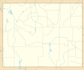
글렌도 주립공원은 미국 와이오밍주 플라테 주와 컨버스 카운티의 노스플라테 강에 있는 글렌도 저수지를 둘러싼 공공 휴양 지역이다.[3] 주 공원은 더글러스 시에서 남동쪽으로 약 32km 떨어진 글렌도 시 근처에 위치해 있다. 이 공원은 산악 자전거 도로 45마일(72km)과 500개 이상의 야영장, 그리고 몇 개의 주 기록적인 크기의 물고기를 생산하는 저수지와 함께 낚시 및 기타 수상 활동을 제공한다.[4][5] 이 공원은 와이오밍 주립공원과 사적지에 의해 관리된다.
역사
글렌도 댐, 발전소, 저수지는 1954년에서 1958년 사이에 건설되었다. 1959년 6월 와이오밍 공원 위원회는 글렌도 저수지의 휴양 목적의 시설 관리 및 개발을 위해 미국 간척국과 계약을 맺었다.[6]
뉴스에서
2017년 8월 21일 월요일, 개기 일식이 공원 바로 위를 지나갔다. 토털리티의 중간점은 UTC 17:46(현지 시간: 오전 11:46 MDT)에서 발생했으며, 토털리티는 2분 28초 동안 지속되었다.[7]
참조
- ^ a b "Glendo State Park". Geographic Names Information System. United States Geological Survey.
- ^ "Table 1. Facilities managed by Wyoming State Parks, Historic Sites and Trails" (PDF). SOAR 2021. Wyoming Department of State Parks and Cultural Resources. p. 12. Retrieved August 23, 2017.
- ^ "Glendo State Park". Wyoming State Parks, Historic Sites & Trails. State of Wyoming. Retrieved August 23, 2017.
- ^ "About Glendo State Park". Wyoming State Parks, Historic Sites & Trails. State of Wyoming. Retrieved August 23, 2017.
- ^ "Wyoming's Record Fish". Wyoming Game & Fish Department. Retrieved November 11, 2015.
- ^ "Glendo State Park Master Plan and Environmental Assessment" (PDF). Wyoming State Parks and Historic Sites. April 2004. pp. 3, 15. Retrieved March 18, 2020.
- ^ "Path of the Total Solar Eclipse of 2017 Aug 21". NASA. Retrieved March 15, 2015.
외부 링크
| 위키미디어 커먼즈에는 글렌도 주립공원과 관련된 미디어가 있다. |
- 글렌도 주립공원 와이오밍 주립공원, 사적지 & 산책로
- 글렌도 주립공원 브로셔 와이오밍 주립공원, 유적지 & 산책로


