프로그모어, 뉴사우스웨일스 주
Frogmore, New South Wales| 개구리모어 뉴사우스웨일스 주 | |||||||||||||||
|---|---|---|---|---|---|---|---|---|---|---|---|---|---|---|---|
 개구리모어 | |||||||||||||||
| 좌표 | 34°16ºS 148°51°E/34.26°S 148.85°E좌표: 34°16µS 148°51ºE / 34.26°S 148.85°E / | ||||||||||||||
| 인구. | 132 (2016년 인구조사)[1] | ||||||||||||||
| 우편 번호 | 2586[2] | ||||||||||||||
| 승진 | 513 m (1,683 피트) | ||||||||||||||
| LGA | 힐탑스 평의회 | ||||||||||||||
| 자치주 | 왕 | ||||||||||||||
| 주의 유권자 | 굴번[3] | ||||||||||||||
| 연방 부문 | 흄[4] | ||||||||||||||
| |||||||||||||||
| |||||||||||||||
| 각주 | 좌표,[5] [6]강우량, 지역[7] | ||||||||||||||
Frogmore는 호주 뉴사우스웨일스 주 남부 테이블랜드에 있는 마을이다.그곳은 이전에는 광산 마을이었다.
채굴 이력
_p115_FROGMORE_COPPER_MINE.jpg)
구리는 1850년대에 프로그모어에서 처음 발견되어 채굴되었지만, 1950년대 [6][8]이후 추가적인 탐사에도 불구하고 1907년 이후로 채굴이 계속되지 않았다.프로그모어 주변에서 은과 텅스텐도 채굴되었다.[9]
1870년대에, 프로그모어에는 두 개의 구리 광산이 운영되었습니다. 바로 디어 브라더스[10] 광산과 벤센산 [11][12]광산이 그것입니다.구리는 또한 프로그모어 [13][14][15][16]북서쪽에서 채굴되었다.
1882년, 프로그모어 북쪽에서 석영초 금이 발견되었고,[17] 그 결과 약간의 주장 다툼이 일어났지만,[13] 그 지역에는 이렇다 할 금광은 없었다.
커뮤니티 및 시설
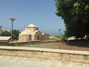
Frogmore는 1875년부터 1982년까지 [18]공립학교를 다녔다.이 마을에는 영국 성공회, 연합교회(옛 감리교), 세례자 성 요한 세례자 [10]성당이 있으며, [19]구내에는 가톨릭 묘지가 있다.일반 [20]묘지도 있습니다.
1997년 산불로 마을회관이 전소됐고, 이를 대체하기 위한 기금 모금에는 리 커나한의 콘서트 어라운드 모자가 포함됐다.옛 홀 자리에 시골 소방서가 있고 그 [21]옆에 새 홀이 있다.
2016년 인구조사에서, 프로그모어의 인구는 [1]132명이었다.
기후.
프로그모어는 남부 테이블랜드와 사우스웨스트 슬로프 사이의 중간 기후를 가지고 있으며, 야스와 가장 유사하다.주간 범위는 일반적으로 일년 내내 높지만, 겨울에는 구름이 더 많이 껴서 현저하게 적다.강수량은 겨울에 약간 최고조에 달합니다.
| 프로그모어(1969–1990, 강우량 1898–1993) 500m AMSL의 기후 데이터 | |||||||||||||
|---|---|---|---|---|---|---|---|---|---|---|---|---|---|
| 달 | 1월 | 2월 | 마루 | 에이프릴 | 그럴지도 모른다 | 준 | 줄 | 8월 | 9월 | 10월 | 11월 | 12월 | 연도 |
| 높은 °C(°F)를 기록하다 | 42.4 (108.3) | 42.2 (108.0) | 36.8 (98.2) | 33.7 (92.7) | 29.7 (85.5) | 21.6 (70.9) | 21.6 (70.9) | 24.7 (76.5) | 29.9 (85.8) | 33.0 (91.4) | 37.8 (100.0) | 38.9 (102.0) | 42.4 (108.3) |
| 평균 최고 °C(°F) | 29.9 (85.8) | 29.2 (84.6) | 26.2 (79.2) | 21.4 (70.5) | 16.7 (62.1) | 12.9 (55.2) | 11.9 (53.4) | 13.4 (56.1) | 16.2 (61.2) | 20.4 (68.7) | 24.3 (75.7) | 28.1 (82.6) | 20.9 (69.6) |
| 평균 최저 °C(°F) | 14.5 (58.1) | 14.4 (57.9) | 12.1 (53.8) | 8.8 (47.8) | 5.5 (41.9) | 2.6 (36.7) | 1.8 (35.2) | 3.0 (37.4) | 4.7 (40.5) | 7.3 (45.1) | 9.5 (49.1) | 12.3 (54.1) | 8.0 (46.4) |
| 낮은 °C(°F)를 기록하십시오. | 3.8 (38.8) | 0.6 (33.1) | 1.1 (34.0) | −1.2 (29.8) | −6.4 (20.5) | −5.2 (22.6) | −6.2 (20.8) | −6.5 (20.3) | −2.6 (27.3) | −2.0 (28.4) | −0.5 (31.1) | 1.6 (34.9) | −6.5 (20.3) |
| 평균 강수량 mm(인치) | 52.4 (2.06) | 38.4 (1.51) | 41.3 (1.63) | 50.9 (2.00) | 46.0 (1.81) | 56.1 (2.21) | 53.3 (2.10) | 55.8 (2.20) | 49.4 (1.94) | 54.7 (2.15) | 48.8 (1.92) | 52.9 (2.08) | 593.7 (23.37) |
| 출처: | |||||||||||||
레퍼런스
- ^ a b Australian Bureau of Statistics (27 June 2017). "Frogmore". 2016 Census QuickStats. Retrieved 2 April 2018.
- ^ "Find a postcode: Frogmore". Australia Post. Retrieved 7 May 2016.
- ^ "Goulburn". New South Wales Electoral Commission. Retrieved 7 May 2016.
- ^ "February 2016 Map of the Federal Electoral Division of Hume" (PDF). Commonwealth of Australia. February 2016. Retrieved 23 November 2019 – via ABC Australia.
- ^ "Frogmore (NSW)". Gazetteer of Australia, Place Names Search. Geoscience Australia. NSW19520. Retrieved 7 May 2016.
- ^ a b B.R.Ackerman (2003). "Frogmore Copper Deposit, NSW" (PDF). CRC LEME. Retrieved 7 May 2016.
- ^ "SIX Maps". Government of New South Wales. Retrieved 7 May 2016.
- ^ "Frogmore copper mine, Frogmore, Boorowa, King Co., New South Wales, Australia". www.mindat.org. Retrieved 6 April 2021.
- ^ "Villages of the Boorowa Council Local Government Area". Boorowa Council. Retrieved 7 May 2016.
- ^ a b McGowan, Barry (September 2007). "Hegemony, localism and ethnicity: The 'Welsh' mining communities of Currawang and Frogmore in southern New South Wales" (PDF). Journal of Australasian Mining History. 5: 44–63.
- ^ "FROGMORE". The Burrowa News. No. 216. New South Wales, Australia. 8 November 1878. p. 2. Retrieved 8 May 2016 – via National Library of Australia.
- ^ "FROGMORE". The Burrowa News. No. 208. New South Wales, Australia. 6 September 1878. p. 2. Retrieved 8 May 2016 – via National Library of Australia.
- ^ a b "Sapling Gully mine, Monteagle Co., New South Wales, Australia". www.mindat.org. Retrieved 16 April 2021.
- ^ "Yundoo lode, Monteagle Co., New South Wales, Australia". www.mindat.org. Retrieved 16 April 2021.
- ^ "Right Hand Creek mine, Monteagle Co., New South Wales, Australia". www.mindat.org. Retrieved 16 April 2021.
- ^ "Bell View Mine, Monteagle Co., New South Wales, Australia". www.mindat.org. Retrieved 16 April 2021.
- ^ "RUSH AT FROGMORE". Australian Town and Country Journal (Sydney, NSW : 1870 - 1919). 11 March 1882. p. 12. Retrieved 16 April 2021.
- ^ "Frogmore Public School". nswgovschoolhistory.cese.nsw.gov.au. Archived from the original on 12 March 2022. Retrieved 6 April 2021.
- ^ "Australian Cemeteries Index - Cemetery 534 - Frogmore Catholic". austcemindex.com. Retrieved 6 April 2021.
- ^ "Australian Cemeteries Index - Cemetery 6099 - Frogmore General". austcemindex.com. Retrieved 6 April 2021.
- ^ "Frogmore fires up". Boorowa News. 22 June 2011. Archived from the original on 14 March 2017. Retrieved 6 April 2021.
- ^ "Australian Climate Normals". Bureau of Meteorology. Retrieved 27 May 2018.