슬레퍼드 만
Sleaford Bay| 슬레퍼드 만 | |
|---|---|
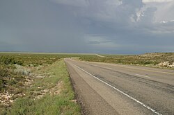
.jpg) 슬레퍼드 만, ca 1935 | |
 슬레퍼드 만 남부 오스트레일리아의 위치 | |
| 위치 | 에이어 반도, 사우스 오스트레일리아 |
| 좌표 | 34°53′54″S 135°46′02″E / 34.898337°S 135.76709°E좌표: 34°53′54″S 135°46′02″E / 34.898337°S 135.76709°E[1] |
| 유형 | 만 |
| 네이티브 이름 | 쿠야 비드니 Tannanna Error {{native name checker}}: 매개 변수 값의 형식이 잘못됨(도움말) |
| 어원 | 슬라포드, 링컨셔 주[2] |
| 분지 국가 | 호주. |
| 지정 | 해양공원[1] |
| 최대 길이 | 약 16km(9.9mi)[3] |
| 최대폭 | 약 9km(5.6mi)[3] |
| 최대 깊이 | 약 53미터(약 1미터)[3] |
| 섬 | 하나[4] |
| 정착지 | 슬레퍼드[1] 링컨 국립공원[1] |
슬레퍼드 만은 에레 반도 남쪽 해안에 있는 오스트레일리아 남호주 주에 위치한 만이다. 1802년 영국의 항해사 매튜 플린더스에 의해 이름이 지어졌다.
범위 & 설명
슬레퍼드 만은 포트 링컨 시의석에서 남서쪽으로 약 21km(13mi) 떨어진 남호주 에어 반도 남쪽 해안에 위치해 있다.[1]
그것은 서쪽 끝단에 있는 케이프 와일즈의 머리땅과 동쪽 끝단에 있는 케이프 투르네포트의 머리땅 사이에 있다. 어업만이라는 이름의 보조 만은 케이프 와일즈 북쪽 약 2해리(3.7km, 2.3mi) 지점에 위치해 있다.[4]
역사
이 만은 1802년 영국 항해사 매튜 플린더스에 의해 영국 링컨셔의 슬라포드 마을의 이름을 따서 명명되었다.[2]
슬라포드 만의 반가를라 이름은 다나나이다.[5]: 78 Sleaford Mere의 반가를라 이름은 Gugyabidni이다.[5]: 78
플린더스의 이름을 따서 방문한 바우딘 탐험대는 두 개의 이름을 붙였는데, 바우딘은 안세 데 네를란스라는 이름을 사용했고 페론과 프레이시네는 바우딘이 죽은 후 그것을 바이 라부아지에로 수정했다.[1]
1839년부터 1841년까지 어업만 내의 해안선에 위치한 포경 기지가 운영되었다.[6]
정착 및 인프라
슬레포드 만의 해안선은 서쪽의 슬레포드의 지역, 동쪽의 링컨 국립공원의 지역에 의해 점령된다.[1]
2005년 현재, 만 내의 항만 기반 시설은 어장만에 위치한 보트 경사로로 구성되어 있다.[7]
제안 해수담수화 발전소
2018년에는 슬라포드만에[where?] 연간 3기가리터 규모의 해수담수화 공장을 건설하자는 제안이 발표됐다. 토지 매입은 7월에 이루어졌으며 이 프로젝트를 완료하는 데 8천만 달러가 들 것으로 예상된다.[8][9] 그 위치는 이전에 SA Water가 2009년에 제시한 몇 가지 전망 중 하나이다.[10]
보호지역현황
가시밭길 해양공원은 만 전체를 차지하고 있고, 링컨 국립공원은 동쪽에 있는 "낮은 물의 흔적"을 연장하고 있다.[11][12]
참조
- ^ a b c d e f g h "Search result for "Sleaford Bay, BAY" with the following datasets selected – "NPW and Conservation Reserve Boundaries", "State Marine Park Network", "Suburbs and Localities" and "Gazetteer'". Location SA Map Viewer. Government of South Australia. Retrieved 9 September 2018.
- ^ a b Manning, Geoffrey. "Place Names of South Australia - Hardwicke Bay". State Library of South Australia. Retrieved 23 March 2016.
- ^ a b c South Australia. Department of Marine and Harbors (DMH) (1985), The Waters of South Australia a series of charts, sailing notes and coastal photographs, Dept. of Marine and Harbors, South Australia, p. chart 34, ISBN 978-0-7243-7603-2
- ^ a b Sailing Directions (Enroute), Pub. 175: North, West, and South Coasts of Australia (PDF). Sailing Directions. United States National Geospatial-Intelligence Agency. 2017. p. 183.
- ^ a b 주커만, 길라드, 반갈라(2019), 반갈리디 마누(Bangarla Together), 반갈라어 자문위원회(Barngarla Language Advisory Committee) (Barngarlidhi Manoo – Part II)
- ^ Staniforth, Mark (1999), "South Australian Projects, Sleaford Bay", Archaeology of Whaling in Southern Australia and New Zealand Project, Flinders University
- ^ Boating Industry Association of South Australia (BIA); South Australia. Department for Environment and Heritage (2005), South Australia's waters an atlas & guide, Boating Industry Association of South Australia, p. 215, ISBN 978-1-86254-680-6
- ^ "SA plans for $80 million desal plant". SBS News. Retrieved 28 November 2018.
- ^ Cootes, Isobel (13 November 2018). "Desal plant talks". Port Lincoln Times. Retrieved 28 November 2018.
- ^ "Three sites earmarked for Eyre Peninsula desal". ABC News. 2 December 2009. Retrieved 28 November 2018.
- ^ "Thorny Passage Marine Park Management Plan 2012" (PDF). Department of Environment Water and Natural Resources. 2012. pp. 24/31. Retrieved 3 April 2014.
- ^ "Lincoln National Park Management Plan". Department of Environment and Heritage (DEH). 2004. p. 4.
사우스오스트레일리아 주의 해안가 베이와 입구 | |||
|---|---|---|---|
| 서해안 | |||
| 스펜서 걸프 | |||
| 탐정 해협 | |||
| 캥거루섬남서해안 | |||
| 걸프 세인트 빈센트 | |||
| 백스테어스 패스 | |||
| 남동해안 | |||
| 본토 |
| ||