엘리아킴
Eliakim엘리아킴 | |
|---|---|
 | |
| 좌표:32°37°57°N 35°3°59°E/32.63250°N 35.06639°E좌표: 32°37°57°N 35°3【59】E/32.63250°N 35.06639° 35. | |
| 나라 | |
| 구 | 북부. |
| 평의회 | 메기도 |
| 제휴 | 모샤빔 운동 |
| 설립. | 1949 |
| 설립자 | 예멘계 유대인 |
| 인구. (2019년)[1] | 910 |
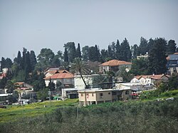
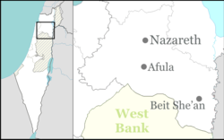
엘리아킴(Hebrew: ֶלְייָקקִ eli)은 이스라엘 북부의 모샤브족이다.메나셰 고원에 위치해 있으며 메기도 지역 의회의 관할에 속합니다.2019년 인구는 910명이다.[1]
역사
이 마을은 1949년 예멘 출신 유대인 난민들이 팔레스타인 부족 마을 움아즈지나트 땅에 모샤브([2][3]Moshav)로 세운 곳으로 유다의 왕(왕 2명 23:34)인 호야킴(원래 이름은 엘리아킴)의 이름을 따왔다.1970년에 공동 거주지로 전환되었지만, 2008년에 다시 모샤브로 돌아갔습니다.
저명한 거주자
레퍼런스
- ^ a b "Population in the Localities 2019" (XLS). Israel Central Bureau of Statistics. Retrieved 16 August 2020.
- ^ Khalidi, Walid (1992). All That Remains: The Palestinian Villages Occupied and Depopulated by Israel in 1948. Washington D.C.: Institute for Palestine Studies. p. 200. ISBN 0-88728-224-5.
- ^ Morris, Benny (2004). The Birth of the Palestinian Refugee Problem Revisited. Cambridge: Cambridge University Press. p. xxii, settlement #117. ISBN 978-0-521-00967-6.


