딕슨 메모리얼 스테이트 포레스트
Dixon Memorial State Forest| 딕슨 메모리얼 스테이트 포레스트 | |
|---|---|
 1935년 딕슨 메모리얼 스테이트 숲에 심은 슬래시 파인 | |
| 지도 | |
 | |
| 지리학 | |
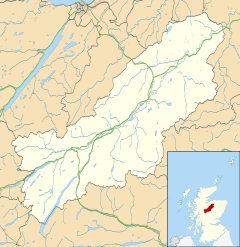
| 위치 | 웨어 카운티, 조지아 & 브랜틀리 카운티, 미국 조지아주 |
| 좌표 | 31°7'13°N 82°15'17″W/31.12028°N 82.25472°W |
| 지역 | 35,000 에이커 (14,189ha) |
| 행정부. | |
| 설립된 | 1938 |
| 관리기구 | 조지아 임업 위원회 |
| 생태학 | |
| 우점수종 | 슬래시파인 (Pinus Elliottii) 긴잎송 (Pinus palustris) 폰드사이프 (탁소듐 상승체) 그리고 여러 가지 단단한 나무들. |
딕슨 메모리얼 스테이트 포레스트(Dixon Memorial State Forest)는 조지아주 웨이크로스에서 남동쪽으로 10마일 떨어진 브랜틀리와 웨어 카운티에 있는 주립 숲으로 남쪽으로는 오케페노키 국립 야생동물 보호구역과 접해 있습니다.그 숲은 대략 35,000 에이커이고 조지아 임업 위원회가 소유하고 관리하는 가장 큰 주립 숲입니다.숲은 주로 소나무, 장엽송, 엽록소나무로 이루어진 소나무 플랜테이션과 연못지옥, 늪지 흑검, 스위트베이 목련, 엽록소 등 다양한 [1]경목림으로 이루어진 습지로 이루어져 있습니다.
역사
1937년, 미국 재정착청은 뱅크헤드-존스 농장 세입자법에 의해 인가된 연방 토지 활용 프로그램에 따라 오케페노키 늪 북동쪽의 황폐한 농장과 목초지를 구입했습니다.토지 매입은 조지아 해안 플랫우즈 업랜드 게임 [2][3]보존 프로젝트를 위한 것이었습니다.이듬해인 1938년 토지를 조지아 주에 임대하여 관리하였고, 웨이크로스 주립 숲으로 이름을 바꾸었습니다.1955년, 산불이 숲의 대략 절반을 태워 치명적인 [4]피해를 입혔습니다.그 해 말, 연방 정부는 숲을 조지아 [5][6][7]주에 양도했습니다.웨이크로스 주립 숲은 1974년 오랜 조지아 임업 위원회 위원인 휴 M.[8] 딕슨을 기리기 위해 딕슨 메모리얼 주립 숲으로 이름이 변경되었습니다.조지아 만 단지의 일부였던 2007년 땀 농장 화재는 삼림의 [9][10]남부와 서부의 상당 부분을 재앙적으로 태웠습니다.그 후 2011년 레이스폰드 산불은 남동부의 많은 [11]수의 국유림을 통과하는 길을 태웠습니다.2007년과 2011년 화재 때 불에 탔던 국유림의 많은 지역이 긴 잎 [12]소나무로 다시 숲을 만들었습니다.
현재 포리스트 관리
현재 Dixon Memorial State Forest는 목재 관리를 주요 목적으로 하는 다목적으로 관리되고 있습니다.소나무 플랜테이션과 습지 원목 숲은 또한 야생동물 서식지, 토양 보존, 물 보존, 그리고 아름다움을 위한 혜택을 제공합니다.그 숲은 또한 연구와 교육의 [1]기회를 위해 사용됩니다.
딕슨 메모리얼 스테이트 산림 야생동물 관리 구역
딕슨 메모리얼 스테이트 포레스트는 또한 사슴, 칠면조, 비둘기, [13]곰, 그리고 작은 사냥감들에게 사냥 기회를 제공하는 야생동물 관리 지역입니다.이 지역은 조지아 천연자원부의 야생동물 자원 부서와 조지아 임업 [14]위원회가 공동으로 관리하고 있습니다.딕슨 메모리얼 사격장도 딕슨 메모리얼 스테이트 [15]포레스트에 위치해 있습니다.
임대된 지역
몇몇 기관들은 조지아 임업 위원회로부터 딕슨 메모리얼 스테이트 포레스트의 일부를 임대하고 있습니다.여기에는 오케페노키 늪 공원, 로라 S. 워커 주립공원과 조지아 라이온스 [7]시각장애인 캠프.
참고 항목
참고문헌
- ^ a b "State Managed Forests". Georgia Forestry Commission. Archived from the original on 2022-10-17. Retrieved October 16, 2022.
- ^ "Human History of the Okefenokee Swamp". New Georgia Encyclopedia. Archived from the original on 2022-10-17. Retrieved October 16, 2022.
- ^ Thomas J. Straka; S. Knight Cox; Heather T. Irwin. "Current Use of Federal Land Utilization Projects Granted to State and Local Agencies" (PDF). Department of Forestry and Natural Resources Clemson University. Archived from the original (PDF) on 2022-06-08. Retrieved October 25, 2022.
- ^ Cypert, Eugene (October 1961). "The Effects of Fires in the Okefenokee Swamp in 1954 and 1955". The American Midland Naturalist. 66 (2): 485–503. doi:10.2307/2423049. JSTOR 2423049. Retrieved 26 October 2022.
- ^ "History of The Georgia Forestry Commission" (PDF). Georgia Forestry Commission. Archived from the original (PDF) on 2022-10-23. Retrieved October 16, 2022.
- ^ "Georgia forestry, Vol. 8, no. 4 (Apr. 1955)". Galileo Georgia Government Publications. Archived from the original on 2022-10-18. Retrieved October 16, 2022.
- ^ a b Ray, Janisse (2005). Pinhook: Finding Wholeness in a Fragmented Land. Chelsea Green Publishing. p. 168. ISBN 9781603581684.
- ^ "Georgia forestry, Vol. 27, no. 3 (Sept. 1974)". Galileo Georgia Government Publications. Archived from the original on 2022-10-17. Retrieved October 16, 2022.
- ^ "Sweat Farm Damage Map" (PDF). NIFC Public Information Server. Archived from the original (PDF) on 2022-10-17. Retrieved October 16, 2022.
- ^ "Big Fires Break Out Near Waycross". Georgia Outdoor News. Archived from the original on 2022-10-28. Retrieved 28 October 2022.
- ^ "Sweat Farm Again Map" (PDF). NIFC Public Information Server. Archived from the original (PDF) on 2022-10-17. Retrieved October 16, 2022.
- ^ "ARRA grant turns challenges into successes". Southern Group of State Foresters. Archived from the original on 2022-10-21. Retrieved October 16, 2022.
- ^ Trani & Chapman. "American Black Bear: Ursus americanus" (PDF). The Land Manager's Guide to Mammals of the South. USDA. p. 518. Archived from the original (PDF) on 2022-10-28. Retrieved 27 October 2022.
- ^ "Dixon Memorial WMA". Georgia Department of Natural Resources-Wildlife Resources Division. Archived from the original on 2022-10-20. Retrieved October 16, 2022.
- ^ "Dixon Memorial Shooting Range". Georgia Department of Natural Resources - Wildlife Resource Division. Archived from the original on 2022-10-20. Retrieved October 16, 2022.