퀸즐랜드 주
Coringa, Queensland| 코린가 퀸즐랜드 | |||||||||||||||
|---|---|---|---|---|---|---|---|---|---|---|---|---|---|---|---|
 코린가 | |||||||||||||||
| 좌표 | 25°22(39°S) 151°57′54§ E/25.3775°S 151.9649°E좌표: 25°22°39°S 151°57°54°E/25.3775°S 151.9649°E) | ||||||||||||||
| 인구. | 77 (2016년 인구조사)[1] | ||||||||||||||
| • 밀도 | 0.588/km2 (1.524/140 mi) | ||||||||||||||
| 우편 번호 | 4621 | ||||||||||||||
| 지역 | 130.9km2 (50.5평방마일) | ||||||||||||||
| 시간대 | 미학(UTC+10:00) | ||||||||||||||
| 위치 | |||||||||||||||
| LGA | 노스버넷 주 | ||||||||||||||
| 주의 유권자 | 캘라이드 | ||||||||||||||
| 연방 부문 | 플린 | ||||||||||||||
| |||||||||||||||
코링가는 호주 [2]퀸즐랜드 주 노스 버넷 지역에 있는 시골 지역입니다.2016년 인구조사에서 코링가의 인구는 [1]77명이었다.
지리
버넷 강은 그 지역의 북쪽 경계를 형성한다.서쪽에는 파라다이스댐(25°210101sS 151°5)이 있다5 paradise 08 creates E / 25 . 3503 ° S 151 . 9189 °E / - . ; ( 댐로, 파라다이스 호수를 형성합니다.댐의 충전으로 인해 파라다이스의 이전 마을 대부분(25°212112′S 151°551515eE/25.3533°S 151E 이전 ))[3][4]가 침수되었다.
역사
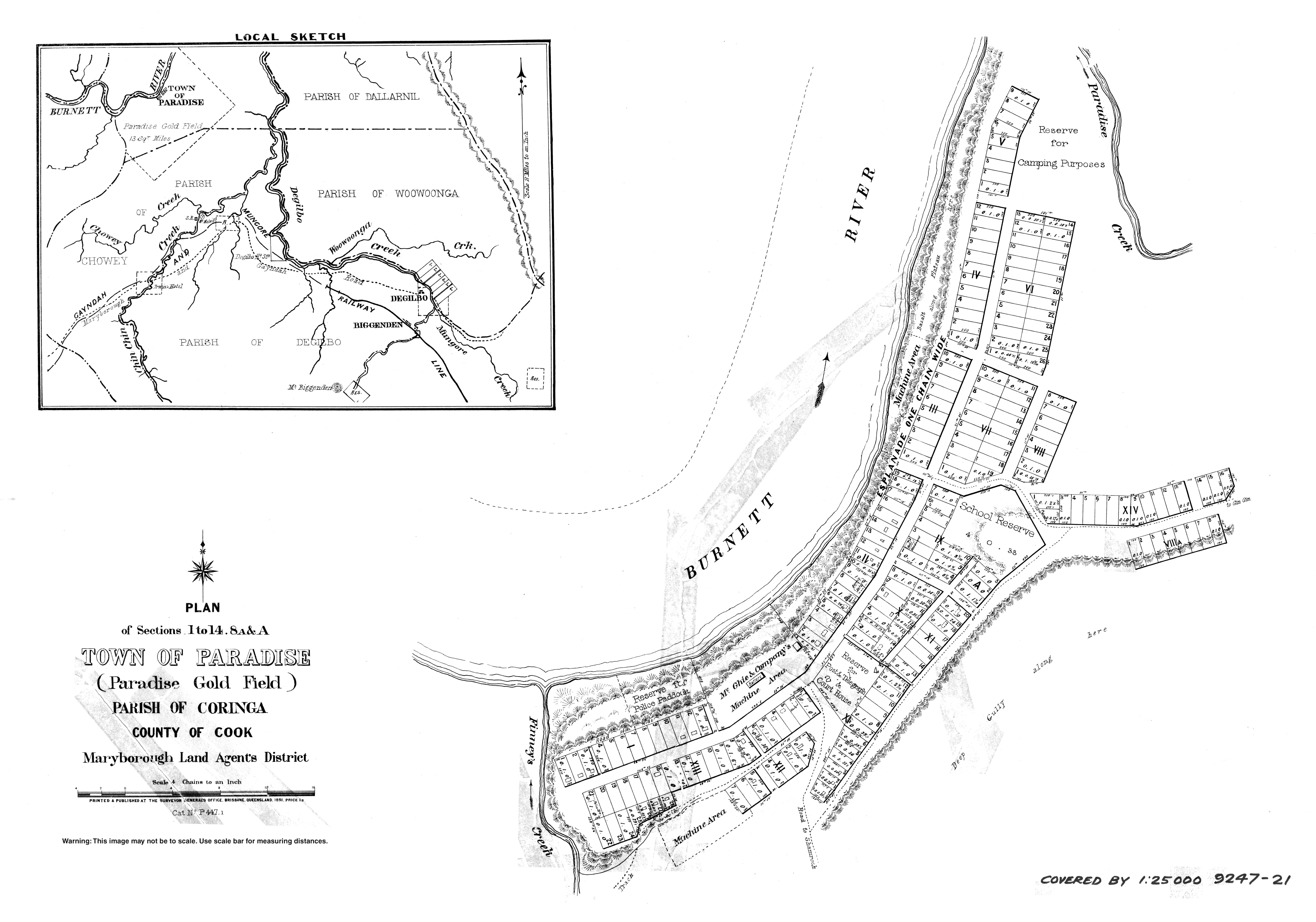
파라다이스 마을은 1889년에 금광 도시로서 설립되었습니다.버넷 강에 있었어요마을 보호구역은 1891년 7월 20일에 설치되었다.1898년 골드러시가 [4][5]끝나자 마을은 버려졌다.최고조에 달했을 때 파라다이스에는 2,000명이 넘는 [6]인구가 살고 있었다.
코링가 임시 학교는 1930년 11월 3일에 개교했다.1936년에 코링가 주립학교가 되었다.1996년 [7][8]6월 21일에 문을 닫았다.코링가 로드(25°23003sS 151°5)에 있습니다.83939eE / 25.3843°S 151.9775°E / ).[9][10][3]
Paradise Dam was completed in 2005, inundating the town of Paradise.[5]
In the 2016 census, Coringa had a population of 77 people.[1]
Heritage listings
Coringa has a number of heritage-listed sites, including:
- Campbells Road: Paradise Cemetery[6]
Education
There are no schools in Coringa. The nearest government primary schools are Dallarnil State School in neighbouring Dallarnil to the east and Biggenden State School in Biggenden to the south-east. Biggenden State School also offers secondary schooling to Year 10. The nearest government secondary schools offering secondary schooling to Year 12 are Isis District State High School in Childers to the north-east and Burnett State College in Gayndah to the south-west.[3]
References
- ^ a b c Australian Bureau of Statistics (27 June 2017). "Coringa (SSC)". 2016 Census QuickStats. Retrieved 20 October 2018.
- ^ "Coringa – locality in North Burnett Region (entry 45336)". Queensland Place Names. Queensland Government. Retrieved 7 March 2022.
- ^ a b c "Queensland Globe". State of Queensland. Retrieved 4 May 2022.
- ^ a b "Paradise – unbounded locality in the North Burnett Region (entry 26024)". Queensland Place Names. Queensland Government. Retrieved 16 August 2019.
- ^ a b "Paradise Dam". Sunwater. Archived from the original on 20 January 2022. Retrieved 4 May 2022.
- ^ a b "Paradise Cemetery" (PDF). North Burnett Local Heritage Register. North Burnett Regional Council. p. 64. Archived (PDF) from the original on 16 August 2019. Retrieved 16 August 2019.
- ^ Queensland Family History Society (2010), Queensland schools past and present (Version 1.01 ed.), Queensland Family History Society, ISBN 978-1-921171-26-0
- ^ "Queensland state school - centre closures" (PDF). Queensland Government. 20 August 2013. Archived (PDF) from the original on 20 March 2022. Retrieved 7 April 2022.
- ^ "Parish of Coringa" (Map). Queensland Government. 1968. Archived from the original on 4 May 2022. Retrieved 4 May 2022.
- ^ "9247 Mount Perry" (Map). Queensland Government. 1971. Archived from the original on 4 May 2022. Retrieved 4 May 2022.
External links
- "Town of Paradise" (Map). Queensland Government. 1891. Archived from the original on 4 May 2022.

