퀸즐랜드 주
Abercorn, Queensland| 에버콘 퀸즐랜드 | |||||||||||||||
|---|---|---|---|---|---|---|---|---|---|---|---|---|---|---|---|
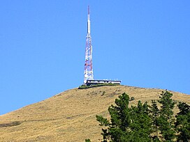
 에버콘의 예전 가게와 집 | |||||||||||||||
 에버콘 | |||||||||||||||
| 좌표 | 25°07′59§ S 151°07′46§ E/25.1330°S 151.1294°E좌표: 25°07°59°S 151°07°46°E/.1330°S 151.1294°E25 | ||||||||||||||
| 인구. | 46 (2016년 인구조사)[1] | ||||||||||||||
| • 밀도 | 0.488/km2 (1.263/140 mi) | ||||||||||||||
| 우편 번호 | 4627 | ||||||||||||||
| 지역 | 94.3km2(36.4평방마일) | ||||||||||||||
| 시간대 | 미학(UTC+10:00) | ||||||||||||||
| 위치 | |||||||||||||||
| LGA | 노스버넷 주 | ||||||||||||||
| 주의 유권자 | 캘라이드 | ||||||||||||||
| 연방 부문 | 플린 | ||||||||||||||
| |||||||||||||||
Avercorn은 호주 [2][3]퀸즐랜드주 노스버넷 지역에 있는 시골 마을이자 지역입니다.2016년 인구조사에서 에버콘의 인구는 [1]46명이었다.
지리
버넷 강은 에버콘의 동쪽 경계를 이룬다.세 개의 문 크릭이 마을 근처를 지나 버넷 강으로 향합니다.버넷 고속도로는 이 지역을 통과하지만 고속도로에서 마을로 직접 접근할 수 없습니다. Abercorn으로 가려면 고속도로에서 Cynthia의 Wuruma Dam Road로 가야 합니다.카팔도까지 뻗어 있는 그 지역의 북쪽에 국유림이 있다.
역사
도시의 이름은 1925년 6월 19일 퀸즐랜드 철도국에 의해 명명된 기차역에서 따왔다. 아마도 서러브레드 말의 챔피언인 [2]애버콘의 이름을 따왔을 것이다.
에버콘 주립학교는 1927년 [4][5]5월 3일에 개교했다.
1927년 9월 5일 랭글리 임시학교가 개교했다.1929년에 랭글리 플랫 주립학교가 되었다.1947년 [5]1월 28일에 문을 닫았다.
1928년 2월경에 아베르콘에 우체국이 문을 열었고 1986년 [6]6월 11일에 문을 닫았다.
1931년 4월 29일에 개교했다.1932년에 구마란 크리크 주립학교가 되었다.1948년 [5]5월 9일에 문을 닫았다.
글렌 록 주립학교는 1931년 8월 27일에 개교하여 1944년에 [5]폐교하였다.버넷 약 25°′54sS 151°104747eE / 25.1484°S 151[7][8] / 에 있었다.
2016년 인구조사에서 에버콘의 인구는 [1]46명이었다.
교육
School은 957 Wuruma Dam Road (25°081111sS 151°074040eE / 25.136508sS 151.127706°E/ 에 위치한 공립 초등학교입니다.2012년에는, 1개의 교실에 21명의 학생이 등록해, 3명의 교사와 함께 등록했습니다(1.5명 상당).아베콘에는 중등학교가 없고 가장 가까운 학교가 몬토에 [9][10]있다.
명소
아베르콘은 수상 스포츠와 [11]낚시용으로 사용되는 우루마 댐의 관문입니다.
레퍼런스
- ^ a b c Australian Bureau of Statistics (27 June 2017). "Abercorn (SSC)". 2016 Census QuickStats. Retrieved 20 October 2018.
- ^ a b "Abercorn – town in North Burnett Region (entry 24)". Queensland Place Names. Queensland Government. Retrieved 15 December 2020.
- ^ "Abercorn – locality in North Burnett Region (entry 45310)". Queensland Place Names. Queensland Government. Retrieved 15 December 2020.
- ^ "Opening and closing dates of Queensland Schools". Queensland Government. Retrieved 29 May 2014.
- ^ a b c d Queensland Family History Society (2010), Queensland schools past and present (Version 1.01 ed.), Queensland Family History Society, ISBN 978-1-921171-26-0
- ^ Premier Postal History. "Post Office List". Premier Postal Auctions. Archived from the original on 15 May 2014. Retrieved 29 May 2014.
- ^ "Queensland Two Mile series sheet 2m158" (Map). Queensland Government. 1939. Archived from the original on 14 December 2020. Retrieved 5 December 2021.
- ^ "Queensland Globe". State of Queensland. Retrieved 5 December 2021.
- ^ "Queensland State and Non-State Schools". Queensland Government. Archived from the original on 8 May 2014. Retrieved 29 May 2014.
- ^ "2012 School Annual Report" (PDF). Abercorn State School. Archived (PDF) from the original on 25 February 2014. Retrieved 30 May 2014.
- ^ "Water Sports and Recreation". North Burnett Regional Council. Archived from the original on 7 February 2014. Retrieved 30 May 2014.
추가 정보
- McCorley, B; Ries, C (1977), Abercorn District Schools Golden Jubilee Chronicle - Abercorn, Cynthia Creek, Goomaram Creek 및 Nogo Creek 학교 포함
- Mulgildie State School. Jubilee Booklet Committee (1977), The golden jubilee of Mulgildie State School 1927-1977 - Glen Loch State School 및 Langley Flat State School 포함
외부 링크
| Wikimedia Commons에는 퀸즐랜드주 Avercorn 관련 미디어가 있습니다. |

