시우정
Ci Ujung| 시우정 우중강, 시우중강 | |
|---|---|
 랑카스비퉁에서 함께 다가오는 시베랑과 시우중 강 | |
| 위치 | |
| 나라 | 인도네시아 |
| 물리적 특성 | |
| 출처 | |
| • 위치 | 자바 |
| 입 | |
• 위치 | 텡쿠라크, 티르타야사, 세랑, 반텐 |
• 좌표 | 5°57′47″S 106°21′25″E/5.962932°S 106.356911°E좌표: 5°57′47″S 106°21′25″E / 5.962932°S 106.356911°E |
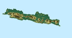
시우중(우정강)은 인도네시아 자바 섬의 서자바 주와 반텐 주에 있는 강이다.
위치
자바의 가장 서쪽에 있는 반텐의 강은 서로 대략 평행하게 흐른다.The main ones are the Peteh, called the Banten on the lower reaches near the city of Kota Banten, the Ujung, which enters the sea at Pontang, the Durian, which enters the sea at Tanara, the Manceuri, and the Sadane, which rises in the mountainous region of Priyangan and in 1682 formed the border between the Dutch East India Company (VOC) territory그리고 바타비아(현대 자카르타).[1]강들은 해안 근처의 델타 지역으로 부채질한다.[1]시우정은 120 평방 킬로미터(46 평방 미) 반텐 만으로 방류된다.[2]
시우중, 시두리안, 시반텐 강의 하구의 원래 거주자는 순다인이었다.[3]1682년 우정과 두리안의 하류에는 논밭이 있었다.[4]폰탕항과 시우중강은 내륙으로 상품을 운반하는 데 중요한 역할을 했었다.[5]
참고 항목
참조
원천
- "Banten", Ensiklopedi Umum (in Indonesian), Kanisius, 1973, ISBN 978-979-413-522-8, retrieved 27 January 2017
- Green, Edmund Peter (2003), World Atlas of Seagrasses, University of California Press, ISBN 978-0-520-24047-6, retrieved 28 January 2017
- Talens, Johan (1 January 1999), Een feodale samenleving in koloniaal vaarwater: staatsvorming, koloniale expansie en economische onderontwikkeling in Banten, West Java (1600–1750) (in Dutch), Uitgeverij Verloren, ISBN 90-6550-067-7, retrieved 27 January 2017
- Titi Surti Nastiti (2006), "Old Sundanese Community", Archaeology: Indonesian Perspective : R.P. Soejono's Festschrift, Yayasan Obor Indonesia, ISBN 978-979-26-2499-1, retrieved 28 January 2017


