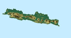
시반텐
Ci Banten| 시반텐 | |
|---|---|
 강 위의 철교 – 20세기 초 | |
| 위치 | |
| 나라 | 인도네시아 |
| 물리적 특성 | |
| 출처 | |
| • 위치 | 반텐, 자바 |
| 입 | |
• 위치 | 반텐 |
• 좌표 | 6°01′40″S 106°10′30″e / 6.027738°S 106.174919°E좌표: 6°01′40″S 106°10′30″E / 6.027738°S 106.174919°E |
| 분지크기 | 194km2(75평방 미) |
시 반텐(Ci Banten, 또는 Ci Peteh)은 인도네시아 자바 섬의 반텐 지방에 있는 강이다.
자바의 가장 서쪽에 있는 반텐의 강은 서로 대략 평행하게 흐른다. The main ones are the Peteh, called the Banten on the lower reaches near the city of Kota Banten, the Ujung, which enters the sea at Pontang, the Durian, which enters the sea at Tanara, the Manceuri, and the Sadane, which rises in the mountainous region of Priyangan and in 1682 formed the border between the Dutch East India Company (VOC) territory 그리고 바타비아(현대 자카르타).[1]
지리
이 강은 열대 우림 기후(Köppen-Geiger 기후 분류에서 Af로 지정됨)가 지배적인 자바 남서지역에 흐른다.[2] 이 지역의 연평균 기온은 25 °C이다. 가장 따뜻한 달은 평균 기온이 28℃ 안팎인 10월이고, 가장 추운 달은 24℃로 1월이다.[3] 연평균 강우량은 3471mm이다. 가장 비가 많이 오는 달은 2월이며, 평균 429mm의 비가 내리고, 가장 건조한 달은 9월이며, 강수량은 116mm이다.[4]
참고 항목
참조
- ^ 탈렌즈 1999, 페이지 40.
- ^ Peel, M C; Finlayson, B L; McMahon, T A (2007). "Updated world map of the Köppen-Geiger climate classification". Hydrology and Earth System Sciences. 11: 1633–1644. doi:10.5194/hess-11-1633-2007. Retrieved 30 January 2016.
- ^ "NASA Earth Observations Data Set Index". NASA. 30 January 2016.
- ^ "NASA Earth Observations: Rainfall (1 month - TRMM)". NASA/Tropical Rainfall Monitoring Mission. 30 January 2016.
원천
- Talens, Johan (1 January 1999), Een feodale samenleving in koloniaal vaarwater: staatsvorming, koloniale expansie en economische onderontwikkeling in Banten, West Java (1600–1750) (in Dutch), Uitgeverij Verloren, ISBN 90-6550-067-7, retrieved 27 January 2017


