A636 도로
A636 road| A636 | |
|---|---|
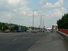
 웨이크필드 손스 인근 Denby Dale Road로 칼더 강 건너기 | |
| 주요 접합부 | |
| 이스트 엔드 | 웨이크필드 |
| 웨스트엔드 | 덴비 데일 |
| 장소 | |
| 나라 | 영국 |
| 기본적인 행선지 | 플록턴, 더카르, 크리글스톤 |
| 도로망 | |
웨스트는 영국의 요크셔에 있는 A636이 주요한 도로, 웨이크 필드(.mw-parser-output.geo-default,.mw-parser-output.geo-dms,.mw-parser-output .geo-dec{디스플레이:인라인}.mw-parser-output.geo-nondefault,.mw-parser-output .geo-multi-punct{디스플레이 아무 것도 없}.mw-parser-output .longitude,.mw-parser-output .latitude{white-space:nowrap}53°40′44″N 1°30′0다.1″W/53.6788°N 1.5002°W/53.6788,-1.5002(A636 도로(북쪽 끝)))과 M1고속 도로에 접합 39과 A637 Flockton 환형 교차로에서로 연결.Denby Dale에서 A635로 끝납니다(53°341314wN 1°40513nW / 53.5705°N 1.6704°W/ (road ()).
좌표: 53°37°38°N 1°34°24°W / 53.6273°N 1.5732°W /


