툰누니크 충격 크레이터
Tunnunik impact crater| 프린스 앨버트 충격 분화구 | |
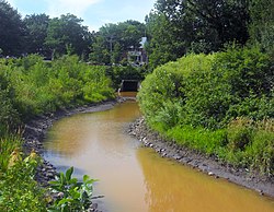
 툰누니크 충격 크레이터 북서부 지역의 툰니크 충격 분화구의 위치 | |
| 충격 분화구/구조물 | |
|---|---|
| 자신감 | 확정 |
| 지름 | ~25km(16mi) |
| 나이 | ~1억 3천만 년 ~ 3억 5천만 년 |
| 노출됨 | 네 |
| 위치 | |
| 위치 | 프린스 앨버트 반도 |
| 좌표 | 72°28°N 113°56′W / 72.467°N 113.933°W좌표: 72°28′N 113°56′W / 72.467°N 113.933°W/ |
| 나라 | 캐나다 |
| 주 | 노스웨스트 준주 |

이전에 프린스 앨버트 임팩트 크레이터로 알려진 툰니크 충돌 크레이터는 최근에 확인된 운석 충돌 크레이터다.[1] 캐나다 북서부의 빅토리아 섬의 북서부에[A] 있는 프린스 알버트 반도에 위치해 있다.[2]
넓이 25km(16mi)의 분화구는 2010년 사스카처원대 지질학과 브라이언 프랫 교수, 캐나다 지질조사국의 키스 드윙 교수가 현지 항공조사 중 발견했다. 이 분화구는 1억 3천만 년에서 3억 5천만 년 전에 형성된 것으로 추정되며, 직경 몇 킬로미터의 유성이 지구에 충돌했을 때 생성되었을 수도 있다.[3] 툰누닉과 같은 충돌 크레이터의 사막 같은 풍경은 화성과 같은 다른 암석 행성들의 지질학을 이해하는 데 유용할 수 있다.[4]
이것은 캐나다에서 30번째로 알려진 운석 충돌 특장점이다.
메모들
^[A] 미국 캘리포니아에 있는 확인되지 않은 빅토리아 아일랜드 구조와 혼동할 필요는 없다.
참조
- ^ "Tunnunik (Prince Albert)". Earth Impact Database. Planetary and Space Science Centre. Retrieved July 16, 2015.
- ^ "Researchers discover new impact crater in the Arctic". University of Saskatchewan. 2012-07-25. Archived from the original on 2013-02-19.
The researchers discovered the crater two summers ago while exploring the area by helicopter for the Natural Resources Canada (NRCan) Geo-Mapping for Energy and Minerals program, and it took two years to properly assemble the geological maps and submit their article for publication. Pratt and Dewing named the new discovery the Prince Albert impact crater after the peninsula where it is situated. Note: Geographic coordinates are in the comments section.
- ^ "Meteor crater: Huge hole 25 kilometres wide discovered in Arctic, but was it made by a meteorite?". Saskatoon: The Toronto Star. 2012-07-25. Archived from the original on 2013-02-19. Retrieved 2012-08-09.
Pratt said he and Dewing knew from earlier surveys of the remote area that dipping, and even vertical rock faces, had been found on Victoria Island, so they wanted to check them out. Most rocks in the Arctic have horizontal strata and have never been folded or faulted by tectonic pressure, Pratt explained.
- ^ 케이트 카일(2015년). 빅토리아 섬 충돌 분화구는 과학자들과 우주 비행사들을 유혹한다. CBC 뉴스 2015
외부 링크
| hide | ||
|---|---|---|
| 목록 |   | |
| 확정지름 20km | ||
| 주제 | ||
| 리서치 | ||