인디애나 주 테쿰세
Tecumseh, Indiana인디애나 주 테쿰세 | |
|---|---|
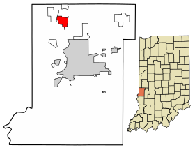
 인디애나 비고 카운티의 테쿰세 위치. | |
| 좌표:39°33′47″N 87°25′18″w/39.56306°N 87.42167°W좌표: 39°33′47″N 87°25′18″W / 39.56306°N 87.42167°W/ | |
| 나라 | 미국 |
| 주 | 인디애나 주 |
| 카운티 | 비고 |
| 타운쉽 | 파예트 |
| 표고 | 558피트(170m) |
| 시간대 | UTC-5(동부(EST)) |
| • 여름(DST) | UTC-4(EDT) |
| 우편번호 | 47885 |
| 지역 번호 | 812, 930 |
| GNIS 피쳐 ID | 444612 |
테쿰세(Tecumseh)는 미국 인디애나 주 비고 현 동부 파예트 타운쉽에 있는 비법인 인구조사 지정지다.[2]테레 오뜨 대도시권의 일부다.
역사
와바시 강에 위치한 이 공동체는 마을에서 남쪽으로 1마일밖에 떨어지지 않은 포트 해리슨에서 윌리엄 헨리 해리슨 장군과 싸운 쇼니의 아메리카 원주민 지도자 테쿰세(Tecumseh)의 이름을 따서 지어졌다.[3]테쿰세(Tecumseh)는 한때 더키스 페리(Durkee's Perry)로 알려졌으며, 1890년에는 단지 대여섯 채의 집이 있는 우체국이었다.[4]더키스 페리는 한때 와바시 강의 주요 횡단 지점 중 하나였다.[5]
1882년 테쿰세(Tecumseh)에 우체국이 설립되어 1907년 단종될 때까지 계속 운영되었다.[6]
지리
테쿰세(Tecumseh)는 39°3에 위치한다.3′47″N 87°25′18″W / 39.56306°N 87.42167°W/ 561피트의 고도에서의 .
인구통계학
| 역사인구 | |||
|---|---|---|---|
| 인구조사 | Pop. | %± | |
| 미국 십수년 인구[7] 조사 | |||
참조
- ^ "US Board on Geographic Names". United States Geological Survey. October 25, 2007. Retrieved 2016-07-13.
- ^ "Tecumseh, Indiana". Geographic Names Information System. United States Geological Survey. Retrieved August 6, 2017.
- ^ Baker, Ronald L. (October 1995). From Needmore to Prosperity: Hoosier Place Names in Folklore and History. Indiana University Press. p. 11. ISBN 978-0-253-32866-3.
Tecumseh was named for the famous Shawnee chief...
- ^ Bradsby, H.C. (1891). History of Vigo County, Indiana, with Biographical Selections. Chicago: S. B. Nelson & Co. pp. 480.
- ^ Oakey, Charles Cochran (1908). Great Terre Haute and Vigo County. Chicago: Lewis Publishing Co. pp. 130.
- ^ "Vigo County". Jim Forte Postal History. Retrieved July 13, 2016.
- ^ "Census of Population and Housing". Census.gov. Retrieved June 4, 2016.


