썸렌
Someren썸렌 | |
|---|---|
 Someren에 등재된(네덜란드 '기념품') 풍차 | |
 플래그  문장 | |
.svg) 북브라반트주 소재지 | |
| 좌표:51°23ºN 5°43°E/51.383°N 5.717°E좌표: 51°23【N 5°43】E/51.383°N 5.717°.717 | |
| 나라 | 네덜란드 |
| 지방 | 북브라반트 주 |
| 정부 | |
| • 본체 | 시의회 |
| • 시장 | 딜리아 블록 |
| 지역 | |
| • 합계 | 81.50km2(31.47평방마일) |
| • 토지 | 80.27km2(30.99평방마일) |
| • 물 | 1.23km2(0.47평방마일) |
| 승진 | 26 m (85 피트) |
| 인구. (2019년 [4]1월) | |
| • 합계 | 19,322 |
| • 밀도 | 241/km2 (620/120 mi) |
| 디노미네임 | 소메레나르 |
| 시간대 | UTC+1(CET) |
| • 여름 (DST) | UTC+2(CEST) |
| 우편번호 | 5710–5715 |
| 지역번호 | 0492, 0493 |
| 웹 사이트 | www |
소메렌(네덜란드 발음: [sosommrr((n)]![]() (listen))은 네덜란드 남부의 도시이자 자치체이다.
(listen))은 네덜란드 남부의 도시이자 자치체이다.
인구 중심
지형

네덜란드 소메렌 시 지형도, 2015년 6월
주목받는 사람들
- 안토니우스 람베르투스 마리아 허크만스(1944년 소메렌 출생) 가톨릭 시헤르토겐보시 교구 명예 주교
- 마리 조세 드 그루트(1966년 ~ )는 네덜란드의 조정 선수로 1992년 하계 올림픽에 참가했다.
- 네덜란드의 쇼점프 선수 빈센트 분(1984년생)은 2008년 하계 올림픽에 참가했다.
- 에비 카이페르스(1995년 리에롭 출생)는 네덜란드의 프로 레이싱 사이클 선수
갤러리

썸렌, 시청

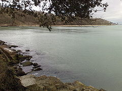
북브라반트와 림부르크의 주이드-빌렘스바르트 경계

Someren, 풍차: 스탠더드몰렌 덴 에버트

소메렌스 하이데

Someren Ruimtelijk 객체 Jan Samsom

Zuid-Willemsvaart의 수문(캐널 잠금) 13

_alongside_Zuid-Willemsvaart_01.jpg)


_13_in_Zuid-Willemsvaart_01.jpg)
레퍼런스
- ^ "College van burgemeester en wethouders" [Board of mayor and aldermen] (in Dutch). Gemeente Someren. Archived from the original on 6 June 2014. Retrieved 4 June 2014.
- ^ "Kerncijfers wijken en buurten 2020" [Key figures for neighbourhoods 2020]. StatLine (in Dutch). CBS. 24 July 2020. Retrieved 19 September 2020.
- ^ "Postcodetool for 5711EK". Actueel Hoogtebestand Nederland (in Dutch). Het Waterschapshuis. Retrieved 4 June 2014.
- ^ "Bevolkingsontwikkeling; regio per maand" [Population growth; regions per month]. CBS Statline (in Dutch). CBS. 1 January 2019. Retrieved 1 January 2019.
- ^ Jos & Cor Swanenberg:스타드 인 랜드의 타알:Oost-Brabants, ISBN 9012090105
외부 링크