루치펜
Rucphen루치펜 | |
|---|---|
 루크펜 거리 | |
 플래그  문장 | |
.svg) 북브라반트주 소재지 | |
| 좌표:51°32ºN 4°35°E/51.533°N 4.583°E좌표: 51°32°N 4°35°E / 51.533°N 4.583°E / | |
| 나라 | 네덜란드 |
| 지방 | 북브라반트 주 |
| 정부 | |
| • 본체 | 시의회 |
| • 시장 | 마르조인 반데르메어모어(VD) |
| 지역 | |
| • 합계 | 64.48km2(24.90평방마일) |
| • 토지 | 64.41km2(24.87평방마일) |
| • 물 | 0.07km2(0.03평방마일) |
| 승진 | 10 m (30 피트) |
| 인구. (2019년 [4]1월) | |
| • 합계 | 22,572 |
| • 밀도 | 350/km2 (900/150 mi) |
| 디노미네임 | 루크페나르 |
| 시간대 | UTC+1(CET) |
| • 여름 (DST) | UTC+2(CEST) |
| 우편번호 | 4710–4722, 4735 |
| 지역번호 | 0165 |
| 웹 사이트 | www |
루크펜(Rucphen, [r netherkf((![]() n)(listen)]로 발음)은 네덜란드 남부 루센달과 에텐뢰르 사이에 있는 도시이며 기차역이 없다.
n)(listen)]로 발음)은 네덜란드 남부 루센달과 에텐뢰르 사이에 있는 도시이며 기차역이 없다.
인구 중심
지형

네덜란드 루첸 시 지형도, 2015년 6월
주목받는 사람들
- 헨드릭 디트머스(1761년 스프룬델–1825년) 워털루 전투 네덜란드 장군
- 딕 야스퍼스(1965년 신트 빌브로드 출생) 네덜란드 프로 당구 선수
- 존 케르스텐스(1965년 제게 출생) 네덜란드 정치인, 전 노조 지도자
- 도니 고터(1988년 ~ )는 200개 이상의 클럽 캡을 가진 네덜란드의 축구 선수이다.
- 테사 테르 슬루이스(1995년 ~ )는 네덜란드의 스쿼시 선수이다.
갤러리
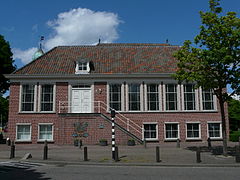
아우데 라드후이스 반 루치펜
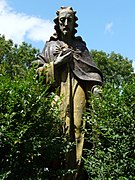
루치펜의 헤일리그 하트벨드 드 지칸트 반 드 마르티누스커크
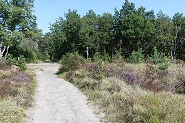
루크펜세 하이데
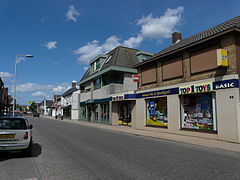
도프슈트라트 주


「 」를 참조해 주세요.
레퍼런스
- ^ "mr. Marjolein van der Meer Mohr" (in Dutch). Gemeente Rucphen. Archived from the original on 6 June 2014. Retrieved 3 June 2014.
- ^ "Kerncijfers wijken en buurten 2020" [Key figures for neighbourhoods 2020]. StatLine (in Dutch). CBS. 24 July 2020. Retrieved 19 September 2020.
- ^ "Postcodetool for 4715RK". Actueel Hoogtebestand Nederland (in Dutch). Het Waterschapshuis. Retrieved 3 June 2014.
- ^ "Bevolkingsontwikkeling; regio per maand" [Population growth; regions per month]. CBS Statline (in Dutch). CBS. 1 January 2019. Retrieved 1 January 2019.