사린
Sarrin사린 صرين | |
|---|---|
도시 | |
 사린 | |
| 좌표:36°35, 15°N 38°17′59§ E/36.58750°N 38.2972°E좌표: 36°35°15°N 38°17°59°E / 36.58750°N 38.2972°E / | |
| 나라 | |
| 주 | 알레포 |
| 구 | 아인 알 아랍 |
| 소구 | 사린 |
| 승진 | 356 m (1,168 피트) |
| 인구. (2004년 인구조사) | |
| • 합계 | 6,104[1] |
| • 소구역 | 70,522 |
| 시간대 | UTC+2(EET) |
| • 여름 (DST) | UTC+3(EEST) |
| P코드 | C2074 |
| 지오코드 | SY020602 |
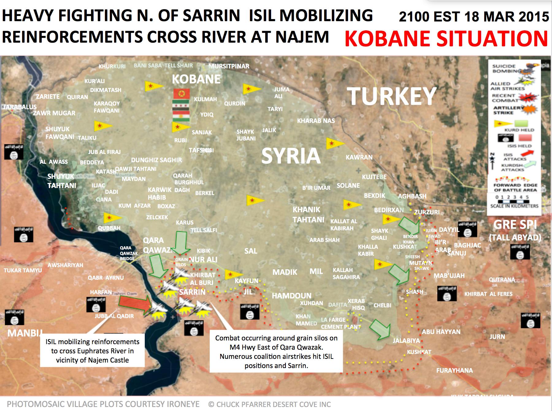
사린(아랍어: Sarrin)[2]은 시리아 북부에 위치한 도시로 알레포 주의 주도이다.유프라테스 강에서 동쪽으로 3km, 코바네에서 남쪽으로,[3] 만비지에서 동쪽으로 3km 떨어져 있다.

2004년 인구조사에서, 사린 마을은 6,140명의 인구가 있는 반면, 사린 지역은 70,522명의 인구가 주로 [1]아랍인이었다.
시리아 내전 중 이라크와 레반트는 2013년 [4]9월 마을을 장악했다.2015년 3월 인민수호대(YPG) 소속 쿠르드족과 자유시리아군(FSA) 반군이 전략적 [5][6]도시를 장악하기 위해 공격을 개시했다.2015년 7월 27일, 이 마을은 쿠르드족 유격대 [7][8]부대의 지배하에 들어갔다.
「 」를 참조해 주세요.
레퍼런스
- ^ a b "2004 Census Data for Sarrin nahiyah" (in Arabic). Syrian Central Bureau of Statistics. Retrieved 15 October 2015. 영문판도 있습니다.
- ^ "Polat Can". Twitter. Retrieved 27 July 2015.
- ^ "Google Maps". Retrieved 1 April 2015.
- ^ Ashkenas, Jeremy; Tse, Archie; Watkins, Derek; Yourish, Karen (July 3, 2014). "A Rogue State Along Two Rivers" – via NYTimes.com.
- ^ "Syrian Kurds, rebels find common enemy in ISIS - Al-Monitor: the Pulse of the Middle East". Al-Monitor. Archived from the original on 28 March 2014. Retrieved 1 April 2015.
- ^ https://pbs.twimg.com/media/CAa__0sUkAA1ffv.jpg:large[베어 URL 이미지 파일]
- ^ "Kurds cut key IS supply route in northern Syria: monitor". France 24. July 27, 2015. Archived from the original on September 24, 2015. Retrieved July 27, 2015.
- ^ "Syrian Kurds capture town from ISIS in north: activists". The Daily Star. Retrieved 27 July 2015.


